

|
|
Area/Range |
|---|---|
|
|
47.92580°N / 24.32476°E |
|
|
Hiking, Skiing |
|
|
Spring, Summer, Fall, Winter |
|
|
6421 ft / 1957 m |
|
|
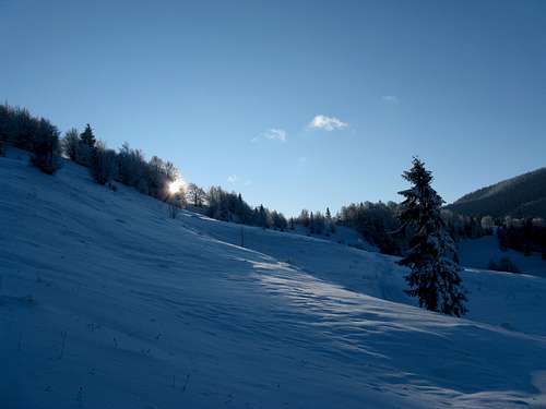
Overview
|
Video created by LukZem after three visits to the Marmarosh Mountains 1/2
Video created by LukZem after three visits to the Marmarosh Mountains 2/2
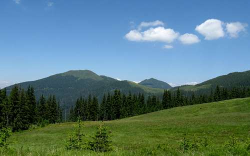
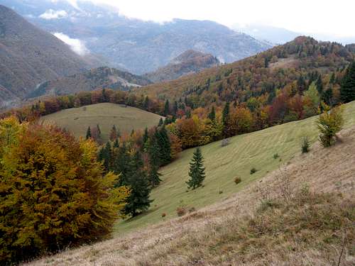
The Marmarosh Mountains should not be confused with a picturesque region of Romania. Neither of them should be confused with a historic province of the Kingdom of Hungary, which covered a much larger area. Most of the main ridge of the Marmarosh Mountains (along with most of the main ridge of their northern neighbour, the Chornohora), has for centuries functioned as an international border. For centuries somewhere near the summit of Hnatasya/Ignăteasa/Hnitessa was the T-junction of borderlines dividing the Kingdom of Hungary, the Polish-Lithuanian Commonwealth and the Principality of Moldavia. Later, between the first and second world wars the three borders converged on the summit of Stih (Stoh/Stóg/Stogu), but at that time the three countries were Czechoslovakia, Poland and Romania. This has had some impact on the toponymy of the mountains, but the most important was the fact that for several centuries the Marmarosh Mountains have been an area where both Slavic (Rusyn) and Romanian-speaking highlanders grazed their sheep, cattle and horses. All this results in the mountain toponyms forming very interesting combinations of diverse languages (and occasional misunderstandings). The first fairly good (despite containing countless spelling and some factual errors) maps which feature names of the most important mountains were made in the 1780s by the Austrian military. A hundred years later the area was mapped at 1:25,000 (!)
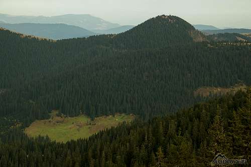
The boundaries of the Marmarosh Mountains are clear-cut, except for the southeast corner. The west end of the mountains is at the confluence of the Tisa and the Vişeu rivers (the latter is believed to be tributary to the former), about 15 km east of the town of Sighetu Marmaţiei. From there the west border runs north along the Tisa to soon turn right, that is to say eastward, up the course of the White Tisa, which flows between the Marmarosh Mountains and the Chornohora. Back across the Marmarosh Mountains, the Vişeu River forms their southwest and south boundary, the latter separating the Marmarosh Mountains from the Rodnei Mountains. Past the pass called Prislop, the south boundary of the Marmarosh Mountains runs along the valley of Bistriţa Aurie (Golden Bistritsa) toward the village of Cârlibaba (Kirlibaba). Just before Cârlibaba, the southeast end of the Marmarosh Mountains is marked by the confluence of the Bistriţa Aurie and Ţibau Creek. The northeast boundary of the Marmarosh Mountains is also well defined by a broken line composed of the uppermost course of the White Tisa, the Black Cheremosh across which the Hryniava Mountains sit, Sarata Creek and Ţibau Creek.
Whereas in the second half of the past century the whole area of the Chornohora was incorporated into Ukraine, the Marmarosh Mountains have remained split between two countries - Romania and Ukraine. In Ukraine, the western part of the Marmarosh Mountains is usually called Rakhivs'ki hory (Rakhiv Mountains, also the Hutsul Alps), while the eastern part is known as Chyvchyns'ki hory.
The table below lists the highest as well as some other conspicuous summits.
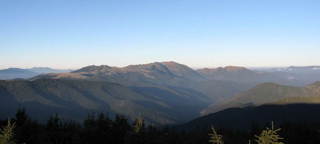
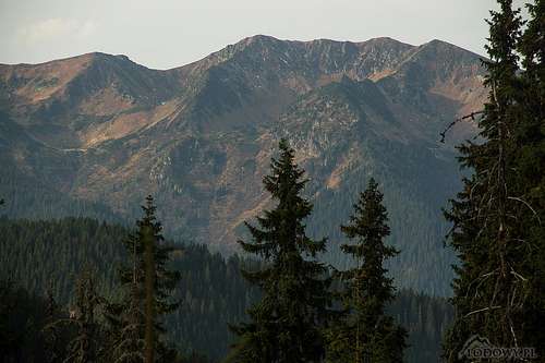
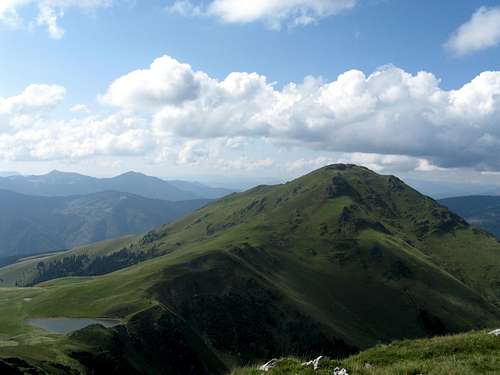
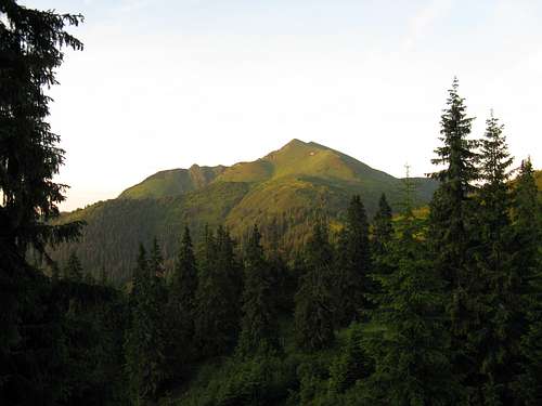
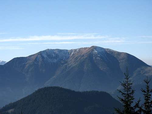
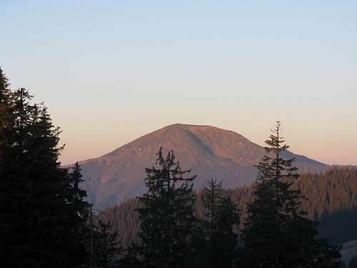
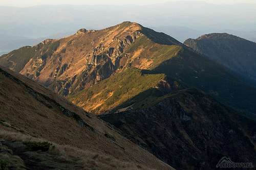
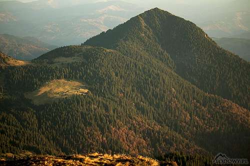
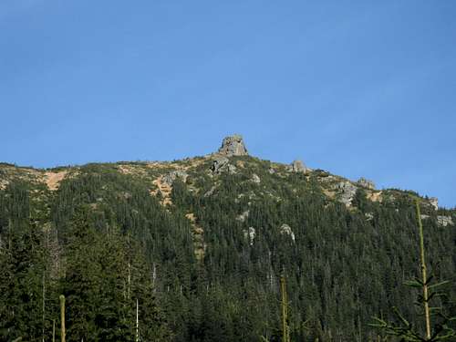
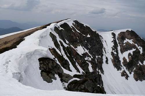
The main ridge has a length of approximately 90km and to a large extent resembles a rolling plateau. It forms a watershed between the Upper Tisa and Cheremosh drainages and it is closely followed by the Romanian-Ukrainian border. On the main ridge sit the following summits, from west to east: Menchul/Muncel (1370m), Polonynka (1627m), Sherban/Zherban (1793m), Pop/Pip Ivan (1938m), Holovac (1549m), Bendrias'ka/Bendreasca (1567m), Mezipotoky (1713m), Neneska/Mica Mare (1818m), Schavul/Shaul' (1753m), Korbul (1696m), Stih/Stoh/Stogu/Stóg (1651m), Rehes'ka/Radiescu (1570m), Kopylash/Copilasu (1599m), Kernichny (1589m), Ledyeskul/Lădescu (1580m), Budiyevska Velka/Budescu (1678m), Chyvchynazh/Civcinaj (1588m), Suligul/Şuligu (1688m), Lostun (1642m), Purul (1617m), Ştevioara (1621m), Koman/Comanu (1724m), Palenitsa (1750m), Hnatasia/Ignăteasa/Hnitessa (1767m), Krechela/Jupania (1853m – in Romania, south of the border, which has just taken a sharp turn east), Fîntîna Stanchi (1726m), Cornu Nedeii (1763m).  Marmarosh Mts from the Rodnei - photo by peterbud Marmarosh Mts from the Rodnei - photo by peterbud |


Red Tape
|
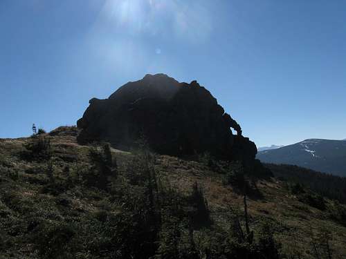
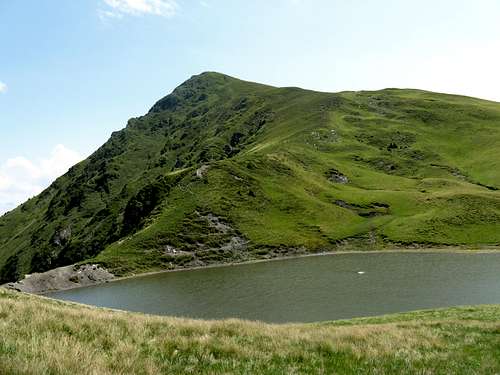
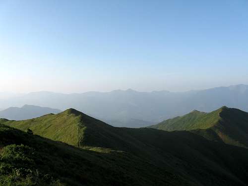
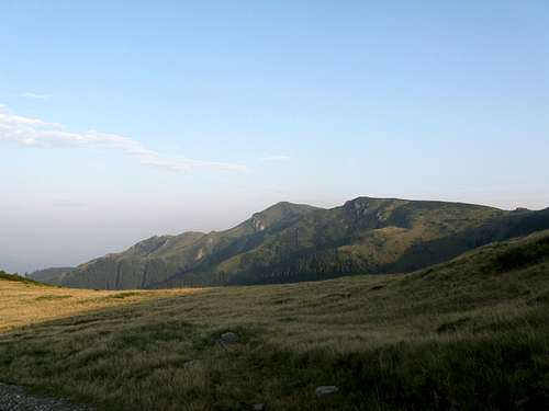
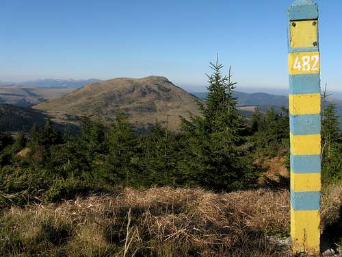
Most of the Marmarosh Mountains is protected, in Romania as Muntii Maramureşului Natural Park and in Ukraine as Marmaroskyi Protected massif. Still, you are allowed to pitch your tent virtually anywhere, on either side of the borderline.  Stih/Stogu on the horizon Stih/Stogu on the horizon Romania vs Ukraine 1 : 0 Romania vs Ukraine 1 : 0 Reminder of communist era Reminder of communist era Tysa River - part of border Tysa River - part of border Border corridor Border corridor Five "domes" - worth clicking to enlarge Five "domes" - worth clicking to enlarge 

 Hnitessa Hnitessa The top of Stih/Stogu The top of Stih/Stogu Wooden shelter of frontier guards Wooden shelter of frontier guards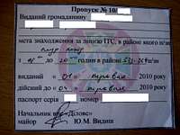 According to the Romanian laws, hikers can get as far as 20 meters away from the border corridor known as a "Protection Area". To enter the Protection Area, you need a permit issued by the border police point in the sector you want to visit. You also need to carry your passport or ID card. If you wish to enter the Protection Area, you can obtain the permit on arrival. Below you will find the addresses and telephone numbers of particular border police points.
If you want to hike along the border line, please fill in the below form and attach a copy of your passport. Then send it all to Inspectorate of Border Police, No. 38 Dragos Voda, Sighetu Marmatiei 435 500, Maramures, ROMANIA (tel. +40 262 314 528 or +40 262 315 228) After several days you can ask for a confirmation that your papers have reached the office. Here is the e-mail address: relatiipublice@ijpfmm.ro (www.ijpfmm.ro) Permit Number Issued to a citizen of …………………… (full name, address, country). The objective of the trip into the border area is ………………………. Hiking is permitted in border section.............from …hours to …hours Issued on…………………… Valid until…………………… Passport number…………………Date of issue......... NB Ukrainian laws are kind of bothersome bureaucracy and you will even need permission to enter the area 3-5 km off the border line. Moreover, the negotiations with the Ukrainian border police can be very frustrating, because they don't usually speak English. If you want to visit the Ukrainian part of the Marmarosh Mountains, please fill in an appropriate form (above) and send it, with a copy of your passport, 15-30 days before your trek, to the following addresses. This border office controls the area between Dilove village and Stoh summit: Мукачивський прикордонний загин, вул. Недецей 45, Мукачeвo 896 00, Закарпаття, УКРАЇНА e-mail: mukachivskiy_zagin@pvu.gov.ua, telephone: +38 03131 2 12 61
This border office controls section from Stoh via Chyvchyn to Hnitessa summit. Чернівецький прикордонний загин, вул.Герцена, 2a Чернівці 58022, Чернівецькa обл., УКРАЇНА email: cherniveckiy_zagin@pvu.gov.ua, telephone: +38 0372 59 19 57 A couple of days before your arrival it is necessary to verify your permit by calling these border police points: Szybene (+38 03432) 3 31 31, Dilove (+38 03132) 3 23 45, Bohdan (+38 03132) 2 20 42. After this procedure is completed, you may (not necessarily will!) receive your permit at these border police points. A story (told by PipIvan) about how some Ukrainian trekkers obtained their permit is here. If you need help with translation, please PM LukZem. |
When To Go
|
Valley of Vaser
  Freight train at Făina stop Freight train at Făina stopOne can visit a small church located above the railway station in Făina (km 32). The church was built by Austrian settlers and is dedicated to the famous empress Elisabeth, to many better known as "Sissi". Some 5 km past the campsite at Făina, near the Măcârlău stop, the railway passes remains of a dam. At this point the Vaser River used to be retained so that timber could be rafted down to the faraway saw mills. Each visit to the valley of the Vaser, whether a day trip along the railroad or a few days' trek with a tent and sleeping bag, is still an adventure. Roaming the shady forests, mountain pastures flooded by sunshine and forlorn railway stops, you will explore a fascinating, different world. Also, please take into consideration the following things:
Video created by LukZem after his two visits to the Vaser Valley
|


Wildlife
 A female capercaillie A female capercaillie
Video by LukZem
|


Getting There

|
|

|
Accommodation
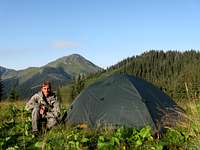
Because of the remoteness of these mountains a tent is really worth carrying. In the Romanian part there is only one unmanned refuge called Lucaciasa, in the Toroiaga massif, at 1688m. Across the border, you may come across a shelter in the vicinity of Pop Ivan. You can also make use of the many shepherd's huts, but in summertime they are ocuppied by the shepherds.
- the Romanian word for 'accommodation' you need while searching for a guesthouse/hotel is cazare
- Cabana Alpina Prislop Pass

|
|

|
- Smerekova khata near Rakhiv
Maps
Online Maps
- by Muntii Nostri
- mapy.cz
- freemap.sk
- The Marmarosh Mountains as Góry Marmaroskie on a Polish map, south-east of the center - against the other mountain ranges in the area. The red dotted line stands for the border of the province of Maramarosh in the early 20th century, then still part of the Kingdom of Hungary. To the northeast of the NE section of this line lay Galicia, which after World War I, i.e. after over a century of Austrian rule, returned to Poland.
 Trail signs in Ukraine
- Austro-Hungarian map made a hundred years ago: the Marmarosh, Chornohora and Svydovets mountains.
Paper Maps
- Maramures 1:65,000 - names in Romanian and English, by Muntii Nostri
- Chornohora/Marmarosh 1:50,000 - names in Ukrainian, Polish and Czech, available from KIWICK
- waterproof 1:50,000 - names in Ukrainian and English, by Hutyriak - the map does not cover all of the Romanian part of the mountains!
- Maramures Mountains 1:50,000 - names in Ukrainian and English, available from KIWICK
- Vaser Valley Map+Muntii Nostri Map
Select External Links
- Maramuresh Mountains Nature Park
- Plenty of interesting photos
- Book: 'Romania & Moldova' by R. Reid and L. Pettersen, with a chapter about Maramures, available from Amazon
- Video (Polish): Szlak Rozrogów im. W. Pola
Animated Snapshots
Best shots of the Marmarosh Mountains taken by LukZem
dorucalinciobanu - May 21, 2014 9:43 am - Voted 10/10
More informationMore information about Maramureș mts. in Romanian periodicals: România pitorească, nr. 2 / 1985 România pitorească, nr. 6 / 1985 România pitorească, nr. 8 / 1985 România pitorească, nr. 1 / 1989 România pitorească, nr. 10 / 1991 România pitorească, nr. 7 / 1995 România pitorească, nr. 8 / 1995 România pitorească, nr. 4 / 2008 România pitorească, nr. 7 / 2009 Almanah turistic, 1987 Almanah turistic, 1990 Almanah turistic, 1991 Carpatica, nr. 1 / 2003 Munţii Carpaţi, nr. 7 Munţii Carpaţi, nr. 9 Munţii Carpaţi, nr. 11 Munţii Carpaţi, nr. 18 Munţii Carpaţi, nr. 19 Munţii Carpaţi, nr. 20 Munţii Carpaţi, nr. 23 Munţii Carpaţi, nr. 24 Munţii Carpaţi, nr. 26 Munţii Carpaţi, nr. 37 And a paper / plastic guide for Țibău mts., a part of Maramureș mts: http://www.libraria-noi.ro/shop/produse/details/0/101536/Ghid+turistic+Tibau/Vasilescu+Ramona/
LukZem - May 21, 2014 11:14 am - Hasn't voted
Re: More informationMany thanks. Are they available online. If not, please is it possible to scan some of them and send to me by mail? Thanks in advance