The mountains were named after the village of Rodna sitting at their southern foot. The name derives from an old Slavic word 'ruda' meaning 'ore'. In the Middle Ages the village was one of the most important mining centers of the Hungarian Kingdom. The miners were mostly 'Saxon', i.e. German settlers. Here is a relevant Romanian-Hungarian dictionary. For more Romanian/Hungarian words translated into English see this Carpathian picture dictionary.
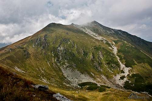
Good old Rebra recently renamed Buhăescu
Glossary
munţii = mountains
vârful = peak
şaua/pasul/tarniţa = saddle/pass
lacul = lake
tău = tarn
izvor = spring/headwaters
peștera = cave
cabana = hut
refugiu = shelter
jos = down
sus = up
Overview
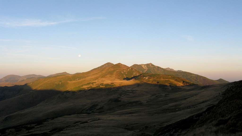
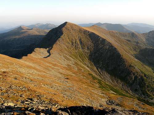
The central part of the Rodna at sunrise
The Rodna or Rodnei range is the second highest or the highest - depending which part of the Carpathian Arc, Eastern or Southern you believe the Bucegi lies in - range in the Eastern Carpathians. It lies in the north of Romania, close to its border with Ukraine. The area covered by the Rodna has the shape of a rough triangle whose northern edge is demarcated by the Vișeu River, Prislop pass at 1416 m (beyond which the Marmarosh Mountains stretch) and the Bistrița Aurie river. The southeastern edge of the triangle is demarcated by the valley of the Someșul Mare and Rotunda pass at 1271 m. To the south of the Someșul Mare lie the Bârgău Mountains whereas to the east of Rotunda pass sit the Suhard Mountains, which are lower than the Rodna but have a similar character and are regarded by some as its eastern reaches. The Sălăuța River, a tributary of the Someșul Mare, and Șetref pass at 818 m form the western boundary of the Rodnei, dividing it from the Țibleș Mountains.
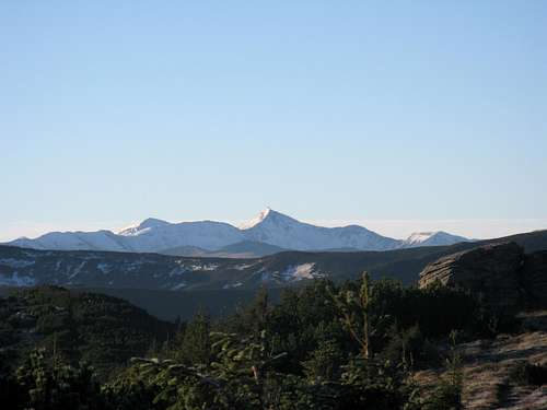
Eastern Rodna seen from Marmarosh Mts (from N)
Central & Western Rodna seen from Marmarosh Mountains (from NE)
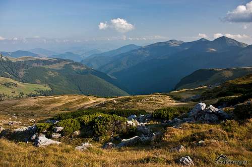
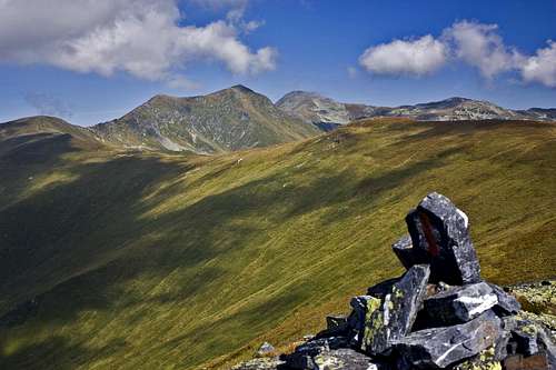
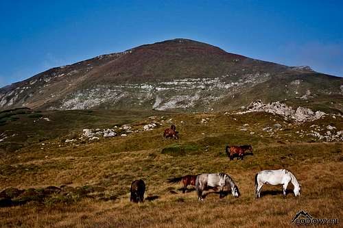
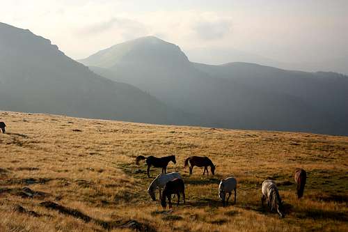
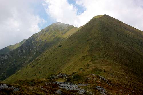
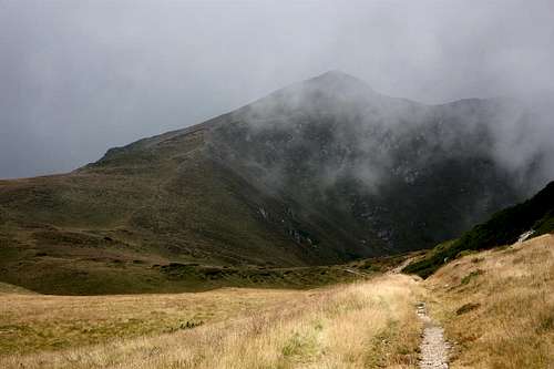
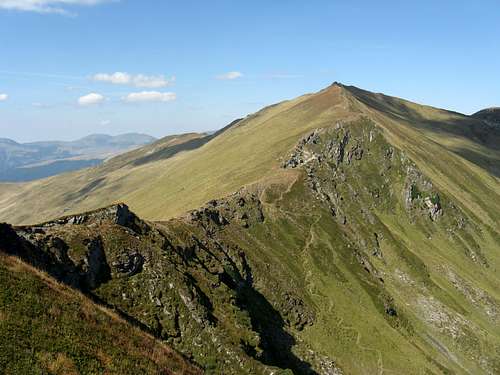
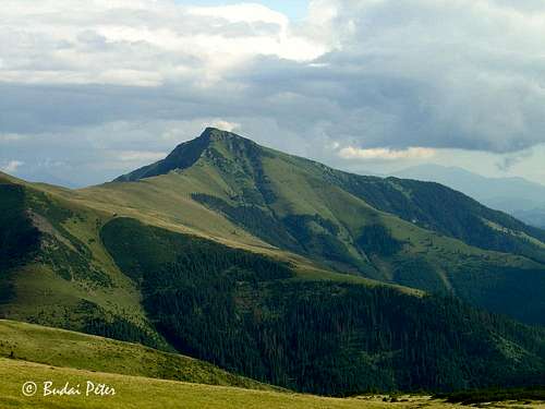
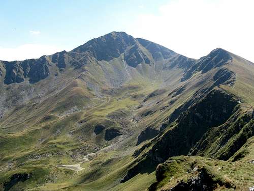
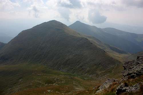
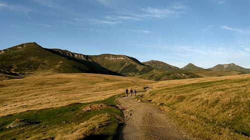
The Rodna is considerably higher than nearby mountain ranges. Its highest summit, Pietrosu reaches an elevation of 2303 m, its isolation is 220 km and prominence 1578 m. Pietrosu stands in the western part of the range, whereas the second highest summit, Ineu at 2279 m, commands its eastern chunk. he main ridge of the Rodna extends from west to east, in disaccord with the trend of the Carpathian arc, over a distance of some fifty kilometers. The northern slopes and valleys of the Rodnei are relatively short and steep, whereas the southern, especially southwestern ones are extremely long and gentle. That is why the main ridge, whose traverse has a distinct SP page, is usually approached from the north. It rises well above 1800 m, that is to say above timberline and well into the dwarf pine zone, much of which has been converted into mountain pastures grazed by herds of horses, flocks of sheep, some goats and cattle. The tops of the highest peaks, especially in the Pietrosu massif, belong in the alpine zone.
The south side
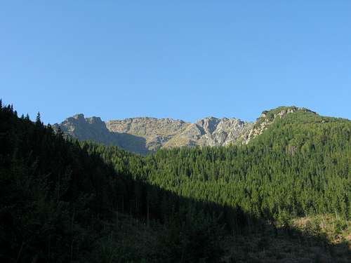
The mountains are composed of some of the oldest rocks in all of the Carpathians, mostly schists and some marble, quartzite and other rocks from the Paleozoic and Proterozic eras. Younger rocks, among them limestone and volcanic stuff, are also to be found, especially in the south. Generally, the Rodna comprises the largest crystalline block in all of the Eastern Carpathians, pushed up along faults by tectonic forces in the Tertiary and chiseled by glaciers in the Pleistocene.
The highest and some other interesting summits in the Rodna, generally from West to East.
The apex of the side ridge running NE from Ineu and dividing the drainages of Bila and Lala creeks, located over 1 km away from Ineu.
Ineut (left)
and
Roşu (right)
2222
and
2113
162
and
97
Ineut sits on the main ridge 1 km ESE of Ineu, Roşu on a side ridge 2 km SE of Ineut.
*Mostly according to the map by Munții Noștri
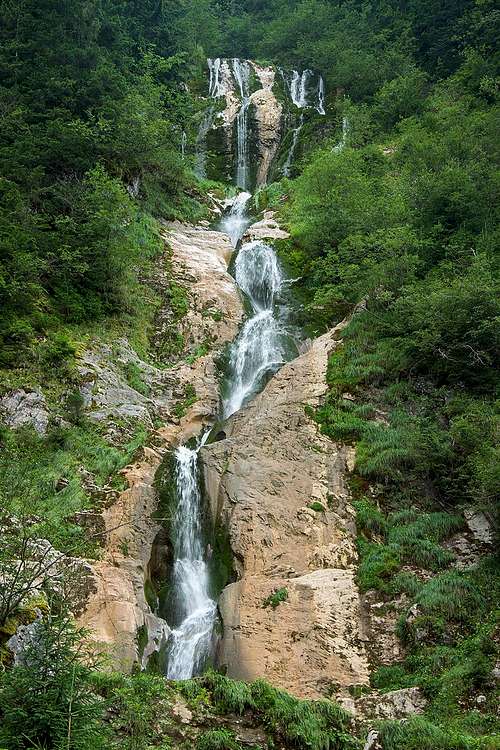
Cascada Cailor
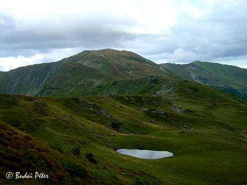
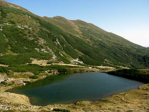
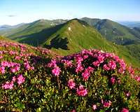
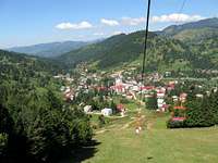
Foreign hikers usually come for a thru hike. Romanian hikers, apart from visiting the two highest summits, often go on a hike from Borșa resort to an 80 m tall Cascada Cailor (Horses' Falls), then a little further south to Tăul Știol aka Iezerul Bistriţei aka Lacul Izvoru Bistriţei Aurii - the largest tarn in the Rodna, sitting at the northern foot of Gărgălău peak. (This hike can be made much shorter if you make use of the chair lift: A walk from the top terminal of the lift to the main ridge takes just about two hours.) There are a few dozen tarns in these mountains, but they are rather small and shallow. Only Știol has an area of more than a hectare, but that is due to its outlet being dammed by man recently. The largest natural tarn, Lala Mare, is half as big and none is deeper than six meters. Still, some of those little lakes - the largest two, Iezer and the tiny Buhăescu tarns - really are scenic. In May a large narcissus field is to be admired on the slopes of Saca peak at 1600m, south of the attractive and famed, limestone peak of Corongiş.
As there are sizable patches of Paleozoic marble as well as much younger limestone in the Rodna, caves can also be found in these mountains. The largest of them is Peştera Izvorul Tăuşoarelor, located in the southwest of the Rodna. Its total length exceeds sixteen kilometers. This cave and most of the others cannot be explored without a permit, not to mention specialist gear and experience.
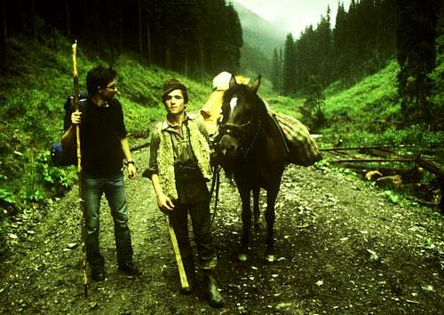
The wildlife of the Rodnei Mountains is typical of the Carpathians. In the vast forests live brown bears, wolves, lynxes, red deer and wild boar. Chamois and marmots, once extinct, have been reintroduced into the nature reserves at the two highest peaks. Eagles, hawks and ravens rule the sky. The rivers and streams are home to trout. In the grass the common viper is common indeed. In the rarely visited areas away from the main ridge and tourist honeypots, sheepdogs can pose some threat to the hiker. Try not to approach flocks of sheep, make detours and carry a sturdy stick to deter the dogs. If you do not have a proper stick you can try threatening the dogs with trekking poles or stones thrown in their direction, or just pretending to throw stones at them. Do not try to run away, move slowly or do not move and wait for the shepherd to come. He will probably be glad to meet you, especially if you treat him with cigarettes.
Red Tape, Camping, Shelters & Huts
Endemic species
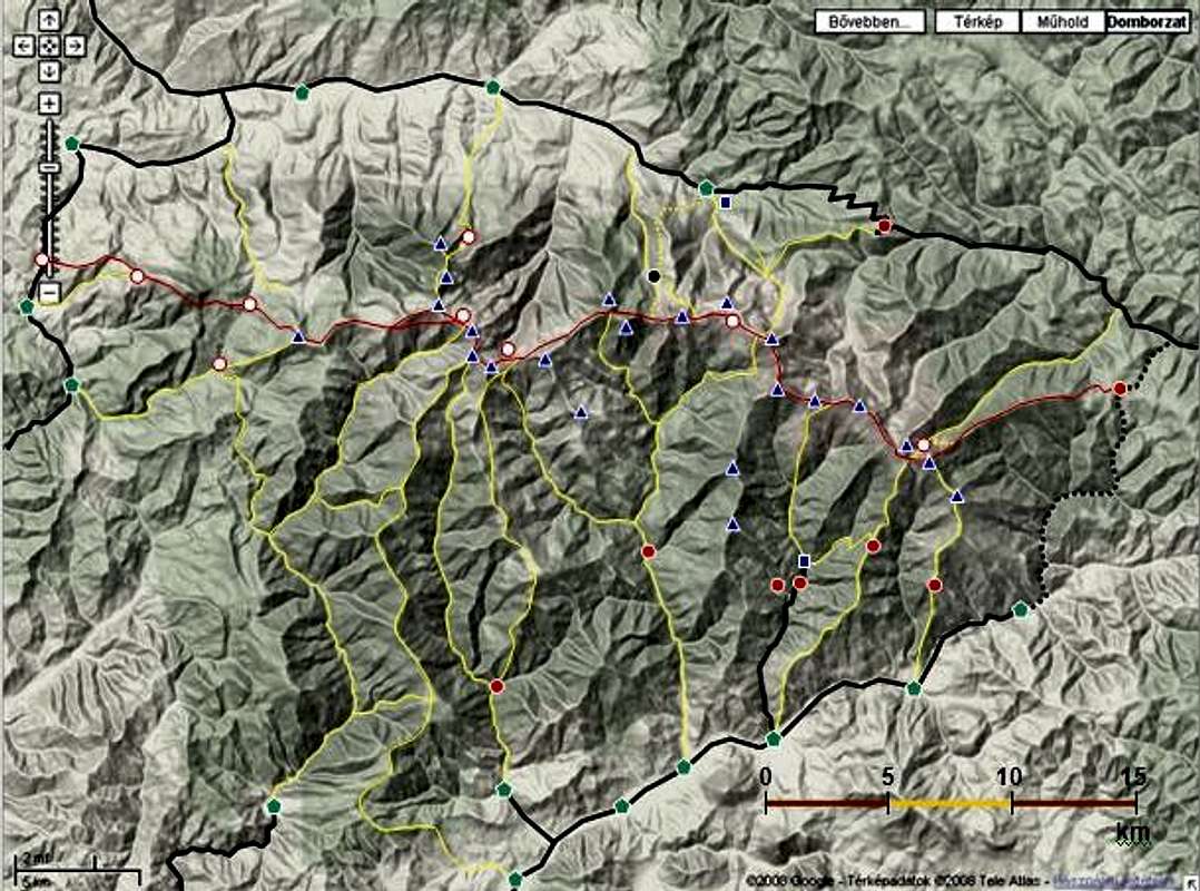
Most of the Rodna Mountains is a national park, where you are supposed to camp only at designated places and walk along waymarked trails. Several areas within the park (the largest and most precious of them in the vicinity of Pietrosu) are more strictly protected as nature reserves. Please follow the Leave No Trace ethics, especially regarding waste disposal. Special permits are needed for visiting most of the caves, even those outside the park. There are no mountain huts on or near the main ridge. Around 400 m SW of the summit of Ineu, at 2150 m on the main ridge trail marked with red stripes sits a tiny shelter which can sleep four to six people. In 2017 a bigger, more decent shelter named 'La Carti' was built at Şaua Între Izvoare (a pass east of Repede peak) at 1828 m. It is a few kilometers SE of Pietrosu. On the very summit of Pietrosu stands a ruin of a weather station, which is also used as a shelter. It is rather unwelcoming though. The map below - created by peterbud - shows (apart from major peaks and waymarked trails) designated campgrounds, mountain huts and some guesthouses in and around the Rodna Mountains. Key - white dots and black dot: designated campsites - red dots: mountain huts and unmanned refuges - blue squares: guesthouses (Please note that there are many more around, e.g in Borşa town or in Borşa resort called Complex Turistic Borşa) - bold black lines: asphalted roads (dotted: unpaved portion of road 17D) - green pentagons: settlements - red line: main ridge trail - yellow lines: other waymarked trails - blue triangles: mountain peaks Some of the featured points are clickable - these contain links to webpages (both SP and external).
meteoblue.com : Forecast for an elevation of 1518m (Scroll down for weather for towns/villages around the Rodnei Mountains.) Current data from the weather station by Iezer tarn at 1786 m (just north of the highest peak) is available online here (towards the top of the page, under "IEZER").
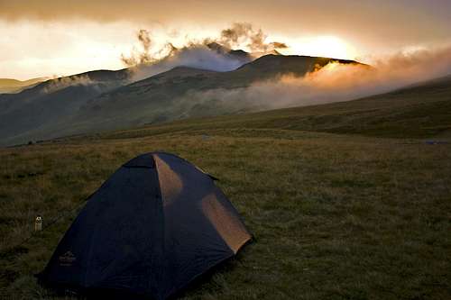
The best time for hiking is late summer. June is the rainiest month. In winter, especially on the main ridge, conditions can be harsh - anyway, full winter gear and good orientation is needed. High winds are frequent. Avalanche risk occurs. The first snow can be expected in September or the beginning of October although it is not likely to last long. Skiing is best from December to March and in some places can be possible as late as June, but snow normally disappears from the southern slopes as early as April. These mountains are quite remote, so rescue may not be possible in a short time. Another problem is that cellphone network does not cover the area well.
For mountain rescue, in Romania known as Salvamont, call 0 725 826 668
Children refers to the set of objects that logically fall under a given object. For example, the
Aconcagua mountain page is a child of the 'Aconcagua Group' and the 'Seven Summits.' The
Aconcagua mountain itself has many routes, photos, and trip reports as children.
Parents refers to a larger category under which an object falls. For example, theAconcagua mountain page has the 'Aconcagua Group' and the 'Seven Summits' asparents and is a parent itself to many routes, photos, and Trip Reports.


 38159 Hits
 92.32% Score
 38 Votes

 1981
1981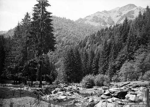 1942
1942