
|
|
Hut/Campground |
|---|---|
|
|
22.3853°S / 44.67922°W |
|
|
Itamonte |
|
|
Spring, Summer, Fall, Winter |
|
|
7851 ft / 2393 m |
This hut serves as a base for walks/ hikes/ climbs to the high part of Itatiaia National Park. The site provides support for visitors and it is used by researchers, mountain climbers and military training.
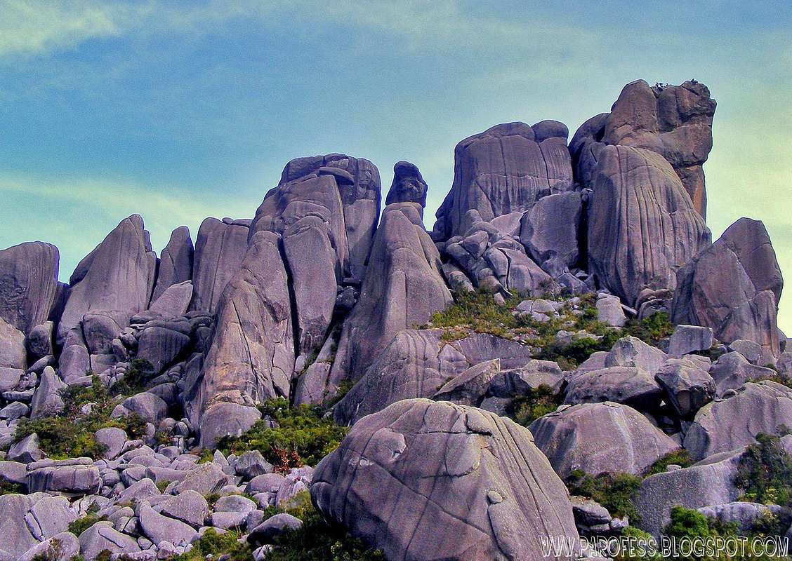
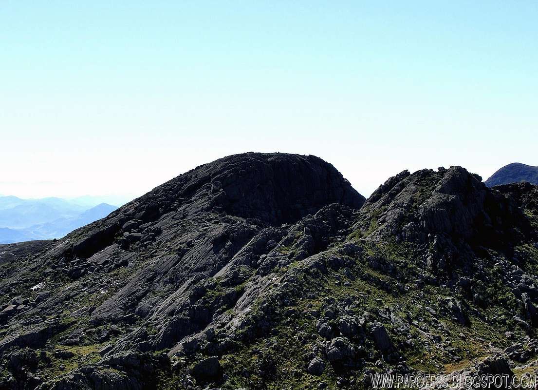
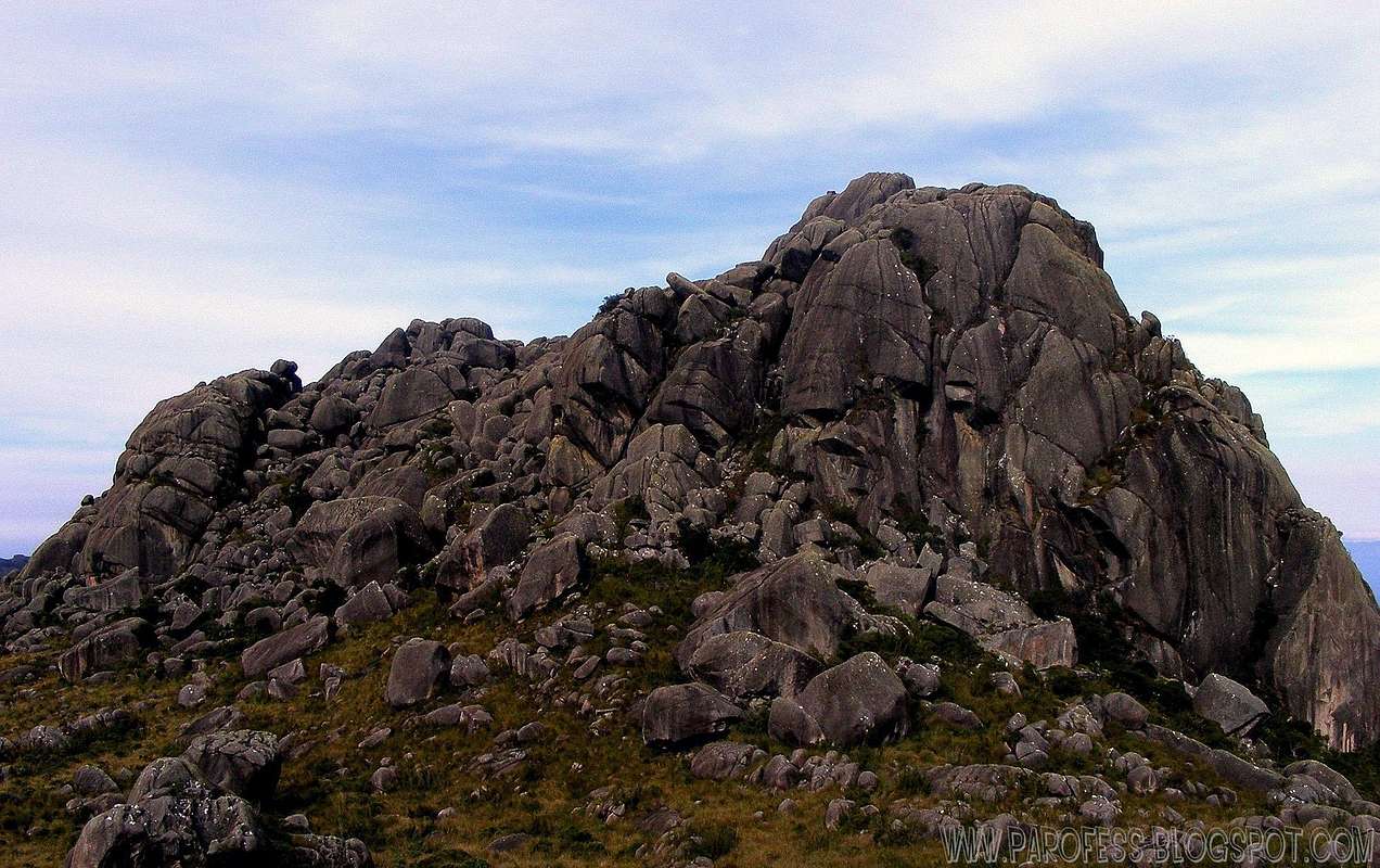
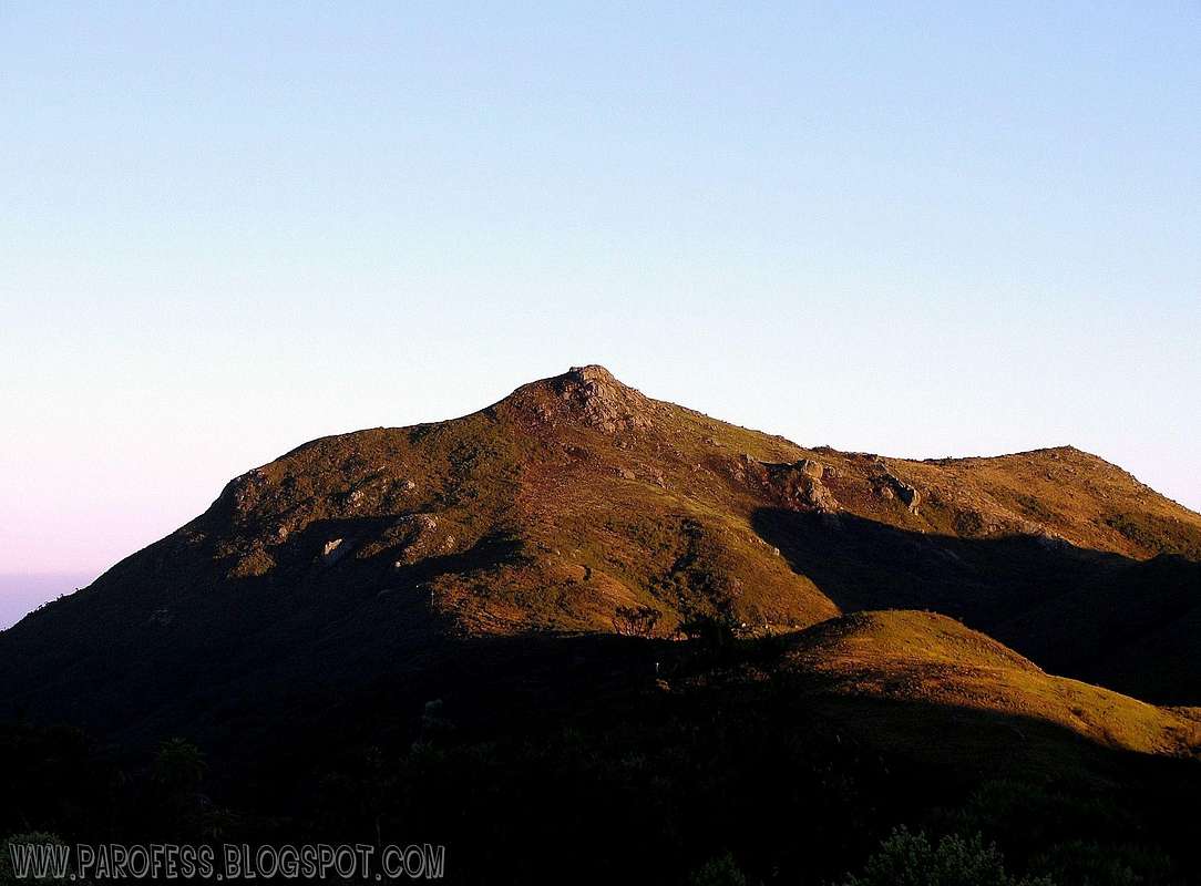
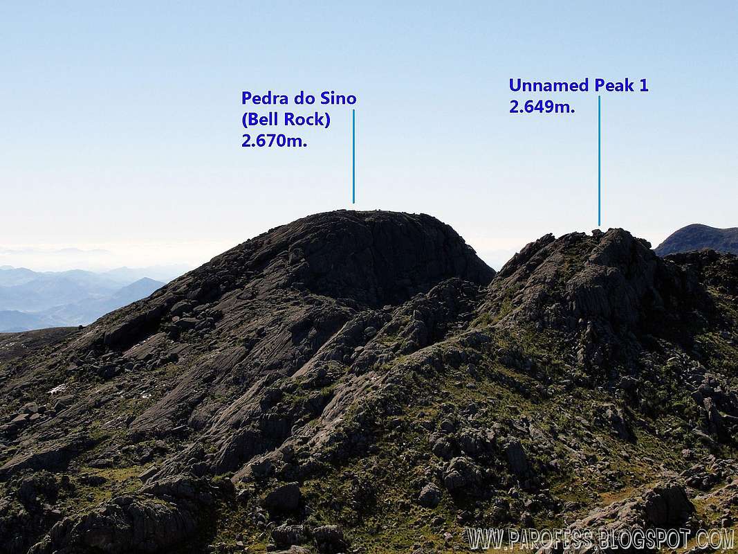
That's the main hut for several summits on the park such as (click on the image to open the mountain page):
Prateleiras Peak:![]()
Agulhas Negras Peak:![]()
Morro do Couto:
Bell Rock (Pedra do Sino):![]()
Pedra Assentada:![]()
Pedra do Camelo:
Pedra do Altar:
Pedra Furada:![]()
Unnamed Peak 1:![]()
And more other summits without the proper register in the IBGE institution. Such as Altar Mirim, Asa de Hermes, Unnamed peak 2, Morro do Massena, Massena Noroeste, Serrilha dos Cristais and
Morro da Antena.
From Minais Gerais/ São Paulo/ Rio de Janeiro, you have to take a bus to a little city called Itanhandú. Several bus companies can take you there. Once you get to Itanhandú, take a nother bus from the same bus station to Itamonte, a smaller town at the bottom of the Sierra.
There is the point: Once you get to Itamonte, it is hard to find transport to the park entrance. But there's some taxi drivers that know the park and can take you up to the park, and that's gonna cost you around R$ 100,00 (about US$ 55.00).
From the main entrance, you have to register at the military office, than you're free to get into the park from 8am to 5pm. It is important to get out at the right time to avoid problems.
Take the road directly to the shelter.
Park Entrance view:

Phone number: 55 + 24 - 3352-1461/ 55 + 24 - 3352-7001
Hut capacity: 20 people.
Reservation: Obligatory (starting 30 days before the date of use)
The mountainous place is ideal for long and amusing hikes in the midst of landscapes of singular beauty. Altitudes vary between 700 and 2792 metres.
It is considered the first national park in Brazil for the preliminary data concerning its creation goes back to the beginnings of the XX century. The Pico das Aguilhas Mountain, the fifth tallest of the country, is located in this natural reserve between the limits of Minas Gerais and Sao Paulo.
After a failed project the then Biological Station of Rio de Janeiro's Botanic Garden became a National Park in July of 1937, during the mandate of president Getulio Vargas, with an area of 12 thousand hectares. Its extension was enlarged to cover 30 thousand hectares in 1982.
To hike/ climb is a dangerous activity and requires proper equipment and clothing, the owner of this page cannot be blamed by injuries caused to anyone who read this page for its info about the mountain, and eventually got hurt by doing so with reckless behaviour or bad weather conditions.
Paulo Roberto Felipe Schmidt – AKA: PAROFES
My youtube channel: www.youtube.com/parofes - Now with 250+ videos online!
The biggest brazilian website about climbing and mountaineering, for which I'm a columnist:

That's the main hut for several summits on the park such as (click on the image to open the mountain page):
Prateleiras Peak:
Agulhas Negras Peak:

Morro do Couto:
Bell Rock (Pedra do Sino):
Pedra Assentada:
Pedra do Camelo:
Pedra do Altar:
Pedra Furada:
Unnamed Peak 1:
And more other summits without the proper register in the IBGE institution. Such as Altar Mirim, Asa de Hermes, Unnamed peak 2, Morro do Massena, Massena Noroeste, Serrilha dos Cristais and
Morro da Antena.
Getting there
By busFrom Minais Gerais/ São Paulo/ Rio de Janeiro, you have to take a bus to a little city called Itanhandú. Several bus companies can take you there. Once you get to Itanhandú, take a nother bus from the same bus station to Itamonte, a smaller town at the bottom of the Sierra.
There is the point: Once you get to Itamonte, it is hard to find transport to the park entrance. But there's some taxi drivers that know the park and can take you up to the park, and that's gonna cost you around R$ 100,00 (about US$ 55.00).
From the main entrance, you have to register at the military office, than you're free to get into the park from 8am to 5pm. It is important to get out at the right time to avoid problems.
Take the road directly to the shelter.
Park Entrance view:
Contact info
E-mail for reservation: parnaitatiaia.rj@icmbio.gov.brPhone number: 55 + 24 - 3352-1461/ 55 + 24 - 3352-7001
Hut capacity: 20 people.
Reservation: Obligatory (starting 30 days before the date of use)
The Park
The area of the Itatiaia National Park is divided into two different environments. One is the Atlantic forest with numerous centenarian trees that keep hold of the lower part, and the other which characterizes for its mountainous topography with crags and peaks on its highest part.The mountainous place is ideal for long and amusing hikes in the midst of landscapes of singular beauty. Altitudes vary between 700 and 2792 metres.
It is considered the first national park in Brazil for the preliminary data concerning its creation goes back to the beginnings of the XX century. The Pico das Aguilhas Mountain, the fifth tallest of the country, is located in this natural reserve between the limits of Minas Gerais and Sao Paulo.
After a failed project the then Biological Station of Rio de Janeiro's Botanic Garden became a National Park in July of 1937, during the mandate of president Getulio Vargas, with an area of 12 thousand hectares. Its extension was enlarged to cover 30 thousand hectares in 1982.
Legal Issues
To hike/ climb is a dangerous activity and requires proper equipment and clothing, the owner of this page cannot be blamed by injuries caused to anyone who read this page for its info about the mountain, and eventually got hurt by doing so with reckless behaviour or bad weather conditions.
Paulo Roberto Felipe Schmidt – AKA: PAROFES
External Links
A brazilian website to get mountains info, including gps files to download:http://www.rumos.net.br/rumos/My youtube channel: www.youtube.com/parofes - Now with 250+ videos online!
The biggest brazilian website about climbing and mountaineering, for which I'm a columnist: