-
 836 Hits
-
 74.92% Score
-
 5 Votes
|
|
Route |
|---|---|
|
|
40.46934°N / 105.89515°W |
|
|
Mountaineering, Scrambling |
|
|
Summer, Fall |
|
|
Most of a day |
|
|
Class 3 |
|
|
Overview
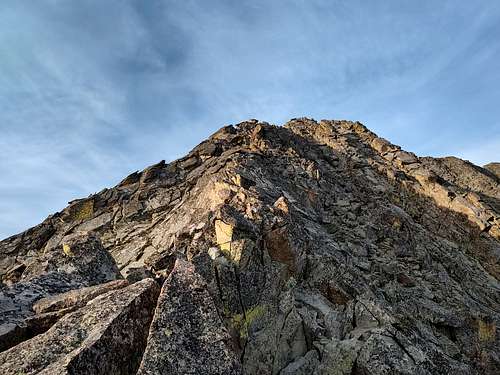
This ridgeline connects the range monarch, Mt. Richtofen, to Lead Mountain. I think that the portion from the saddle to the flat section of ridge leading to Lead is some of the absolute best exposed class 3 scrambling I've ever done! Thus, I believe this route deserves a page and some attention from climbers already in the area looking for link-ups.
This traverse is easily connected with Static Peak (Unranked), Tepee Mountain (Unranked), and "Never Summer Peak" for those looking to top some additonal beautiful landmarks.
The ridge by itself is ~1.7 miles with sustained class 3 sections, so be prepared for a long day.
Getting There
This route is best done N -> S.
See the pages for Mount Richtofen and Lead Mountain seperately for approach/ descent, as this page will primarily be about the traverse.
My personal reccomendation, however, is to camp at American Lakes and start the day by climbing Static Peak's fantastic class 3 east ridge. Getting to the summit of Richtofen is fairly trivial from there.
Route Description
From the summit of Richtofen, virtually the entire traverse can be seen.
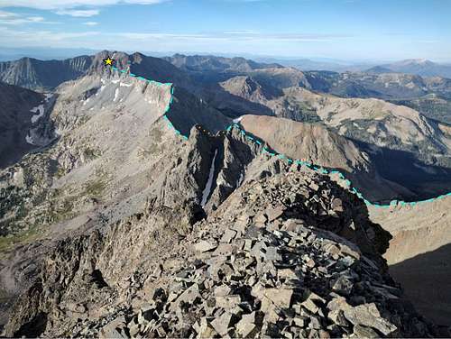
Do not descend the ridge in the photo, instead turn west towards a small point in the ridge to Mt. Mahler. Scramble down the ridge until you can get in the gully, which unfortunately must be used to descend.
Once at the bump, return your attention south. Try to reach the ridge proper where the solid rock is, and stick to the ridge or just right of it until you get to some small towers. Dodge right/ west around the first one, then either climb the second one directly (my recommendation, class 3+), or skirt on the left/ east on a series of ledges (what I did and don't particularly think was necessary afterwards, but limits exposure). If skirting, stay on the lower ledge, then scramble back up one of the gullys (first one that came up was low class 5) and find a spot to regain the ridge. Continue dancing on/around the ridge until you reach a headwall just below the west summit of Tepee.
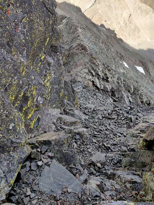
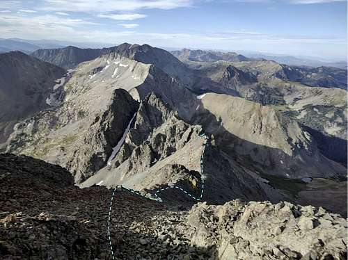
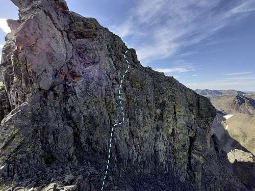
There are many potential lines on this headwall, but all of them have some level of difficulty and a bad fall. This is the crux of the route. The photo below shows the route I took in blue, which involved a fairly exposed step out onto a slab with a good foot depression. After this, find jugs above and ascend the slab. This is no harder than class 3+, but harder fun options certaintly exist.
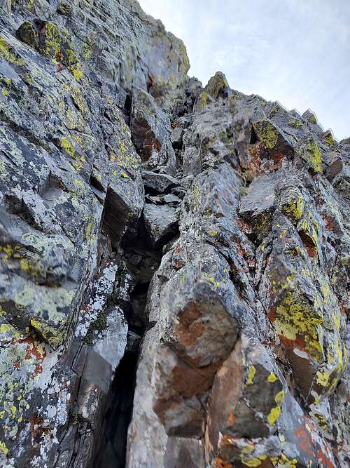
Once on Tepee's west summit, you can drop down to the saddle and climb up a gully that forms a weakness in the cliff. This looks impossibly steep from the west summit, but it is actually quite easy after doing a couple unexposed chimney-like moves to get in (class 3+). At the top of the gully there was a webbing rap anchor, but I do not believe it is needed as the rock here is quite solid until you get on easier terrain above it. From Tepee, enjoy the epic views of the start and end points of the traverse, Skeleton Gulch, and the rest of the park. The summit register was 3 years old when I was there (from 2020), with only 5 ascents (now 6!)
Once back on the main ridge, quickly take a wide slope just right of the ridge to avoid cliffing out on the ridge itself. If you do, no big deal, just backtrack / downclimb onto the slope. Turn the corner to find a nice break of easy terrain. Travel along this stretch until you reach the Richtofen/ Lead saddle. This is your LAST CHANCE to bail to either side of the ridge if there is incliment weather. The remaining stretch involves a lot of exposed class 3 scrambling, and the downclimb off the summit of Lead is class 3, so avoid continuing if rain is probable!
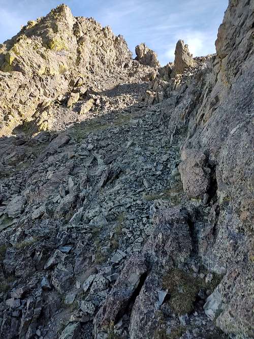
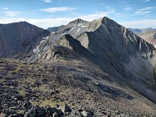
Once at the saddle, an absolutely fantastic class 3 ridgeline stretches from you to Point 12,080. This might be the most fun class 3 ridge I've ever done. Exposed, aesthetic, and relatively solid (although you have to be careful for the occasional wobbly boulder as this is fairly untravelled terrain). Continue directly along the ridge, dodging from side to side when needed. For the most fun, stick as directly on the ridge as possible all the way to the top. You can, however, drop right onto the face to limit exposure and it would probably go at class 3 as well. Have fun on this part!!
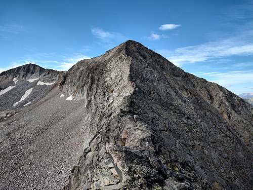
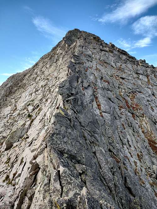
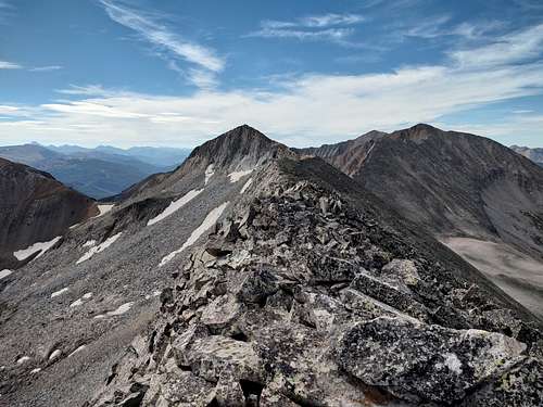
Once the point in the ridge is gained, the remainder of the ridge flattens out considerably. It consists mostly of boulder-hopping with the occasional class 3 section. The exposure towards Skeleton Gulch is still fantastic, with massive cliffs looming below. Ascend to the summit and celebrate!!
From here, tagging on "Never Summer Peak" is as simple as dropping to the saddle (class 3) and mustering the energy to ascend another ~460 feet on an easy slope.
Essential Gear
Helmet, rain gear, and experience on exposed terrain are highly recommended.
External Links
Add External Links text here.
