|
|
Mountain/Rock |
|---|---|
|
|
40.47700°N / 105.891°W |
|
|
12571 ft / 3832 m |
|
|
Overview
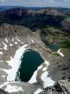
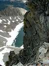
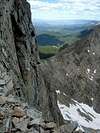
Static Peak, along with Nokhu Crags, forms an impressive cirque wall around the breathtaking Snow Lake and American Lakes (called Michigan Lakes on some older maps) in the Colorado State Forest. The summit of Static Peak rises from the intersection of the north-south ridge that connects Nokhu Crags with Mount Richthofen and Static Peak’s east ridge that separates Box Canyon on the south from the American Lakes basin on the north. This east ridge also forms the border between Rocky Mountain National Park to the south and Colorado State Forest to the north. Both Static Peak’s east and north ridges are challenging and exposed. Gerry Roach calls the East Ridge “serious Class-3 scrambling along a very exposed knife edge.” Roach says that the north ridge consists of much Class-4 scrambling with some short sections of 5.0-5.2 climbing. Static Peak’s southern ridge provides an easier, class-2 walk-up.It’s worth noting that the American Lakes basin is spectacularly beautiful. Besides the formidable Static Peak and Nokhu Crags towering above, the area is home to a multitude of wild flowers; lush, green meadows; and lakes that are chock-full of trout.
Route Overview
| ||||||
Getting There
|
Red Tape
Most climbers will approach through Colorado State Forest. Day use fees for Colorado State Forest are $5.00 per vehicle. Alternatively you could park at the top of Cameron Pass and hike in from there. There is a $2 day fee for foot-travelers. Snow Lake and American Lakes are good fishing but there is a two-trout limit. Back Country camping is allowed anywhere in the American Lakes basin but please use leave-no-trace wilderness ethics.For more information concerning Colorado's State Forest and other state parks visit their website: Colorado State Forest
RMNP has many regulations if you plan to camp in the park or access Static Peak from a trailhead inside the park.
When To Climb/Mountain Conditions
To avoid large amounts of snow, Static Peak is best climbed July through October. The area is also a popular destination for wintertime snowshoeing and backcountry skiing.For up-to-date mountain conditions try contacting Colorado State Forest. The following weather forecast gives info for the town of Gould, Colorado which sits in North Park on the west side of Cameron Pass.
Camping
Car camping is available at Crags Campground in Colorado State Forest at the foot Nokhu Crags on the north side.Camping in the backcountry is allowed at long as campsites are 200' from any significant body of water (fires are not allowed in the backcountry). There are many great campsites in the American Lakes basin. However, this area is very popular so expect to share it with many other campers. When I was there on July 26th I shared the area with at least four other groups of campers.
Camping in RMNP is allowed in designated campsites only and requires a permit.
Contact Rocky Mountain National Park
| email ROMO_Information@nps.gov *e-mail messages will be responded to in the order received and usually within 24 hours of receipt. write to Rocky Mountain National Park 1000 Highway 36 Estes Park, CO 80517-8397 fax 970-586-1256 | phone Visitor Information 970-586-1206 Visitor Information Recorded Message 970-586-1333 Visitor Information (TDD) 970-586-1319 Backcountry 970-586-1242 Campground Reservations 800-365-2267 |
Contact Colorado State Forest
Colorado State Forest State Park2746 County Road 41
Walden, Colorado 80480
PHONE: (970)-723-8366
EMAIL: state.forest@state.co.us


