A Novel Quest
I have wanted to get up to Cold Spring Knob for quite a long time; probably for over 10 years. Actually…a better way to word it would be that there was a loop hike I wanted to do, and it just happened to take me up to the shoulder of Cold Spring Knob. Not that there is anything particularly spectacular about the Knob. Trust me, there isn’t! Residing along the Appalachian Trail, it’s just another tree covered bump on the spine of the Smokies. But getting up there was an idea I had drummed up in my head many years ago, probably from spending too much time looking at the GSMNP trail map. Give me a trail map, a guide book and a novel idea, and I can usually come up with a crazy adventure. In this case the novel concept was trying to reach the Appalachian Trail from a front country campsite in Elkmont. Elkmont is where I normally camp on my trips to the Smokies, and there are a number of connecting trail options available from there that make a trip to the AT a possibility. The distance on most of these routes is a bit long for a dayhike, coming in at 20+ miles roundtrip, but a dayhike is what I wanted. Starting at Jakes Creek Trail, and making a loop out of the route by going up Miry Ridge Trail and descending Greenbrier Ridge Trail, brought the distance in at 22-23 miles. A long day, but a possibility. Completing the route festered in my head for quite a while, but I finally decided to make it happen this fall.
Since I hiked the
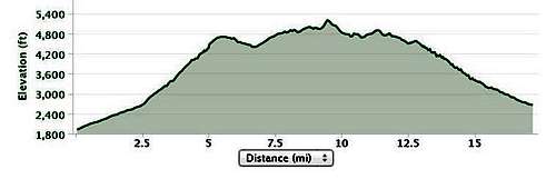
Jakes Creek Trail back in 2008 I ended up altering the route and chose to start in Tremont at the Middle Prong Trail. Rather enjoying hikes along Smoky Mountain streams, I had wanted to hike up the Middle Prong for quite a while. This change didn’t alter the route very much, and it would shorten the day by two or three miles. The route for the day would follow a series of connecting trails: Middle Prong Trail to Panther Creek Trail to Miry Ridge Trail to the AT to Greenbrier Ridge Trail returning to the Middle Prong Trail. Using the mileage listed on the trail signs, the route would end up being 20.1 miles long. I estimated the elevation gain at only 3,400 feet. Pretty tame for 20 miles! It would end up being 4,100 feet of gain. Still, pretty tame for 20 miles.
![Cold Spring Knob Elevation Profile]() Elevation profile for the day (minus the last 2+ miles)
Elevation profile for the day (minus the last 2+ miles)
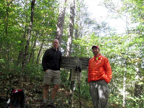
I brought my co-worker Matt along with me for this trip. I needed someone crazy enough to be willing to hike 20 miles through the woods, and Matt was a good fit, being an avid runner - and rather fit - and he loves the mountains. With the way I sold the concept to Matt, I’m surprised he wanted to come along. I gave him an honest description of the route, indicating that there was a good chance we wouldn’t get a single good view of the mountains all day. It really was going to be a walk in the woods. He more than happily agreed anyway.
Cold Spring Knob
So what made me so interested in Cold Spring Knob? For good reasons, it doesn’t exactly garner the attention of say, Mount LeConte, which we would hike up on Sunday. I suppose it does actually qualify as a peak, but while hundreds of hikers cross Cold Spring Knob on the AT, a good number of them being thru-hikers heading north towards Maine, I would bet that it is a rare occurrence when someone actually sets foot on the true summit. I know I didn’t! The AT just undulates up and over the peak’s shoulder. Reaching the true summit, which is probably less than 30 vertical feet above the AT, would require quite the bushwhack, for which I assume you would be rewarded with a view of trees and shrubbery.
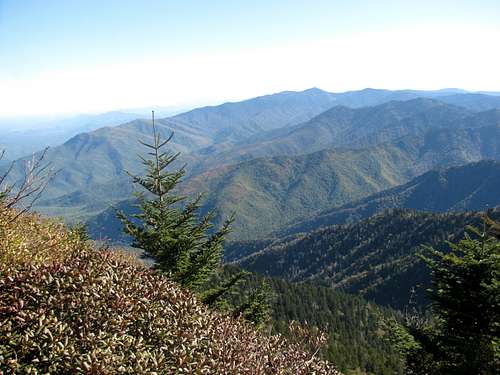
I will confess, at least when it comes to the southern Appalachians, I am not much of a peakbagger. I am a viewbagger when I am down south – I want to see mountain vistas. And when in the Smokies, add in prongbagger. Well our route did include the prongs, it just didn’t include the views. All the way up Miry Ridge, the AT connector, and then down Greenbrier Ridge, we only had one clear view of the mountains all day. The trees along the ridge continually obstructed the views. And as for the summit of Cold Spring Knob, it looked like a shrubbery invested bump, so I didn’t see the need to suffer through a needless bushwhack just to say I graced the summit…and look at more trees.
But one thing that the Cold Spring Knob hike did give us was some rare GSMNP solitude. I doubt that you could complete the route we took without seeing any other hikers, but you will probably only bump into a few, particularly after you leave the first mile or so of the Middle Prong Trail. We would only see five groups all day! That’s an average of one every four miles, which is pretty good by Smokies standards! When we descended LeConte on Sunday there were times when I couldn’t walk 40 feet without having to step aside for another group of hikers…let alone 4 miles.
So other than the solitude, what the draw? Again, some of it was just novelty. For one, I love physical challenges, and at 20 miles, at least to me, it qualifies as a challenge. Second, our route was a loop hike, and I love loop hikes. And finally, I liked the idea of being able to reach the AT from the valley floor. Add in that I would get to hike just over 20 new miles of Smokies trails…well, that was all the reasoning I needed.
I picked Matt up at his apartment in Indy on Friday afternoon and we drove straight to the Elkmont campground, arriving at 10:30 PM, which allotted us enough time to set up tents and get some sleep. It might have rained most of the evening, but we woke before dawn to clear skies. We made the 45 minute drive from Elkmont to Tremont and the Middle Prong Trailhead, starting our day right at 8 AM. I was rather happy when I counted a mere 3 cars at the trailhead.
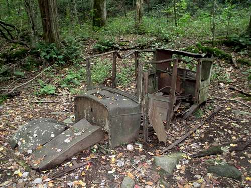
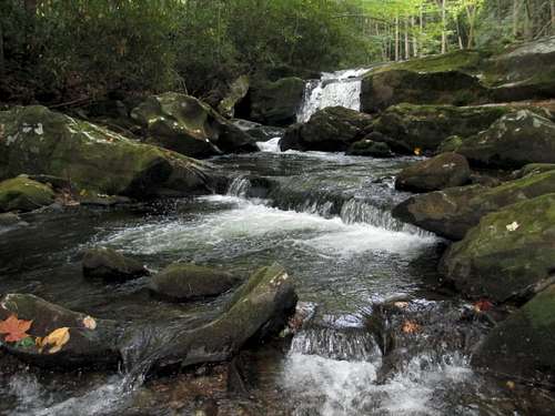
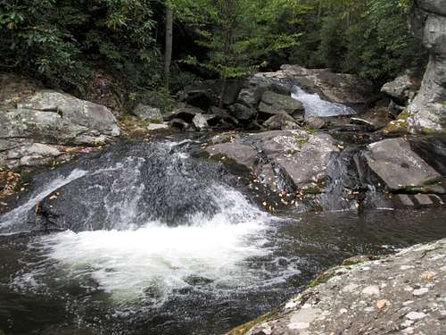
The Middle Prong made for a great start to the hike. The trail is an old railroad bed, so it is wide, well graded, not very steep and most importantly, hugs the Middle Prong for most of the 2.3 miles to the Panther Creek Trail junction. I love hiking along the Smokies prongs, and Middle Prong ranks pretty high as one of my favorites so far. It was a cool October morning, but with all the swimming holes I spotted, I couldn’t help but think that this would be a great hike for a hot summer day. We passed several good waterfalls that were visible from the trail. There looked to be some easy scrambles to better viewing spots of the falls. I wanted to head down for better looks, but also realized that we had a long 20 mile day in front of us. I passed on the scrambles hoping that I would be able to do some exploring on our way out later in the day. We looked for the spur trail that is about 2 miles in that leads to an old gutted Cadillac but didn’t see it, so we continued on to the Panther Creek Junction.
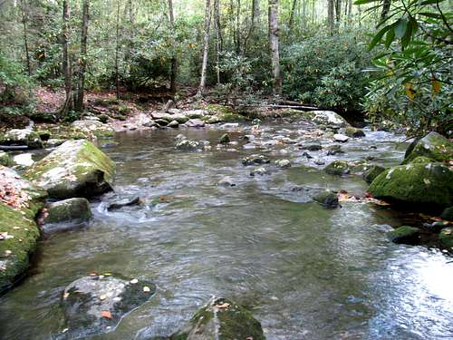
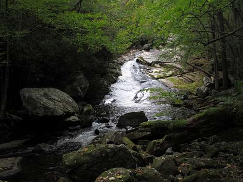
![Lynn Camp Prong]() Looking back across Lynn Camp Prong
Looking back across Lynn Camp Prong
Panther Creek was one of the big draws for this hike. The trail description always intrigued me, with its reference to nine stream crossings. In the end, it was only the first crossing that was remotely challenging. The rest of them provided no difficulty. The initial crossing was of the Lynn Camp Prong. While it ended up being pretty simple, barely getting my shoes wet, I could see how after a heavy rain and with high flow, the odds would be good that you would have to get wet. While the other stream crossings were simple, to barely ranking as stream crossings, this was a great trail. The Middle Prong Trail was wide and graded, but on this trail the rhododendron bushes closed in and made for a nice tunnel. In July under full rhododendron bloom, this would be a beautiful trail! This would end up being the steadiest vertical gain we had all day. The trail climbs for all of its 2.3 miles, accounting for about 1,400 feet of our total 4,100 vertical feet of gain for the day. We hit the triple junction with Jakes Creek Trail and Miry Ridge Trail and took a quick break for food and water before heading up Miry Ridge.
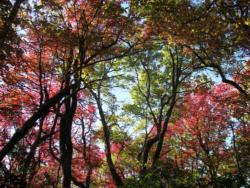
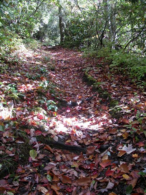
I was curious to see what the Miry Ridge Trail would offer. I hoped for plenty of good views of the Smokies on its 4.9 mile slow but steady climb to the AT. We unfortunately wouldn’t be rewarded with lots of mountain vistas, as we would get our one and only view for the day, but the trail was intriguing regardless. I knew we were early for fall colors, but we were still on the lower portions of the ridge when we were treated with some early signs of the changing seasons. Besides the beautiful red leaves still on the trees, many leaves had already fallen and they laid down a nice carpet on the trail.
![Fall Colors on the Miry Ridge Trail]() Early signs of the changing seasons
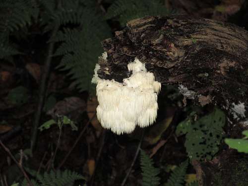
Early signs of the changing seasons![Cool White Stuff]() Not sure what it is...just thought it looked cool!
Not sure what it is...just thought it looked cool!
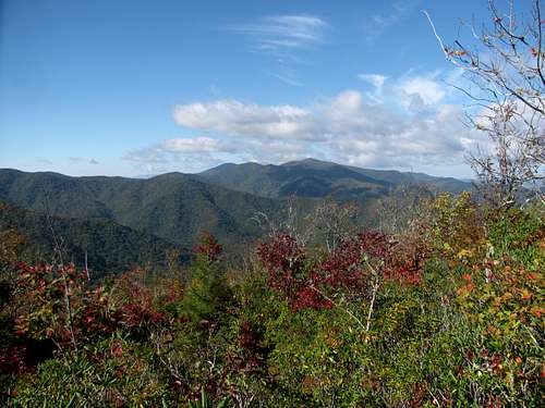
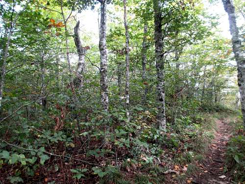
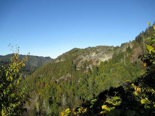
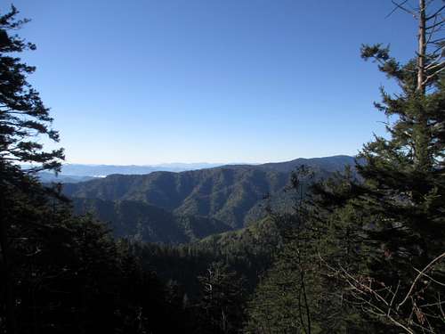
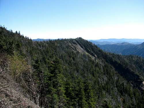
And it was on Miry Ridge where we were treated to our one and only break out view for the day. At a level portion of trail there was an obvious and open spur trail to the left which offered a beautiful view to the right. I didn’t realize it at the time but we were getting a look at our destination for the day, Cold Spring Knob. There was supposed to be another overlook on up the trail about a half mile above the junction with the Lynn Camp Prong Trail, referred to as the Ben Parton Overlook, but we must have blown right past it. Beyond this, Miry Ridge turned into what I expected – a very narrow overgrown trail. Miry Ridge isn’t a particularly busy trail, and the last mile or so below the AT it is sometimes no more than a rut, a little wider than a hiking boot, with plenty of brush blocking your view. Despite this it was always pretty easy to follow.
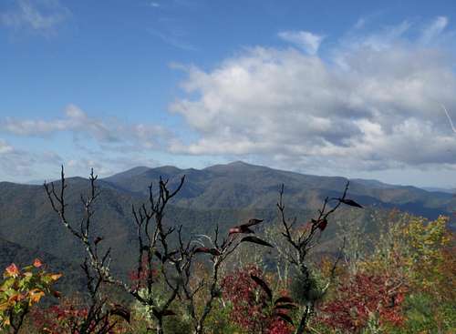
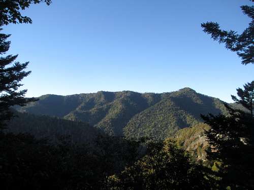
![Rocky Top]() Looking towards Rocky Top with Cold Spring Knob in there somewhere.
Looking towards Rocky Top with Cold Spring Knob in there somewhere.![Rocky Top]() Rocky Top
Rocky Top
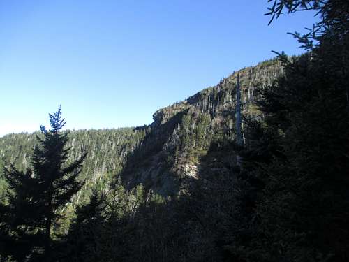
We made it to the AT, took a break and had our mug shot taken by a member of only the second group we had run into nearly 10 miles into our day. We turned south and started up the shoulder of Cold Spring Knob. This would be the steepest part of trail for the day. Once we stopped ascending I knew we were close to the summit. I tried to discern a possible high point but it was impossible through all the trees. I chuckled, and headed on down the trail for the Greenbrier Ridge Trail junction. I was hoping this 2.4 mile stretch of the AT would offer some good vistas, but again, they were all blocked by the trees. I started thinking that this would be a good hike for April, before the leaves arrived on the trees, or in November, long after the leaves had fallen. In either case, the ridgelines would be more visible and pronounced.
![Cold Spring Knob]() The summit of Cold Spring Knob
The summit of Cold Spring Knob
We hit the Greenbrier Ridge Trail junction, and it was an uneventful hike all the way to the Middle Prong Trail. We kept getting teased with possible openings that would reveal the beautiful Smokies hidden behind, but it never happened. The trees just kept staying in the way.
By the time we hit the Middle Prong Trail we were 16 miles into the day and my legs were turning to toast. Despite this I was bound and determined to find the old Cadillac and to get some good looks at the waterfalls we walked by earlier in the day. We had made good time so there was plenty of daylight left, which meant we didn’t have to be in a hurry. We did find the spur trail to the Cadillac, which was only about 50 feet off the trail, versus the 50 yards my beta said. We made the short scrambles down to the three waterfalls so I could get my pics, and after that headed for the car.
After 9+ hours of hiking and 20 miles I was ready to reward myself with some
steak, beer and a good campfire, of which we got all three. Despite the lack of mountain vistas it was great to finally finish this hike.
Mount LeConte: 14 and Counting...
We had plans for a hike on Sunday morning before making the long drive back to Indiana. Matt didn’t have strong opinions on what hike to do…actually he had no opinion. He was strictly going to go off of my recommendation. We discussed some options on Saturday night, but hit our tents with no firm decision made. When I woke in the middle of the night with my aching legs screaming at me I was thinking Chimney Tops. While steep, it was only four miles. I figured I could handle four miles. But when I rolled out of the tent at 6 AM the decision still wasn’t made. I walked around camp, trying to loosen up my legs and my sore knees, and the more I thought about it, I realized that Matt deserved to enjoy the 11 mile hike up the Alum Cave Trail to Mount LeConte and Myrtle Point.
Despite how much Matt enjoyed our 20 mile hike on Saturday, I still felt bad for him. By the time we rolled out of the tents on Sunday morning, Matt had been in the Smokies for over 30 hours, and he had only seen one view! He deserved to see how beautiful these mountains are. And the best way to do that is to hike up the Alum Cave Trail. Solitude at Myrtle Point would just be a bonus. I explained my reasoning for the choice to Matt and he was all for it… and he wouldn’t be disappointed. I am not aware of another hike in the Smokies that offers so many beautiful views. And we had a blue bird day to enjoy all that the trail had to offer. This would be my 14th trip up LeConte, and as I told Matt, it never gets old!
![Cliff Top]() Cliff Top - One of the summit viewing points
Cliff Top - One of the summit viewing points![Alum Cave Trail]() The view near the summit
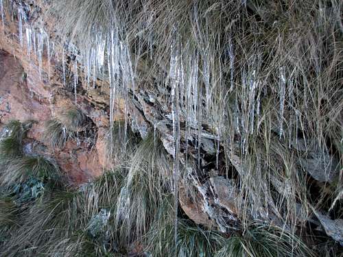
The view near the summit![LeConte-cicles]() Icicles near the trail below the summit. It was 17F on the summit the night before.
Icicles near the trail below the summit. It was 17F on the summit the night before.
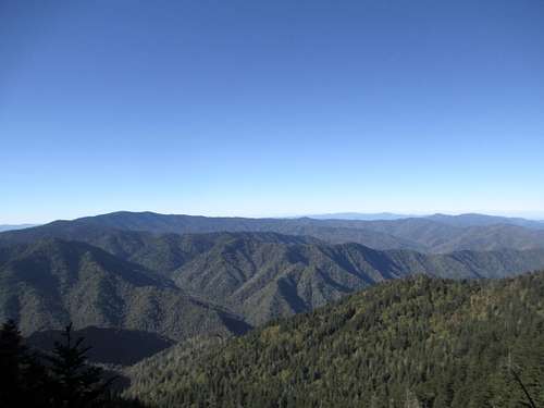
The Alum Cave Trail is almost always busy, but for a Sunday morning, we didn’t run into a lot other hikers coming down the mountain. We made it to the summit, blew by the lodge and headed for Myrtle Point, which we would have all to ourselves for 30 minutes. At this point I knew I had made the right decision. Matt was loving the view from the Point, and commented that he never knew that the Smokies were this vast and beautiful. As I told Matt, if I had to pick just one hike to do in the Smokies, hands down, it would be Alum Cave to Myrtle Point. Crowds or more crowds…the views just don’t get any better.
![Myrtle Point]() Myrtle Point from The Boulevard
Myrtle Point from The Boulevard![Myrtle Point]() From Myrtle Point
From Myrtle Point
We enjoyed our 30 minutes of solitude and then headed down the trail…and to the steady stream of late starters. While the hike up was peaceful, the hike down was just busy. I suppose some of it had to do with how tired I was on those last few miles, but I got rather annoyed having to move aside or wait for other people on the trail, and I became less than jovial to say the least.
The last mile was tough! My legs were shot and I was oh so happy to make it back to the car. A quick change into more comfortable driving clothes, a fist bump with Matt for the two great hikes, and then it was time for the nine hour drive north. A great, short, crazy, hiking-filled weekend!
Comments
No comments posted yet.