
|
|
Route |
|---|---|
|
|
53.07000°N / 158.11000°E |
|
|
Hike, in winter basic snow climb |
|
|
A long day |
|
|
most of it just walk-up |
|
|
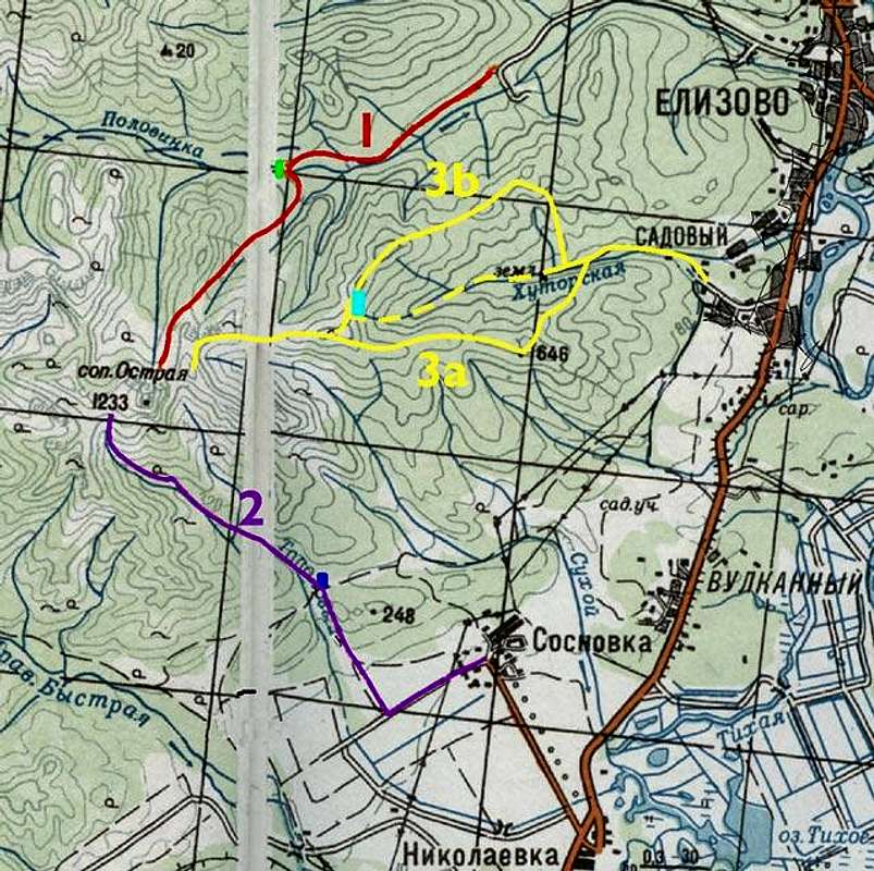
Approach
From Sadovyj - part of Elizovo, you need to take the bus No. 3 or a taxi to the end of steady road in Sadovyj.
Route Description
Walk on the mud road to the valley of the Chutorskaja stream. As the road end, you can continue hardly through the valley, or just turn left (3a) or right (3b) to reach one of the range above valley. Then the route continue gently to the pass between the Polovinka and Chutorskaja rivers' valleys. From the pass you take just another range to the pre-peak before the Ostraja pass. Last rocky part from the pass leads to the summit.
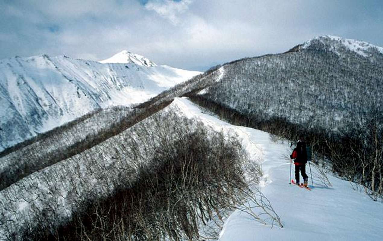
A ski mountaineer on the route "Ostraja from Sadovyj", Ostraja sopka is the highest peak on the left.
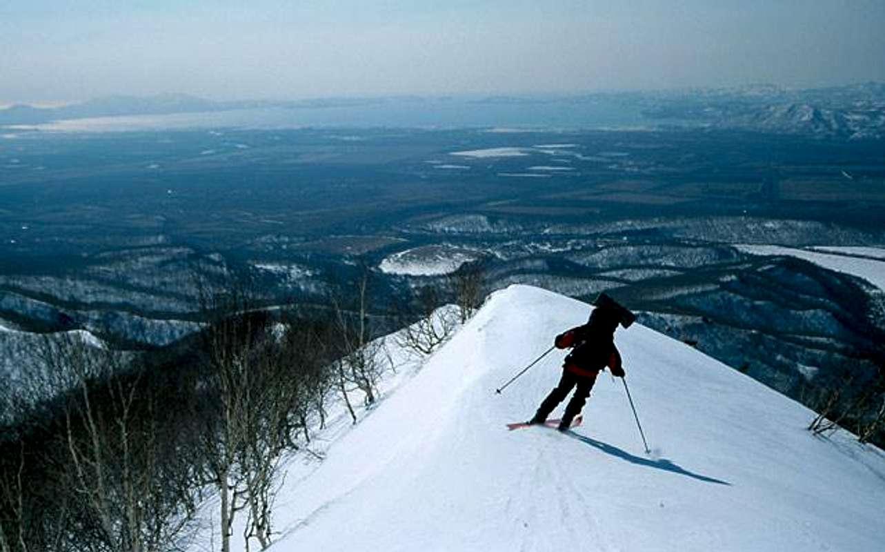
Descending from Ostraja sopka via the range by this route. Far away there are Avacha bay, and behind Pacific ocean. On the left, small peaks in the centre of old Petropavlovsk-Kamchatskij can be seen.
Essential Gear
In last part of the route you need crampoons, and probably ice-axe during the winter. Descending through the coulois basic avalanche safety equipment is necessary. During the summer only troubles with free stones in the last part.
Camping
Nice place to set up a camp/tent is just on the range (or little below) the pass between the Polovinka and Chutorskaja rivers' valleys. It is located by light blue in the map.