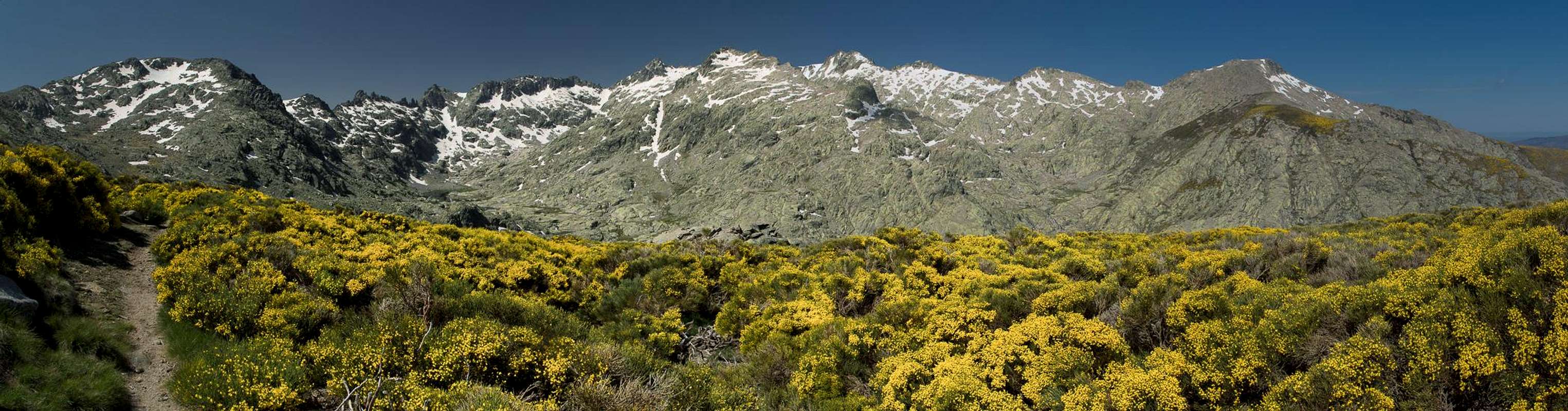
Introduction
![Circo de Gredos]() Circo de Gredos as seen from Trocha Real Circo de Gredos as seen from Trocha Real |
Years ago, a colleague of Judith, who had studied an married in Madrid, suggested
Sierra de Gredos to her. We were (and are) always searching for good places to spend our spring vacation and he had liked the mountains west of
Madrid so much that he recommended them to us. However, at the time you could only find few offers for apartments on the internet and all of them were in Spanish, a language we don’t speak. At the time we thought we wouldn’t be able to get along and went to Sicily instead.
When this winter we started to browse for a new location, Judith suggested the Abruzzi. We looked for a guidebook but had to realize that the one we would have chosen would only be released later this year which made us postpone the trip to next year. But while browsing the hiking guide page of Rother Verlag we stumbled across the guidebook about
Sierra de Gredos and decided to take a second look. We found half a dozen apartments, wrote to all of the hosts, received three answers and decided on the first one. It would be in
El Barco de Avila to the north-west of the range, which appeared to be a good if not really central location.
![Laguna de la Nava]() Laguna de la Nava
Laguna de la Nava
Over the months we followed weather forecasts for
El Barco and were happy that most of the time the weather was perfect. Still, some weeks before our trip there was a spell of 10° C weather with lots of rain, which must have resulted in snow on the mountaintops. Nice to look at but not the perfect hiking ground.
“Where will you spend your vacation?“ - my colleagues kept asking me.
“Spain, Sierra de Gredos, left of Madrid“
“Central Spain? Won’t it be too hot? Don’t you go to the sea?”
Well, by now they should know me and know that I would rather spend my vacation at home than to go to the beaches.
“It’s a mountain range and actually I’ll be happy if there is no snow.”
Disbelieving smiles greeted me; the routine remained the same for each colleague.
Summit View Canchal de la Ceja |
As our plane started descending towards
Madrid Airport we realized that we would come in from the west and consequently I was on the lookout for mountains south of our route. And indeed: there they were, the mountaintops shrouded in thick layers of clouds. But every now and then we would get a glimpse through the fog. A brilliantly white patch would become visible and our hopes sank. Snow on the summits! Some of them looked easy enough so maybe we could get there without winter equipment? We would see …
Madrid airport turned out to be a nightmare. Very crowded and our plane had to taxi for half an hour until it reached Terminal 4. We had to wait half an hour for our luggage and then realized we had to get to Terminal 1 to get our rental car. Another half our later we finally were inside a Nissan Juke, our means of locomotion for the coming two weeks.
It’s a trip of about two hours from
Madrid to
El Barco de Avila, half of which runs along a motorway. We crossed
Sierra de Guarderama through the tunnel and turned off from the motorway near
Avila, the provincial capital. There we had our first views of
Sierra de Gredos and sure enough – there was still snow on the summits. We took the highway to
El Barco (which is straight as a ruler) and then got lost inside the town as we couldn’t find our holiday home. We tried to get there four times (from different angles but only in the end did we reach the spot. “This looks like on the picture on the internet” – Judith recognized the house and finally we had arrived.
![Rio Tormes]() Rio Tormes Rio Tormes | ![Stork at Moonrise]() Stork at Moonrise Stork at Moonrise | ![El Barco s Church]() Stork infested Church Stork infested Church |
We were greeted by our hostess, Olga, and her daughter. We had a very nice chat with them while visiting / inspecting the apartment. Everything was fine – we received a lot of information about the area, maps, guidebooks, everything we would need. Unpacking I had a look outside the window towards the church tower and I didn’t believe my eyes: there were storks on the tower, nine (!!) nests on various parts of the church. Again and again one of the big birds would arrive and be greeted with bill-clattering by the resident ones. This sound would accompany us for the whole vacation, even at night. Later, as we had a short stroll through the town, we realized that there were even more nests on the four towers and battlements of the castle. The area must be a veritable stork paradise!
June 8th 2014: Through Garganta de Trampal to Cuerda de Calvitero
For a first tour Judith suggested a ridge hike along the wide crests of
Sierra de Bejar from
Plataforma de Travieso to
Torreon de Calvitero but looking at the weather forecast and the mountains outside (
Sierra de Bejar was visible from our living room window) we realized that there were still thick clouds around the summits even though weather was bound to get better during the day. Therefore we decided on the same destination but rather by another route, through the valley of G
arganta de Trampal. Also, it would be the shorter drive and we had travelled so much the day before that we were not keen on a long trip to the trailhead.
After some 20 minutes we arrived at
Central de Chorro, the trailhead of our hike, and were angrily greeted by three dogs, who seemed to think it their duty to protect the campers in the place. But after ignoring them for a minute they became friendly and one of them rather tried to accompany us on our hike. We sent it back to its owner, who just happened to step out of her mobile home to see what the noise was all about. We set out and after a short detour entered the valley of
Garganta de Trampal.
![Euphydryas aurinia]() Euphydryas aurinia Euphydryas aurinia | ![Dactylorhiza maculata]() Dactylorhiza maculata Dactylorhiza maculata | ![Argynnis (Speyeria) niobe]() Argynnis (Speyeria) niobe Argynnis (Speyeria) niobe |
We were greeted by a multitude of butterflies, which were heating up in the morning sun. But looking forward we realized thick clouds above our destination and started to doubt the success of our hike. Everywhere there were cascades of meltwater and in between, on the flat sections of the trail we had to cross a multitude of bogs. Splashing through them I saw lots of orchids, just opening their petals to the morning sun.
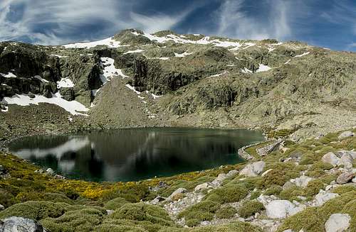
![Canchal de la Ceja]() Canchal de la Ceja above the largest of the Lagunas del Trampal
Canchal de la Ceja above the largest of the Lagunas del Trampal
Our first section ended when we arrived at the lowest and biggest of the
Lagunas de Trampal, a natural lake, now dammed up by a low dam. Still, big clouds were hanging above
Canchal de la Ceja and even the saddle
Portilla de la Ceja could barely be seen. Keeping on the right bank of the lake we headed across the rocky south slopes of
Cuerda de Calvitero, losing the trail and thus ending up on tricky terrain for the next 30 minutes. Instead of hiking the regular trail to the western end of the lake and ascending to the next platform we crossed into the valley of a tributary, which after a while ended in a cascade. We climbed across it, then headed for a snowfield which led us to an alternative way to the platform.
![Western summit of Canchal de la Ceja]() Western summit of Canchal de la Ceja Western summit of Canchal de la Ceja | ![Laguna del Trampal]() Laguna del Trampal Laguna del Trampal | ![Lagunas del Trampal]() Lagunas del Trampal Lagunas del Trampal |
Again, a bog greeted us, this time with lots of crocuses, and different kinds of wild daffodils. After splashing through it we looked back and realized we had missed the two smaller
Lagunas de Trampal, which had been hidden in a side valley. Now a large snowfield lay ahead, seeming to block access to
Portilla de la Ceja. However, we realized we could head up on the near side of it until we reached the elevation of the Portilla. There we simply crossed over a small, flat section, ending up in the saddle.
![Summer Crocus]() Summer Crocus Summer Crocus | ![The high plain Cuerda de Calvitero]() Cuerda del Calvitero Cuerda del Calvitero | ![Narcissus bulbocodium]() Narcissus bulbocodium Narcissus bulbocodium |
Still, clouds kept rolling across
Canchal de la Ceja and it was stormy up here. Without the chance of a view we decided to forgo
La Ceja and head up to the broad back of
Cuerda de Calvitero instead. Maybe we would come here again, this time from
Plataforma de Travieso, as Judith had intended in the first place. Crowds of people seemed to do just that as they passed us coming the other way. None of them was interested in the summit of the Cuerda, even though the trail went close by. We had a quiet, if very windy lunch.
![The uppermost Laguna del Trampal]() The uppermost Laguna del Trampal
The uppermost Laguna del Trampal
Returning to
Portilla de la Ceja we had to face the wind and the 20 minutes it took to get to the saddle drained the last bit of heat out of our bodies. The clouds had lightened but still
Canchal de la Ceja was partly hidden. We dropped back into the valley and quickly the grip of the wind loosened. Weather changed for the better during our trip down so that we finally were able to see the mountains of
Circo de Gredos in the distance. Of course we passed everything on our way back, lakes, bogs, orchids, butterflies and finally ran into the dogs again. But these were busy as the parking lot had filled and quite a lot of people kept them busy, spending their Sunday afternoon at our trailhead.
June 9th 2014: Ridge traverse to la Mira
Circo de Gredos seen from La Mira |
Now the idea was to get a closer look at
Circo de Gredos and to inspect snow conditions there. From afar we had seen snow but we wanted to see up close whether we would stay a chance for
Almanzor or
La Galana. The guidebook suggested a hike from
Plataforma de Gredos to the saddle
Puerto de Candeleda and a ridge traverse to
La Mira. We expected some good views and a closer view of the Circo, than we had had before. Still, it wouldn’t be a close inspection, though.
We were the first ones at the parking lot where the air was still freezing cold. There was rime on the bushes and we put on some additional layers of clothing. Another couple arrived and we got going simultaneously. They headed for
Laguna Grande inside
Circo de Gredos, however, so that we lost them at the first trail intersection already. Our path led through the meadows of
Prao Puerto, at this time of the year almost a swamp. Water was everywhere and we had to take good care to find a “dry” path. We were impressed by the large fields of blossoming Spanish Broom bushes on
Cuerda del Refugio, which accompanied us to our right.
![Prao Puerto]() Prao Puerto Prao Puerto | ![First summit view towards Ciroco de Gredos]() Central Sierra de Gredos Central Sierra de Gredos | ![Los Campanarios]() Los Campanarios Los Campanarios |
We had almost reached
Puerto de Candeleda when we thought we saw Ibexes among a herd of cattle up front. Our path wouldn’t lead us where they were so that we couldn’t verify our observation. A few ups and downs and we reached the saddle and – sure enough – here was a herd of female ibexes with their kids. They didn’t seem to be scared but slowly vanished behind a summit on the ridge we would take to get to
La Mira. Maybe we would see them again…
![Los Campanarios]() Los Campanarios
Los Campanarios
We headed up an unnamed first summit, which appeared to be a bump on the ridge. On top we realized, however, that to the south it dropped several hundred meters in a steep, almost vertical face. And up front, our ridge would do the same. It curved across
Alto de Pajonal,
Los Campanarios,
Risco Pelucas and
Las Molederas towards
La Mira in a sweeping curve. We didn’t climb all these summits, instead we passed
Las Molederas to their northern side but still the hike offered good views and impressions.
![Capra pyrenaica victoriae]() Gredos Ibex Gredos Ibex | ![Grandfather Ibex]() Gredos Ibex Gredos Ibex | ![Capra pyrenaica victoriae]() Gredos Ibex Gredos Ibex |
As we left
Los Campanarios I suddenly saw a pair of large horns peeping above a rock up front. And sure enough, as we got close we saw the Ibex behind them. The
Iberian Ibex (actually not an Ibex but Capra pyrenaica) is a close relative of the alpine Ibex (Capra ibex), even though it looks quite different. Out of the four genders only two survive with the
Gredos Ibex (Capra pyrenaica victoriae) consisting of some 4000 animals. Their horns are bent far more than the ones of their alpine brethren and they don’t reach the size and weight. Still, looking at these mountain goats up close remains very impressive.
![Risco Pelucas]() Risco Pelucas Risco Pelucas | ![La Mira]() La Mira La Mira | ![Rock mushroom in front of Circo de Gredos]() Rock Mushroom Rock Mushroom |
We passed the ibex, realizing he was accompanied by a couple of his relatives and I was glad they had come in range of my 250mm zoom lense so that I could get a handful of photos. We headed onwards and reached a broad, flat section of our ridge where the trail wound through Spanish Broom bushes. Judith was up front and paying attention to her steps not looking left and right when suddenly, a few feet in front of her a large grandfather ibex stood up to walk into the bushes. Here he joined a whole herd of his (male) relatives and we gazed at them from only a few feet distance. Obviously realizing that we were no match for them, our grandfather ibex scratched his back, then lay back down again. Now, these guys know that they are protected in
Sierra de Gredos!
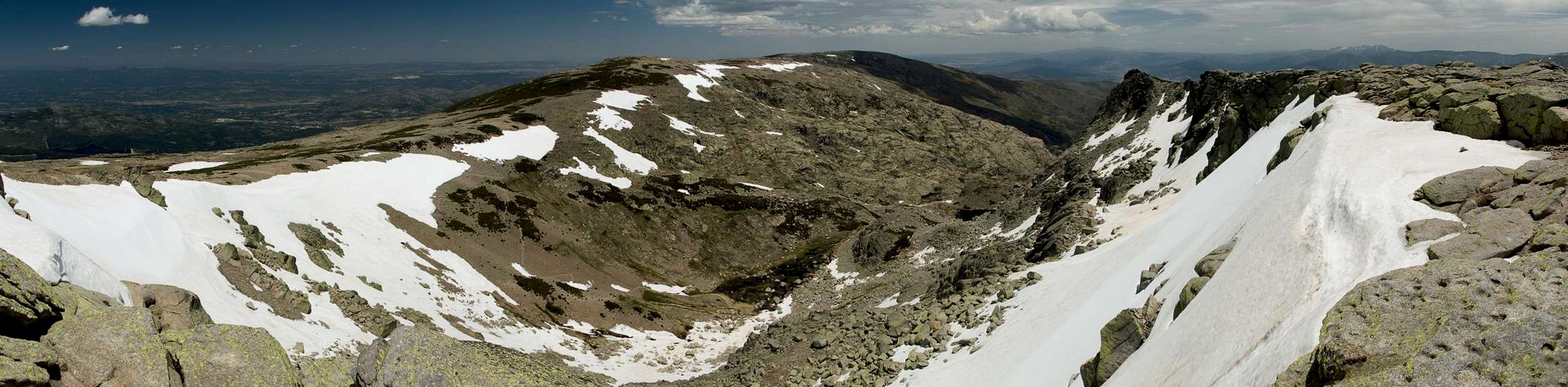
360° summit panorama from La Mira |
We headed up to
Risco Pelucas around the summit of which you can find a number of nice granite formations. We then crossed over a plateau-like section of the ridge to get to the final ascent along the north slopes of
La Mira. Again we avoided several snowfields before we reached the summit – which was in possession of a group of some 15 hikers. We looked for a wind-free place beneath the summit structure to have our lunch after which we had the summit to ourselves. Not quite, actually since we had to share it with lots of
Iberian mountain lizards (Iberolacerta monticola), the males of which are coloured brightly green.
![Capra pyrenaica victoriae]() Gredos Ibex Gredos Ibex | ![Iberolacerta monticola]() Iberolacerta monticola Iberolacerta monticola | ![Capra pyrenaica victoriae]() Gredos Ibex Gredos Ibex |
After taking in the views we returned the way we came, again (almost) stumbling across the Ibexes. This time we left the ridge after having crossed
Los Campanarios and headed down to
Prao Puerto close to
Plataforma de Gredos. Again we were amazed by the thick clusters of yellow Spanish Broom bushes as we headed down to our car.
![The Mira south ridge]() The Mira south ridge seen from Portilla de las Pelucas
The Mira south ridge seen from Portilla de las PelucasJune 10th 2014: Laguna de la Nava and Portilla de las Hoyuelas
![Laguna de la Nava]() Laguna de la Nava seen from the east
Laguna de la Nava seen from the east
To the south-west of
El Barco there are three long valleys which lead to beautiful cirques and given the snow conditions on the tops we decided to hike all of them.
Garganta de la Nava was the first (central) of them and it turned out to be a long hike. Basically it reminded us of
Garganta de Trampal: butterflies, orchids, bogs and snowfields and a lake at the end, placed inside a beautiful cirque. As it was still early when we reached the lake we decided to keep climbing towards the next saddle,
Portilla de las Hoyuelas and maybe on to
El Pelado.
![Lacerta schreiberi]() Lacerta schreiberi Lacerta schreiberi | ![Garganta de la Nava]() Garganta de la Nava Garganta de la Nava | ![Pico del Mosquito]() Pico del Mosquito Pico del Mosquito |
However, we lost our trail right after the lake and headed through Spanish Broom bushes instead. Later we regained it but now we had to realize that we had to hike through the bed of a creek, which was flooding the meadows through which it was flowing. Staying on dry land took quite some effort so that we were quite exhausted when we neared the portilla. Before we did, we had to bushwhack through breast-high Spanish Broom bushes which calmed down our enthusiasm. Seeing the ridge to
El Pelado we realized we would have to bushwhack there as well, so that we decided to stay where we were. Also, clouds started to cover the sky and we thought it better to return. It was a long trip, getting longer the closer we thought we were getting to our car.
June 11th 2014: Cuerda del Calvitero (again), Canchal de la Ceja, Torreon del Calvitero
![Canchal de la Ceja]() Canchal de la Ceja seen from Cuerda del Calvitero
Canchal de la Ceja seen from Cuerda del Calvitero
Again, Judith proposed the hike from Plataforma de Travieso to
Canchal de la Ceja and who am I to contradict her twice? So we took the long way around
Sierra de Bejar to reach the large parking lot at the Plataforma to start our hike from the north. Weather was much better this time: few clouds on the horizon, almost no wind and much higher temperatures.
The ascent from the Plataforma to
Cuerda del Calvitero turned out to be a boring affair. Even though views were good, they didn’t change and the endless switchbacks soon tired us. But finally we headed out on the large plateau-like mountaintop to hike across it. As we had already lunched on the summit we passed it to its east and headed for
Portilla de la Ceja instead. From here the trail retreats from the ridge and climbs
Canchal de la Ceja from the west. It briefly touches the ridge once, where we had wonderful views across the snowfields in its north face. Back again to the west the trail lead us to the summit plateau and from there to the summit itself. We had nice views back the way we came but our next destination,
Torreon del Calvitero was almost hidden beneath the summit plateau.
![Dos Hermannos]() Dos Hermanitos Dos Hermanitos | ![Canchal de la Ceja]() Canchal de la Ceja Canchal de la Ceja | ![Torreon del Calvitero]() Torreon del Calvitero Torreon del Calvitero |
We crossed the plateau, slowly descending towards
Portilla de las Agujas. Right before the saddle the descent turns into an exposed scramble across some granite towers with a wonderfully impressive gully view towards
Dos Hermanitos in the west. From
Portilla de las Agujas the north ridge of
Torreon looks imposing and you wonder how you’ll reach the top. However, it turns out to be a steep but easy hike which crosses saddle after saddle, all with good views to the plateaus underneath.
![Dos Hermanitos]() Dos Hermanitos Dos Hermanitos | ![Torreon summit]() Torreon Summit Torreon Summit | ![Canchal de la Ceja]() Canchal de la Ceja Canchal de la Ceja |
Finally, as we thought we finally had it made with Torreon’s summit up close we realized we had to down climb a chimney. The climb is UIAA III but there is a chain to help you here even though I’m not sure it actually decreases the difficulty. The chain crosses the actual route and thus dangerously dangles between your legs. But in the end we made it down and crossed over to the summit pillar. We headed onwards a little further (it was still early) and had lunch on one of the secondary summits.
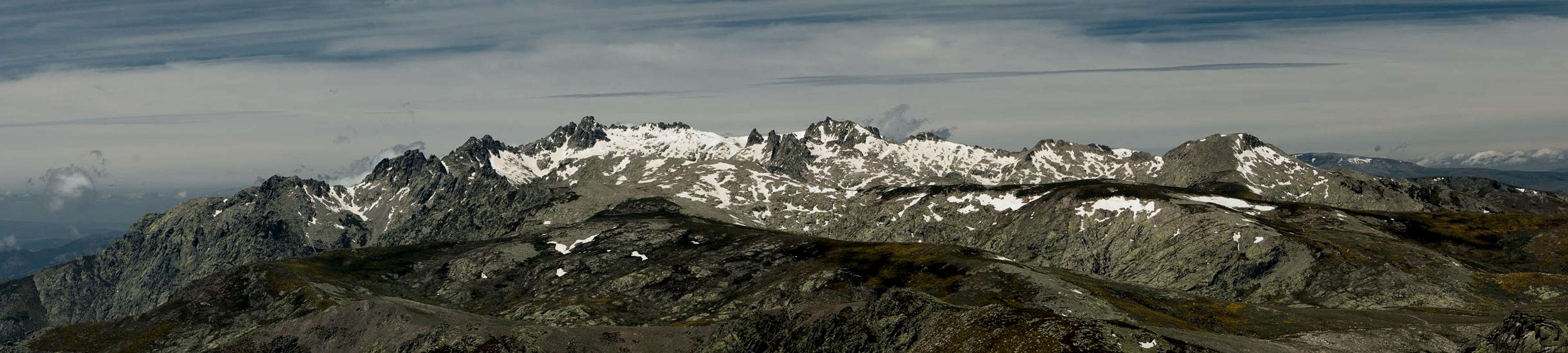
360° summit panorama from Torreon del Calvitero |
We returned the same way enjoying the whole trip up to
Cuerda del Calvitero. Weather was fine, lighting conditions were much better than in the morning so that all of these pictures were taken on the descent. After
Cuerda del Calvitero we lost our trail, however, and were forced again to bushwhack through Spanish Broom bushes. This time it was a long bushwhacking traverse until we finally regained the trail.
![Torreon del Calvitero seen from Canchal de la Ceja]() Torreon del Calvitero Torreon del Calvitero | ![Rocky section on Torreon]() Torreon Summit Ridge Torreon Summit Ridge | ![Canchal de la Ceja]() Canchal de la Ceja Canchal de la Ceja |
June 12th 2014: Laguna Grande and Morezon
As we still had not inspected conditions of
Circo de Gredos we decided to get up close today, hiking from
Plataforma de Gredos to
Morezon and
Laguna Grande, two short hikes combined in one. We started with
Laguna Grande as we were expecting crowds of people thanks to
Refugio Elola, the mountain hut on the lake’s shore. As we got out of our car at the platafoma, we realized a helicopter haul of provisions was under way, no doubt equipping the hut for the summer.
![Blooming gorse bushes]() Blooming Spanish Broom bushes Blooming Spanish Broom bushes | ![Rio de las Pozas]() Rio de las Pozas Rio de las Pozas | ![Morezon]() Morezon Morezon |
Again, we were amazed by the masses of yellow Spanish Broom bushes along the trail. The air was heavy with the fragrant smell. We cut through the valley of
Rio Pozas, hiked the north slopes of
Cuento Alto and arrived at
Mirador de la Pena del Rayo. Here, like so many people before us, we got our first full view of
Circo de Gredos,
Almanzor,
La Galana,
Ameal de Pablo and all the other summits. However, we also could see that big snowfields were still restricting access to these mountains so that we had to say good-bye to our hopes of climbing them.
![Circo de Gredos]() Mirror lake Laguna Grande
Mirror lake Laguna Grande
As we drew closer to the cirque we realized that
Laguna Grande was going through a perfect moment of tranquillity. No wind would cause any ripples on the surface of the lake so that it turned into a perfect mirror for the mountains above. We enjoyed these views, but only briefly. After all we still planned to climb to
Morezon after this.
![Ameal de Pablo (2489m), Risco Moreno (2478m), La Galana (2564m)]() Risco Moreno Risco Moreno | ![Almanzor]() Almanzor Almanzor | ![Salamandra salamandra almanzoris]() Gredos Fire Salamander Gredos Fire Salamander |
We turned around and headed back to the mirador. Already many groups of people were streaming towards
Laguna Grande, heading our way. We greeted them but didn’t stop until we found the intersection with
Trocha Real, an old paved trail, built for
King Alfonso XIII to get him to the hunting grounds of the area. Today the trocha is fallen in disrepair and you barely see the old paving stones. But sill it is used as a hiking trail to reach
Puerto de Candeleda from
Circo de Gredos.
Spanish Broom blossom on Trocha Real |
led us through an amazing amount of Spanish Broom bushes and again and again offers wonderful views of the cirque. On our way to
Morezon we followed it to the base of the summit, where we left onto another path. Crossing a snowfield we encountered a specimen of the rare
Gredos fire salamander (Salamandra salamandra almanzoris) which only occurs in this specific region. It was struggling up the snowfield, obviously less than happy about my experiments with the camera.
![Summit Panorama Morezon: Circo de Gredos]() Circo de Gredos from Morezon
Circo de Gredos from Morezon
Next, a herd of ibexes pointedly ignored us by showing their hind quarters but they were too far off anyway. We reached and followed the
Morezon north-east ridge until we reached the summit. Myriads of flies were buzzing around up there, a sign for the lack of wind at this time of day.
![El Casquerazo]() El Casquerazo El Casquerazo | ![Cuchillar de las Navajas]() Cuchillar de las Navajas Cuchillar de las Navajas | ![Almanzor]() Almanzor Almanzor |
As we had our lunch we realized that clouds were quickly forming above
Circo de Gredos, first small ones, but at the end of our lunch break a large cumulus cloud had developed on Almanzor’s northern shoulder. Towards the east everything was still fine and we started to descend in that direction. As we reached
Trocha Real again above
Manantial de las Pozas a thunderclap struck through the air. To the north it was already raining and the sky above
Circo de Gredos looked foreboding. We decided to shortcut back to our car along the east slopes of the
Rio Pozas Valley. More thunderclaps reached us while we were haven a short break right above the parking lot and when we reached it it started to rain.
Good luck so far …
June 13th 2014: Sierra de Cabezo
![Risco de Miravalles]() Risco de Miravalles
Risco de Miravalles
Today we hiked another ridge traverse across the wide massif of
Cabezo, highest mountain of the western part of
Sierra de Gredos. We had to drive quite far until we reached our trailhead at
Seranillos. The first part of the hike was uneventful. We met a herd of peacefully grazing horses and in
Puerto de Lagarejo we encountered hundreds of butterflies, all of them small tortoiseshells (Nymphalis urticae).
![Cabezo de Gavilanes]() Cabezo de Gavilanes Cabezo de Gavilanes | ![Cabezo de Gavilanes]() Gavilanes summit block Gavilanes summit block | ![Summit view Cabezo de Gavilanes]() Gavilanes summit view Gavilanes summit view |
But in the saddle the real climb started: a steep hike through the omnipresent Spanish Broom towards an outcropping of granite rocks on the shoulder of
Cabezo. Its name is
Risco de Miravalles and that’s what it is: a big rocky shoulder with a wonderful view of the valleys underneath. Beyond the risco we entered flat terrain which took us to the base of our first summit:
Cabezo de Gavilanes. After negotiating the Spanish Broom maze at the base we hit the west ridge, which we followed towards the top. It is a very steep hike, not helped by the incredible amount of flies residing there.
![Cabezo de Gavilanes]() Cabezo de Gavilanes Cabezo de Gavilanes | ![Cabezo de Mijares]() Cabezo de Mijares Cabezo de Mijares | ![On the ridge traverse]() On the ridge traverse On the ridge traverse |
Yet, we had our lunch break nevertheless but we cut it short due to the nasty insects. We followed the rocky ridge towards
Cabezo de Mijares, the second highest summit hopping along the numerous granite boulders. Sometimes we saw a cairn but most of the scramble was freestyle. However, the rocks ended a few hundred metres before we reached the summit and again we had to bushwhack through Spanish Broom. This was becoming a habit…
![Cabezo de Mijares]() Cabezo de Mijares Cabezo de Mijares | ![Cabezo de Gavilanes]() Cabezo de Gavilanes Cabezo de Gavilanes | ![Cabeza Santa]() Cabeza Santa Cabeza Santa |
… which became worse during our descent towards
Collado de la Cumbre. There was no trail to be seen. Even before we reached the saddle we had to turn onto a side ridge which we followed to the valleys beneath. It was a horrible hike – very steep and often ambiguous. However, we managed and found ourselves in a blazingly hot valley which we returned to
Seranillos.
June 14th 2014: La Mira (again) across Puerto del Peon
![Penon de Mediodia]() Penon de Mediodia covered in a sea of yellow Spanish Broom
Penon de Mediodia covered in a sea of yellow Spanish Broom
As we had realized two days before that there was still too much snow around
Circo de Gredos for us, we regrouped and decided on a second ascent to
La Mira, this time from the east. We started 6km before
Plataforma de Gredos from the same road. At first the road was paved, later it turned into a dirt road to be continued by a narrow hiking trail. While crossing a creek we encountered a tree frog in the grass, the first such specimen I ever saw outside a jar.
![Tree frog (Hyla arborea)]() Tree Frog Tree Frog | ![Los Galayos and La Mira]() Los Galayos and La Mira Los Galayos and La Mira | ![Los galayos]() Los Galayos Los Galayos |
We headed for
Puerto del Peon, an important pass for transhumance in former and current times. It connects
Hoyos del Espino in the north with
El Hornillo in the south. The path was steep but well-kept so that we could reach the saddle easily. Up there a veritable sea of Spanish Broom blossoms greeted us with wonderful views towards
Los Galayos and
La Mira. We waded through this sea, a bit disappointed that the path left the crest and headed towards a secondary summit to the north. From there we traversed the huge plateau towards the
Mira north slopes which we crossed to reach the summit.
![Central Sierra de Gredos]() Central Sierra de Gredos
Central Sierra de Gredos
Again, our lunch was plagued by flies so that I went out for a photo hunt for lizards and butterflies. The hunt was successful with additional nice views towards
Circo de Gredos. We stayed half an hour, then returned the way we came. As we were nearing
Puerto del Peon we had to cross the yellow sea again, realizing that
Peñon de Mediodia beyond the pass was also dressed in yellow. The decent from the pass was uneventful and we returned to our car in good time.
June 15th 2014: Laguna del Barco (Laguna de Galin Gomez)
![Laguna del Barco]() Laguna del Barco
Laguna del Barco
Today we explored one of the south-western valleys, the one leading up to
Laguna del Barco. It turned out to be a very long hike, even though the elevation difference was only some 700m. We started at
Puerto de Umbrias, a road pass between the villages of
Umbrias and
Nava del Barco. The first two thirds of the hike led along a broad ridge, using a well-worn dirt road with impressive views to
Sierra de Bejar in the north-east and two cirques in the south:
Corral del Diablo and
Circo de Galin Gomez. We had visited the former already and were about to hike to the latter today.
![Pico del Mosquito]() Pico del Mosquito Pico del Mosquito | ![La Azagaya]() La Azagaya La Azagaya | ![Circo de Galin Gomez]() Circo de Galin Gomez Circo de Galin Gomez |
The road ended in front of a gate, from where a hiking path led down into
Garganta de Galin Gomez. It passed the refuge
Chozo de Anselmo and headed up
Garganta de la Vega, the narrow upper part of the
Garganta de Galin Gomez Gorge. We admired a beautiful waterfall, then hiked across another of the Gredos bogs only to end up at the wide dam of
Laguna del Barco. Staying on the west bank of the lake we headed onwards into the cirque where we lunched in the shadow of
Azagaya. Again, we found a lot of orchids and butterflies visiting them.
![Laguna del Barco]() Laguna del Barco
Laguna del Barco
Upon returning to the end of the dirt road we observed the hunt of a
black kite. It swept down towards the bushes, picked up its prey and started feeding on it while airborne. I’d never seen a bird of prey do this before. In the end we returned to
Puerto de Umbrias after a 24km hike, very glad to be back but also happy to have visited this beautiful cirque.
June 16th 2014: Cinco Lagunas
Laguna de la Galana panorama |
After yesterday’s experience we decided to head to another of those cirques, this time in central Gredos, close to
Circo de Gredos but located on its western side. We started at
Navaperal de Tormes and this day would become the highlight of the whole two week vacation. As we started out from
Rio Tormes the moon was setting above the mountains to our left. I caught it rolling down the south slopes of
Cerro Pajares before we reached the mouth of
Garganta del Pinar.
![Monset above Cerro Pajares]() Rolling Moon Rolling Moon | ![Risco de Cinco Lagunas]() Risco de Cinco Lagunas Risco de Cinco Lagunas | ![First glimps of Circo de Cinco Lagunas]() Circo de Cinco Lagunas Circo de Cinco Lagunas |
We followed this valley all the way to its end with the snow-capped mountains of central Gredos standing sentinel over us on both sides. Before we reached
Hoya de las Berzas, the cirque at the end of the valley, we came across
Laguna de Majalaescoba, the first of six glacier lakes (however not counted among the
Cinco Lagunas at the very end of the trail). Here we had a first glimpse of things to come with the wonderful mirror at the base of the cirque.
![Hoya de las Berzas]() Hoya de las Berzas
Hoya de las Berzas
Beyond the laguna the path left the cirque, climbing its eastern slopes. It was a very steep climb at the end of our hike so we were very exhausted and only barely made it to the top. Here we visited the first of the five lakes,
Laguna Bajera. We had to negotiate hanging snowfields on its east bank before we reached the tiny
Laguna de Brincalobitos. A tricky creek crossing plus a short scramble took us to
Laguna Mediana, from where we reached
Laguna Galana and finally the largest of them all,
Laguna Cimera. There was still snow and ice inside the lake and this definitely didn’t look like central Spain – or the prejudices my colleagues had of it.
![Laguna Bajera]() Laguna Bajera Laguna Bajera | ![Risco de Cinco Lagunas]() Risco de Cinco Lagunas Risco de Cinco Lagunas | ![Laguna Mediana]() Laguna Mediana Laguna Mediana |
Naturally it was lunchtime and while we were unpacking our food two female ibexes and a kid appeared on the other side of the lake. As I was busy taking pictures of the trio, Judith suddenly exclaimed: “Now look at this!” Behind her another ibex girl stood and watched her. “What do you think, 5 meters (18 yards)?” she asked. “No, rather 4 – or make that 2”. Miss Ibex was slowly sidling towards us. We watched her and while we did another one appeared in front of us, also within 2m. Next thing we realized that there was a second circle of ibexes at some 10m and a third one a bit farther off. In all we had been surrounded by some 12 – 15 ibex ladies! As we unpacked our desert (some pieces of chocolate) the two closest to us started smacking their lips. But we are willing to share anything – but not chocolate!
![Capra pyrenaica victoriae]() Female Gredos Ibex Female Gredos Ibex | ![Laguna Cimera]() Laguna Cimera Laguna Cimera | ![Capra pyrenaica victoriae]() Ibex Kid Ibex Kid |
Finally we said goodbye to the ladies and started to hike back. Literally everywhere more ibex girls with their offspring appeared and we wondered why we hadn’t seen any of them on our way in. Also we saw rainbow trout, Gredos toads and even a Gredos green lizard, both the latter of which occur only in
Sierra de Gredos. We returned to the car as the sun was setting, again happy about this eventful day.
June 17th 2014: Torozo and Senda de la Rubia
![Torozo]() Torozo seen from Senda de la Rubia
Torozo seen from Senda de la Rubia
After last day’s exertions we decided that today would be a short one. We drove to
Puerto del Pico, the road pass which separates the eastern
Sierra de Gredos from the central part. To the east of the pass stand
Torozo, one of the best known climbing destinations of the range. The big granite south face offers multiple routes, which are easily accessible from the pass. We, however, decided on the normal route across the western and southern slopes, a short two hour ascent, which circles the mountain to finally come to the top from the east.
Weather was perfect as we started from
Puerto del Pico and hit the trail which climbs the west face. It turned out to be an easy hike with ever developing views towards central
Sierra de Gredos in the west and across the plains in the north and south of the range. We visited two sources (
Fuente de las Belesas,
Fuente de las Cervunales) and reached the plateau to the east of the summit. From here we hiked to a saddle right underneath the summit block, which we climbed from the east.
![Summit Sentinels]() Gredos Ibexes Gredos Ibexes | ![Rock formation near the Torozo summit]() Rock Face Rock Face | ![Torozo South Face]() Torozo South Face Torozo South Face |
We were greeted by a herd of male Ibexes, resting on a side summit of
Torozo. The herd must have been some 30 individuals strong with old and young alike. The young ones were measuring their strength with the old guys looking on. Only when the young ones got the idea to lie down besides the chieftains of the tribe would these get up and quickly re-establish their superiority.
![Chozo de La Rubia]() Chozo de la Rubia
Chozo de la Rubia
From the top we marvelled at the south face but then quickly started to descend along the west ridge. After a while we left it to return to the normal route near
Fuente de las Belesas, from where we returned to the pass. As the day was still young we decided to cross over to the western side of the pass onto
Senda de la Rubia, a panoramic trail, which offers good views to the plains in the south. However, a forest fire had destroyed the pines on the slopes beneath
Risco del Duque so that we returned after having visited the thatched hut
Chozo de la Rubia.
June 18th: Canto Cochino and La Cabrilla across Collado del Llano
![Summit view towards central Sierra de de Gredos]() Summit view La Cabrilla towards central Sierra de de Gredos
Summit view La Cabrilla towards central Sierra de de Gredos
Our guidebook suggested a hike from
Parador Nacional del Gredos to the sources of
Rio Torozo and since part of the route was supposed to run along the main ridge of
Sierra de Gredos we decided to hike it today. However, it turned out to be a route with long access and only a short ridge traverse so that in all we were a bit disappointed. Moreover we lost our path and freestyled through the Spanish Broom bushes near the ridge which resulted in cuts and bruises all over the lower sections of our bodies.
![La Cabrilla]() La Cabrilla La Cabrilla | ![Black kite feeding airbourne]() Black Kite Black Kite | ![Mojon de las Tres Cruces]() Mojon de las Tres Cruzes Mojon de las Tres Cruzes |
The ridge traverse, which started at
Collado del Llano turned out to be nice, however. There was no real path but the Spanish Broom bushes left enough room to hike to
Canto Cochino and later
La Cabrilla unharmed.
La Cabrilla offered good views along the front of
Sierra de Gredos towards
Los Galayos and
La Mira in the west as well as
Torozo and
Cabezo in the east. Do I have to mention, that we met an Ibex mother with her kid close to the summit?
June 19th: Laguna de los Caballeros
Finally we hiked the last of the three cirque hikes in western
Sierra de Gredos, along
Garganta de los Caballeros to the lake with the same name. Clouds were hovering above the main ridge as we set out and entered the valley. While not sure how far we would get before the rains started we tried to stay optimistic. Again, like so often in the weeks before, we marvelled at the wonderful granite domes and walls of this canyon-like valley.
La Camocha rose above us in a bend of the valley, after which we entered a narrow gorge.
![La Camocha]() La Camocha La Camocha | ![Waterfall at La Camocha]() Waterfall Waterfall | ![Granite face above La Mina]() At La Mina At La Mina |
Staying on the higher slopes of the right hand side we quickly gained elevation before another bend led us into the opposite direction again. Here the valley opened up and even the clouds above the summits appeared to retreat. At
la Mina, an old abandoned mine the valley turned west again and we started to head up to the laguna. The mountains of the cirque were heavily shrouded in clouds again but we kept on going until we reached
Laguna de los Caballeros.
![Laguna de los Caballeros]() Laguna de los Caballeros beneath La Covacha
Laguna de los Caballeros beneath La Covacha
Here we had an uncomfortable lunch, tucked away behind a rock to shelter from the high, cold winds.
La Covacha, which rises above the lake, only made occasional appearances through the fog and apparently clouds started to get thicker and darker. We returned trying to hike as quickly as possible but long before we had reached our trailhead we realized that it would not rain today. We slowed down and returned to our car at a leisurely pace.
Garganta de los Infiernos
Heavy clouds and rain were forecasted for our last day so we decided on a short drive down into
Valle de Jerte. Our destination was
Garganta de los Infiernos, which contains beautiful cascades with pools and rock basins (
Los Pilones). We reached them after some 45 minutes and hiked along the creek bed. Later, we turned onto
Ruta del Emperador Carlos V, an old traverse across western
Sierra de Gredos, which was used by the emperor
Carlos V, after he had abdicated and travelled to the
Yuste Monastery, where he spent the last days of his life.
![Cascades at Los Pilones]() Los Pilones Los Pilones | ![Inarchis Io]() Inarchis io Inarchis io | ![Cascades at Los Pilones inside Garganta de los Infiernos]() Los Pilones Los Pilones |
Weather and views were far from perfect so that we returned after lunch, taking a slightly different route back to
Los Pilones, where now a host of picknickers stayed. We returned to our car, drove back to the apartment. In the end the vacation had turned out fine even though we hadn’t been able to climb the big mountains of Circo del Gredos. We have had a wonderful time and those granite rocks, those Ibexes and certainly those yellow carpets of Spanish Broom will stay in our minds.


Comments
Post a Comment