Sierra Blanca Overview
At an elevation of 11,973 feet, Sierra Blanca is the high point for Otero County and is also the highest peak in southern New Mexico. It is of noteworthy mention that Sierra Blanca, with a prominence of 5,543 feet, ranks #1 on New Mexico’s list of prominence peaks. This huge extrusive volcanic mountain towers 7,800 feet above the Tularosa Basin for the greatest relief in New Mexico. The peak and surrounding ridges and summits are the only area in southern New Mexico to rise above the timberline into alpine tundra vegetation. It is located near the resort town of Ruidoso, however, it sits inside the northern boundary of the Mescalero Apache Indian Reservation.
False Start
The day got off to a bad start when my internal alarm clock roused me at 5:30 am -- three hours late. I don’t even remember the real alarm clocks -- all six of them -- going off at 2:30. This can probably be attributed to my feline pal, Sticker. He has no problem nudging me and walking across my chest and gut, waking me at all hours of the night, except for when I need to wake up.
![User Profile Image]() Sticker was fired after I woke up late.
Sticker was fired after I woke up late.
I wanted to get an early start in order to beat the summer thunderstorms that are present virtually every afternoon. It’s a 2 ½ hour drive to reach the trailhead past Ruidoso from my home in Las Cruces, so I wasn’t too happy about waking up late. I decided, despite the late start, that I was going to make a go of it. I had wanted to get to the top of Sierra Blanca in June, and that didn’t happen, so I didn’t want to put it off any longer.
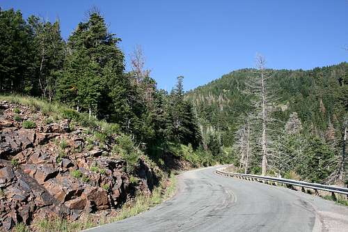
I hit the road at about 6:15 am. The drive out to the Ruidoso area takes me right by White Sands National Monument on US Highway 70. From there, the awesome prominence of Sierra Blanca is unmistakable. The final leg of the trip is on the 12-mile scenic and winding NM Highway 532. I like to take this stretch slow. Around every curve is a potential opportunity to see deer, elk, wild turkey, or maybe even bear.
![Scenic NM Hwy 532]() The scenic Highway 532.
The scenic Highway 532.The Ascent
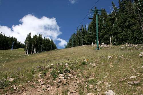
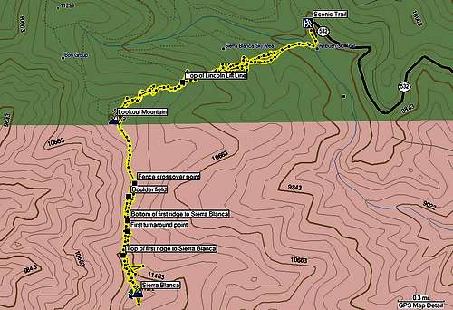
I finally arrived at about 9:15 am. I parked near the Scenic Trailhead (USFS #15) at the terminus of Highway 532. I started around 9:30, but instead of taking the Scenic and Crest Trails route, I decided to go through the Ski Apache resort and take the Lincoln Lift Line ski lift slope up. This would cut the distance needed to travel, however, the grade of the slope would take a physical toll on me. The beginning elevation is roughly 9,800 feet and the ski lift slope tops out at 11,020 feet -- more than 1,200 feet elevation gain over 0.7 miles.
![The way up]() The view ahead, about two-thirds of the way up the ski lift slope.
The view ahead, about two-thirds of the way up the ski lift slope.![Close to the top (of the ski slope, not Sierra Blanca)]() Looking down from near the top of the ski slope.
Looking down from near the top of the ski slope.
After finally making it to the top of the ski lift slope, tired and winded, but determined, I continued along the ski resort maintenance road that would take me right by the Lincoln County high point, Lookout Mountain (11,580 feet).
I proceeded south along the wood fence line. You want to be to the left of the fence line on this part of the trek. You will need to crossover later to the right side, where a broken section of the fence conveniently facilitates this. You will come upon an expanse of boulders. You can either negotiate your way through this, or go around it on a small trail that is not well marked and can be easily missed. Which way is easier is a toss up, in my opinion. I went through the rocks on the ascent and took the trail around them on the descent.
![Silvery Lupine]() Silvery lupine near Lookout Mountain.
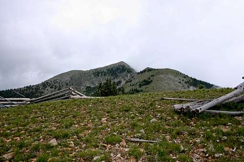
Silvery lupine near Lookout Mountain.![View of Sierra Blanca after passing by Lookout Mountain]() Stay to the left of this fence line after passing Lookout Mountain.
Stay to the left of this fence line after passing Lookout Mountain.![Crossover point to Sierra Blanca]() This broken section of fence makes a good crossover point.
This broken section of fence makes a good crossover point.![Boulder field]() The boulder field and first ridge leading to Sierra Blanca.
The boulder field and first ridge leading to Sierra Blanca.
After going through the boulder field, I started up the first ridge that leads to Sierra Blanca. Not far up the ridge, the lingering weather had closed in and completely engulfed the mountain. The weather report I checked prior to departing said 20% chance of thunderstorms. 20% for Ruidoso…not for the mountains. Having come this far, I did not want to turn around. I took a few minutes to ponder my options. The last place I wanted to be was on an exposed ridge in the middle of a thunderstorm, in low visibility conditions and likely with no bail out point. I decided to pull the plug and headed back down the ridge. I would come back another day, waking up on time for the next attempt. But now I had BBQ on my mind.
The Ascent (again)
At the boulder field, I encountered a hiker headed in the direction of Sierra Blanca. He asked me if I was on SummitPost. It turns out that the hiker was Lizrdboy. As we talked, the weather around the mountain had cleared significantly, so I decided to turn around, make another attempt, and hope for the best.
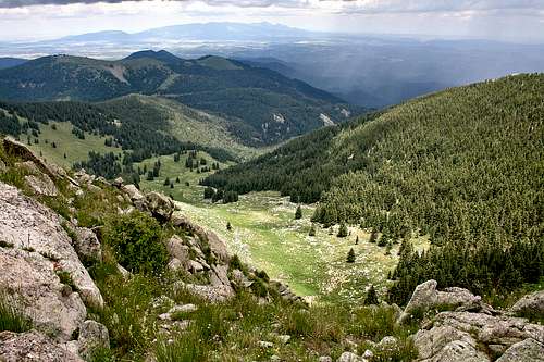
Lizrdboy moved like a lizard and proved to be too fast for me. Not wanting to kill myself, I didn’t even attempt to keep his pace. He left me in the dust on the first ridge. I saw him again on the next and final ridge, after he had already summited and was on his way down. After a few words, he left me with a bottle of PowerAde and continued on his way down. The views off this ridge are spectacular and I took my time to enjoy them.
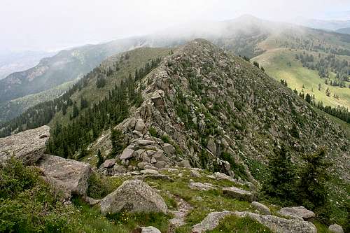
![Final ridge to Sierra Blanca]() Low-level cloud layer shrouds the summit of Sierra Blanca. There is a sheer drop-off on the east face of this final ridge.
Low-level cloud layer shrouds the summit of Sierra Blanca. There is a sheer drop-off on the east face of this final ridge.![View from ridge to Sierra Blanca]() Views to the east from the final ridge are spectacular.
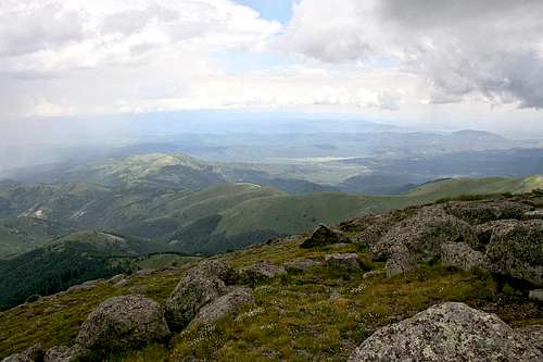
Views to the east from the final ridge are spectacular.
I finally reached the summit at 2:15 pm and clouds had again rolled in by this time. Upon summiting, I was greeted by rain which soon turned to hail. Luckily, the rain and hail stopped after about 10 minutes. The 360 degree views from the summit are stunning – the Malpais lava beds to the northwest, the Capitan Mountains to the northeast, White Sands National Monument to the southwest, and the vast expanse of the Lincoln National Forest all around you.
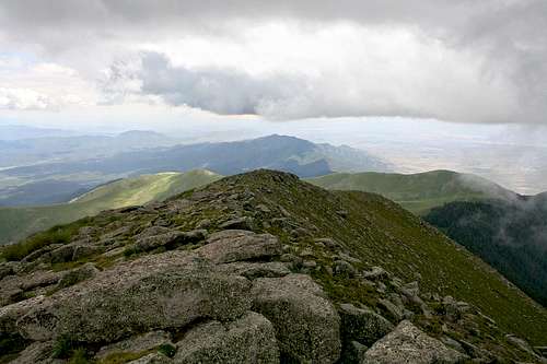
![View to the north from Sierra Blanca]() From the summit, looking north back to the final ridge. Lookout Mountain can be seen in the distance just to the right of the ridgeline.
From the summit, looking north back to the final ridge. Lookout Mountain can be seen in the distance just to the right of the ridgeline.![View to the south from Sierra Blanca]() View to the south from the summit.
View to the south from the summit.![View to the east from Sierra Blanca]() Sierra Blanca’s east ridge.
Sierra Blanca’s east ridge.![Sierra Blanca benchmark]() Sierra Blanca summit benchmark.
Sierra Blanca summit benchmark.The Descent
After spending 15 minutes taking in the views (some of which were obstructed by the cloud cover) and a few pictures too, I started my descent. As I hit the first ridge from the summit, I took a slightly different route than I took on the ascent. Instead of trekking the top of the ridge as I did coming up, I noticed a trail below and to the left of the ridge line. This would’ve saved me some time had I taken this route on the ascent. Much of the terrain on the ridges going down were slippery due to the rain. I had probably close to 10 near-falls. My trekking poles saved me on all but one. As I descended the final ridge, I noticed the small trail to the right of the boulder field, which I took to minimize the risk of further slips on wet rocks.
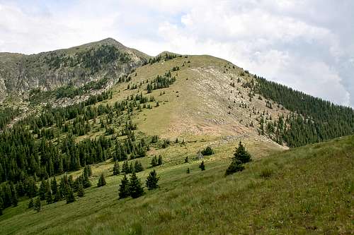
![Sierra Blanca]() Looking back to Sierra Blanca a final time.
Looking back to Sierra Blanca a final time.
I continued north, passing Lookout Mountain just to the left of the maintenance road. I thought about taking a quick trip to the top, then decided against it for two reasons. Clouds had continued to roll in, which undoubtedly would’ve resulted in a poor view. But the main reason was that I still had BBQ on my mind, and I was hungry.
At 4:00 pm, the thunderstorms arrived to the east. At 4:45, I started my descent of the Lincoln Lift Line ski lift slope. The thunderstorms to the east continued and new thunderstorms had developed to the south by this time and were moving in a northerly direction towards my position, so I stayed close to the tree line on the way down instead of the middle of the ski slope.
I made it to the ski resort parking area at 5:30. After unpacking, I went directly to Can’t Stop Smokin’ just off NM Highway 48 in Ruidoso and got my BBQ – 1 lb. of tri-tip sirloin, ½ lb. of brisket, and ½ lb. of smoked sausage.
Even taking into account what went wrong (right from the start), this trip was well worth my time. I plan to do it again in the future, next time earlier and in better weather, and hopefully with better views from the summit.
![Sierra Blanca GPS track]() GPS track.
GPS track.









Comments
Post a Comment