
Comments
No comments posted yet.
|
|
Trip Report |
|---|---|
|
|
37.27900°N / 113.6542°W |
|
|
Nov 24, 2019 |
|
|
Hiking |
Snow Canyon State Park sits to the north of the town of St. George in southwestern Utah. A trail starts on Route 18 and goes 2.25 miles on a juniper covered plateau to reach the north rim of Snow Canyon. The trail then goes away from the rim of the canyon and travels on the surface of the plateau until after 8.5 miles, it reaches a place called Red Mountain where cliffs drop 1400 vertical feet to reach the town of Ivins, Utah.
I followed the trail 3.5 miles and then left the trail finding my own way over the slickrock country to the western edge of Snow Canyon. After hiking along the edge of the canyon for some time, I went back to the trail creating a 12.4 mile lollipop loop hike.
Hiking Distance: 12.4 miles
Maximum Elevation: 5120 ft
Minimum Elevation: 4680 ft
Total Ascent: 1650 ft
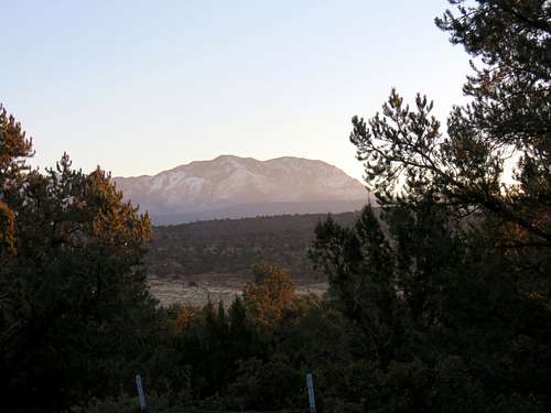
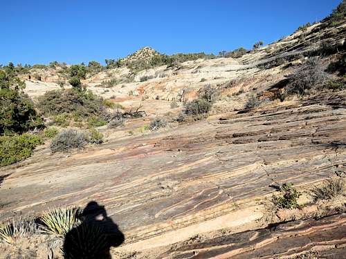
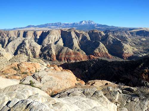
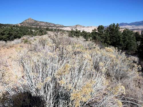
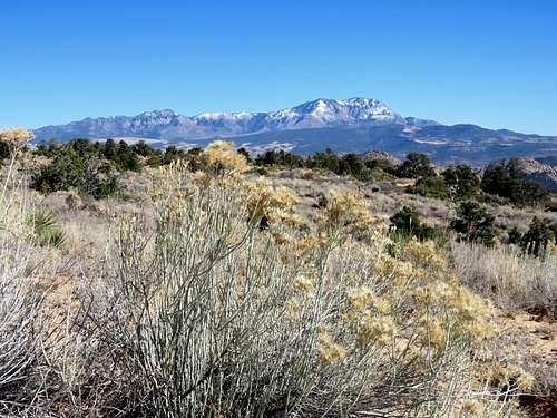
Started my hike at 7:30 a.m. on Red Mountain Trailhead at an elevation of 4685 ft. It was 28 degrees F and no one else was there. I did not see any other hikers until late in the day when I was back close to trailhead. The trail went southwest over the surface of a juniper covered plateau slowly going up in elevation. For the first mile, the trail was as wide as a road with wire fence on both sides of it. I could look behind me to the northeast to see the early morning sun over the 10365 ft high Signal Peak.
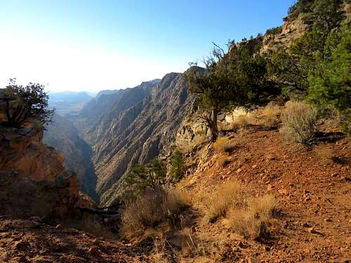
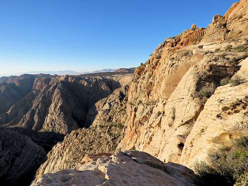
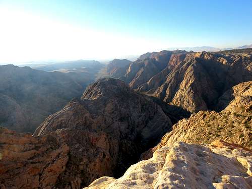
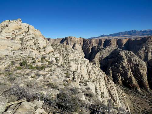
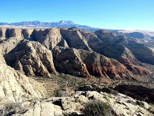
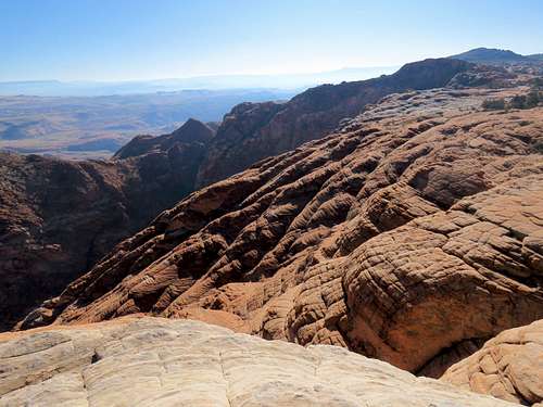
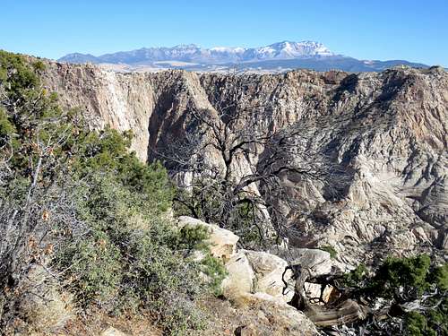
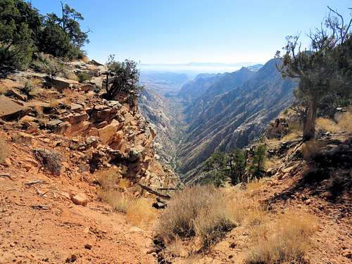
After 1.9 miles, I reached a split in the trail. Turned left and followed the trail half a mile more until I reached the north rim of Snow Canyon. I was at an elevation of 5000 ft. Below me cliffs dropped 1200 feet to the bottom of Snow Canyon where the canyon dead ended.
|
|
Soaked in the views, then returned to the main trail away from the canyon. Went up to a high point and then down to the edge of the canyon again.
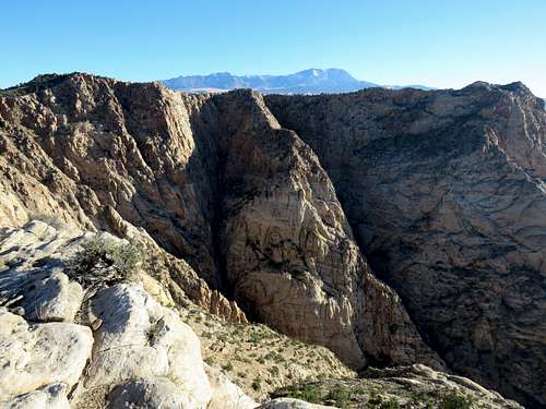
After that, the trail headed south going away from the canyon not giving me any views. At a spot where the trail came close to the canyon, I left trail going east a short distance to reach the western rim of Snow Canyon where I had a great view of the north end of the canyon and the distant Signal Peak.
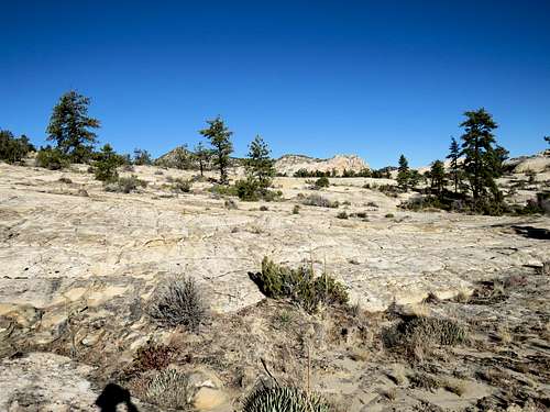
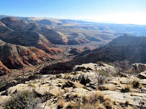
Back to the main trail, I knew that I would no longer get any views of the canyon so I left trail following a path that I had entered into my GPS over the slickrock country toward the edge of Snow Canyon.
|
|
Finally reached the western rim of the canyon.
|
|
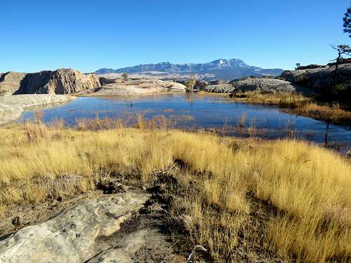
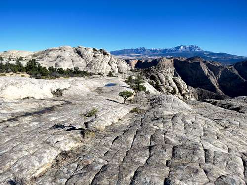
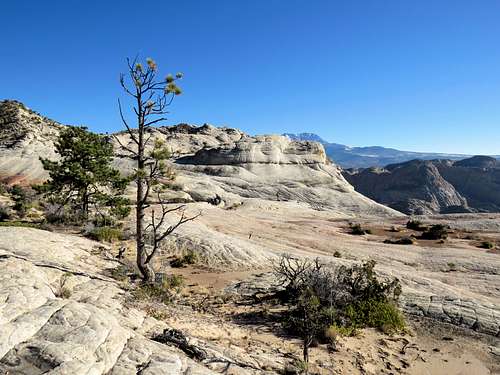
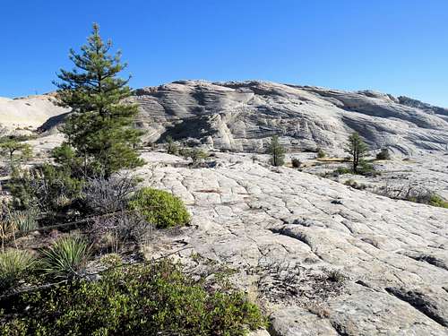
My plan was to hike south remaining on the western rim of the canyon but there were obstacles on the rim so I went away from the rim where I suddenly reached a pond with grass on its shoreline in the middle of the slickrock plateau.
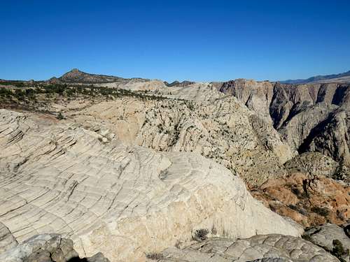
More slickrock on my way south.
|
|
|
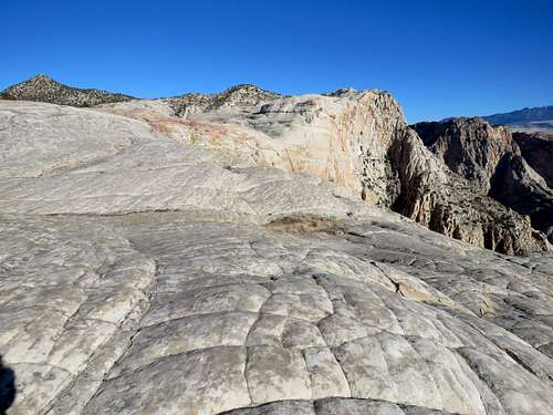
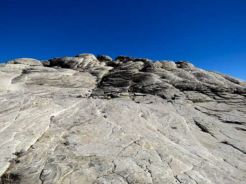
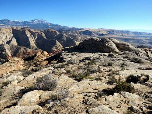
I then went to the top of a 4760 ft high point on the rim of the canyon. It was 10:20 a.m. and at that point I had hiked 6.1 miles.
|
|
|
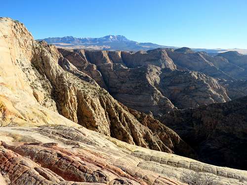
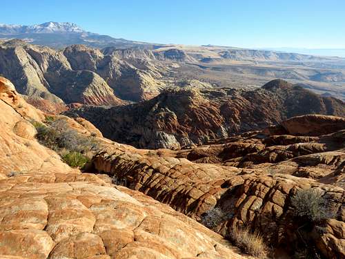
I was wondering how much further south I should hike. I knew that reaching the end of the plateau, would turn into an almost 20 miles roundtrip off trail hike so I was not ready to do that. I could see another high point further south where the slickrock seemed to be more reddish in color. Began walking over the white slickrock toward the red spot.
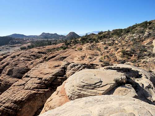
The slickrock soon became red.
|
|
At 10:50 a.m. and 6.85 miles, I reached the red spot. Sat there to have my lunch and enjoy the views.
|
|
|
|
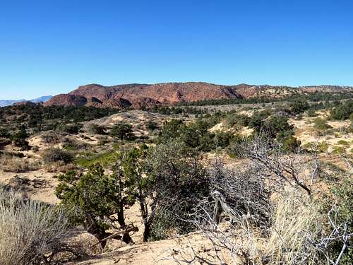
I then left the rim of Snow Canyon and headed west over the surface of the plateau to reach the trail. The plateau in that area no longer had slickrock and was instead covered by sand.
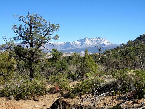
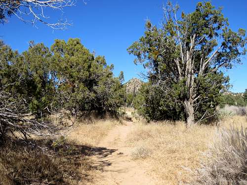
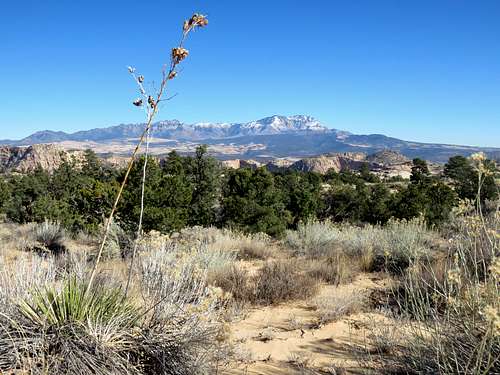
Reached the trail at 11:20 a.m. and 7.4 miles. Started hiking north toward where I had left trail. Views from the trail.
|
|
|
|
|
|
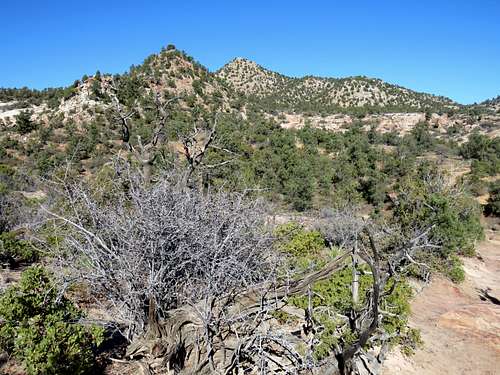
At 8.9 miles, I reached where I had left the trail and was then retracing the way I had come over the trail. I saw a jogger going south. Views of Snow Canyon again from where the trail came close to the rim.
|
|
I was then running into hikers rather frequently. Reached my car at 1:30 p.m. A lot of cars were in the parking area. Temperature had risen to 52 degrees F.