
-
 39123 Hits
-
 82.66% Score
-
 16 Votes
|
|
Route |
|---|---|
|
|
44.35220°N / 107.2169°W |
|
|
Hiking, Mountaineering, Scrambling |
|
|
Summer, Fall |
|
|
Most of a day |
|
|
Class 2-3 |
|
|
Overview
The southwest ridge of Cloud Peak is one of the most popular hiking and scrambling routes in the state of Wyoming, and it is not uncommon to see anywhere from 10-25 people a day on the route during the summer months after most of the snow has cleared off of the mountain. Cloud Peak is one of only four peaks in Wyoming outside of the Wind River Range higher than 13,000 feet, and its status as a range highpoint and one of the highest U.S. ultra-prominence peaks draws climbers and hikers from all over the country. The southwest ridge is the easiest and most obvious route to the top, and is generally done over a couple of days with a camp near the base of the mountain.
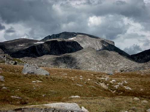 Cloud Peak
Approach

Mistymoon Lake Trail

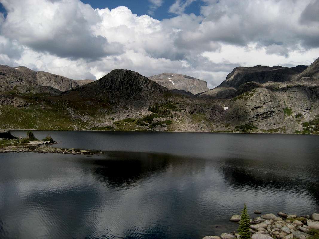
Cloud Peak over Lake Helen
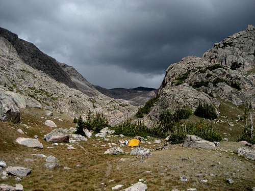
There are several ways to reach the west side of Cloud Peak. The most common approach starts at the West Tensleep trail head, which is reached by turning left off of the Cloud Peak Scenic Byway (Highway 16) at Deer Haven Lodge onto Forest Road 27. Follow this road for about 9 miles to the parking area at the trail head. Hike on the Mistymoon Lake Trail (trail #063) around the shores of West Tensleep Lake, and negotiate a small stream crossing. There used to be a bridge here, but it has been removed; it is not too difficult to rock-hop across when the water is low. Follow this trail for about 6.5 miles, passing Lake Helen and Lake Marion before arriving at the shores of Mistymoon Lake. After skirting around the lake, the trail meets up with the Lake Solitude Trail (trail #038), which heads west along the hillside across the valley south of Paint Rock Creek. Many people camp at Mistymoon Lake, but there are some nice spots near or above the falls on Paint Rock Creek.

Mistymoon Lake

Paint Rock Creek
Another option is to drive the lengthy road (about 15 miles) to the Battle Park trail head to make the approach to Cloud Peak via the Lake Solitude Trail. This road turns left off of Forest Road 27 shortly after you leave the highway. The total hiking distance on both approaches is about the same.
Keep in mind that it is required to fill out a free Cloud Peak Wilderness use permit and carry it with you during your trip. These are available at the West Tensleep trail head.
 Looking up the Paint Rock Creek drainage at Cloud Peak
Route Description

Paint Rock Creek waterfall

Typical rock cairn
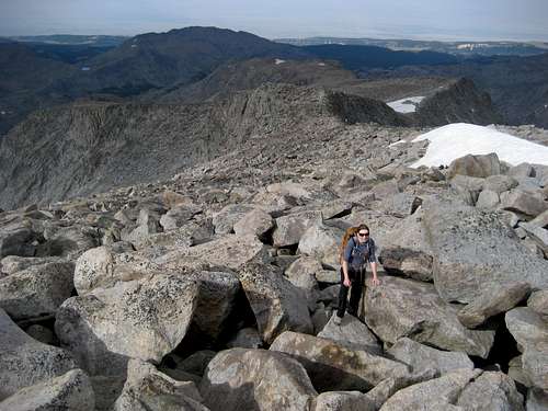
The climber's trail starts at the large waterfall on Paint Rock Creek, which is easily visible from the trail across the valley. Rock hop over to the left side of the creek just below the falls and scramble up the hill to find the trail. This trail is marked by cairns for almost two miles, crossing through many rocky areas and marshy, grassy places. Keep in mind that many of these cairns are very small and it is quite easy to lose track of them; just be sure to stay on the left fork of the creek and head into the obvious cirque. Near the base of the headwall at the headwaters of the creek, make your way up onto the plateau at just under 12,000 feet. As you head up the mountain, the boulders get bigger and there are numerous Class 2+ sections to navigate, culminating in some easy Class 3 moves near the very top.
 Just past the Narrows section

Looking back down the route

About 600 feet below the summit
Once on the plateau, stay left as much as possible, as there are several good trails from which to choose. As you ascend, the ridge narrows through a short section to a width of only about 20-30 yards; there is considerable exposure on either side, but if you stay in the middle, there should be no problem for people who fear heights. Past the narrow section, find your way up some steeper sections, keeping away from the extreme left side of the ridge. Keep heading straight until you are looking over the cliffs just south of the top. Turn slightly left and you will be on the summit after a little more scrambling.
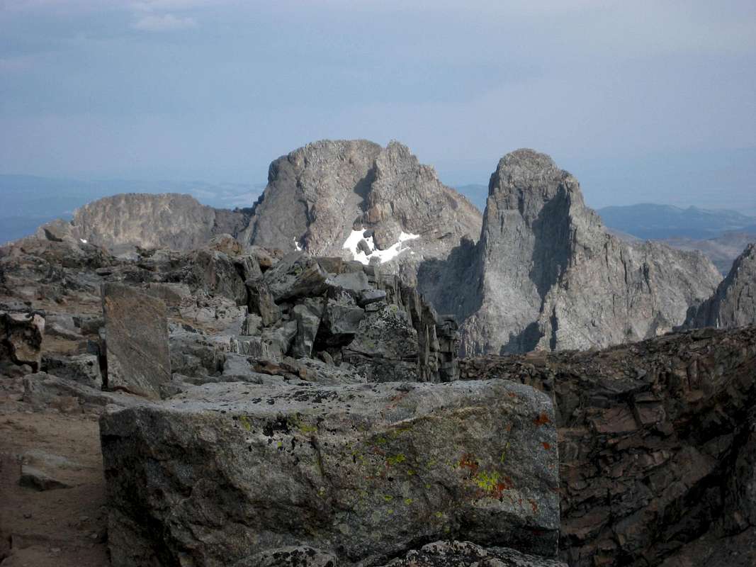
The summit is on the extreme east side of the plateau and overlooks Glacier and Sapphire Lakes. Enjoy the great views of Bomber Mountain to the south and the spectacular spires of Black Tooth Mountain, Mount Woolsey, and The Innominate to the north.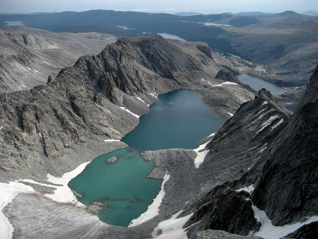
It is also possible to scramble up the extreme end of the Southwest Ridge from the valley; this has the advantage of providing better views throughout the hike, but it is more difficult than the standard approach.
The total one-way distance and elevation gain on this route varies depending on where you camp, but expect a trip of 5-6 miles and 2,500-3,000 feet of vertical gain. The total round trip distance including the approach is about 23 miles and 4,000 feet of elevation gain.
Essential Gear
Bring general dayhike gear for the summit day; it is often very cold on top, so bring plenty of layers. An ice axe and crampons may be necessary early in the summer. The bugs around Mistymoon Lake are legendary, so don't forget the bug spray!