
-
 4931 Hits
-
 79.04% Score
-
 10 Votes
|
|
Canyon |
|---|---|
|
|
38.29467°N / 111.29335°W |
|
|
Canyoneering |
|
|
Spring |
|
|
Overview
Capitol Reef – Towering sandstone sentinels, rock strewn canyons, dusty washes. A stunningly complex and beautiful place to explore and enjoy. But after days hiking amidst that beauty, I started longing for a route with water. Not just the occasional desert tank, or the cultivated orchard-lined Fremont river, but a route with wild, flowing, living water.
Let me introduce you to Sulphur Creek.
Sulphur Creek Canyon
Water is likely here throughout the year, hidden away in the depths of Capital Reef’s rocky redness. It is a beautiful route with a wild, more primeval slot heart that contains a nice series of waterfall obstacles.
As always, talk with the Rangers at the Visitor Center to check current conditions. I did this in late May 2014 and water levels were ideal. Others I respect give the rating of this canyon as 2A II, and theysuggest checking the water level behind the route’s ending point behind theVisitor Center: Ankle deep, OK; Knee deep, maybe not for most.
And of course, avoid this creek and its slot canyon on days with rain or the threat of rain.
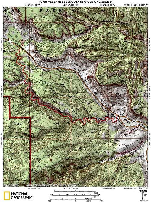
Getting There
The 5 mile Sulphur Creek route begins conveniently across Utah Route 24 from the Chimney Rock trailhead (about 5 miles east of Torrey onNorth side of UT 24; or 3 miles west of the Visitor Center) and ends conveniently behind the park Visitor Center.
Sulphur Creek Trailhead
Inconveniently, you either have to:
a) Arrange a car shuttle back
b) Stash a bike a the Visitor center and pedal back
c) Try your thumb at hitchhiking from the crowd at the visitor center
d) Walk 3 scenic but dangerous miles back to your vehicle along UT 24
Neglecting to shave for a week, I tried option c above but had no takers, so I did option d above. A bike would have been better.
The Route
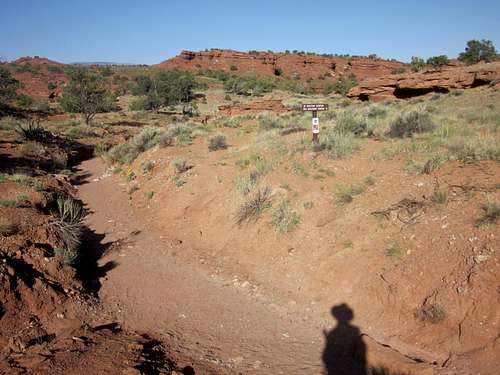
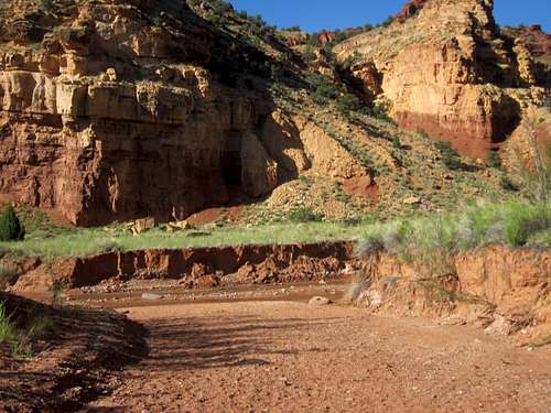
This canyon hike, winding its rocky way down a dry, red rock wash, does not seem initially very promising as far as water is concerned.
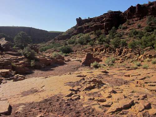
Sulphur Creek is named that way for a reason. You will find plenty of yellow walls and sulphurbearing rocks along the way. This also makes the water undrinkable, I am told (I did not try myself), so bring as much water as you would on any comparable desert route.
Wash leading to Sulphur Creek
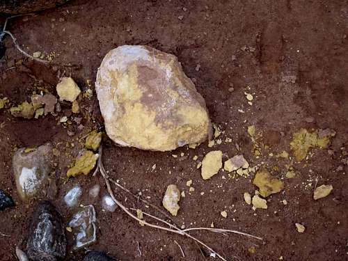
Sulphur of Sulphur Creek
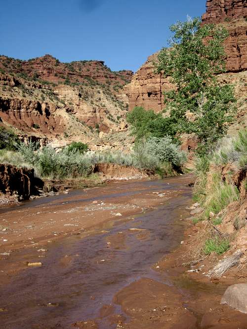
After its dusty beginning, you will intersect the stream flowing in from the west.
Water of Sulphur Creek
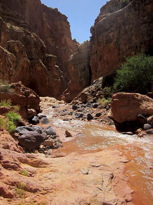
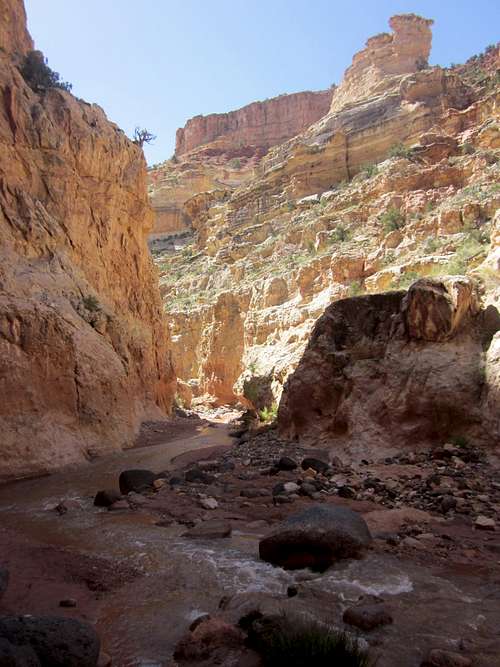
Miles of delightful stream-side and in-stream hiking amidst the rocky canyon walls are in your future. You will cross and re-cross Sulphur Creek continuously as the stream twists and flows within the bounds of the canyon walls.
Sulphur Creek
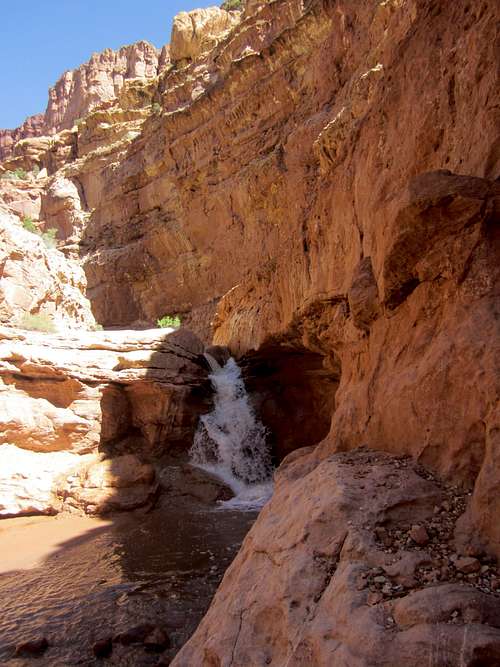
The pleasantness will eventually be interrupted by the roar of the first waterfall. As the roar increases, the primeval heart of Sulphur Canyon will be revealed.
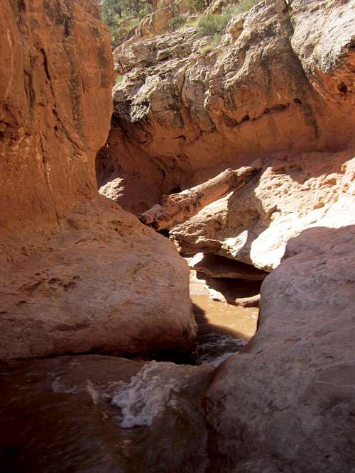
Sulphur Creek Route - Approach to 1st Fall
Greenery recedes, the canyon closes in, and the flow of water gets squeezed between curved gray rock and drops 10 feet into a pool. An absolutely huge old log (for the area) was jammed in the passage in 2014. There are ledges on the right side (as you look downstream) that get you around this fall. This detour was hard enough to deter the casual and make me regret hiking solo that day.
Sulphur Creek - First Fall
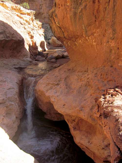
A short time later a second fall drops down about 10 feet, necessitating a second detour on the right side. Again, this detour was hard enough to make things interesting.
Sulphur Creek - 2nd Fall
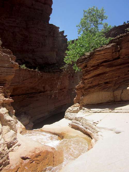
After these two falls, the stream settles down a bit and greenery returns, but the stream seemed to retain a bit of the wildness that it had just passed through. Beautiful stream walking was interspersed with small falls.
Sulphur Creek Canyon
One last waterfall confronts you before you are done.
Sulphur Creek - Approach to 3rd Falls
Though smaller (6 feet) than the others, I found it much more perplexing as an obstacle. The fall penetrates a wide circular steep sided area, with higher sheer sided walls surrounding it, except where the falls sprays through. I probed routes looking to bypass to no avail.
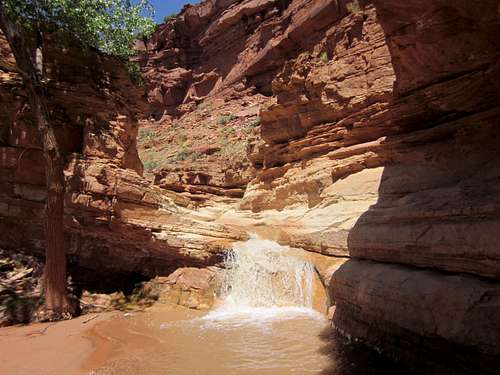
Sulphur Creek - 3rd Falls
Once through this last fall, you have about a mile to the Visitor Center, where you either grab your shuttle car/bike, try your luck hitchhiking, or start walking back west.
Sulphur Creek Route