

Comments
No comments posted yet.
|
|
Trip Report |
|---|---|
|
|
45.69102°N / 121.98305°W |
|
|
Download GPX » View Route on Map |
|
|
Jul 2, 2023 |
|
|
Hiking, Mountaineering |
|
|
Summer |
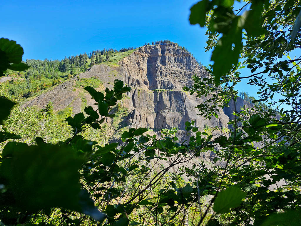
The 3417 ft Table Mountain rises to the north of Columbia River near Bonneville Dam in the state of Washington. This little peak comes with impressive statistics, its southeast face creates an 800 ft cliff making the mountain rise dramatically above the river which sits at near zero elevation. A hike to the summit of Table Mountain tuns out to be 17 miles roundtrip with 4300 ft of elevation gain (900 ft more than the elevation of the peak above sea level).
Private property blocks driving access to the base of Table Mountain. The usual starting point for the hike is at North Bonneville Trailhead on Washington Route 14. You will follow the Pacific Crest Trail up and down the forested hills 6.75 miles to reach a split in the trail at an elevation of 1750 ft. You can go up one way to the summit and down the other way. Both are very steep. The east path is mostly in the forest except for a boulder field 250 vertical feet tall and involves a small amount of elevation loss. The west trail is more in the open.
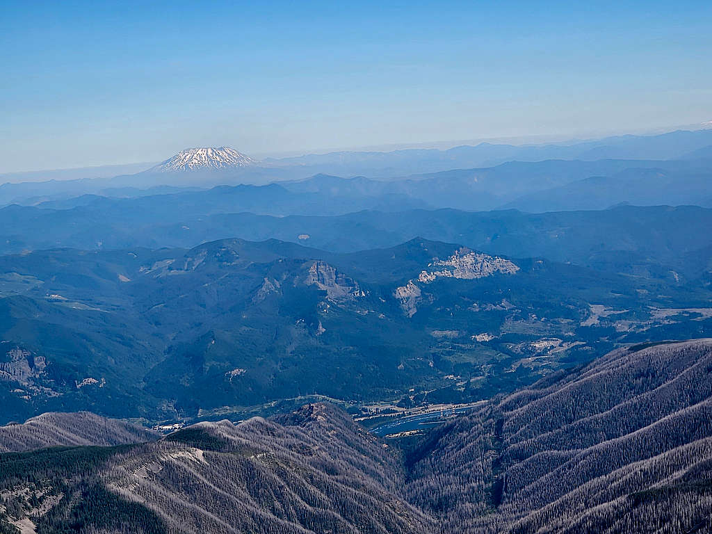
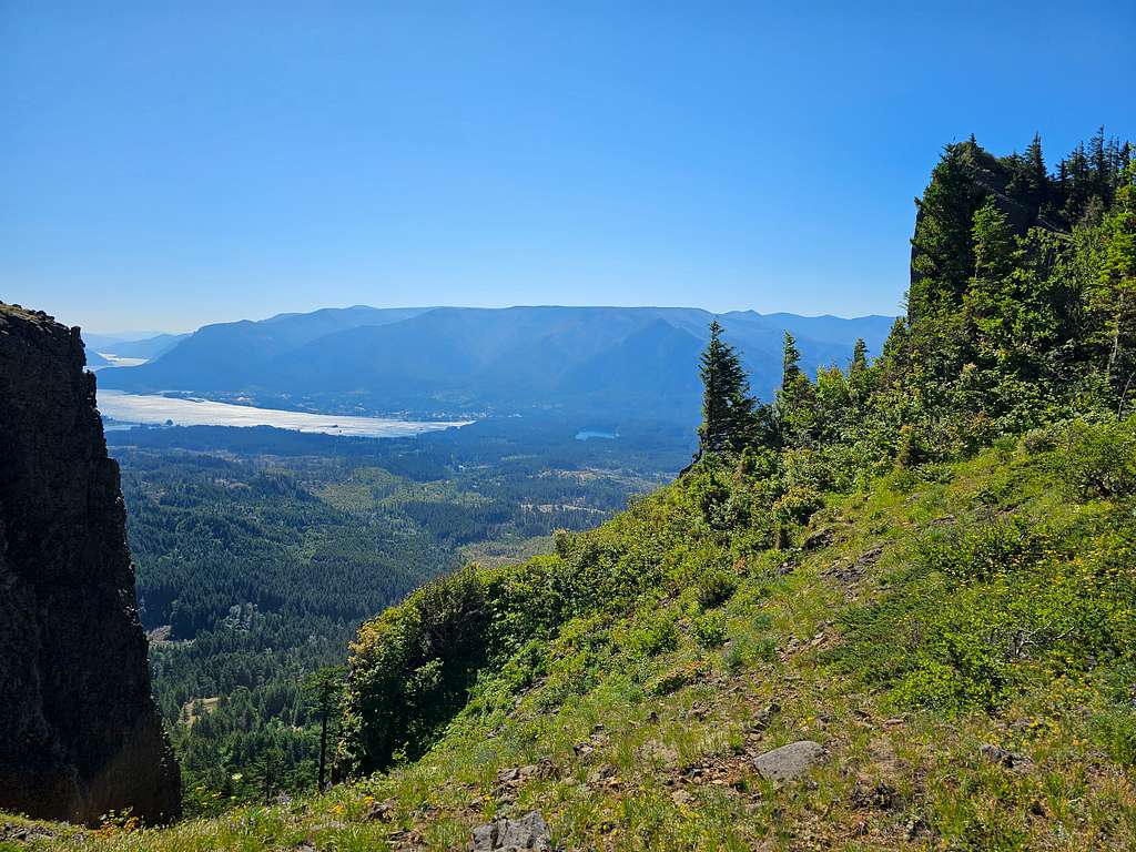
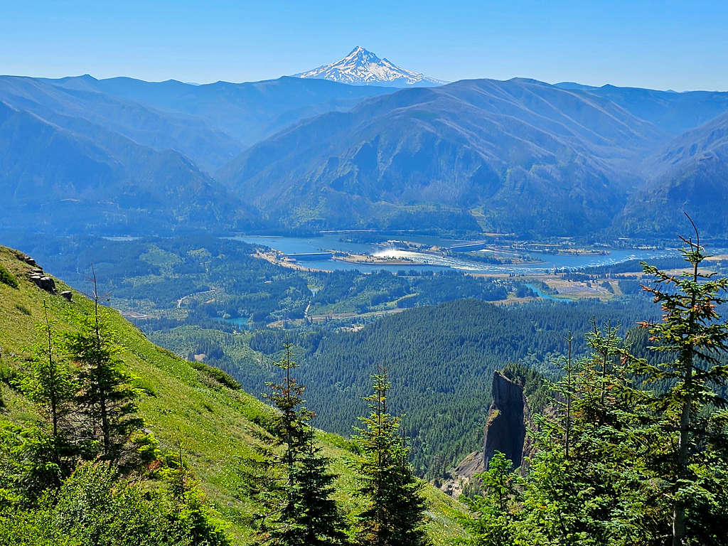
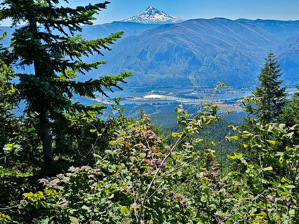
Just below the summit, you should follow a 0.25-mile spur trail to a viewpoint at the edge of the cliffs where you can get dramatic views of Columbia River Gorge, Bonneville Dam and Mt. Hood. The summit is a flat forested area however from the edge of the forest you will have dramatic views of Mt. Rainier, Mt. Adams as well as Mt. St. Helens in addition to other peaks.
Trailhead Elevation: 110 ft
Summit Elevation: 3417 ft
Hike Length: 17.0 Miles
Total Elevation Gain: 4300 ft
Left the vacation rental house in Dallesport, Washington around 4:35 AM (Sunrise 5:25 AM) and drove some 40 miles to North Bonneville Trailhead. Two cars were there, but I did not see any people until I was on my way back down the mountain. By the time I started my hike, it became 5:30 AM. Elevation was 110 ft.
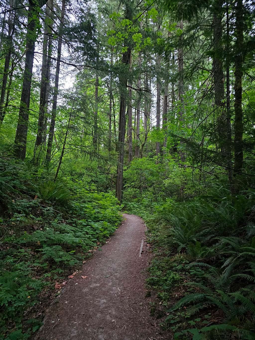
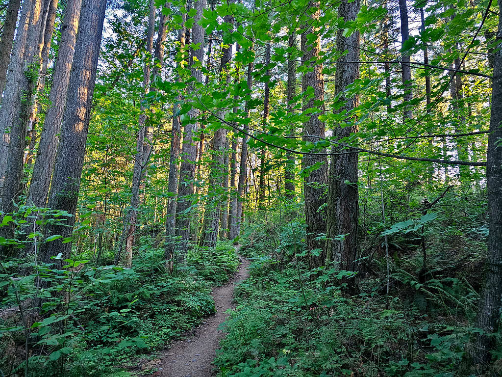
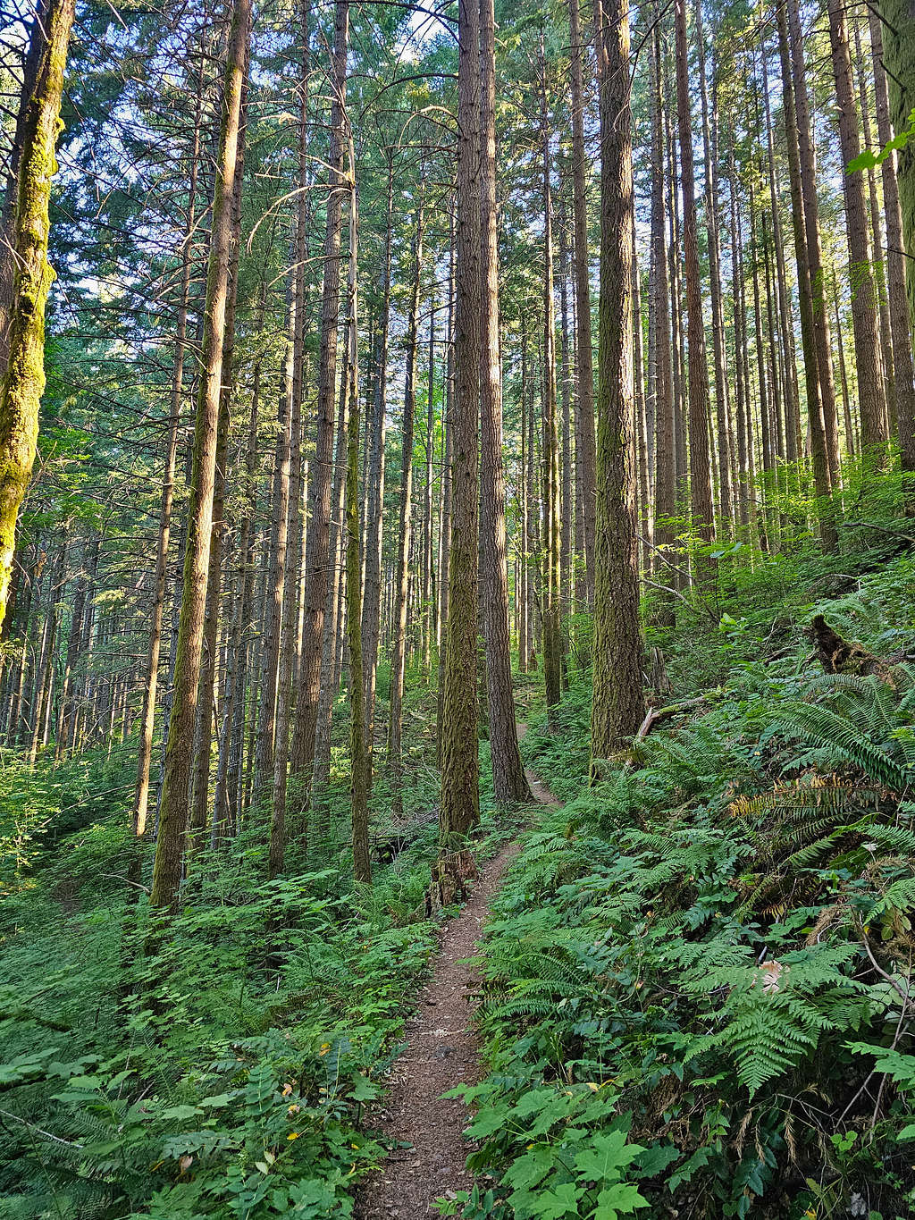
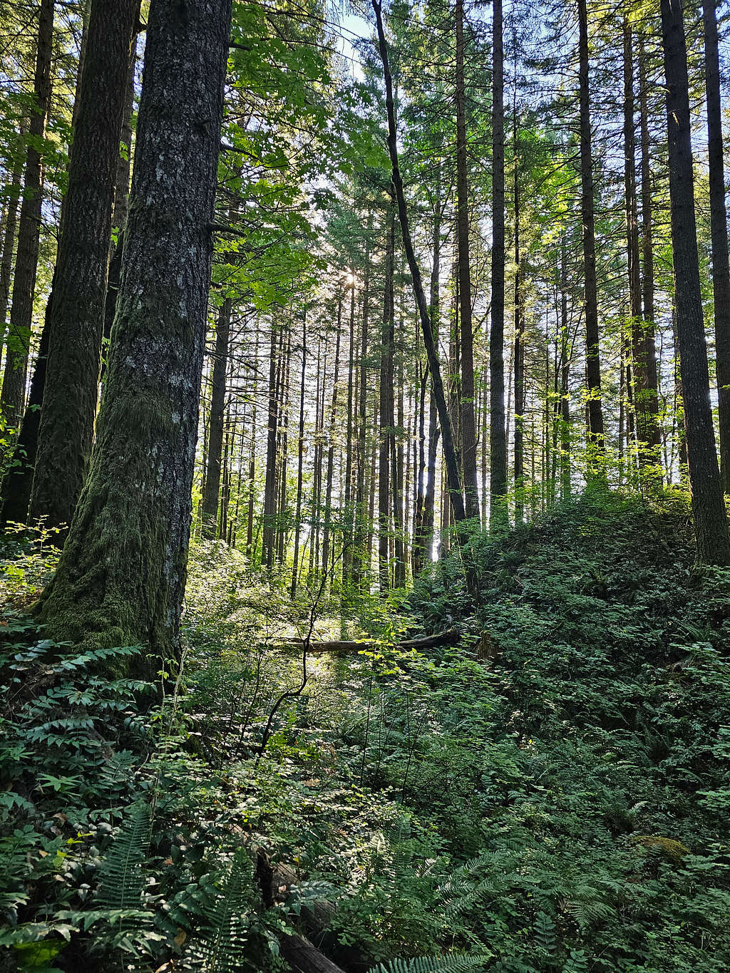
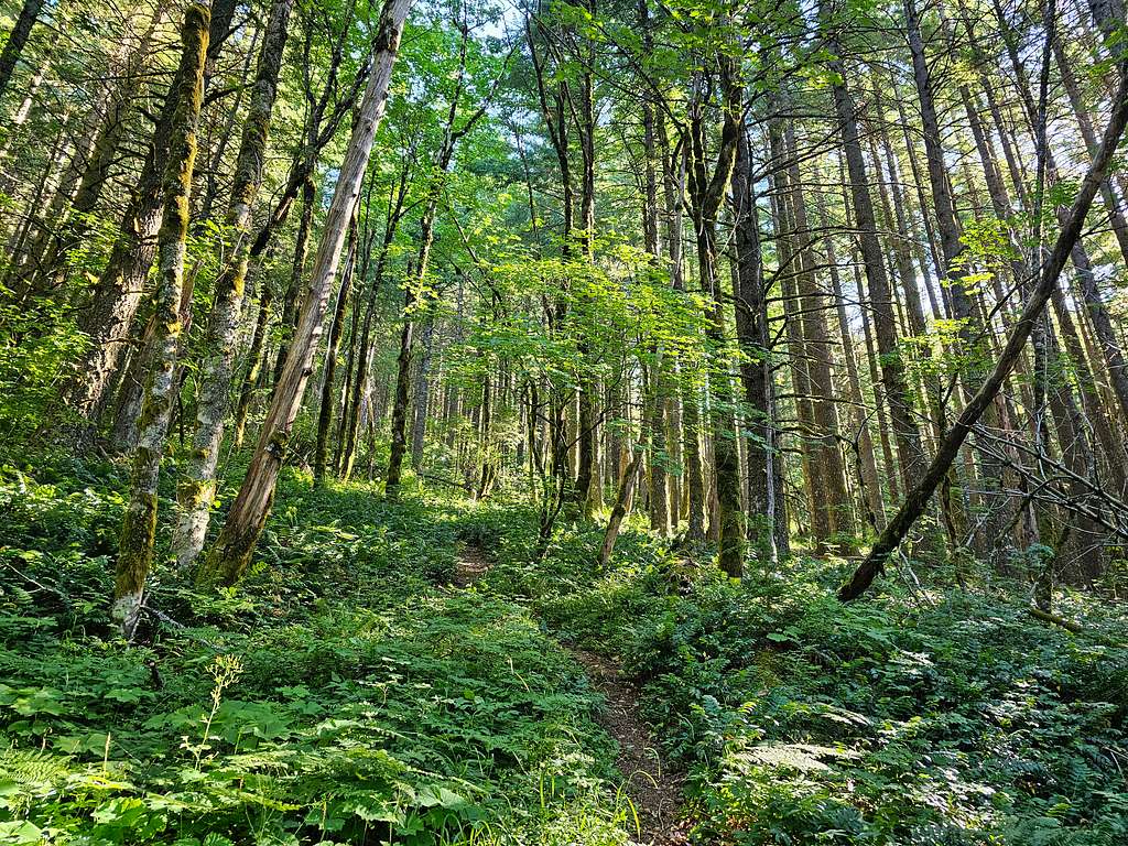
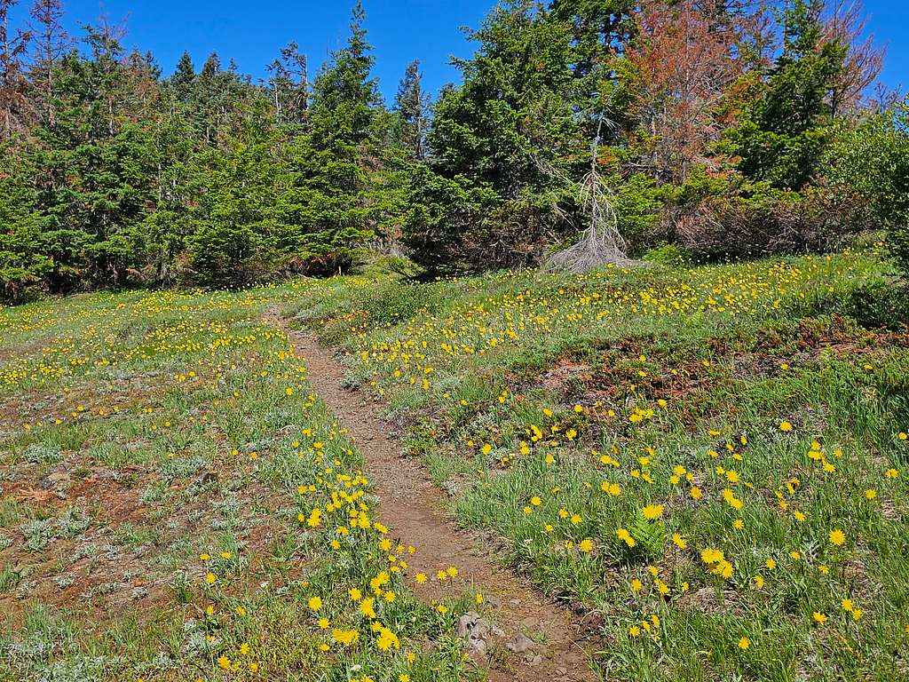
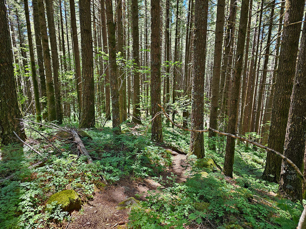
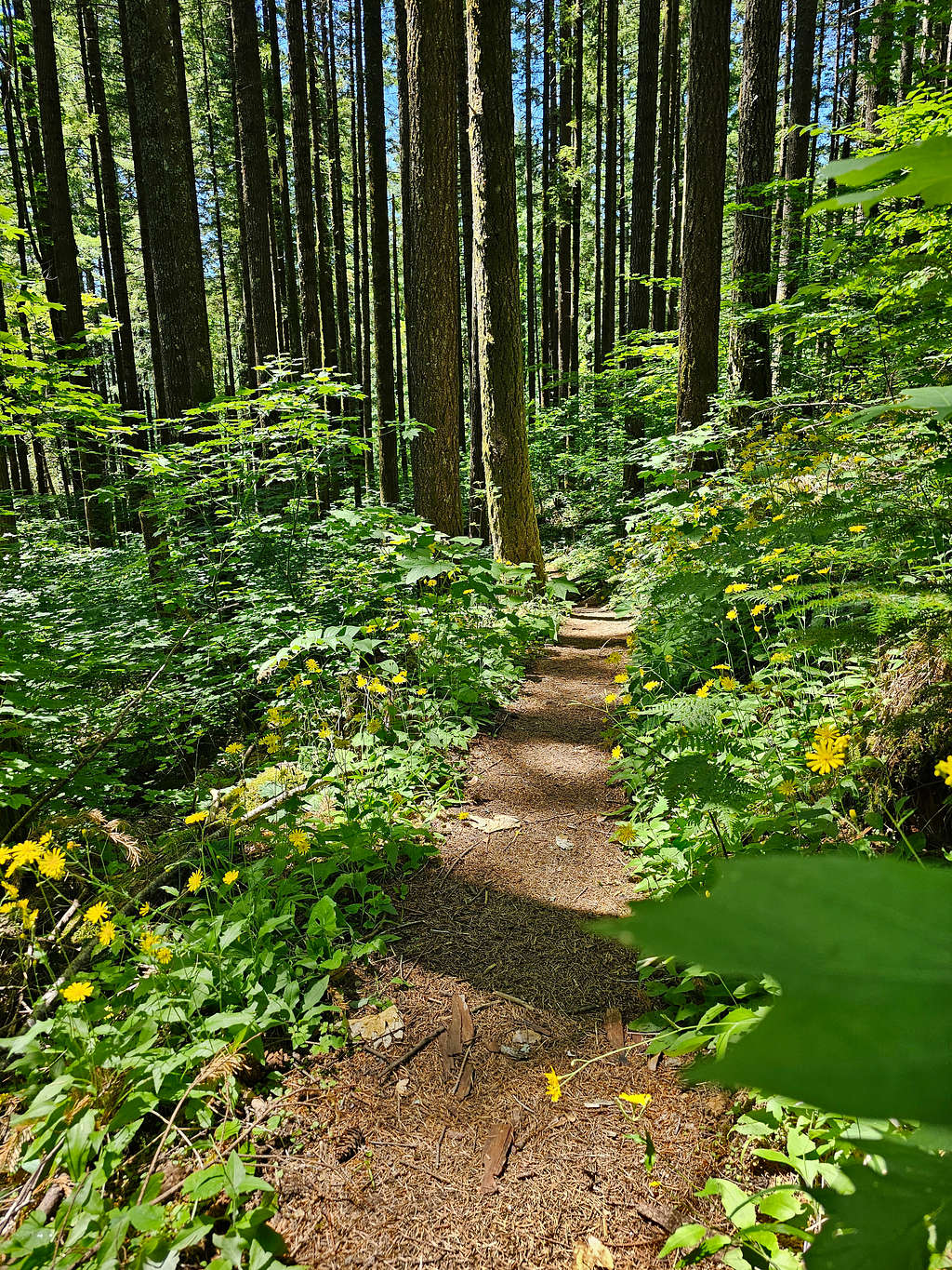
Got on the trail which went into a beautiful forest going uphill until after 0.6 miles, it joined the Pacific Crest Trail.
The trail went out of the dense forest into open areas. Although I started having views of the surrounding mountains, I became concerned about being under direct sunlight on the return leg of the trip when the high temperature was supposed to reach 90 degrees F. For the moment, however, I remained in the shade.
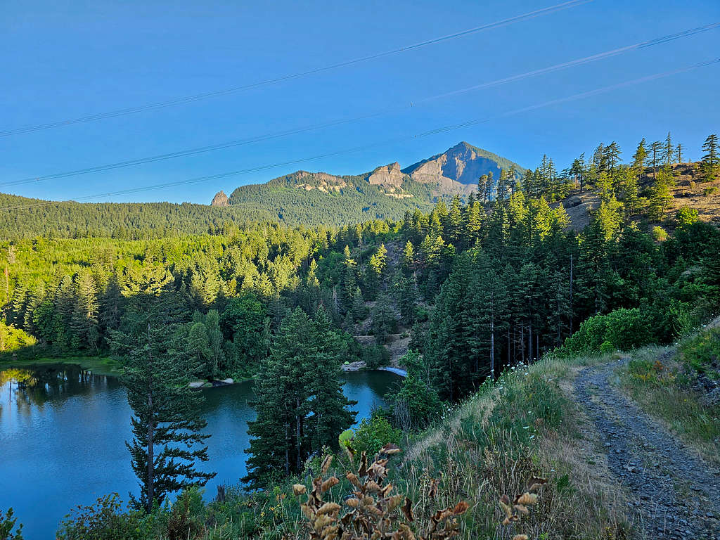
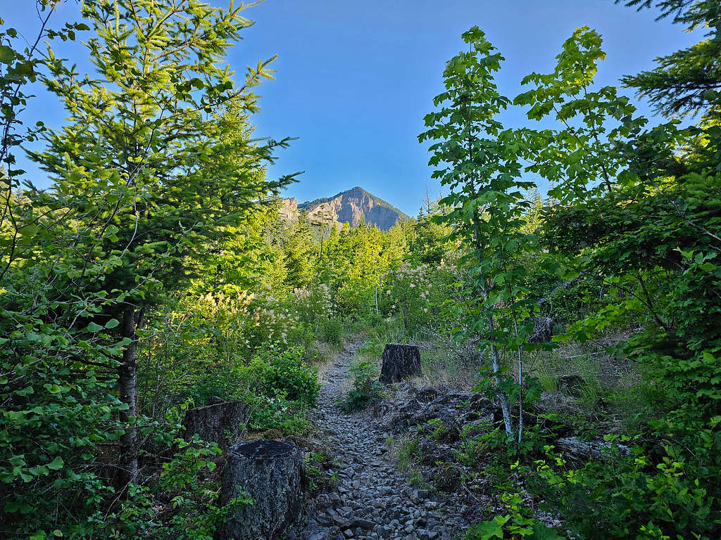
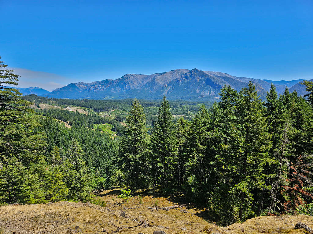
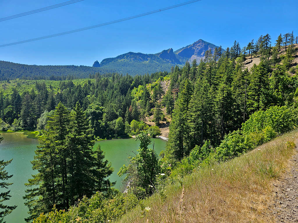
After 2.4 miles at an elevation of 420 ft, the trail crossed a dirt road where Table Mountain came to view for the first time. The trail then went down 110 vertical feet toward Gillette Lake. I could see a couple of tents by the lake, but no one was there.
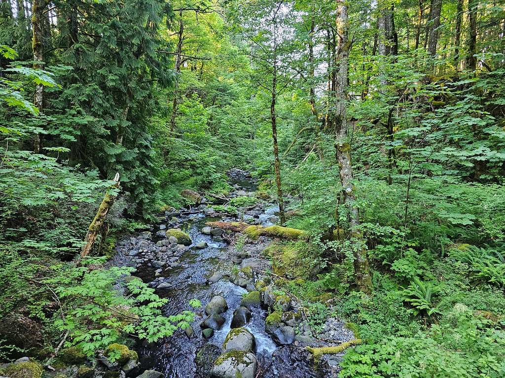
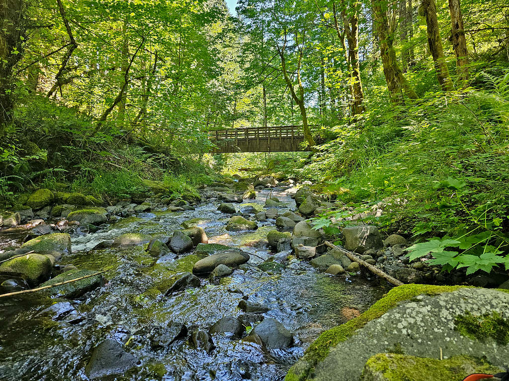
Crossed a creek over a bridge and the summit came to view again.
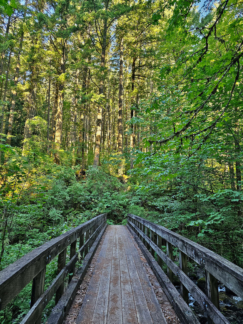
At 7:15 AM, 3.5 miles and 480 ft elevation, the trail went over a big bridge that crossed Greenleaf Creek.
I was then in a beautiful dense forest again. The early morning horizontal sunrays created an enchanted environment.
The going soon became steep. After making several switchbacks, continued in the forest until at 8:46 AM, 6.75 miles and 1750 ft elevation, I reached a signed split in the trail. Left said “Hard” and right said “Harder”. Took the right (east) path and followed it as it went very steeply up the forested slope.
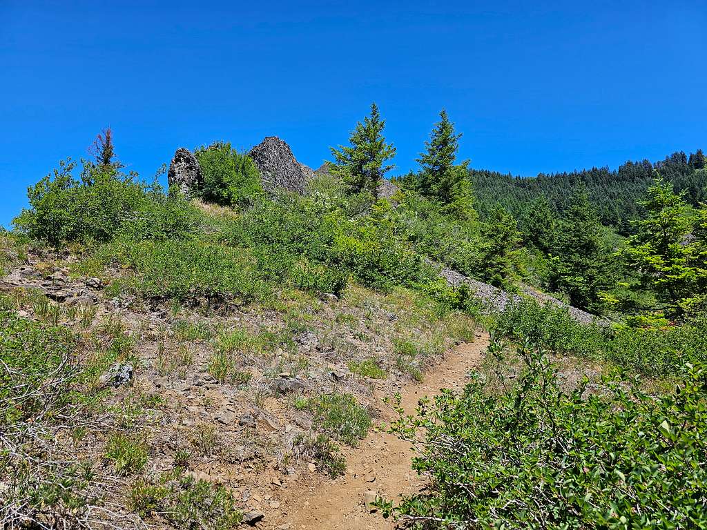
The path then became overgrown, and I had to whack my way through the bushes until I found myself at a 2510 ft saddle out of the forest near the base of the cliffs of the summit.
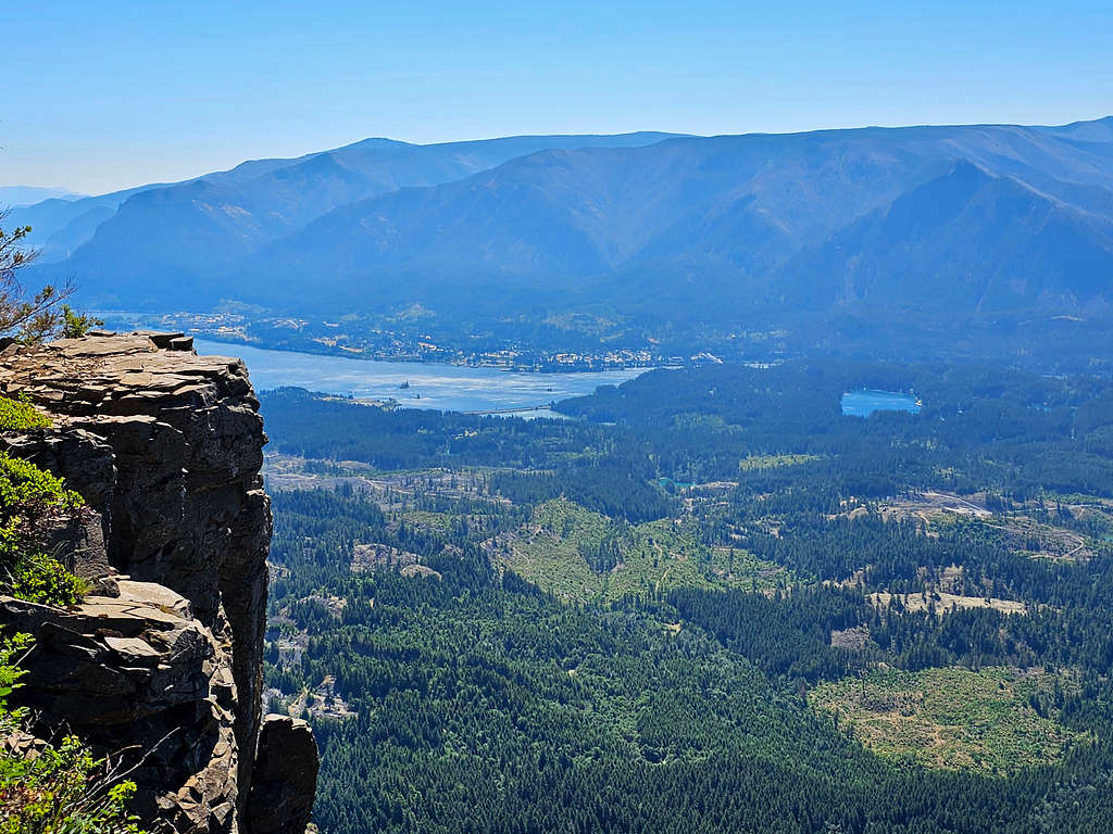
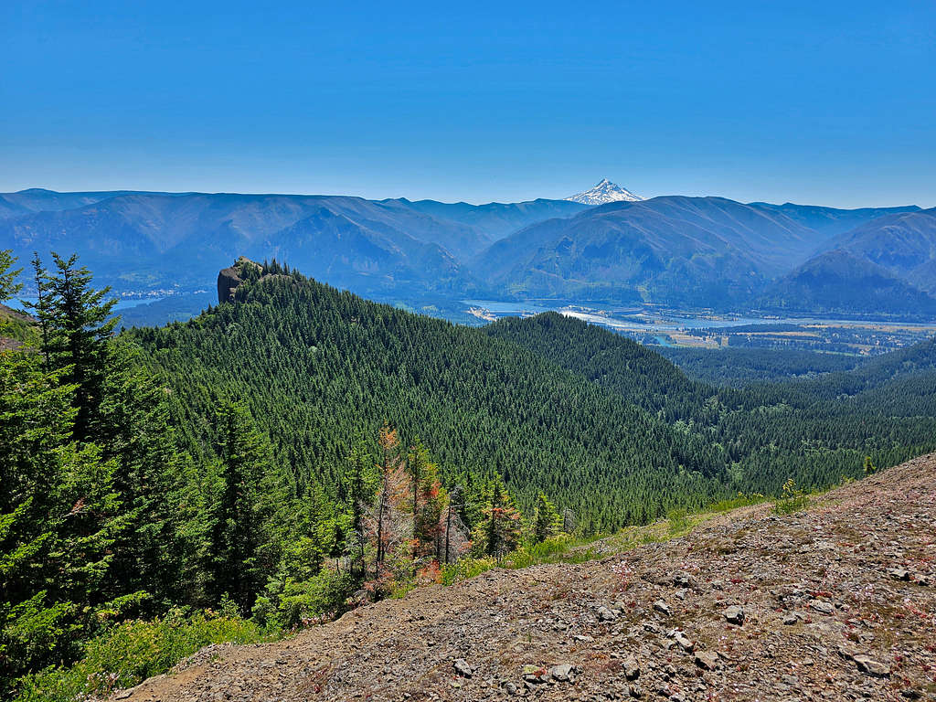
Finally got a view of the Columbia River. The rocky Point 2692 ft seen on the right.
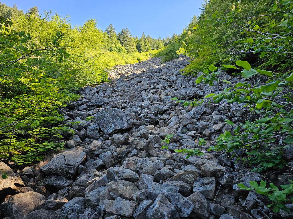
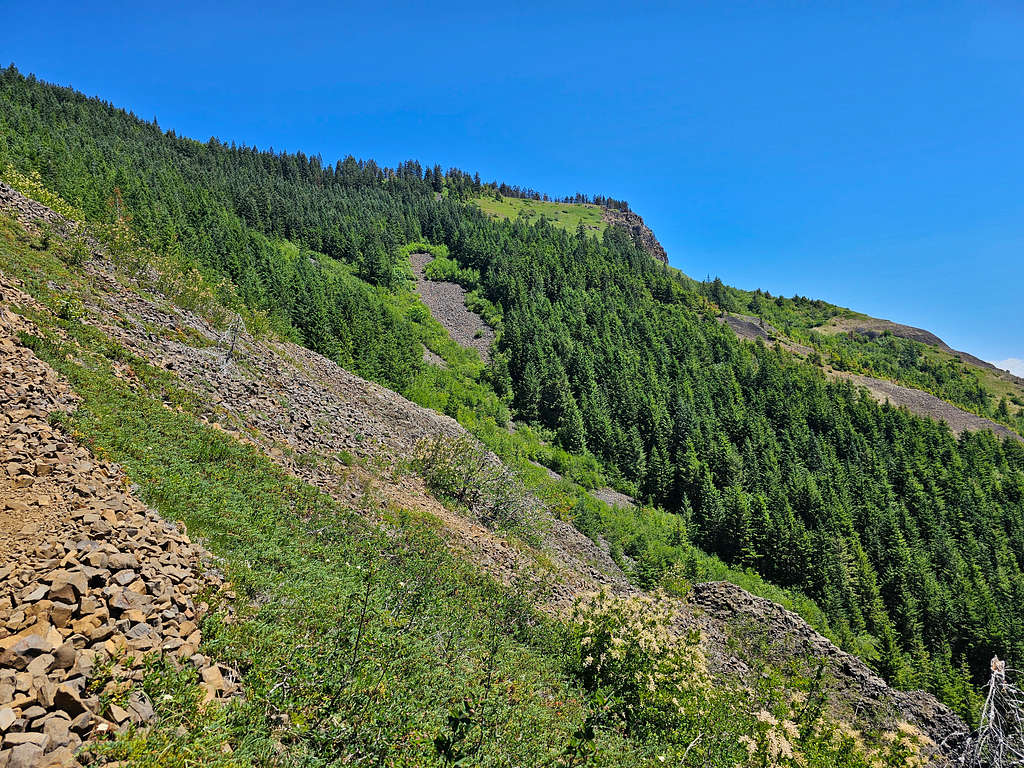
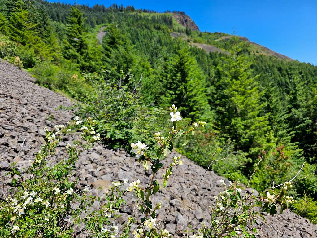
Began to follow a steep beaten path up the grassy slopes under the hot sun but when I looked at my GPS, I noted that I was going the wrong way. Went back down to the overgrown area and soon found the trail that kept going in the forest. Was happy to be out of the sun. The trail did a little downhill, then began to go up steeply until at an elevation of 2750 ft, it reached a boulder field.
The boulder field continued up to 3050 ft elevation where the trail entered an overgrown area again. Looking down at the boulder field.
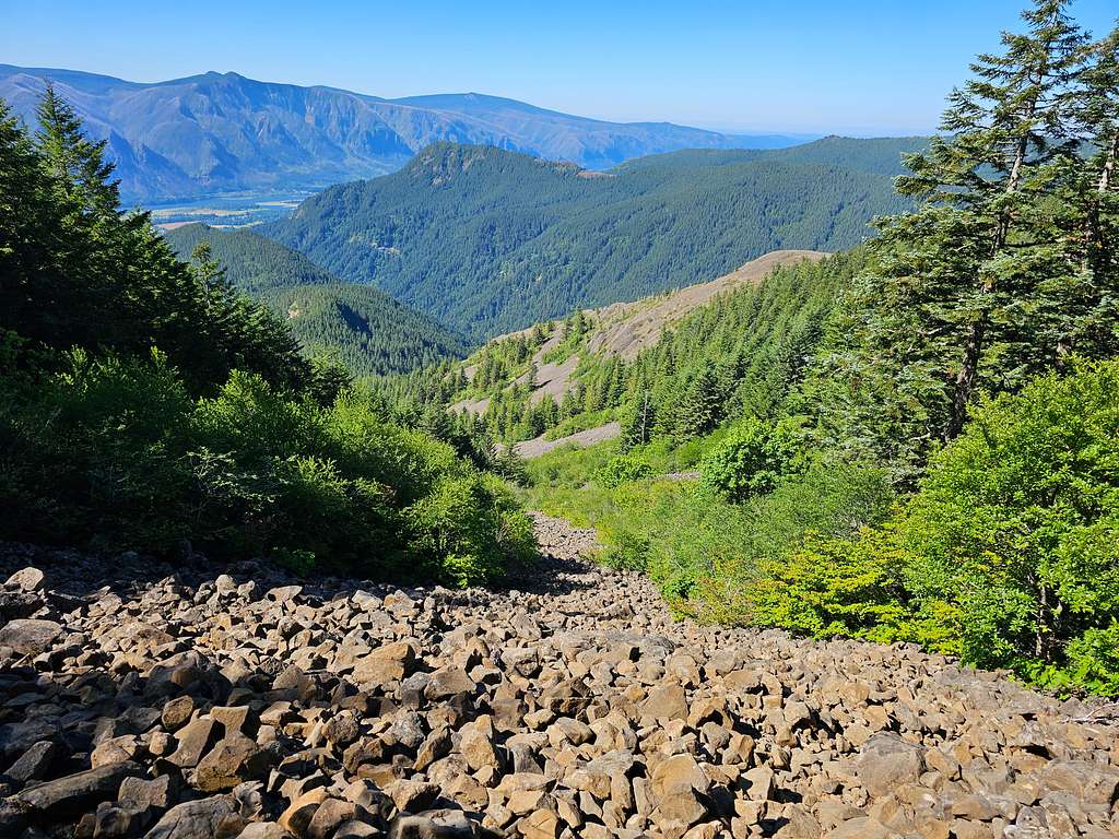
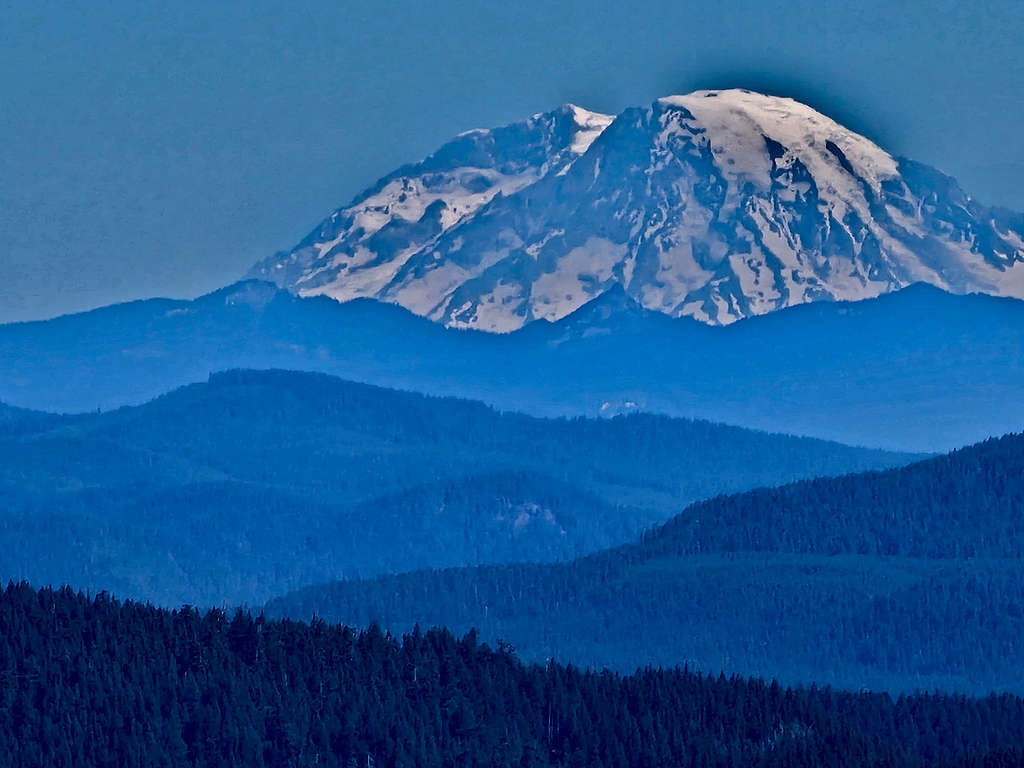
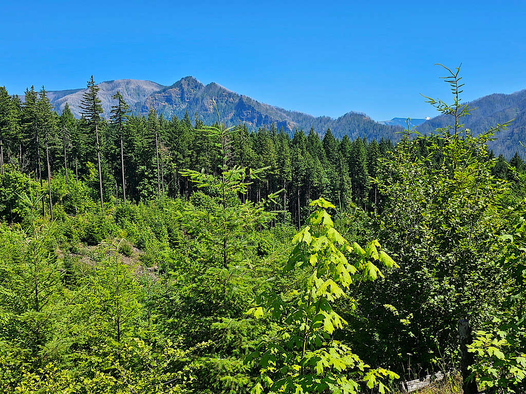
At 10:30 AM, 8.25 miles and 3400 ft elevation, the trail went out of the forest and reached a signed junction. Got a great view of Mt. Rainier in the distance.
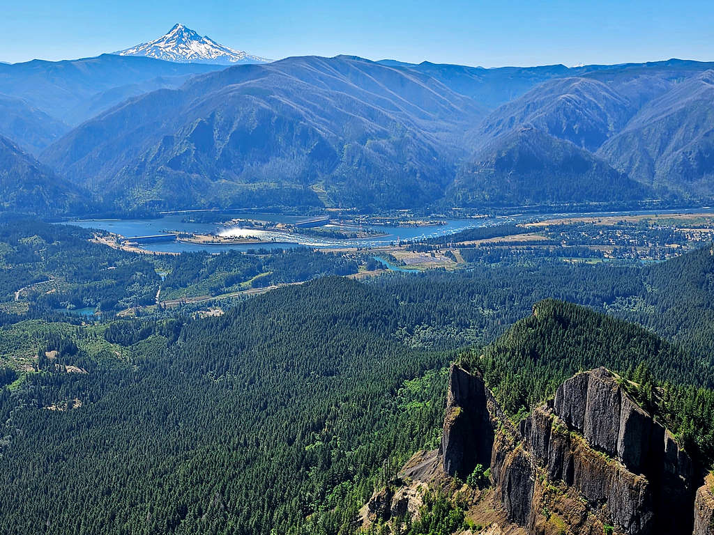
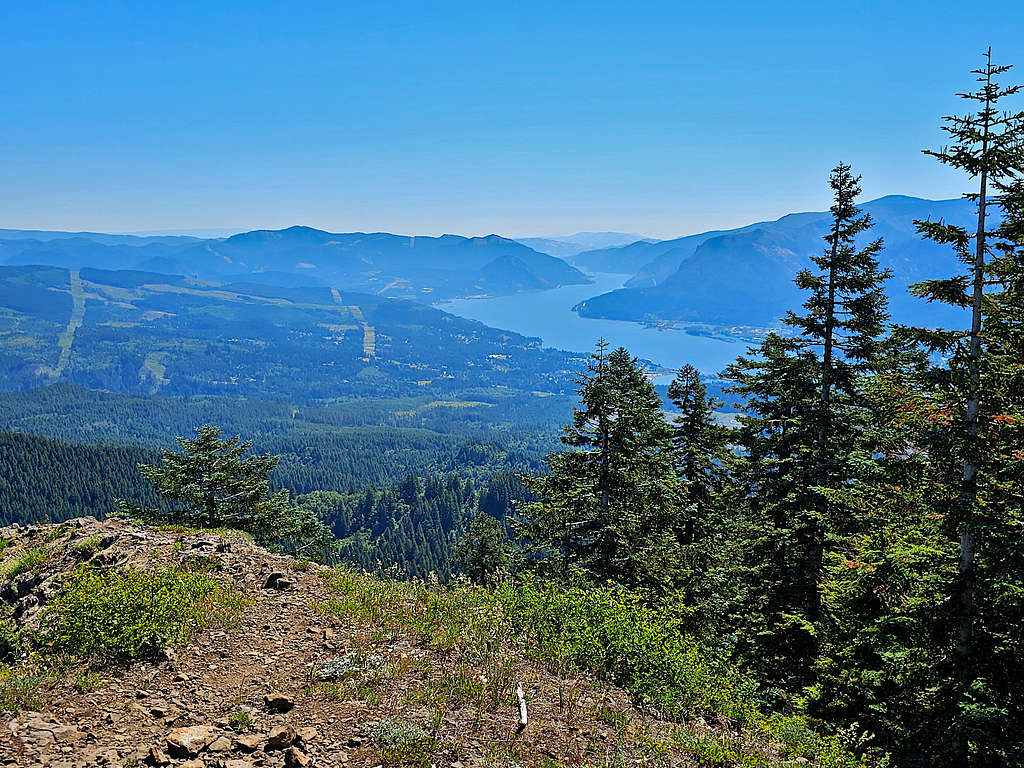
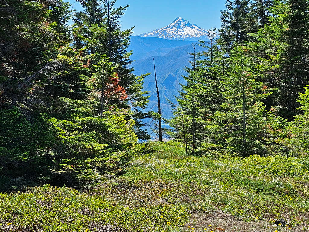
Turned right and followed a 0.25-mile-long spur trail downhill over a beautiful meadow where I had wonderful views of Mt. Hood, Columbia River and Bonneville Dam.
I then reached the edge of the cliffs. Columbia River Gorge to the southeast.
Mount Hood, Columbia River and Bonneville Dam.
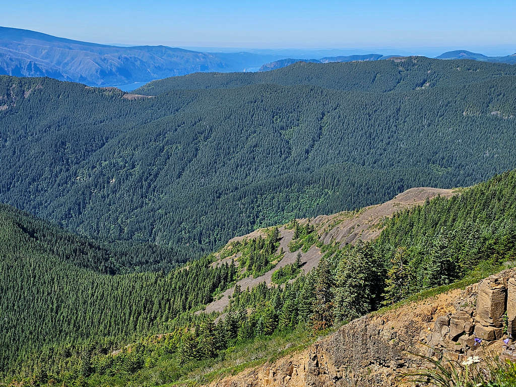
Looking southwest.
Video from the edge of the cliffs.
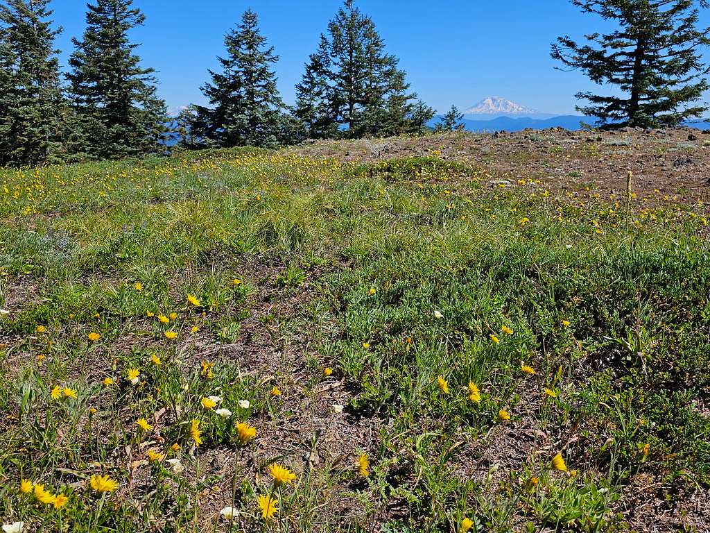
Went back to the junction then continued the main trail over a meadow, Got a glimpse of Mt. Adams.
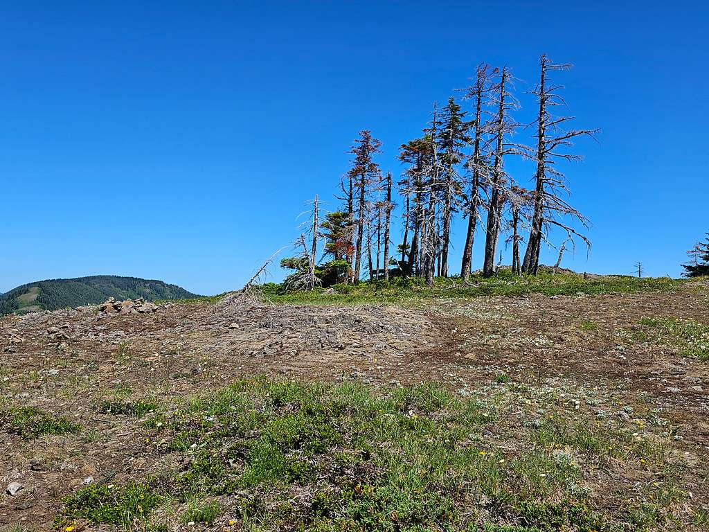
At 11:00 AM, 8.8 miles and 3417 ft, I reached the summit of Table Mountain which was a flat forested area but had plenty of open spots where I could get good views east, north and west. Looking west at Columbia River Gorge.
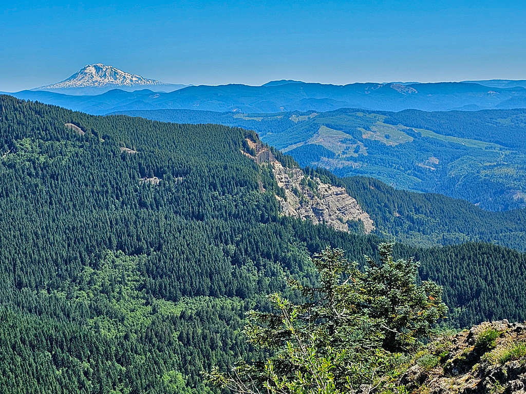
Mt. Adams 43 miles to the northeast.
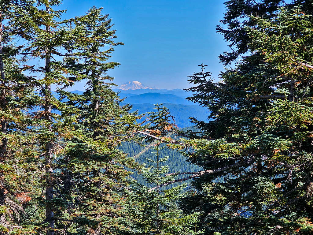
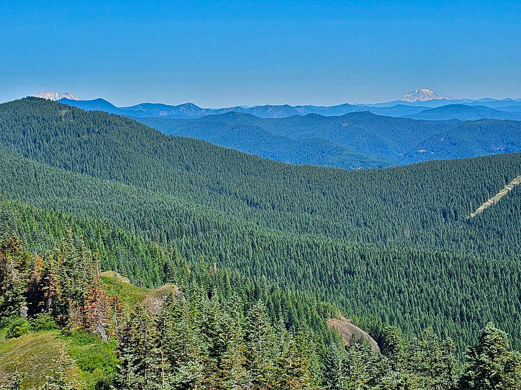
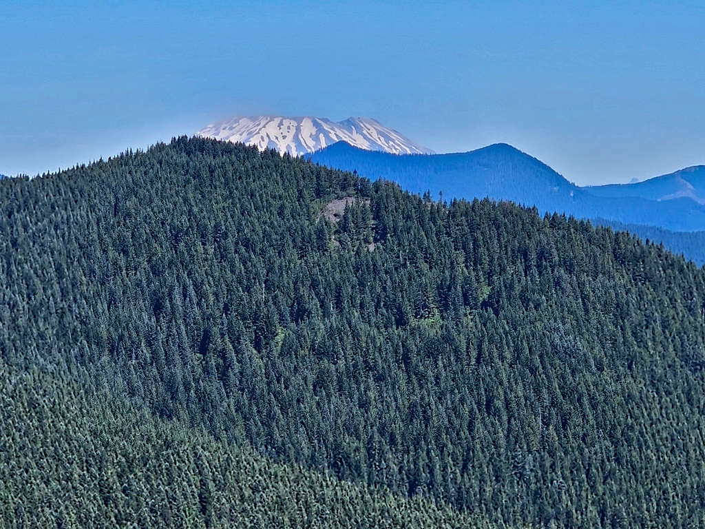
Mt. Rainier (82 miles) and Mt. St. Helens (37 miles) to the north.
Video from the summit.
Found a nice cool place in the shade to eat and enjoy the views.
Left at 11:30 AM and began to go down the west trail, which was not forested exposing me to the hot sun, but I had good views of Mt. Hood. After 15 minutes, I ran into a group of 4 ladies walking up. Those were the first people I saw all day.
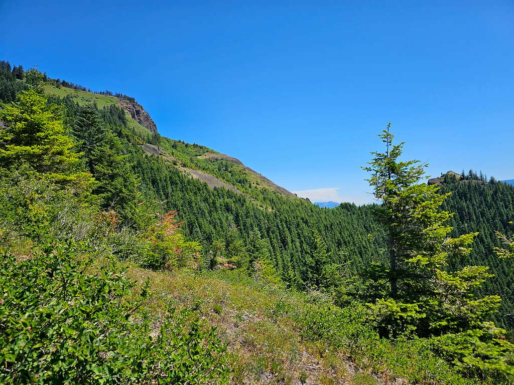
In some places, the trail went down very steep loose rock slopes. I thought that was supposed to be the “less hard” trail. Looking back at the boulder field and the viewpoint below the summit.
To the east, what looked like a cloud of smoke was rising into the sky. I sure did not want to get stuck in a fire. Later I found that was the so called “Tunnel 5 Wildfire”.
Continuing down.
Was glad to be back in the forest out of the burning sun.
At 12:50 PM and 10.3 miles, I reached 1750 ft where the trail had split. Sat there to rest. After that, I ran into a few people who were walking up. View from an open area.
At 2:20 PM and 13.5 miles, I was at the bridge over Greenleaf Creek. Went by the creek and dipped my head, arms and legs in the water to cool down, then had a short break.
At the next creek, I got myself soaked again, then was under the sun near Gillette Lake going up the slope. View of Table Mountain again.
Continued under the sun until I was in the forest again. Ran into a few more hikers.
Reached the trailhead at 4:20 PM and 17.0 miles. That was a great hike. After driving toward the rental home on Washington Route 14 for 15 miles, I reached a roadblock. They said the road was closed due to fire. Had to drive 15 miles back to cross the bridge into Oregon and reach home the longer way.