Toggle navigation
Mountains
Routes
Images
Trip Reports
Forum
What's New
People
Areas & Ranges
Articles
Trailheads
Canyons
Huts & Campgrounds
Albums
Logistical Centers
Fact Sheets
Lists
Custom Objects
Gear
Plans & Partners
WELCOME TO SUMMITPOST
SIGN IN
REGISTER
Mount Constance
Additional Parents
Image
topo map
View High-Resolution Image
topo map
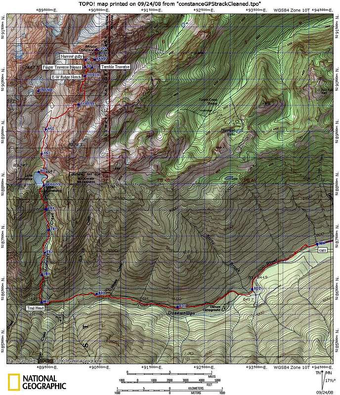
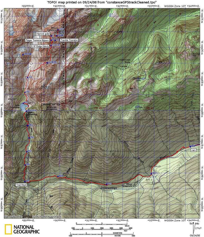
Here is our GPS track. Waypoint "FB" (Finger-Bypass) is the approximate location where we went left (west) to bypass the Finger Traverse (FT). For details, see the "South Chute" route description. July 13, 2008
« PREV
NEXT »
larryN
on
Sep 28, 2008 1:54 am
Comments & voting
Other parents
Image Type(s):
Topo/Diagram
Image ID:
447124
18915 Hits
72.08
% Score
2
Votes
Log in to vote
Comments
No comments posted yet.
to post!
Don't have an account?
Mount Constance
(Mountain/Rock)
« PREV
Viewing
#95 of 152
GALLERY
NEXT »
larryN's Image Gallery
« PREV
Viewing
#123 of 267
GALLERY
NEXT »
South Chute
(Route)
Loading....
×
You need to login in order to vote!
User Name
Password
Remember me
Forgot your password?
Log me out when I close my browser.
Keep me logged in all the time.
sign in as a user
Don't have an account?
Register now for FREE
Rating available
Suggested routes for you
People who climb the same things as you
Comments Available
Create Albums
Register Here


