
|
|
Area/Range |
|---|---|
|
|
46.65550°N / 89.5184°W |
|
|
Hiking |
|
|
Spring, Summer, Fall, Winter |
|
|
1772 ft / 540 m |
|
|
An Undiscovered Treasure in a Remote Land…
Michigan’s Upper Peninsula is a country that few visit. The lucky few who do travel to this land of unsurpassed beauty will discover wonderful places like Pictured Rocks, the Porcupine Mountains, Tahquamenon Falls, and the secluded shores of Isle Royale. Yet few if any have heard of one of the UP’s most remarkable treasures…the Trap Hills. Covering an area of roughly 350 square miles the Trap Hills are a nearly trackless area of rugged, exposed ridges, rushing streams, and virgin forests. The North Country Trail runs east to west right through the heart of the hills passing some of the most stunningly secluded terrain in the Midwest. Yet, it’s virtually unknown. I lived in the Upper Peninsula for 8 years…traveled and hiked the peninsula from end to end, and never heard of them. Only through chance, reading a back-issue of Backpacker Magazine, was I let in on the secret…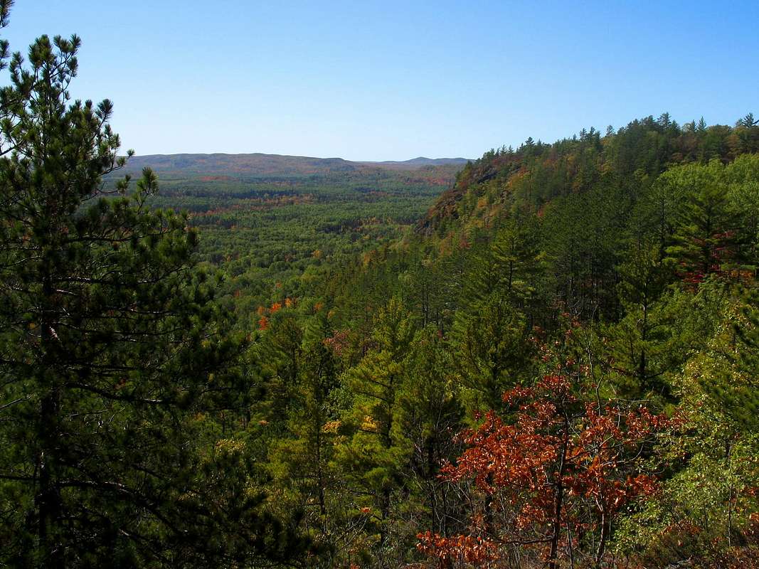 The story of the Trap Hills began some 1.1 billion years ago when the region was split by a large rift from which molten lava flowed across the landscape. Added to the mix was an enormous amount of sediment which flowed down from nearby mountains. Over the ages the lava and sediment hardened and formed the erosion-resistant ridges that we find today. Also over the years numerous streams cut deep gorges through veins of softer rock creating an even more broken landscape. Finally, came the glaciers which filled the valley with sediments and scraped bare the hills.
 Born of fire and ice, the Trap Hills are an extremely rugged landscape unique in the Midwest.
Due to this rugged landscape and harsh climate, the Trap Hills have resisted human intrusion. The only exception was a brief period during the mid-1800’s during the copper boom. When the mines closed, the people moved out and little evidence remains today. This lack of human intrusion has resulted in an pristine and almost undisturbed habitat for many forms of life, both common and uncommon. Many of the larger species such as Bears, Deer, and Raccoons are the same as what you might find elsewhere in the Upper Peninsula. Additionally, the hills are home to a variety of flora. Boreal and Northern Hardwood forests, cedar swamps and lichen-encrusted cliffs create a quite a diverse display of flora. In addition some 200 acres are designated as primary old-growth forest with an additional 4,000 acres of secondary old-growth. Due to the remarkable nature of this area efforts are currently underway to protect the Trap Hills as a wilderness area.
  |
Going off the Grid...
The Trap Hills are easy to find…if you know where to look. I have yet to find a map that even shows the range by name! Looking at a map of Michigan's Upper Peninsula the Trap Hills are located in Ontonagon County southwest of Rockland, roughly between US-45 and M-64. As the crow flies they are only about 20 miles from their more famous neighbor the Porcupine Mountains.The only paved roads through the area run in north-south directions through the hills. US-45 marks the eastern boundary of the Trap Hills, running south from the Rockland area. However you are a number of miles from the highest of the Trap Hills at this point. M-64, on the opposite side, runs north from Bergland and also provides access to the NCT. From here you are only a few short miles from the highest and most scenic cliffs in the hills. Both highways are well-maintained in the winter.
Two paved roads reach into the interior of the Trap Hills:
Victoria Dam Road - Heads south out of Rockland to the ghost town of Old Victoria. Provides access to the NCT and eastern portion of the Trap Hills, including Lookout Mountain. The road is quite steep and windy, however, so this may not be a great option in the winter although it is plowed.
Norwich Road - This is the only other paved road through the Trap Hills and it runs south from Ontonagon to M-28 just west of Ewen. It provides the most direct access to the Norwich Bluff and Cascade Falls area. The NCT does cross this road but there is no trailside parking available. Norwich Road is plowed in the winter though it may not be cleared as quickly as the main highways.
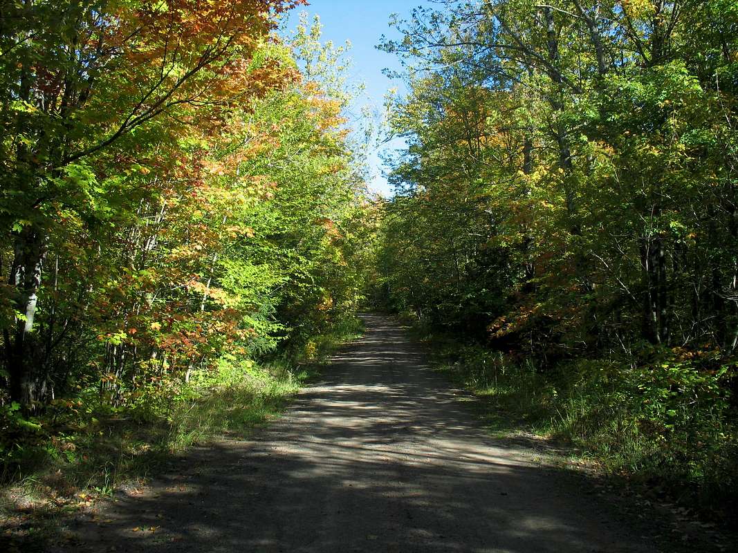
Getting from east to west is a bit more difficult. There are no paved roads that you can travel. Numerous Forest Roads crisscross the area so make sure you have a good map before setting out. Locals make good use of these roads so for the most part they are kept in good shape.
Pack Your Long Johns and a Bug Net…
As with other hiking destinations within the UP each season offers its own set of rewards and drawbacks…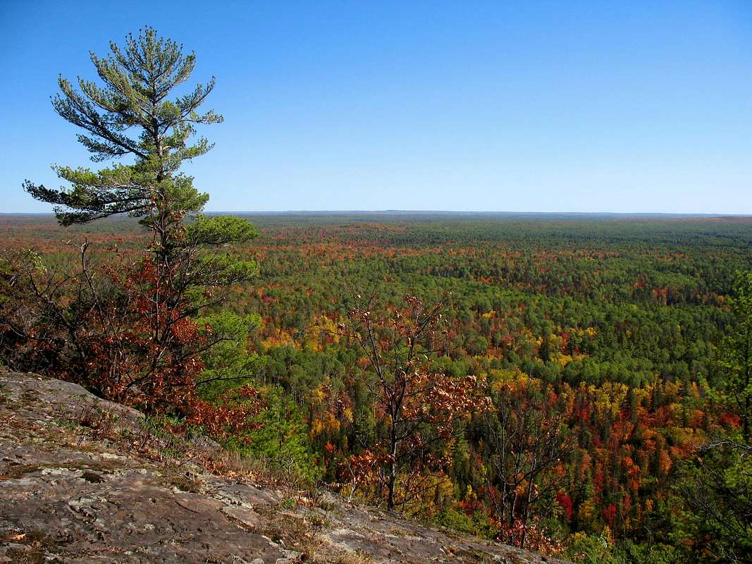 Winters can be harsh, as you might expect. Over 200 inches of snow blankets the Trap Hills and nighttime temps are frequently below zero. Winter provides the most solitude of any season but access can be difficult. The forest roads that provide access in the summer are mostly impassible to vehicles so your only reliable way in are from either M-64 or US-45. Both of these roads are well maintained. For more info on winter activities in the Trap Hills look here.
Spring can be the most frustrating time to visit the area as heavy late season snowfalls are common and forest roads can remain snow-covered well into May, long after you might expect. By the time the snow melts and the roads dry bug season is usually in full force.
Summers are very pleasant at this latitude with average highs in the mid-70’s. Bug season usually drags on until late July depending on the wetness of the season. Don’t think the UP is without hot weather though. Most years the thermometer tops out above 90 at least a couple of times. On the other hand frosts have fallen in late July so be prepared for anything.
Fall is my favorite time of the year in the north woods. Nights are comfortable if not chilly, the bugs are gone, and the colors…oh, the colors! There can be some hot days in September (by that I mean above 80) and the snow usually holds off until November giving you two perfect months of hiking weather.
Highlights of the Trap Hills
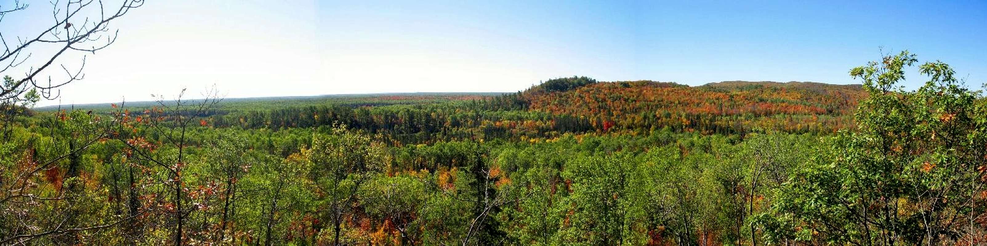
 Cookout Mt. (1741’) – Along the Gogebic Ridge Trail about a mile and a quarter west from Old M-64. The summit is wooded but a short side trail leads to the south side of the peak and some beautiful panoramic views.
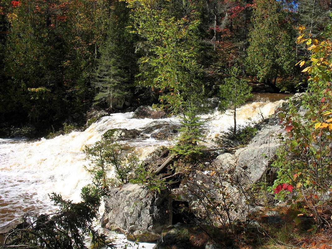
Cascade Falls – Located along the beautiful Cascade Falls Loop Trail. A small but secluded waterfall and many ridge-top views make for an enjoyable hike.
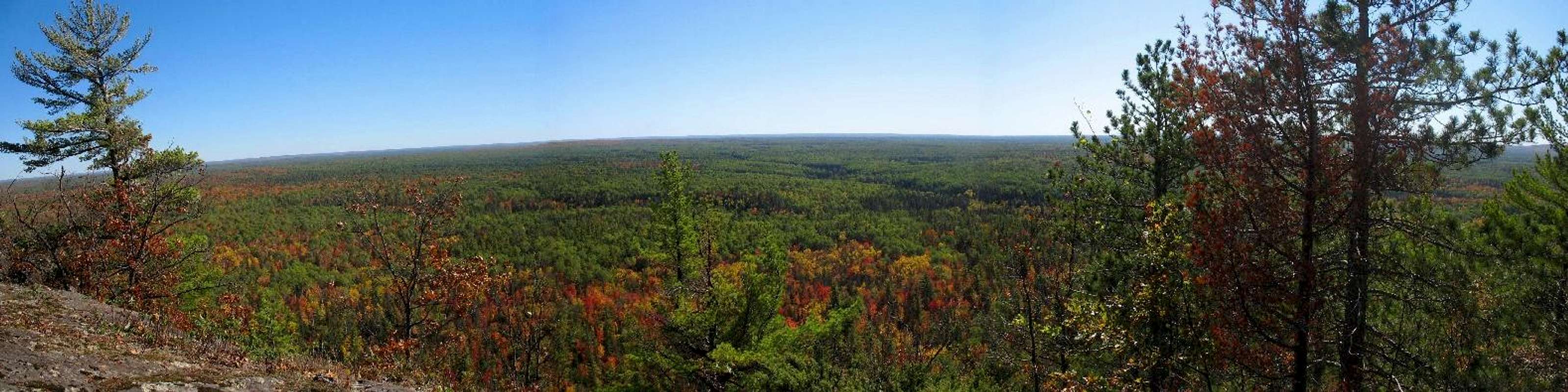
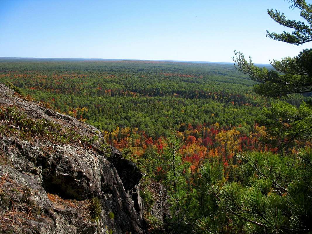
Norwich Bluff (1597’) – Perhaps the Trap Hills most famous landmark. Norwich Bluff is described as being “Michigan’s highest bluff,” whatever that means. The views from the cliff top are stunning. The panorama stretches out for miles in nearly every direction. Access is off Norwich Road just north of the Ontonagon River. Park in the clearing and follow an ATV path east along the base of the cliffs. About a quarter-mile in watch for a trail branching off to the left marked for hiking. The next half mile is among the steepest and most rugged in Michigan. When the trail levels out a bit watch very carefully for the NCT (blazed blue) cutting off to the right. This junction is unmarked and easy to miss. Head east on the NCT. After a couple of steep climbs you enter a stand of Red Pines with views to the south peeking in between. Head south through the trees about 200' to the cliff edge.
 |
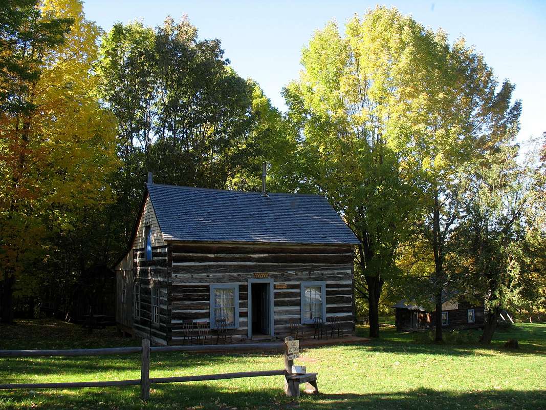 Old Victoria Townsite – A ghost town from the mid-1800’s during the copper boom. There are several restored buildings to tour for a small admission fee. Old Victoria was the site of the legendary “Ontonagon Boulder.” The boulder was a 3,708 pound chunk of pure native copper pried from the backs of the nearby Ontonagon River. The boulder is now on display at the Natural History building of the Smithsonian in Washington D.C. Guided tours are available during the summer for a small fee.
Lookout Mt. (1431’) – A nice short hike up the NCT from Victoria Dam Rd. takes you to the cliffs of Lookout Mountain. There are some nice views of the Victoria Dam and Reservoir below.
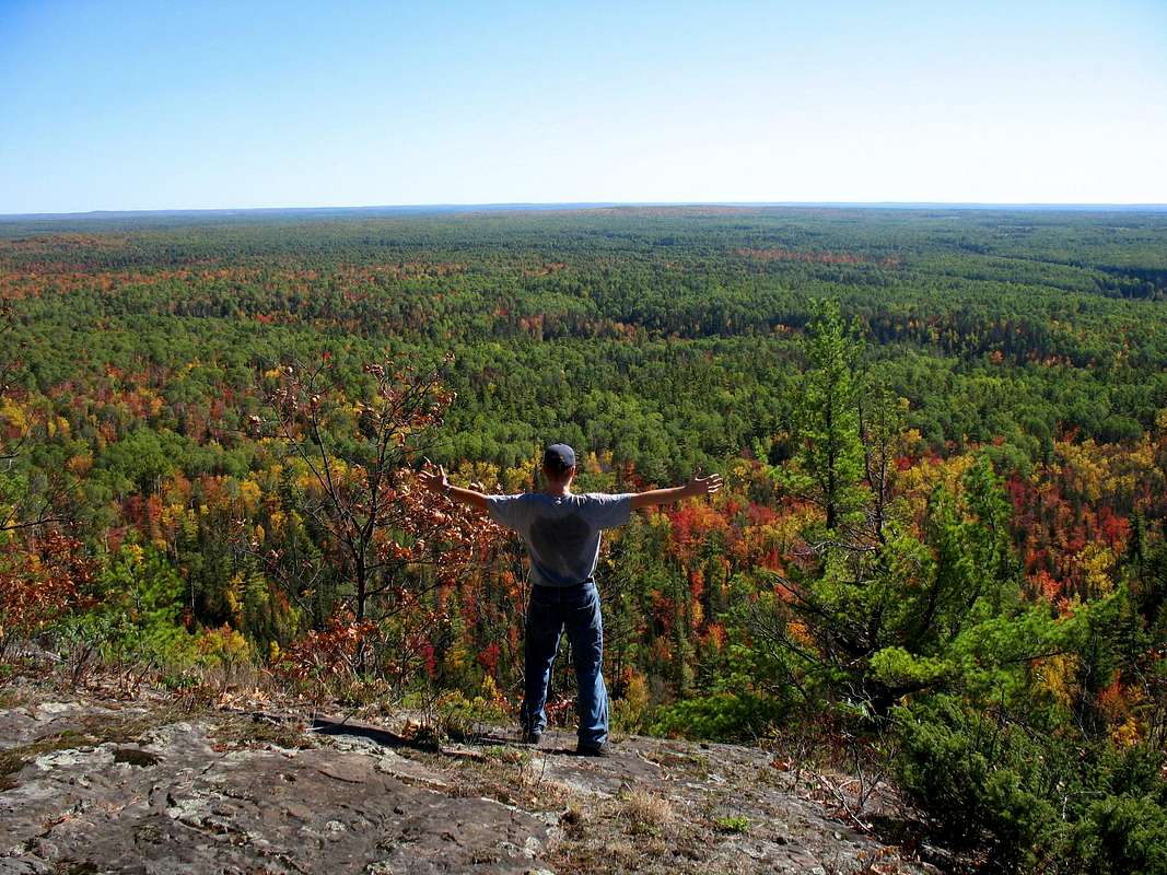
Trap Hills Ridge (1772’) – This is the heart of the Trap Hills. The NCT reaches its highest elevation here, east of M-64, and the trail frequently breaks out to stunning cliff top overlooks on its trek east. Some of the prettiest wilderness campsites in Michigan can be found along this section of trail!
Enjoy Your Own Private Trail…
Okay, I can’t really guarantee you’ll never see another soul but the paths that wander the Trap Hills are some of the least traveled in the state. Get farther from the main roads to the east and west and the number of people you are likely to meet decreases proportionally. The following is a list and brief description of the marked trails in the area…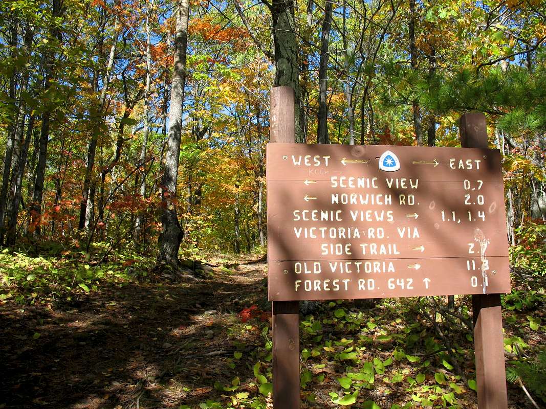 North Country Trail (34 miles) – Makes its way through the heart of the Trap Hills from M-64 in the west to US-45 in the east. The trail leaves M-64 and immediately climbs to the summit of 1772’ Bergland Hill (no views) and then gradually descends to Old M-64. East of Old M-64 is perhaps the most scenic section of trail. The NCT passes the highest portions of the Trap Hills and frequently runs along the cliff edge providing some of the most stunning scenery in the state. After the trail crosses Bush Creek it spends its time between dense woodlands and bare ledges. Continuing east on the NCT you pass the scenic Norwich Bluffs, Gleason Falls, and Lookout Mountain before descending to the lowest point in the Trap Hills along the West Branch of the Ontonagon River at around 700’. This is the largest river you’ll have to ford along the trail by far. Water levels are generally between ankle and knee deep. If you visit during the spring snowmelt, however, you may have more trouble. The remaining portion of the NCT between the river and US-45 is generally a pleasant woodland hike with no views.
Gogebic Ridge Trail (8 miles) – A linear trail that connects with the NCT just east of Old M-64. Traveling west from the NCT and Old M-64, the GRT climbs Cookout Mountain and its nice views to the south (see below). Continuing east the trail makes its way through the hilly woodlands towards Lake Gogebic. Just before reaching the western terminus of the trail along Forest Road 250, the trail ascends a high bluff with beautiful views to the south.
Cascade Falls Loop (1.4 mile loop) – This nice family hike combines a number of beautiful cliff top overlooks with a wonderful, secluded cascade. The Valley Trail follows the valley floor and makes for the easiest and most direct route to the falls. Make sure you take the Bluff Trail which loops off the main trail though. The various overlooks along this rugged trail are amazing!
Old Victoria Loop (1.0 mile) – This trail winds its way through the ghost town of Old Victoria, taking you past many interesting historic structures. A nice side trip to Lookout Mountain ads about another 1.5 miles to the hike.
 |
Pick Your Own Piece of Paradise…
 A good indicator of how undeveloped this area is by the number of campsites within it. Zero. Luckily a majority of the Trap Hills is located within the Ottawa National Forest. Within forest boundaries you can camp pretty much anywhere you please. Occasionally the NCT does cross private land where camping is prohibited. Don’t expect any trailside signs explaining this though, so get a good map so you can keep track of where you are. There are plans ongoing to build lean-to’s and shelters along the NCT. Please visit the NCT-Peter Wolfe Chapter page for up-to-date info.
Water access isn’t really an issue either. While on the ridge tops water can be scarce but the NCT crosses no less than 7 named streams on its way through the range. Again, get yourself a good map to help you out in this regard.
A Wilderness to be Protected...
 Over the recent years there has been a growing interest in the preservation of the Trap Hills. The major danger that the area faces is logging. The private land that criss-crosses the Trap Hills is largely the property of local logging companies and the National Forest, as we all know, can be all to eager to allow loggers to wander over onto “protected” land. To combat this a couple of organizations have taken it upon themselves to push forward an effort to preserve the Trap Hills a designated “wilderness area.” These organizations are the Trap Hills Conservation Alliance and Northwoods Wilderness Recovery. As recently as 2001, these organizations were able to halt potential logging of National Forest lands within the range. As the Northwoods Wilderness Recovery website states though, “we expect the Forest Service to continue trying to push through logging plans in the future.” If interested I would strongly urge you to contact one of these organizations.
 More Info...
Here's a list of websites I found helpful when making my initial foray into the Trap Hills...North Country Trail Association-Peter Wolfe Chapter: The best page I've found for logisitcs, maps, and suggested hikes in the Trap Hills.
Hunt's Guide to the U.P. (Trap Hills): Another page with info and many of the links you see here.
Ottawa National Forest
Backpacker Magazine Trap Hills Article: The article that revealed the Trap Hills to me.
Trap Hills Conservation Alliance and Northwoods Wilderness Recovery: Conservation groups interested in preserving the Trap Hills as a federal wilderness area.
DWhike's Adventures - Shameless self promotion...come visit my website for more pics of the Trap Hills and other places that I have wandered off to in recent years...
