


Viewing: 1-2 of 2

Marmaduke - Aug 10, 2015 12:41 am - Voted 10/10
Nice page,Interesting and really great photos!

Rocky Alps - Aug 10, 2015 2:30 pm - Hasn't voted
Re: Nice page,Thanks!
Viewing: 1-2 of 2
|
|
Trip Report |
|---|---|
|
|
Jun 26, 2015 |
|
|
Hiking |
|
|
Summer |
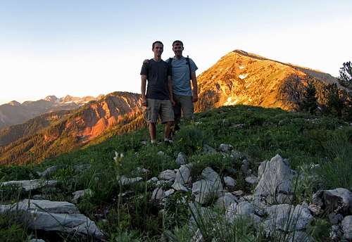
This time I’d be taking my brother Johnny instead of my wife, and with the hotter temperatures this time around I didn’t anticipate snow being an issue. It had been so hot in fact, that instead of starting at a normal hiking hour for me (~ 7/8 am), we figured an extra early start (~ 3/4 am) would make things easier for us, and would enable us to get back down to the car before the temperatures got really uncomfortable.
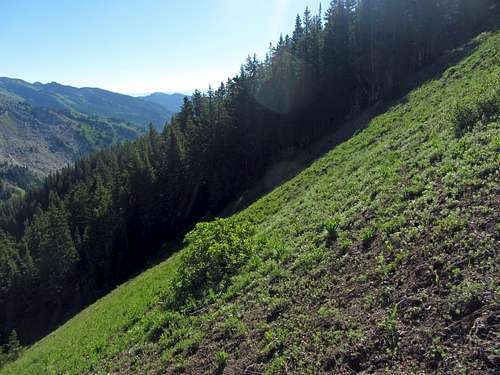
We got to the gate outside of the Granite Flats campground at around 3:30 in the morning, only to find that it was locked, so we parked at the dirt lot just outside the gate, where the dirt road branching off towards Silver Flat Reservoir is found. This only added a couple hundred feet to the start of the hike, so it was no big deal. Last time, we made our major route-finding error right at the beginning, so this time I was extra attentive to make sure we stayed on the Deer Creek Trail, especially since it was still dark.
The first branch in the trail was clearly marked with a sign, so we stayed to the right and followed the Deer Creek Trail. We encountered a small section of trail shortly thereafter that had been washed out by run-off water, which took us a few extra seconds of rock-hopping to prevent a fall in the mud. Coming to the second split in the trail, we stayed straight and to the right instead of cutting to the left, as prompted by the directions on this site. After just a hundred feet though, this led to a dirt road (most likely the one leading up to Silver Flat Reservoir). We backtracked all the way back to the first junction again, looking on the sides of the trail to see if we had somehow missed the second turnoff (spotting a cute little bunny in the process), but upon discovering that we hadn’t, we decided to cut to the left this time.
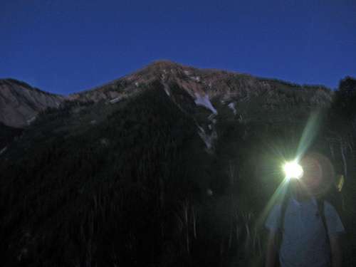
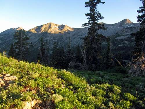
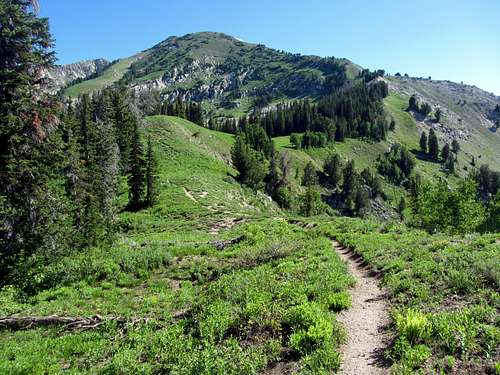
We noticed two or three other turnoffs within the first mile or so of the trail, but discovered that they usually were just divergent branches of the same trail (on the way back down, we found that a couple of the western-most branches led to scenic overlooks). As we started gaining elevation on the east side of the drainage I became more confident that we were going in the right direction. The temperature was in the high 40’s, which is personally my favorite for hiking, and my headlight made it easy enough to see that I was optimistic we’d be able to make it up to the meadow around 9,500 feet around the time the sun rose.
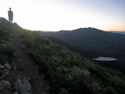
There was one switchback cutting back to the southeast (away from Box Elder Peak) that made me a little nervous that we’d somehow gotten onto a different trail, but my concerns went away when it cut back to the northwest. After that we came across a pair of glowing green eyes, which fortunately only belonged to a baby deer. Around 5 am the birds started chirping and at 5:15 the sky slowly started lighting up enough that we no longer needed our lights.
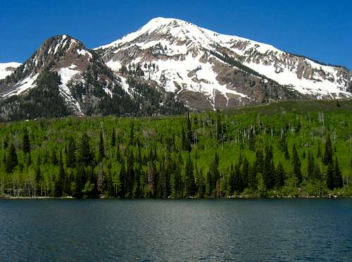
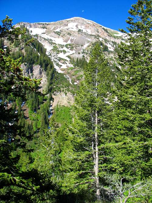
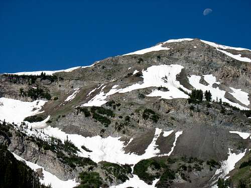
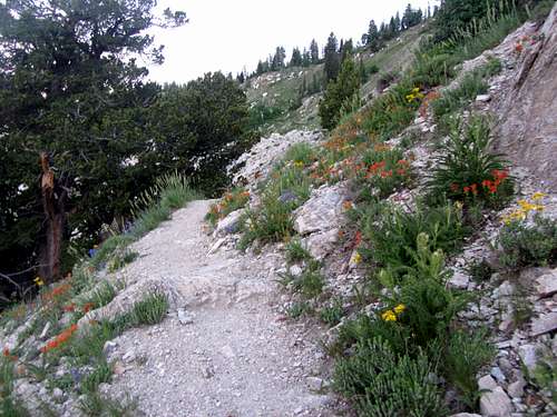
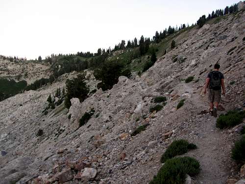
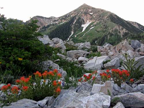
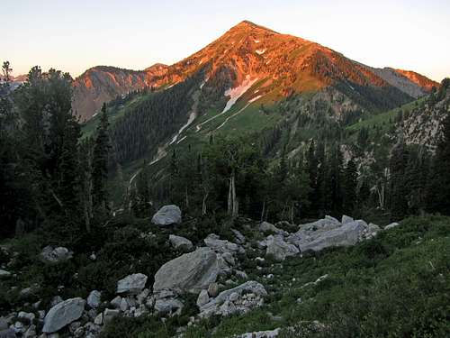
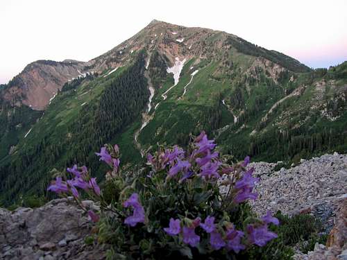
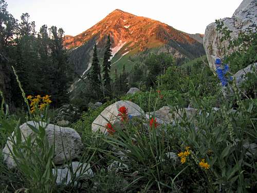
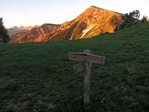
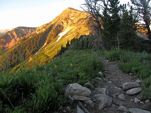
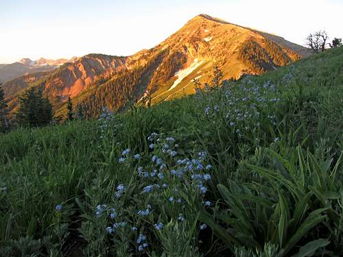
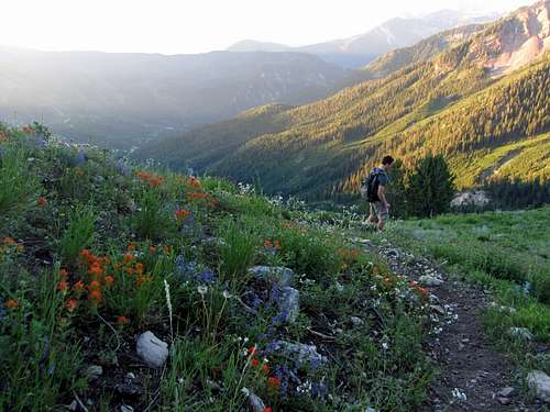
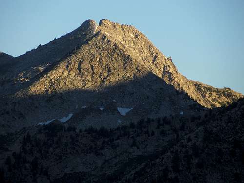
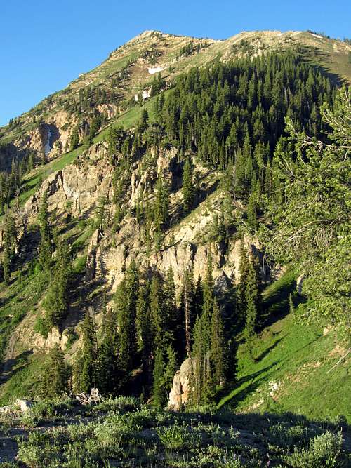
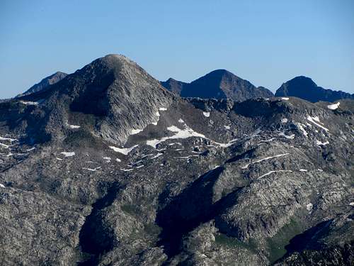
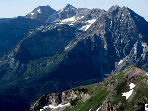
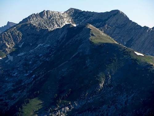
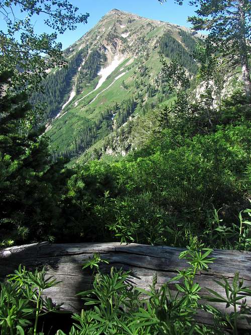
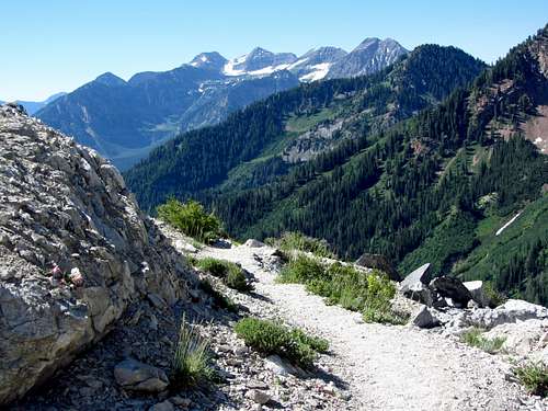
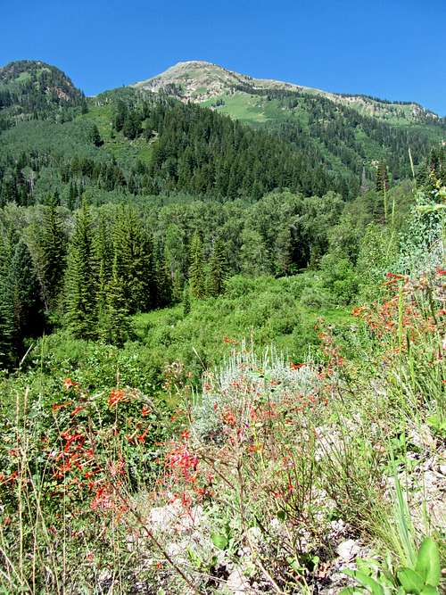
Around the spot where the trail starts going through some more rocky terrain, the scenery became very nice. To the sides of us were every color of wildflower (red, orange, pink, yellow, blue, purple, & white), and the views to the south (Mount Timpanogos) and west (Box Elder Peak) became better the higher we got. Just before reaching the meadow the first rays of sun hit the summit of Box Elder, bathing the peak in a bright orange glow.
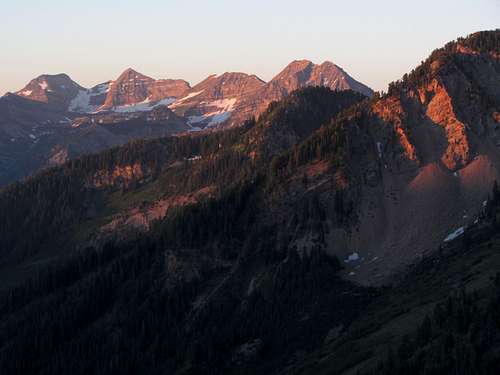
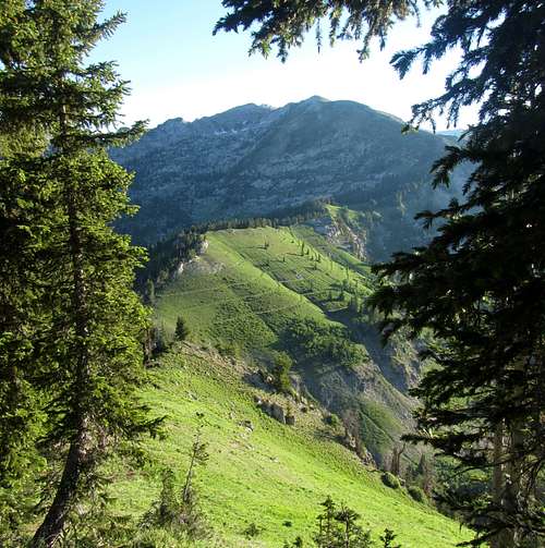
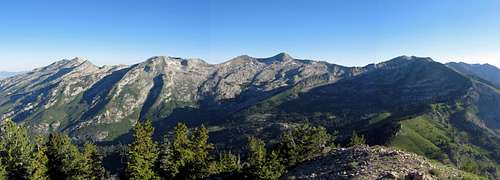
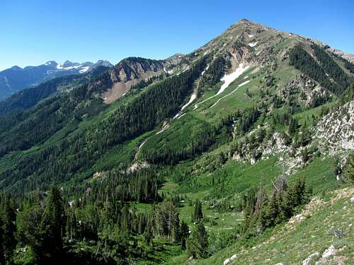
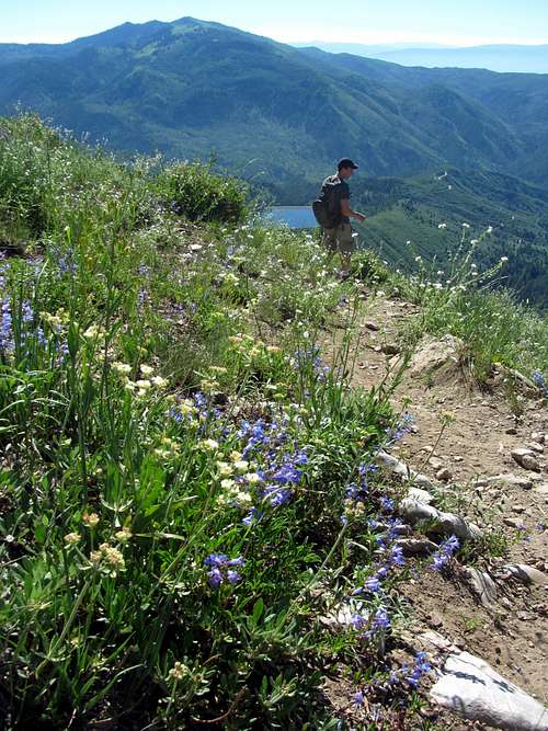
I went a bit crazy taking pictures at this point, so it was a little after 6 when we finally arrived at the meadow. The meadow was even nicer than I had anticipated, with scenic views of the Alpine Ridge and peaks like Pfeifferhorn off to the north. A lone tent was situated a couple hundred feet to the northeast, so we continued west along the trail so as not to disturb the campers. If I ever get into backpacking, this is a spot that would definitely crack my top ten places to camp in the Wasatch, as it’s far enough from the trailhead to deter most casual hikers from crowding the area, and the surroundings are top-notch.
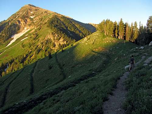
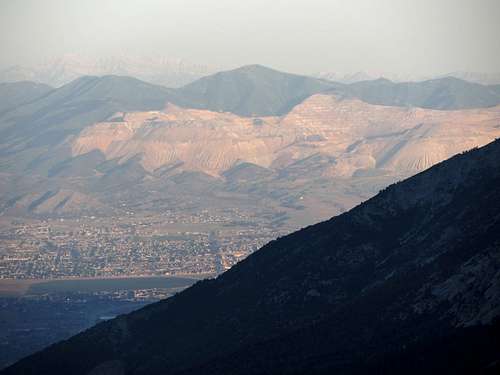
Since we still had a ways to go to get to the top, we continued farther along the ridge towards where the trail starts losing a bit of elevation (near the north ridge of Box Elder Peak) before stopping for a snack break. Along the way we heard quite a few coyotes howling in the distance, which was pretty cool. It was hard to tell where they were, but my guess is that they were somewhere down near the Dry Creek Trail to the northwest (the other trail that leads from the town of Alpine to the meadow we had just left, which is longer and gains more elevation on the way). We found a nice rock outcropping where we could see the shadowy silhouette of the peak stretching out over Utah Valley to the west, which seemed as good a spot as any for a little picnic. Below us to the south we also saw several deer bounding down the grassy slopes near the man-made terraces put in place to prevent erosion.
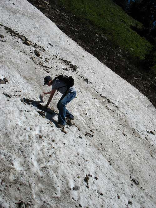
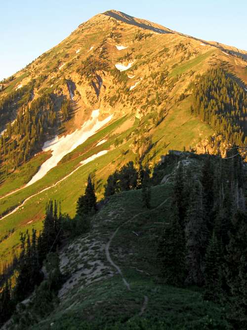
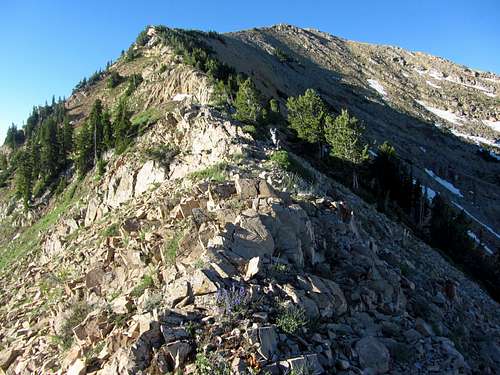
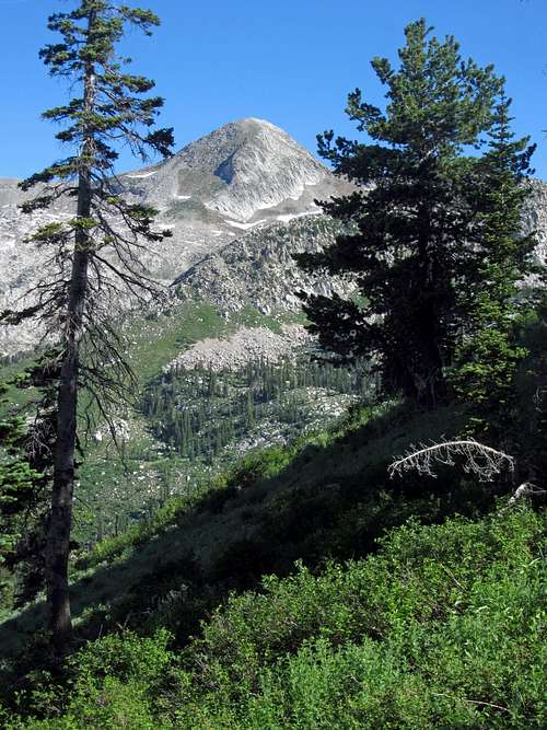
After dropping back down a couple hundred feet we began the steep ascent up to the summit. The trail initially started up the edge of the ridge, but then crossed into the trees to the right (west), becoming more and more faint. Johnny started slowing here since he wasn’t used to the altitude, but we continued our way up the north ridge of Box Elder Peak. We crossed an open 40-degree slope towards a different line of trees to the west, and with no more signs of the trail we decided to go straight up from here.
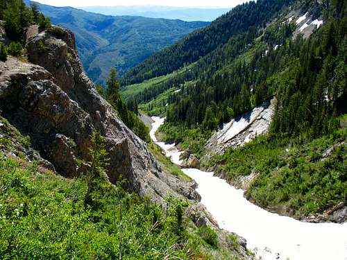
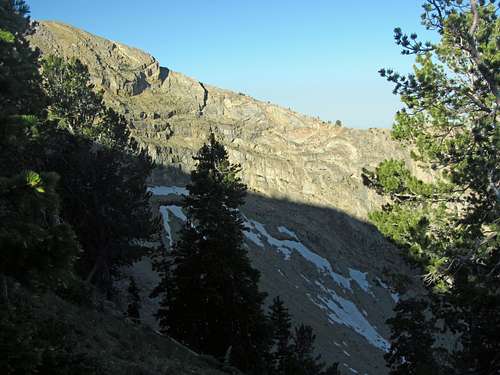
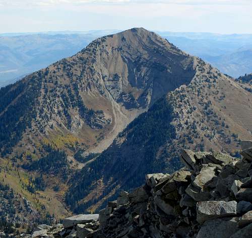
The steepness and altitude (this was my first hike in a while as well) slowed our pace, but eventually the trees opened up and we could start to see the remainder of the ridge leading to the summit. Off to the west (right) we could see the distinctive crater-looking cirque, which surprisingly didn’t seem that steep from our angle (looks more impressive when viewed from farther away on a peak like Lone Peak or Thunder Mountain). Finally getting back onto the ridge crest itself, it looked like we were about halfway to the top from the saddle near the meadow. Johnny wasn’t feeling well though, so he said he wanted to stay here while I continued to the top.
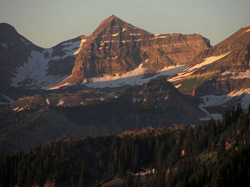
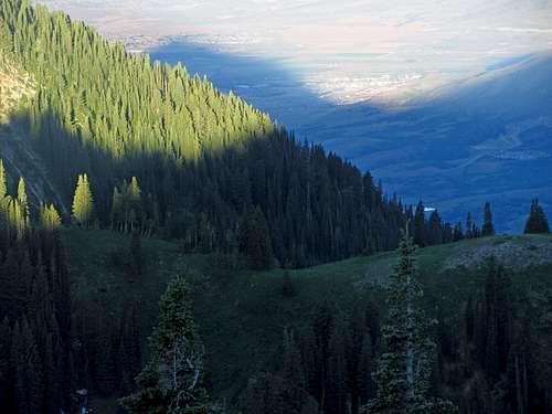
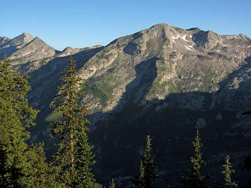
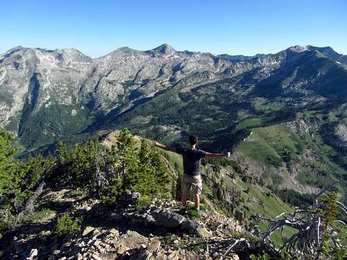
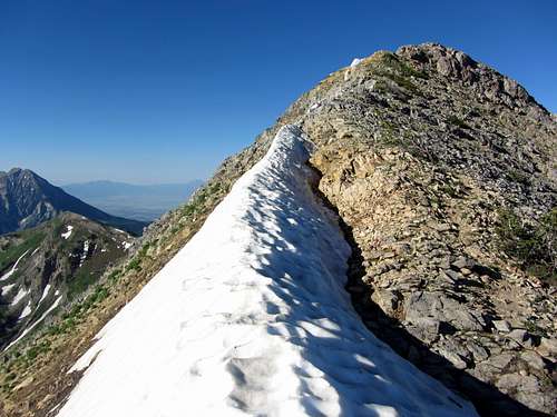
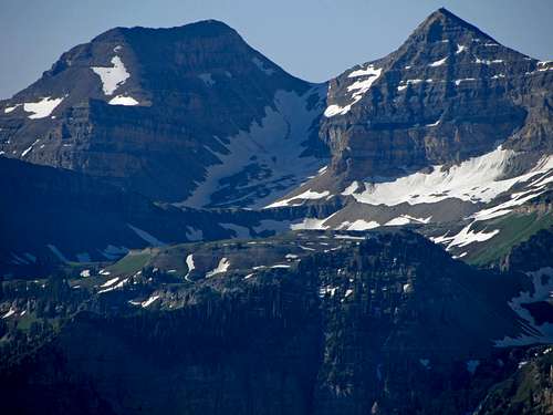
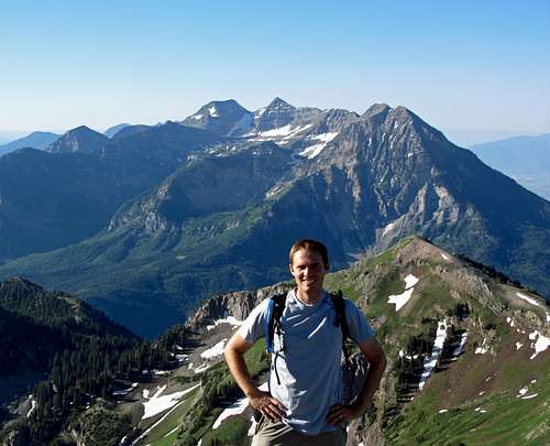
The remaining ridge walk to the top was easy, with no scrambling moves required, and the views back behind me to the north towards the Alpine Ridge were impressive. I finally crested the south side of the ridge just below the summit, and was greeted with an awesome perspective of Mount Timpanogos. From the top, I was able to clearly see the route I was hoping to take up North Timpanogos later in the summer, along with the big snow fields still present below the main summit and south summit.
I started back down after a short stay on the summit and soon met back up with Johnny, who was fine with going back down since it was already starting to heat up in the sun, even though it was only just after 8 in the morning. On the way back to the saddle below the meadow we went straight down a little too far before veering right, and as a result had to bushwhack over a couple little gullies and through some trees, but we soon found ourselves back on the trail.
Above the saddle we ran into someone on a horse, who apparently was trying to get all the way to the summit. The animal seemed surprisingly agile in beating a way through the trees where there was no trail, but I doubt he’d be able to make it all the way to the top like that (at least I hope he didn’t end up trying to do so, for the animal’s sake). Despite not requiring any scrambling for a hiker, I don’t think the steep terrain below the summit is conducive to horseback riding, unless you’re the Man from Snowy River.
On the way back down we ran into a few other small groups of hikers, all who appeared to be on their way to the top, and I was glad that we had chosen to do the majority of the hike in the cool early morning instead. Near the bottom we saw that what apparently were extra trail turn-offs were in fact just little detours to a couple scenic overlooks. The main takeaway I got from the route-finding at the beginning of the trail is that if after a mile you’re going up the right (east) side of the drainage below Box Elder Peak and can see the summit to the west, then you’re on the right trail.
Box Elder Peak was a great hike, and while I wouldn’t say it’s quite as spectacular as Mount Timpanogos or even Mount Nebo (it seemed more on par with Deseret Peak in the Stansbury Mountains in that regard, although a bit steeper and more difficult at the end), it had some really nice scenery and is a walkup that I wouldn’t mind doing again in the future.
Interesting and really great photos!
Thanks!
Comments
Post a Comment