

selinunte01 - Mar 27, 2013 8:22 am - Voted 10/10
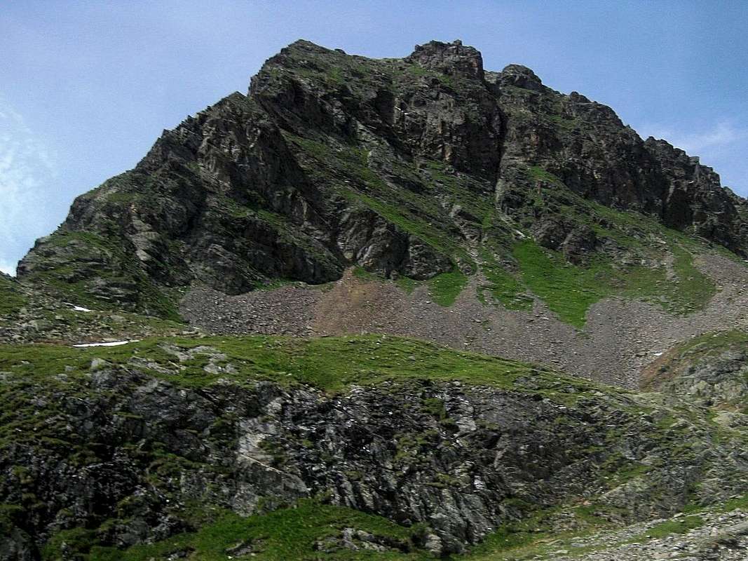
A first guess....... if your Kapuzinerjoch is also named Rötkarljoch (located between Gahwinden to the south, the starting point for Hohe Geige west ridge and Breitlehnjöchl to the north alongside Rüsselsheimer Weg) your summit is named Hoher Kopf (2784 m)after www.alpenkarten.eu;
I try to verify it with my maps at home.
Cheers, Michael

rgg - Mar 28, 2013 12:58 am - Hasn't voted
Re: A first guess....That looks like a pretty good guess! I checked my guidebook again (the AV Führer Ötztaler Alpen), and now that I had a name to look for, I found it. The description, and especially the description of the south ridge route, matches up very well, so Hoher Kopf (2784m) it must be.
My Freytag & Berndt map as well as AMAP Austria don't give a name, but state an elevation of 2779m. I couldn't possibly say which elevation is better, but it's the same place.
Rötkarjoch is the old name of the Kapuzinerjoch:
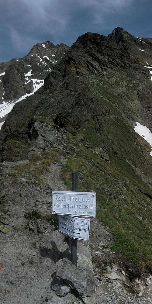
Kapuzinerjoch, looking east
By the way, when I tried your link, it didn't work, and discovered it should be http://www.alpenkarte.eu.
Cheers, Rob
selinunte01 - Mar 29, 2013 9:54 am - Voted 10/10
Re: A first guess....I checked my Alpenvereins map "Ötztaler Alpen, Kaunergrat-Geigenkamm, number 30/3: there it is: Hoher Kopf, a double summit, 2784 m and 2783 m being the two culmination points.
PS: it is alpenkarte.eu indeed!
Michael


Comments
Post a Comment