
-
 1385 Hits
-
 79.04% Score
-
 10 Votes
|
|
Mountain/Rock |
|---|---|
|
|
45.36167°N / 14.19080°E |
|
|
Hiking |
|
|
Spring, Summer, Fall, Winter |
|
|
4173 ft / 1272 m |
|
|
Overview
The mountains of Ćićarija are the result of collision of the Istrian micro-plate and the continental plate, specifically the outer belt of Dinaric Mountains. Veliki Planik is the highest summit of the narrow Ćićarija range, because usually the mountain of Učka, which is stretching further, but more in the southern direction, is considered a separate massif.
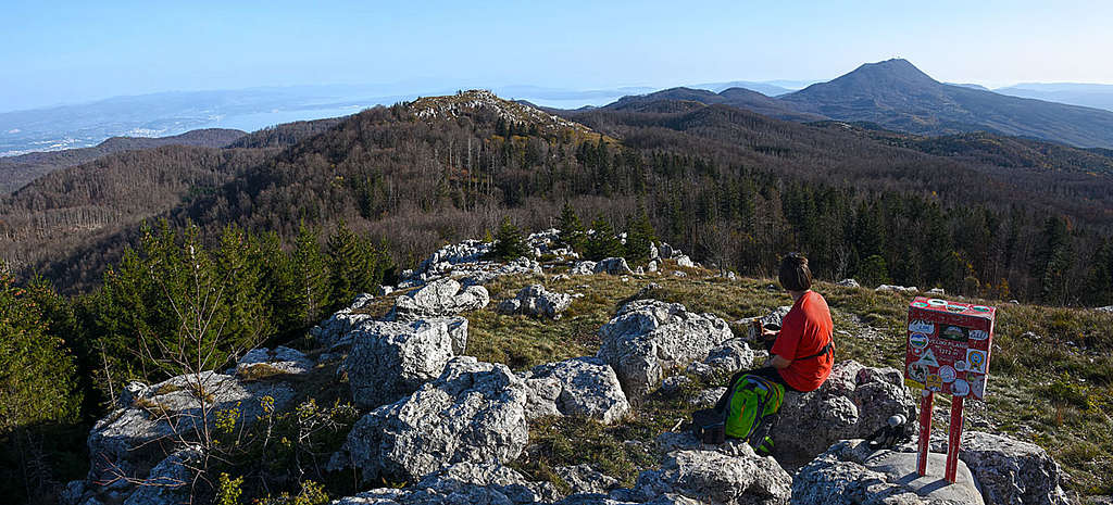
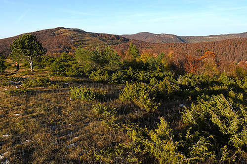
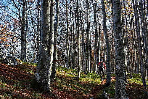
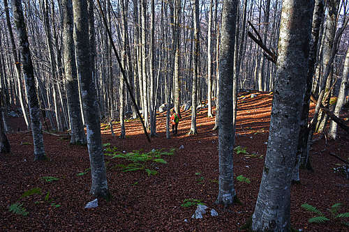
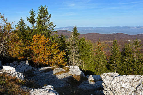
As other mountains of Istria anticline, also Veliki Planik is rounded, with slopes falling gently on all sides. Towards the S and SE, the slopes are grassy and rocky, all other sides are forested. On the first glance nothing spectacular, but if you visit it in the right time of season and in good visibility, you can enjoy far views and pristine nature. Endless beech forests can’t be more beautiful as end of October on Veliki Planik.
Southeast of the main summit, there’s also the Mali Planik, 1259 m. As you might expect, the names mean “Big” and “Small”. As the small one is closer to the Kvarner bay, the views from it are equally fine.
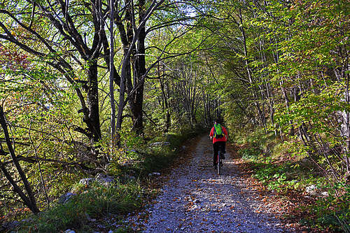
Veliki Planik is almost exclusively a hikers’ destination. Regarding outdoors activities also mountain biking can be mentioned, because mountain roads are reaching high. And the broader area of Istria is anyway known as a paradise for biking. Due to quite pure limestone, we can expect that in the future even more caves will be discovered. Currently only two are on the maps – one to the NW of Veliki Planik (a smaller cave with some decoration), the other one to the SE of Mali Planik.
Getting There
You best reach close to the mountain by your own car. In that case the best trail head is Brgudac village (45.380840528594895, 14.14096362506699), where on the altitude of 718 m you can find a suitable, free parking place. The other trail head is a bit more remote, but also a bit higher. That’s the Poklon road pass, where the old road reaches 934 m. Make sure you don’t drive into the Učka tunnel, which goes deep under the old road pass!
If you must rely on bus connection, then Poklon road pass (45.309277413746166, 14.214759910872166) is also a good option. The other one is Lupoglav village (45.351687651216, 14.109908351809647), which is also quite remote. That village has even a train connection.
Other trail heads are more remote (for example Veprinac on the Kvarner bay side).
Korita
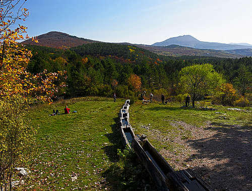
To the NW of Veliki Planik, by the route from Brgudac, there’s a wonderful place which for sure you must visit. In a completely dry, karstic terrain, there’s a water source, which has been used since ancient times. Located on a meadow under the Brajkova stijena cliff, this source of drinking water pours into ten solid wooden troughs (once there were 13), beneath which is a pool rich in plant and animal life. The “cascade” of troughs has a suitable function. The upper trough (once it was made of stone) was used for drinking, the second one for washing legs, and all the remaining below for watering animals.
The village of Brgudac is 45 min of walk away. In the past up to 3000 animals were held there, but it could happen that all nearby water sources got dry. Then women of the village were daily carrying water from Korita down in the village.
Summit Routes
|
There are many options to reach the summit of Veliki Planik – even if we consider only the marked trails. Other trails are not to be recommended, unless you are an orientation expert. 1. Veliki Planik from BrgudacThis is the most recommendable option. It’s the shortest one and by the way you visit also the beautiful Korita meadow. The best way to do it is on foot from the very village of Brgudac. In 45 min you’ll reach by the shortest path the Korita, from there you have another 1 h 30 min to the summit. To Korita also a mountain road goes. It runs far around, but allows you to get there by (mountain bikes). From the big left turn on the Brgudac-Korita road you can also continue by a cart-road first straight then mostly in the S-SE direction till the junction with the S approach. On 1072 m crossroad turn sharp left and follow the cart-road all the way to the saddle between Mali and Veliki Planik, 1218 m. It’s some 4 km of that stretch. |
See full screen |
From Korita on Veliki Planik a nice marked path goes (No. 400). You first ascend on the baldy Škrljavnik, 1070 m, Then continue along the forested NW ridge. In higher regions the path is weak, so carefully follow the marks and plates on paths branchings.
|
|
|
Veliki Planik from Poklon
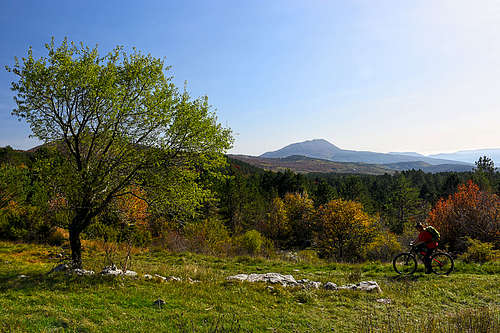
From the Učka Nature Park building you follow the marks No. 401 towards the N-NW. You mostly go by cart-roads, gently ascending. That route could be also used for mountain biking. The cart-road brings you on the saddle between Mali and Veliki Planik, from there you continue left on the highest point.
Veliki Planik from Veprinac
This is a longer route, starting also quite low (on 466 m). The marked path No. 481 goes mostly all the time towards the NW.
As said, there are many more forest roads, cart-roads and trails. To use them you need a good map and sufficient time. This holds true especially for longer treks across the Ćićarija mountains.
Maps
Good site is the official map of Croatian Mountain Rescue Service. On the home page choose the map No. 19 (Ćićarija): https://www.hgss.hr/kartografija/
The general OpenStreet Map is also valid, but there’s no distinction between marked and non-marked trails. That’s why I prepared my own simplified version, embedded on this page.
Red Tape
The area of Veliki Planik and Korita is a part of Učka Nature Park.
When to Climb
The ascent on Veliki Planik can be done in any season. But the far most preferable are spring and autumn. Summer can be hot, there’s a lack of water along the paths and visibility is not always the best. Winter can be even more tricky. The area is remote, high enough to have a considerable snow cover and in those times you can’t expect the paths are trodden. Of course you can take skis or snow-shoes, but Veliki Planik is not a nice tour skiing mountain.
Camping
The official mountain hut is Planinarska kuča Korita. It has 30 posts for sleeping and is mostly open in weekends (during the season). Contact: Sašo Trajčeski 095/91-18-118.