
-
 4960 Hits
-
 81.18% Score
-
 13 Votes
|
|
Mountain/Rock |
|---|---|
|
|
47.61542°N / 90.79757°W |
|
|
Cook |
|
|
Hiking |
|
|
1550 ft / 472 m |
|
|
Overview
The low slung Sawtooth Mountains that line the northern coast of Lake Superior in Minnesota are not glamorous in any alpine way, hardly ever breaching 2000 feet. But they are wild, caught between the world’s largest freshwater lake and huge tracts of the lake studded Northwoods.
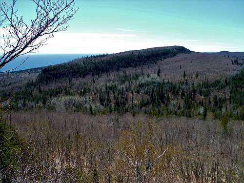
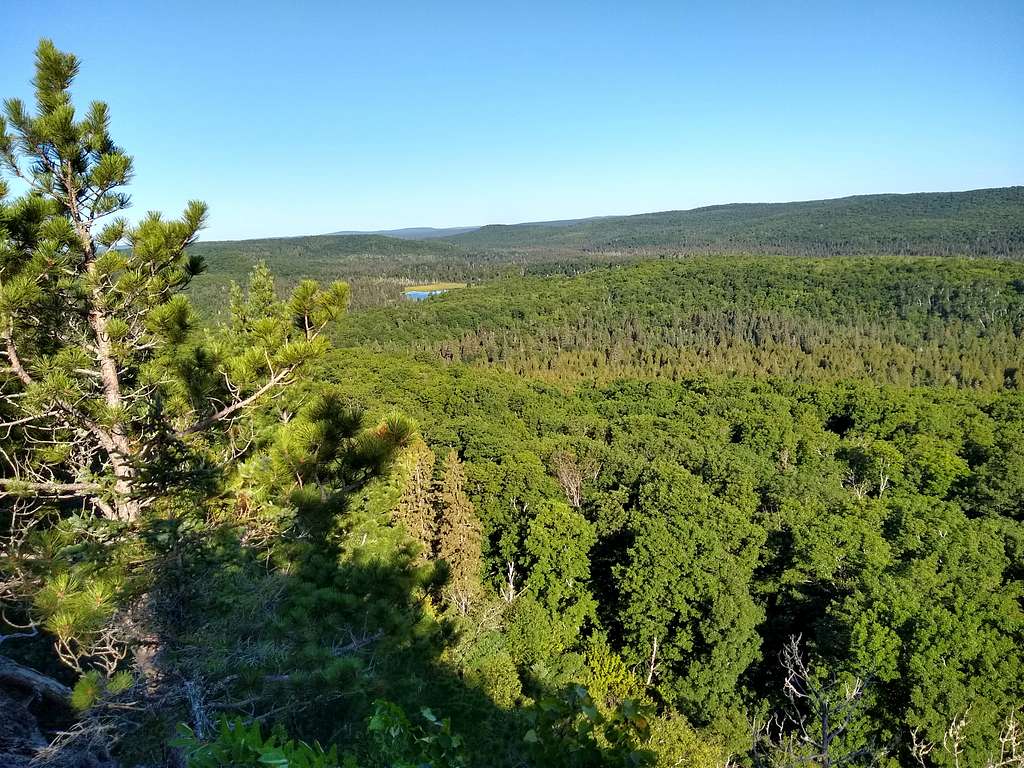
The Sawtooths host the rugged 300+ mile Superior Hiking Trail, which by means of its zig zag route and many spurs captures most of the viewpoints that break through the thick forest that covers the range. Leveaux Mountain, on a spur trail of the SHT, is a short enjoyable climb that contains two appropriate viewpoints for one of the the Sawtooths – one facing the Lake, one facing the Northwoods. It is an easy shaded hike in summer and a good snowshoe in winter.
Getting There
Most start the trip to 1550 foot LeVeaux from the trailhead found at 1150 feet or so, climbing 500 feet above the lakefront by vehicle on the gravel Onion River Road, which makes this summit far less of a challenge than other mountain trails that start near lake level. The Onion River Road is a mile or so east of the Onion River itself on Minnesota’s Route 61, the main drag for the North Shore, between mile markers 87 and 88. Take the road about two miles to the obvious parking area on the left. Park at the far end (Northwest end) of the lot near the well marked LeVeaux trailhead.
Route
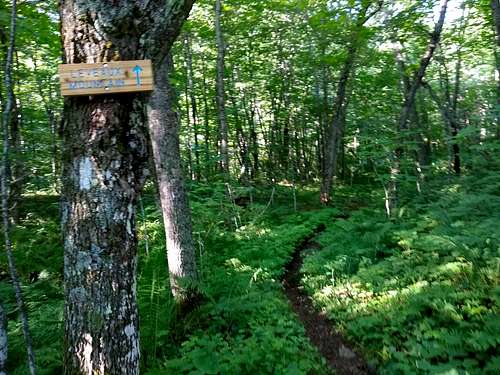
The beginning of the hike immediately places you on the Superior Hiking Trail, where you will hike in deep woods for nearly the entire hike.
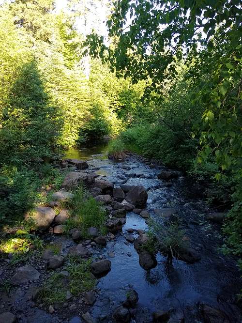
You will eventually dip into the valley of the Onion River, more a creek at this point, and cross over.
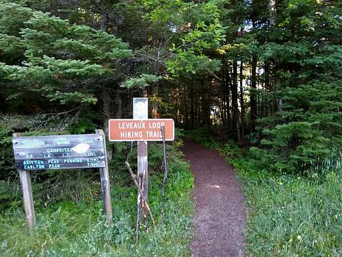
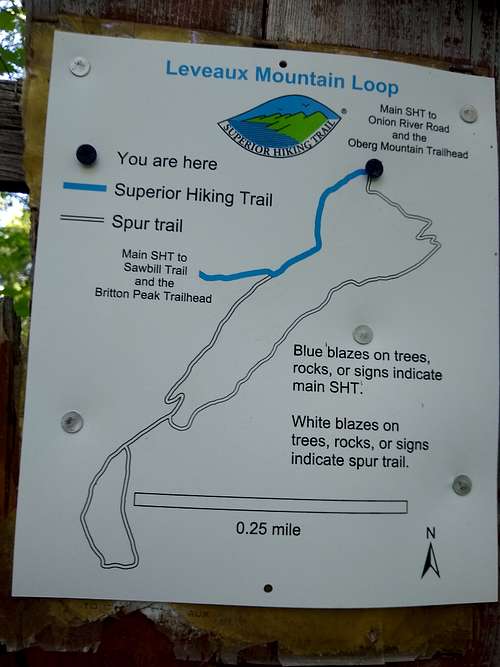
The trail was well signed in 2020. At the first fork, you will get a very good map to guide to the rest of your hike, a spur trail from the SHT that will hit both overlooks. Note the trail is shown on this sign (below) only from the point on the SHT where the spur trail begins, and not your starting point. The spur consists of two irregular loops linked by a connector trail between them.
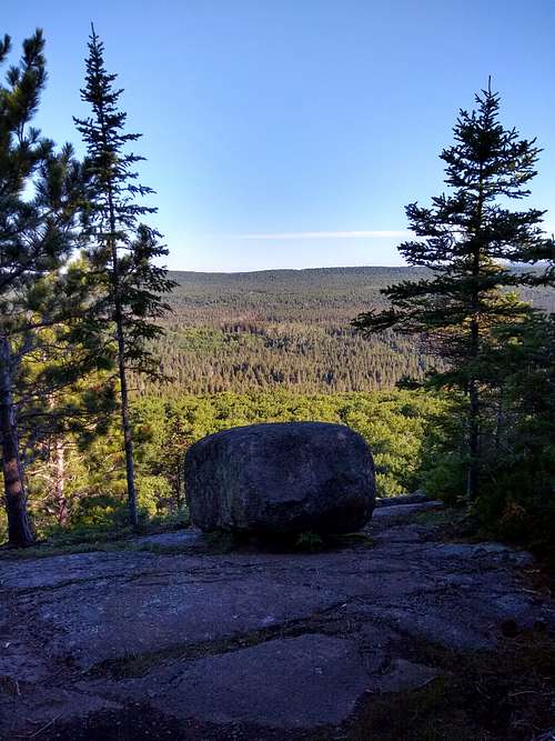
I will assume a clockwise route in the directions that follow. After taking the left hand fork to the spur trail, your climb will steepen considerably but you will quickly ease your way up to the flattish but still heavily forested top of LeVeaux. Soon you will hit the first overlook, guarded by a good size boulder.
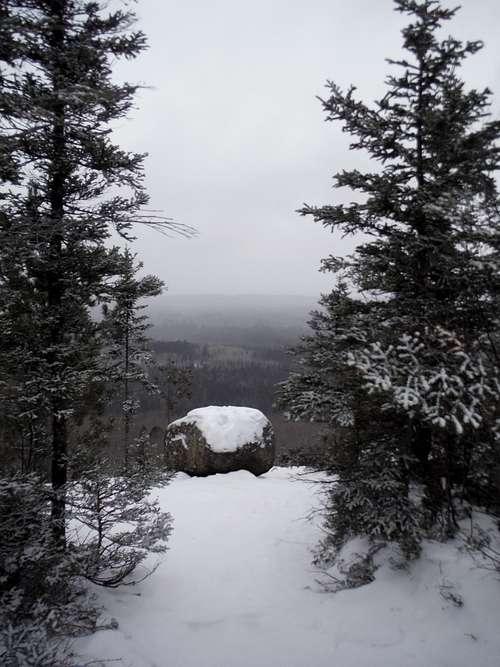
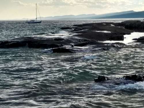
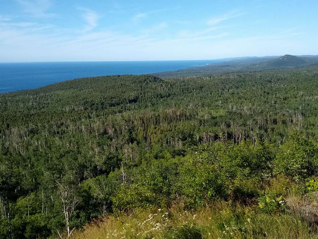
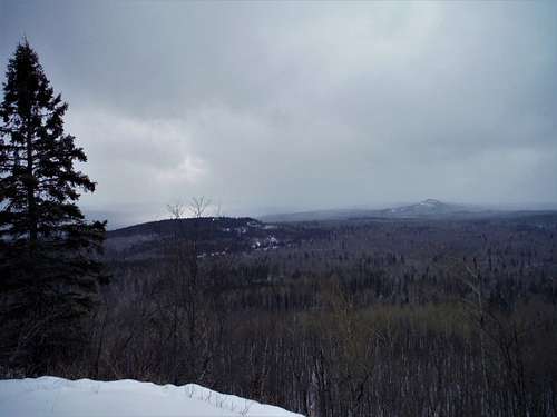
Heading further west, you will hit the connector trail between the two loops of the LeVeaux trail. Go left to travel along the connector and make another left at the fork that marks the start of the second loop You will pass unnoticed near the forested summit, but eventually break out into a good sized view of Lake Superior and down the coast. Carlton Peak is visible. Lake Superior on most days makes any view majestic ...
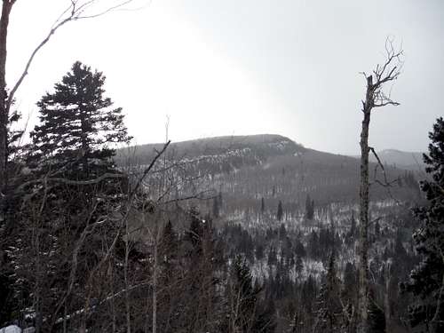
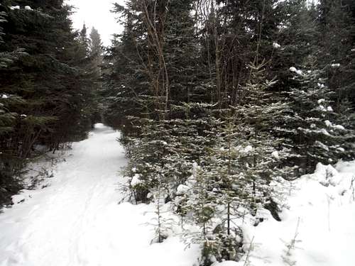
...unless it is a snowy winter day.
Continue following the trail as it loops back to the connector trail, taking that back to the first loop, where you can go left to see new forest back to the Superior hiking trail, and then back to the trailhead.
Nearby Options
The parking area can be popular winter or summer, as another hike (Oberg Mountain) starts on the other (southeast) end of the lot. Oberg is a much easier and more open, and has many more stunning viewpoints.
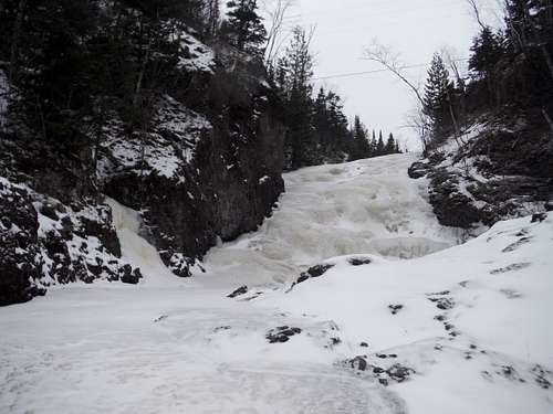
The Onion River has several large falls as it nears Route 61. If you pull over and park just east of the river at the Bergland rest area, you can take the stairs and see these falls.
Or walk parts of the river itself to the falls in Winter, Crampons or snowshoes recommended.
When to Climb
Any season, I have heard that Fall is spectacular
Red Tape
None - no fees.
External Links / Resources
Everyone going to the North Shore should own Andrew Slade's Hiking the North Shore