
-
 27904 Hits
-
 79.78% Score
-
 11 Votes
|
|
Mountain/Rock |
|---|---|
|
|
37.26180°N / 90.5244°W |
|
|
1313 ft / 400 m |
|
|
Overview
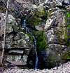
Mudlick Mountain is claimed to be the most prominent point in Missouri by Peakbagger.com but I'm not sure I agree. It does offer the most elevation gain in the State with nearly 900 feet of gain from trailhead to summit. Mudlick Mountain is also one of the oldest areas of exposed rock in North America.Mudlick Mountain is 459 feet shorter than the State’s highpoint Taum Sauk Mountain. The trailhead is located near Big Creek just above where it drains into the St. Francois River. Sam A. Baker State Park also contains the Mudlick Mountain Natural Area. The mountain has three really cool stone shelters built by the Civilian Conservation Corps (CCC) on its slopes that have fireplaces and make a great overnight backpack. You will pass each of these on the way to the summit.
 |  |  |
Getting There
Drive south from Fredericktown on US Highway 67. Between the small communities of Lodi and Silva, turn west (right) on Highway 34. Turn north (right) in a few miles on Highway 143 to Sam A. Baker State Park. The Park Office and Dining Lodge are on the right. The Trailhead is across the road from the Dining Lodge.Directions can also be found on the Sam A. Baker State Park website.
Both the Shut-Ins Trail and the Mudlick Trail begin here and can be used to summit Mudlick Mountain. The Shut-Ins Trail follows Big Creek and eventually climbs to meet the Mudlick Trail.
AlanP - Jan 21, 2013 7:00 pm - Hasn't voted
Mudlick vs BlackMudlick is not the highest change in elevation in Missouri. It rises 880 feet. Black mountain in Madison county rises 940 feet from the Saint Francis River at its base.
AlanP - Jan 21, 2013 7:00 pm - Hasn't voted
Mudlick vs BlackMudlick is not the highest change in elevation in Missouri. It rises 880 feet. Black mountain in Madison county rises 940 feet from the Saint Francis River at its base.