
-
 5949 Hits
-
 84.76% Score
-
 19 Votes
|
|
Mountain/Rock |
|---|---|
|
|
37.96403°N / 13.99641°E |
|
|
Hiking |
|
|
Spring, Summer, Fall, Winter |
|
|
3950 ft / 1204 m |
|
|
Overview
 Monte Macabubbo north face Monte Macabubbo north face |
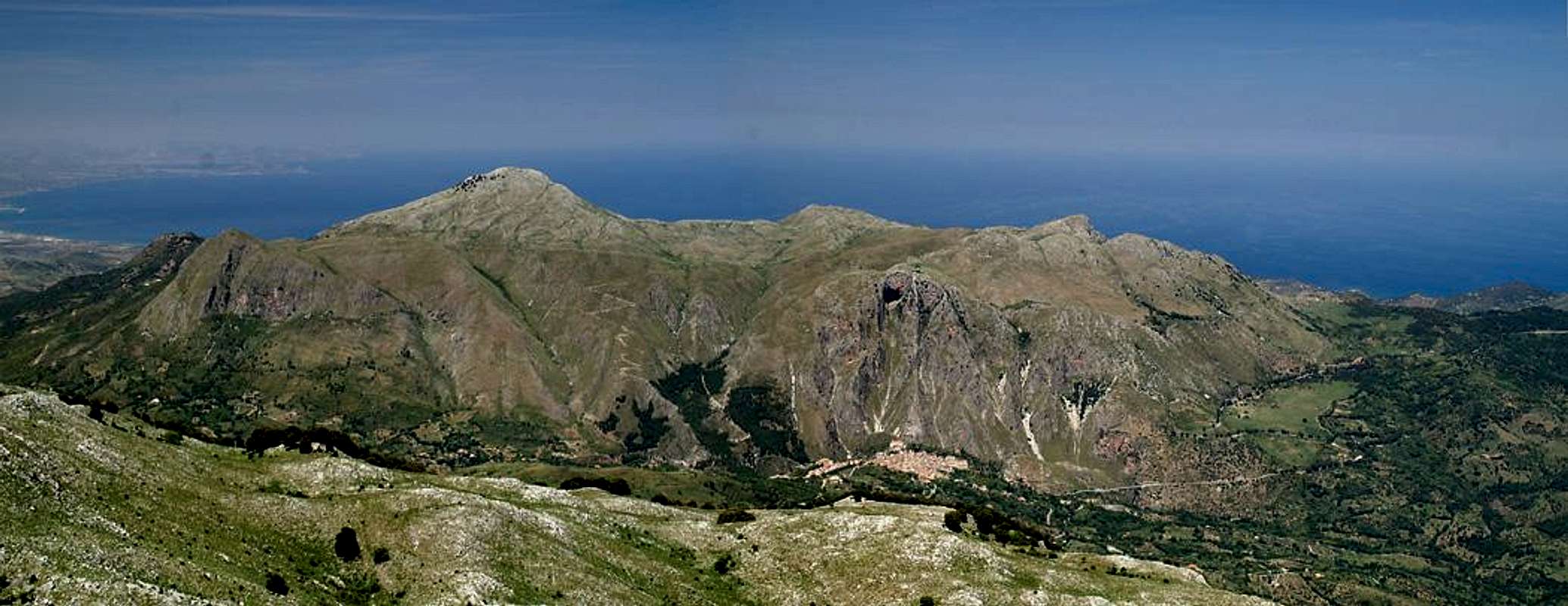
The Dipilo Group in the Madonie mountain range on Sicily consists of a high plateau, out of which several mountains rise on each sides. Most of them, with the exception of Pizzo Dipilo itself - are located at the edges of the plateau and drop away to the outside with big faces. Monte Macabubbo is one of these mountains, easily reachable from the plateau along a steep slope and with a vertical wall towards the north-east. In fact Monte Macabubbo is the highest point of a long ridge which consists of a number of beautiful towers and which runs north-west to south-east with Macabubbo in the south. This ridge flanks a valley which on the other side is flanked by a similar ridge, the north ridge of Monte Puraccia.
The Dipilo Group is made up of brittle limestone, which on one hand forms the large plateau with karst-like ravines and caves but which - on the other hand - leaves quite interesting structures standing beneath the faces of the mountains. In Monte Macabubbo's case this is a finger-like tower, which is located to the north of the Macabubbo north face, together with the towers of the north-western ridge. Climbing the faces is out of the question, thanks to the low rock quality.
Like all the mountains along the north coast of Sicily, Monte Macabubbo is a good lookout point. To the west the coast around Palermo can be seen with Monte San Calogero up front, on all other sides the mountains of the Madonie mountain range (Monte dei Cervi, Pizzo Carbonara, Pizzo San Angelo) surround it. On a fine day the Eolian Islands are visible to the north, volcanic islands, the forms of which easily betray their origin.
|


Getting There
  |
Sicily can be reached from all Italian and the major European airports by plane. There are two large international airports, one at Catania in the east and one at Palermo. Since Palermo is much closer to the mountain than Catania my itinerary starts here. Also, Palermo is the main ferry port in the area.
From Palermo airport
- Take motorway A29 direction Palermo
- In Palermo the motorway turns into a four laned city highway which circles the city to its south
- The city highway turns into motorway A20 direction Messina
- Turn off at the exit Cefalù and head for the town centre
- Shortly before you reach the town centre take SP28 south towards Isnello and Gratteri
- A couple of 100m behind the Sanctuario di Gibilmanna turn right (still SP28) towards Gratteri and park in the saddle I Pianetti
Red Tape
 Amata phegea
 The Dipilo Group and with it Monte Grotta Grande belong to the Parco delle Madonie, which was established in 1989 and covers an area of approximately 40000ha. In the Sicilian parks you can climb and hike almost everywhere. Obstacles are the many barbed wire fences, which however can be crossed. They serve only for the pastures and to keep cattle sheep and horses from getting lost in the vast terrain.
Camping is not tolerated in the parks, better look for accommodation in the nearby villages. The northern coast is close by and there you will be able to find all kinds of accommodation (see below).
Accommodation
You can quite easily find hotel rooms and apartments everywhere on the coasts. All European travel companies offer accommodation so a visit to your nearest travel office will find you some. In the mountains themselves accommodation is much harder to come by. Since camping is not allowed (see red tape) you have to ask at the local inns. Moreover there are some farms which offer “agriturismo” though on Sicily this often means only food and no rooms.Weather Conditions
Sicily is located very close to northern Africa (Marsala on the west coast is closer to Tunis than to any place on the Italian mainland), thus temperatures can get very high. March, April and early May are the best months if you plan to hike the mountains, the winter can be wet, the summer scorchingly hot. Here the nearest weatherunderground link for Palermo:Maps & Books
Maps
Unfortunately there are no current topographic maps of Sicily. The best are reported to be more than 50 years old and probably are the same as the basis for the digital maps of atlanteitaliano.it.
As a workaround you can use street maps for general orientation together with a good guidebook (see below). The most accurate maps are scaled 1:200000, sometimes detailing everything down to forest and dirt roads through the mountains. I settled for
- Sizilien
Shell Generalkarte
1:200000
Mairs Geographischer Verlag
ISBN: 3-8297-2080-7
Books
Since there are no good topographical maps of Sicily you should take care to get a good guidebook. The one I used is in general excellent. For Monte Macabubbo the route descriptions were accurate - though the tour is a roundabout trip across the whole plateau of the Dipilo Group. The book is available in German and English.
- Sizilien / Sicily
M. Omidvar
Rother Verlag
ISBN:
3-7633-4266-4 (German)
3-7633-4813-1 (English)