
-
 9235 Hits
-
 83.69% Score
-
 17 Votes
|
|
Mountain/Rock |
|---|---|
|
|
29.22245°N / 13.53974°W |
|
|
Hiking |
|
|
Spring, Summer, Fall, Winter |
|
|
584 ft / 178 m |
|
|
Overview
 Montaña Amarilla above Playa de la Cocina Montaña Amarilla above Playa de la Cocina |
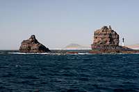
The desert island La Graciosa, which is part of the Archipelago Chinijo to the north-east of Lanzarote in the Islas Canarias is a barren flat plain out of which four mountains rise. All of them are volcanoes, created during eruptions between 3000 and 5000 years ago and all of them have something special. Montaña Amarilla, which is located at the south-western tip of the island is no exception.
The name Montaña Amarilla already indicates the volcanoes speciality: the yellow mountain it is called and yellow or ochre it appears when seen across the straight from "mainland Lanzarote. Upon closer inspection the reason for the mountain's colour becomes apparent. It is located directly above a little bay - Bahia de la Cocina. Over the millenia the Atlantic Ocean has eaten away part of the mountain, thus eroding the scarlet top level of lava and exposing the ochre tuff formations underneath. From Playa de la Cocina, the small beach in the bay the mountain reveals its bright colours best.
 |  |  |
Visitors to La Graciosa - at least those who love to hike - have to decide between two possible loops. The northern loop touches Montaña Amarilla's northern couterpart, Montaña Bermeja (the scarlet mountain) while the slightly smaller southern loop runs by Montaña Amarilla. Both loops follow dirt roads for much of the way but near the both ends all paths and tracks vanish. Thus orientation can become a real problem, especially since hiking through sand dunes can turn rather strenuous.
However, Montaña Amarilla stands out and can't be missed. its crater is open on its north-eastern side, indicating that even several thousand years ago the prevailing winds during the eruption blew from that direction. Today they are called the trade winds and still blow across the Canaries for roughly 75% of the year.
 |  |  |
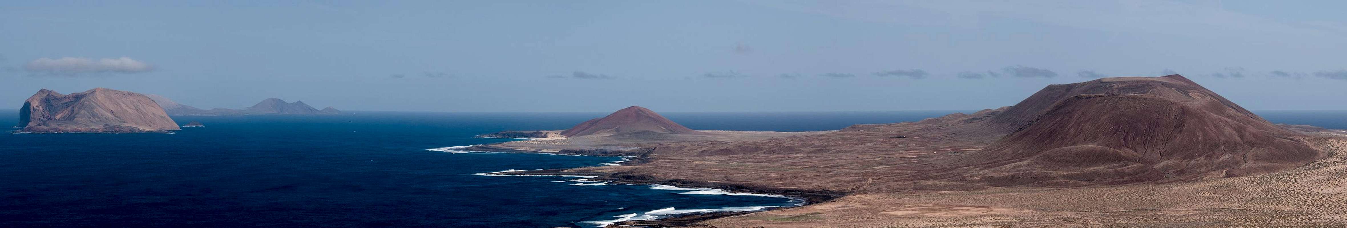
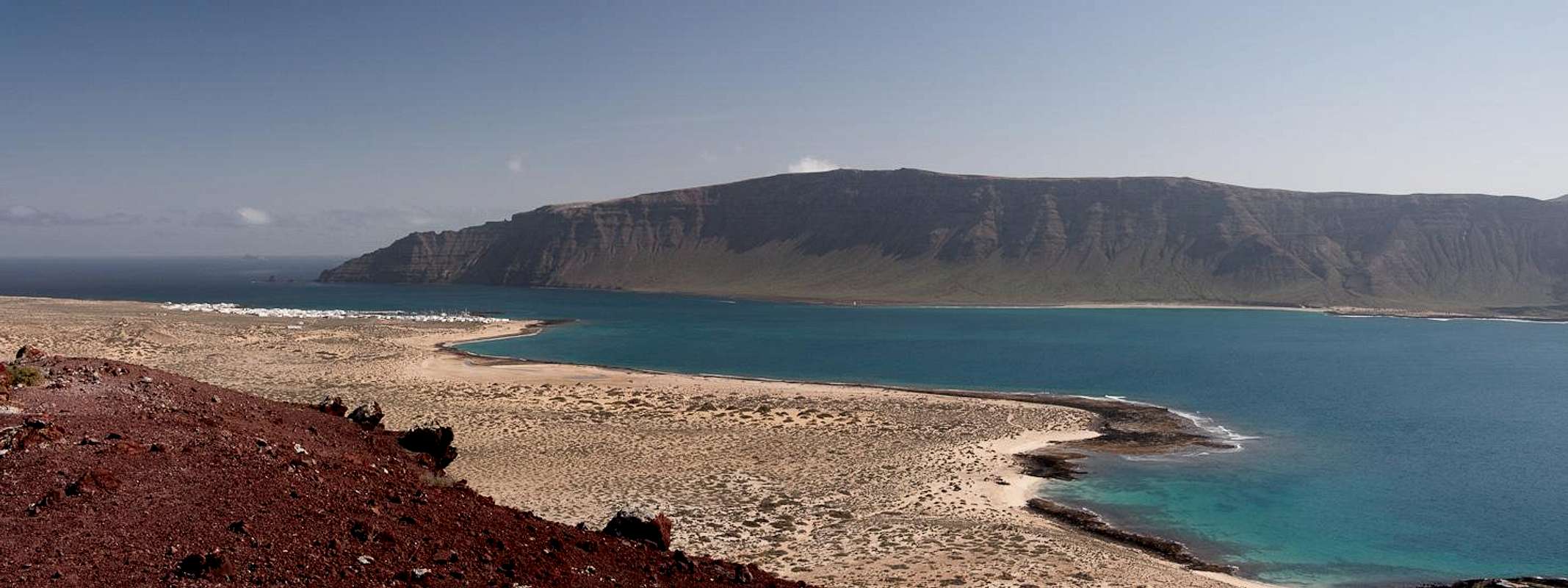
Montaña Amarilla, though far from being a tall mountain, nevertheless is an excellent lookout spot. To the west and south, across the straight El Rio you can see Lanzarote with the huge Risco de Famara close by and the pock-marked scenery of the Montañas del Fuego in the far south. To the north-east the islands of the Archipelago Chinijo seem to hover in the ocean while La Graciosa itself is stretched out to the north-east. Especially spectacular are the views along La Graciosa's north coast and across Caleta del Sebo to Punta Fariones, Lanzarote's northernmost cape.
Summit Panorama
  |
Getting There
 |
Getting to La Graciosa is a lengthy affair. Though there are ferries from the Spanish mainland to the Canary Islands, they take more than 24h for the trip. Therefore most visitors therefore go by plane. Every travel agency in Europe offers flights, hotel rooms, apartments, rental cars etc. so that reaching the Canaries is rather a matter of money than opportunity. During the summer season flight fares can be reasonable but during the Easter and Christmas holidays you have to be prepared for additional fees of 500€ per person.
Lanzarote has its own airport between the capital Arrecife and one of the main tourist centres, Puerto del Carmen. There are public bus lines but – like on all the islands – they don't run too regularly. If you plan to stay on your own, better take a rental car right at the airport.
From the airport take highway LZ1 through Tahiche and Arieta to Orzola, the northernmost village of the island. From the harbour the LLa Graciosa Ferry departs several times a day. The first departure is at 10:00 a.m, the last return ferry is at 4 p.m. in winter and 6 p.m. in summer.
On La Graciosa the ferry lands at Caleta de Sebo from where a 2h hike takes you to Montaña Amarilla
Red Tape
 Raven on Montaña Amarilla in front of Punta Fariones and Roque del Este
Montaña Amarilla, in fact the whole island of La Graciosa belong to the Parque Natural del Archipelago Chinijo. In this natural park the usual restrictions apply. La Graciosa is a desert island so any single plant or animal is unique. Don't pluck any flowers, don't disturb any animals, most notably nesting seabirds. In reality you'll be hard up to find any of both kinds.
Accommodation
La Graciosa doen't offer too many accommodation possibilities. Generally, most visitors take the first ferry in the morning and return by the last. If you miss the ferry there are opportunities to find a bed - you simply need to ask anyone who's hanging out at the harbour of Caleta del Sebo.There is a campground between the village and Montaña Amarilla. Like everything on the island it is dry and sandy. However, a 15 minute walk will take you back to Caleta del Sebo.
As for holiday homes, hotels or apartments on Lanzarote either consult your nearest travel office, or – search for lodgings on Google. There are several sites on the web, dedicated to rent privately owned houses or apartments. Prices are generally a bit less expensive than for tour operators but you don't have as much security. With a bit of luck you even might find something in Caleta del Sebo but don't expect any luxury.
Weather Conditions
 Sailboat in front of Montaña Amarilla
Maps & Books
Maps
Regular Maps
- Lanzarote
Kompass Map WK241
Kompass Verlag
1:50000
ISBN 3-85491-175-0
Digital Maps
Kompass is the only company known to me which offers GPS digital Maps. In addition for those of you with Garmin GPS receivers there is a map source map set of all Canary islands out there.
- Lanzarote
Kompass GPS4241
Kompass Verlag
ISBN 3-85491-223-4
- Islas Canarias
Map Source custom map
By Manfred Pepper
downloadable zip-file
Books
My recommendation is a guidebook by Rother Verlag, available in German. The book is an excellent hiking guide covering all the interesting areas of the island. Since it comes with small maps for each excursion it might even be used without a map to support them.
- Lanzarote
Rolf Goetz
Rother Verlag
ISBN 3-7633-4302-4