
-
 2684 Hits
-
 76.66% Score
-
 7 Votes
|
|
Route |
|---|---|
|
|
28.37914°N / 14.07709°W |
|
|
Hiking, Scrambling |
|
|
Spring, Summer, Fall, Winter |
|
|
Half a day |
|
|
Hike and Scramble |
|
|
Overview
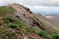
 Risco Blanco seen from Valle de los Grenadillos Risco Blanco seen from Valle de los Grenadillos |
The ascent of Cuchillo de Ezquén and Gran Montaña through Valle de los Grenadillos is one of the most interesting hikes / scrambles on Fuerteventura. It can be started at either of two trailheads, in Vega de Rio Palmas or in Buen Paso. Starting in Buen Paso you can hike through the short but impressive canyon of Barranco de las Peñitas before joining the ascent route from Rio de Vegas Palmas.
The first part of the ascent, before you reach Degollada de los Grenadillos is an easy hike though orientation is not always easy. Above the saddle (which separates the valleys of Rio de Vagas Palmas from those of Pajara it turns into a trail-less scramble. The steep slopes of Cuchillo de Ezquén are infested with cacti so that the tour can turn into a bushwack of a special kind. Once on the ridge, the further ascent turns back into a hike with some precarious moves near the rocky summits. Take extreme care in wet conditions as the basalt turns real soapy.
Getting There
Details for the trailheads of Vega de Rio Palmas and Buen Paso can be found on the main pages for Cuchillo de Ezquén and Gran Montaña.Route Description
  |
- Start altitude: 130m
- Summit altitude: 715m
- Prevailing exposure: N and S
- Type: Hike and Scramble
nbsp; - Protection: None
 At the trailhead of Buen Paso
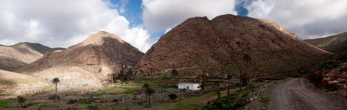
At the end of the road through Buen Paso there is a small parking lot created for the hikers who want to hike through Barranco de las Peñitas. From the parking lot traverse the creek bed to the northern side, where a valley leads you north and away from the mouth of the canyon. The track turns after some 300m and now leads across a ledge to enter the barranco. Once inside the path becomes obvious with chains and railings which lead to the chapel Nuestra Señora de la Peña, the guardian saint of Fuerteventura. The chapel lies beneath and aside from the hiking trail but can be visited in a couple of minutes.
 |  |  |
From the chapel return to the trail, which now haeds upward to the wall of the Peñitas Reservoir. Again, the path is protected by railings but take care as many of the posts have already become loose. As you reach the top of the reservoir dam there are two options: either take the northern shore of the lake and hike to Vega de Rio Palmas from where you can return by a side road into Valle de los Grenadillos. Or cross the dam and take a barely visible path along the south shore of the lake. It crosses garden patches and get to within 20m of the aforementioned road through Valle de los Grenadillos. Don't take the road, rather stay to the right of it following the right side of a heavily eroded creek bed.
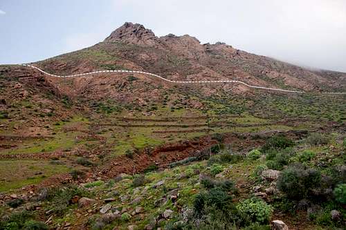
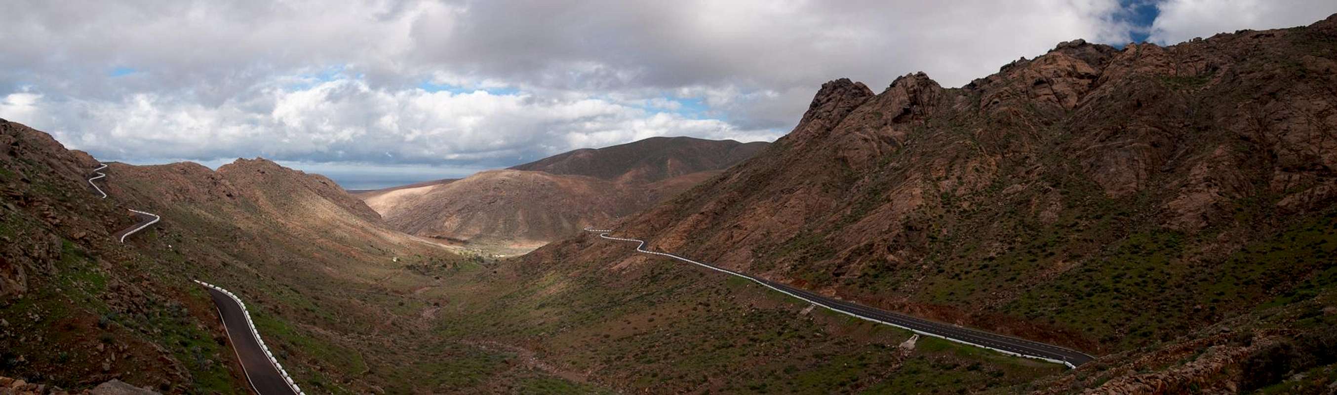
In this area orientation is not obvious, thanks to the erosion. Stay on the right hand side and turn a little away from the creek. The valley turns east and here finally the old mule trail becomes visible. The path across Degollada de los Grenadillos is part of a Camino Real, a connection trail between Vega de Rio Palmas and Pajara. The vallley ends and the path suddenly ascends steeply along its south side. Halfway up it reaches FV-30, the mountain road which connects the villages today.
 |  |  |
Cross the road (keep to the left) and start the ascent to the Degollada. The trail leads in several switchbacks to the saddle, which is only slightly pronounced but is obvious for the little sheperd's hut which has been erected in this place. The camino turns right to Pajara. Instead turn to the left and head for a fenced rabbit trap.
Rumours (and guidebooks) have it that to the left of the trap a path starts which leads up to Risco Blanco. While this might be true we decided to take the right hand side where there was less undergrowth, at least in the lower part of the ascent. Unfortunately the open spaces led us to a system of slabs which turned out to be very slippery due to rainfalls the night before. We headed for a gully the west side of which we used to head for the summit ridge of Risco Blanco. Several detours and blocks led us across another slab system but finally we reached the ridge to the east of the main summit of Risco Blanco. Up there a path seemed to be coming from the west so that the rumours still might be true and an easier ascent might be found starting on the left side of the rabbit trap.
On the ridge orientation becomes obvious again. It is wide and only the rocky summits require some careful planning. We found the southern sides to be less exposed but the (imagined) paths seemed to lead across the northern sides. On Pico Lima, which we passed on slabs to the north of the summit block, there is quite some exposure. Thanks to the humidity the slabs were very slippery.
 |  |  |
After Pico Lima, Cuchillo de Ezquén turns south-eastward and heads for the higher Gran Montaña. The broad ridge poses no difficulties anymore. Instead of taking the direct ascent the path turns towards the west face of the mountain which it traverses to come up to the summit from the south. On the round topped summit there are several low walls, created as wind shelters by local shepherds. You'll need them almost at any time of the year.