
|
|
Route |
|---|---|
|
|
37.74327°N / 112.30087°W |
|
|
Hiking |
|
|
Spring, Summer, Fall, Winter |
|
|
Less than two hours |
|
|
Hike |
|
|
Overview
This short trail takes you 250 vertical feet up a slope to a spot where you will have great views of the two small tunnels on Route 12 at the bottom of Red Cayon. Many of the nearby hills and valleys will also be in good view.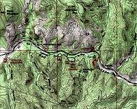 Map |
Getting There
From the intersection of Routes 89 and 12 (6 miles to the southeast of Panguitch, UT), drive a little more than 4 miles east on Route 12. Between mile markers 4 and 5 (to the west of the tunnels), look for a small pull-off and trailhead sign on the south side of the road.Route Description
The trail goes down a short distance and then crosses a stream bed that is usually dry.
 Crossing dry stream bed |
 Crossing dry stream bed |
The trail makes a series of switchbacks and goes up a slope. The west tunnel soon comes to view.
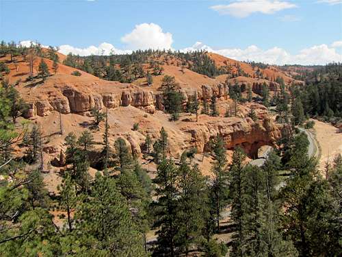 West tunnel |
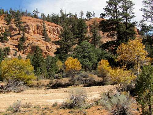
You will have good views of the Red Canyon, Black Mountain and the nearby valleys.
 |  |
 Black Mountain & Red Canyon | |
After half a mile you will reach a flat area that marks the end of the trail.
 End of trail |
You will have good views of Route 12
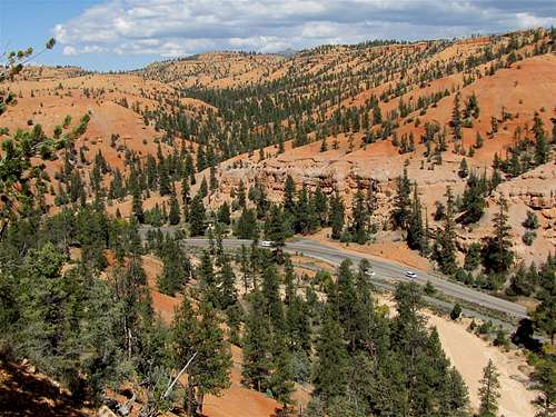 Route 12 |
And the two tunnels.
 Tunnels on Route 12 |
Red Tape
No Fees or permits needed for day hikes.For all rules and regulations contact:
Powell Ranger District-Dixie National Forest
Panguitch, UT
Weather Forecast
See the forecast for the nearby Bryce Canyon National Park:Forecast.