
-
 4238 Hits
-
 82.16% Score
-
 15 Votes
|
|
Mountain/Rock |
|---|---|
|
|
49.20489°N / 7.90209°E |
|
|
Trad Climbing, Sport Climbing, Toprope, Scrambling |
|
|
Spring, Summer, Fall |
|
|
1175 ft / 358 m |
|
|
Overview
 Große Weiherwand east Face Große Weiherwand east Face |
To the east of the small but quite typical Südpfalz village of Spirkelbach, on the south slopes of Rindsberg seven climbing cliffs are located side by side in almost identical distances like strings on a pearl. The cliffs have only a fairly recent climbing history but thanks to easy access they have become very popular among all kinds of climbers. Beginners like to test their skills on the slabs of Westliche Kesselwand or on the protruding tower of Rindsberg Westpfeiler and the more skilled head for the 7+ and 8+ Routes of the Weiherwände, the westernmost of the seven cliffs. Quite often you can observe whole families enjoying their outing on one of the many routes of the area.
To the east of the village, to the north of the road to Sarnstall, there is a giant parking lot, often used by logging trucks, which deliver to the nearby sawmill. From this lot, a broad hiking trail heads into the forest, at first in parallel to the road but soon following a bend in the terrain and passing a narrow valley. On the far side of the valley, the first of the cliffs, Große Weiherwand looms above the trail and a short path heads for the base of the west face. It is a tall and massive face, slightly overgrown in its top western part but nearly bar in the east. If you follow the descent path to the top you will observe a second cliff, Kleine Weiherwand, standing at an approximate right angle but not as tall and massive. However, the face has even less features than Große Weiherwand and thus promises shorter, but more difficult routes.
 |  |  |  |
As said above, the two cliffs are rather popular. A short 500m hike gets you there and good routes abound. On weekends you might have to wait in line until it's your turn to climb a particular route. The east face routes are perfect for summer climbing when you run in danger of burning your fingers on the west faces. In autumn and winter things change: the west faces often see the sun until late in the evening while the east face routes tend to become cold and very wet.
 |  |  |  |
Weiherwände got their name from Schafwoogweiher, a small lake or pond in the centre of the Spirkelbach valley, close to the base of the cliffs.
Climbing Routes on the Weiherwände Cliffs
 Kleine Weiherwand south-east face
Both kleine and große Weiherwand are latecomers in the climbing history of the Südpfalz. The first documented routes were set up in the 1960s and - as usual during that timeframe - Hans Laub was one of the protagonists. The more interesting routes can be found on Große Weiherwand: "Echo der Savanne" (6+), "Stairway to Heaven" (7-), or "Vollendung" (7). On kleine Weiherwand, one of the most important routes is "Mainzer Kante" (6+) with several variations..
The following information is linked from the site of the Vereinigung Pfälzer Kletterer I link to their routes database directly with some summary info. Here is the link to the complete database.
| Region | Routes link | Summary |
| Kleine Weiherwand | Kleine Weiherwand | 9 routes with variations ranging from 3+ - 5+ |
| Große Weiherwand | Große Weiherwand | 6 routes with variations ranging 6 - 7 |
Getting There
 Große Weiherwand south-east face
The cliffs on Rindsberg can be reached from the village of Spirkelbach. It can be most easily reached from the main highway B10, exit Wilgartswiesen. Follow the signs to Spirkelbach once you are in the centre of Wilgartswiesen (small hidden road).
The closest airports are at Frankfurt and Stuttgart so the itineraries start there too.
From Frankfurt
There are two possible routes which both take equally long- Via Ludwigshafen
- From Frankfurt take motorway A5 southward to Darmstadt.
- There change to A67 south.
- At Viernheimer Dreieck turn onto A6 west. Leav
- e it at Frankenthaler Kreuz for A61 south.
- At Mutterstädter Kreuz take A65 south until you reach Landau.
- At Landau turn on B10 west.
- Leave B10 at Wilgartswiesen and drive into the village
- Right in the center K54 turns off south in the direction of Spirkelbach
- Drive through the village, direction Sarnstall. Right after the end of the village there is a big parking lot to the left of the road.
- Via Kaiserslautern
- From Frankfurt take motorway A3 west
- At Mönchhofdreieck turn onto A67 south
- At Rüsselsheimer Dreieck take A60 west
- At Kreuz Mainz Süd take A63 south
- At Kreuz Kaiserslautern turn onto A6 west
- At Kreuz Landstuhl turn onto A62 south
- At Pirmasens turn onto B10 east
- At Wilgartswiesen turn off and follow the instructions above
From Stuttgart
- Take motorway A8 to Karlsruhe
- At Karlsruher Dreieck turn north onto A5
- Tke the next exit to head for A65
- At Landau North turn to B10
- Rest as above
Red Tape
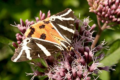 Arctia caja
Yes, there is red tape and lots of it. The sandstone of Südpfalz forms lots of caves and overhangs. Though this makes it most interesting for climbers, two species of birds of prey compete for this habitat: the peregrine falcons and the eagle owls. Both are endangered and wherever there is a eagle owl pair found nesting in the sandstone the crag will immediately be closed. Generally this closure lasts from the beginning of each year through Aug. 1st. If breeding is not successful the closures will be cancelled even before that date. For a list of closures see the Closure List of PK.
The cliffs on the south side of Rindsberg are rather often closed to climbing. Never all of them so you should check the link above before venturing out in the first half of the year.
The use of magnesia is not allowed in the whole Südpfalz region. This is rather a directive or an arrangement than an outright law. Thus you probably will get away with using it but do so only when absolutely necessary. Magnesia closes the pores which you find in the sandstone and together they form a smooth surface which will get very slippery in wet conditions. The rule of thumb is to use magnesia in the highest difficulty sections and only extremely sparingly.
A list of guidelines can be found here (in German).
Accommodation
You can find hotels and apartments in Wilgartswiesen or neighbouring Rinnthal and Hauenstein. Have a look at the following links (which are in German, however):- Wilgartswiesen information
- Trifelsland information
- Hauenstein Pfalz information
- Hauenstein information
- Rinnthal information
Weather Conditions
Maps & Books
Maps
As for maps there is a good overview map (1:50000) by Kompass Verlag but the best ones are the official topographic maps by the state government of Rheinland Pfalz, scaled 1:50000, 1:25000 and 1:5000. All official maps can be found on the web page of Landesvermessungsamt Rheinland Pfalz
1:50000
- Naturpark Pfälzer Wald
Kompass Map WK766
ISBN: 3-85491-523-3
- Annweiler am Trifels
LVA RLP Map L6712
ISBN: 3-89637-191-6
1:25000
- Annweiler am Trifels
LVA RLP Map 6713
ISBN: 3-89637-141-X
Books
There are a number of climbing guidebooks on the region of Südpfalz. The best ones, however, have been published privately and are sold only in selected bookshops of the region.
- Hiking
- Pfälzerwald
B. & J.-Th. Titz
Rother Verlag
ISBN: 3-7633-4268-0 - Klettern im Buntsandstein
U. Daigger, H.-J. Cron
Westpfälzische Verlagsdruckerei St. Ingbert
ISBN: 3-00-0155457-4
- Pfalz - Klettern im Buntsandstein des Pfälzer Felsenlands
J. Richter, S. Tittel
Panico Alpinverlag
ISBN: 978-3-936740-41-7
- Pfalz ++, Klettern im Buntsandstein
R. Burkard, P. Weinrich
Published privately
- Klettern im Naturpark Pfälzerwald
Naturfreunde Lambrecht
Published privately - Pfalz & Nordvogesen en bloc
A. Wenner, Y. Corby, I. Bald
Panico Verlag
ISBN: 3-936740-19-4
  Climbing Guidebook |
Climbing