
|
|
Route |
|---|---|
|
|
39.33530°N / 106.1069°W |
|
|
Snow Climb / Ski Descent |
|
|
Most of a day |
|
|
Class 2 / Moderate Snow |
|
|
Introduction
This is a little known route on Mt Bross that provides a great snow climb and ski descent in Winter and Spring. It has moderate snow all the way from Kite Lake to Bross' summit if you time it right in the Spring. It can also serve as a quick glissade route after doing the standard trails to Democrat and Cameron. Due to loose rock, this route is not recommended when it is dry.
Note: This is not the southwestern gully that many people use as a scree descent after bagging Bross via the Bross-Cameron saddle. It is this gully.
 |  |
Approach
Kite Lake Trailhead: 12,000 feet.
Drive on Colorado 9 from the north or south to the town of Alma. In the center of Alma, look for a wooden sign that marks the Buckskin Creek Road (also called the Kite Lake Road, Park County 8).
Follow the Kite Lake Road for 6 miles to the pay parking area. Parking costs $3, and camping costs $7. This road can be done with a passenger car, but it can be very rugged and rutted after a hard winter. Most cars can make it to near the Sweet Home Mine.
Snow closure will vary on Kite Lake. Typically in winter, snow closure will be below the old mill at 4.0 miles from Alma. If you intend to snow climb and ski this route, chances are you will have to park below the actual Kite Lake parking area. Ensure that you factor this into your start time.
 |
Route Description
Refer to the TOPO and Route Photos below for the following text:
Snow Climb:
From Kite Lake Parking, angle slightly northeast and aim for a road closure gate. This road is just to the east of the standard Kite Lake route for Democrat. From the closed gate, locate a snow gully that angles northeast and then disappears into Bross' west slopes. This is the route.
Note: This gully is not the scree descent gully that some use in summer to get back to Kite Lake after bagging Bross. This gully is to the north of that one, and is hidden until you travel high enough into the Kite Lake drainage.
The gully you are now in should lead directly on snow to the West Gully. Follow the snow to the opening at the bottom of the gully. From here, follow the obvious snow gully to the top of Mt Bross. It is fairly low-angled, and will provide good snow to the top early in the Spring. Later in Spring, snow may end at about 13,500 feet.
Near the summit, it may be easier to angle slightly south to gain the summit proper if snow has melted out.
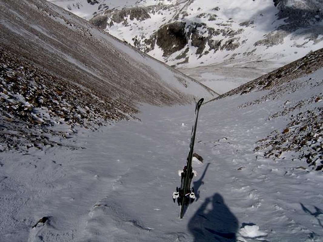
Ski Descent
This route is a great summit ski descent early in the Spring, and usually provides a good ski from 13,600 into June. The snow reaching to the summit melts out first.
This is an intermediate ski, and can be really fun when it is in good condition. The gully has a serpentine nature, and forms a sort of natural half pipe in certain areas, making wide traverses up the walls a fun way to get down.
If you follow snow gullys past Kite Lake, you should be able to ski nearly back down to your car.
Round Trip Mileage: 2.9 miles
Elevation Gain: 2,300 feet

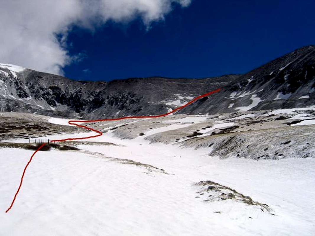
This photo shows the route from just above Kite Lake to the entry to the gully. Note the gate referred to in the text above.
 |  |  |  |  |
Essential Gear
Snow climb: You may not need an ice axe, but if the snow is really hard or you intend to glissade down, bring it. Crampons will probably not be needed except for when the snow has matured and is rock hard.
Ski: Skis, of course. It is possible to skin this entire route. An avalanche beacon, probe, and shovel are always mandatory for backcountry skiing.
Hike: I wouldn't recommend this one as a hike route. It will be loose and you will cause erosion. Stick to the other summer routes.
Backcountry Ski Ratings and Disclaimer
Skiing in the backcountry is nothing like skiing at a resort. Ratings of "beginner," "intermediate," and "advanced" are backcountry ratings. They do not correspond to ski resorts. At ski resorts, beginner and intermediate runs are almost always groomed and cleared of obstacles. Not so in the backcountry. Expect to find rocks, trees, patchy snow, and all sorts of obstacles on the easiest of runs. Route selection and avalanche avoidance are also key to your safe navigation of backcountry ski terrain.
Avalanche Information
Check the Colorado Avalanche information Center's Website for current information on Mount Bross.
An avalanche in this gully could be very dangerous because there is no way to get out of the way of a slide. Use caution.
Current Conditions
Post current beta here under "Add Info." I will add it to the main text.
- May 31, 2005:
Snow ends at about 13,600 feet. You can ski from here back to Kite Lake Parking on good snow.
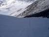
A shot of the Ski terrain in the gully
 |
Red Tape
ACCESS ISSUES:
All routes on Mt Lincoln, Mt Bross, and Mt Democrat are on private property.
The Forest Service originally distributed flyers in the area about the routes to all 3 summits being on private property. Kite Lake is public, the Bristlecone Pine area is public, but everything above them is not. The flyers caused millions of phone calls and grief for the Forest Service and the landowners. For instance, Mt Bross has over 50 owners. Mt Democrat and Lincoln don't have that many, but there are still quite a few.
So the Forest Service recently did the press releases that many of us saw in the Dever Post and other news outlets to limit phone calls to the rangers. This is where we currently stand. The land owners are concerned about liability issues, but so far, have not posted or blocked their land. They don't respond to phone calls or emails.
If you call the rangers, they will offer no information on routes and tell you that they are all on private property. This is the official FS stance.
Several organizations, including the Colorado Fourteeners Initiative, are currently trying to work out a plan that works for everyone.
My two cents: Continue to hike and climb here. Respect the land owners and avoid all posted property. Leave No Trace. Pick up trash. Travel in small groups. Give all mining areas a wide berth. Use established trails and roads.
Travel at your own risk.