
|
|
Route |
|---|---|
|
|
48.08800°N / 120.91°W |
|
|
Scramble |
|
|
One to two days |
|
|
Class 3+ |
|
|
Approach
The start for this climb is at Trinity (2,772 ft) at the end of the Chiwawa River Road. The Chiwawa River Road is accessed from US-2 (Stevens Pass Highway) by turning north onto SR-207 at Coles Corner. It is about 33 miles from US-2 to Trinity.
Buck Creek Trail No. 1513 starts from the Trinity parking lot (Trail Park Pass currently still required). The Chiwawa River Trail No. 1550 forks at 1.5 miles (~3,000 ft). Choose the left fork.
Route Description
This route contains seven distinct sections:
Section 1 - The Trail. Take the Buck Creek Trail to about 5-1/4 miles from Trinity (~4,300 ft). When a clearing presents itself, look left across Buck Creek for the unmistakable timbered East Ridge of Mt. Cleator.
Section 2 - The Timbered Ridge. You want to cross the creek here and aim for this timbered ridge. You essentially want to bear WSW to the ridge. If you venture too far left, you'll get into brushier, lower angle underforest at ridge-terminus (plus you'll be covering more ground). If you venture too far right, you'll run into steeper (and somewhat cliff-banded) forest. Initially, the underforest is a little more open. The density gets slightly worse (more windfall, etc.) the closer you get to the broad lower ridge. However, once you get to what you believe is the corner of the ridge (it can be hard to tell here without distant reference points to guide you), turn right and ascend the ridge. Shortly the ridge will open up to much more manageable terrain.
Section 3 - The High Pass Basin. This is the first critical point: at a large open area campsite circa 5,800 ft on the ridge, angle down to the left (a trail might be located) into the basin south of the East Ridge. This basin is below High Pass. (If you continue going up the East Ridge from this camp you will find it increasingly more difficult to get off of it. The ridge starts to get cliffy on the south side. Some steep access gullies are available higher up though.) The lower end of this basin is super-brushy. DON'T GO THERE! The middle of the basin is forested but cut by many intervening gullies and some streamcourses. Not a wise route to take. The upper basin is open heather, grasses, and sundry other weedy forms. It is easiest to climb up directly toward High Pass and then traverse the basin this way. You want to contour around the upper basin toward the prominent East Buttress of Mt. Berge. Once at the buttress wall (it abruptly meets heather at its base; no talus slope), follow it downhill eastward for about 1/3rd of a mile to the FIRST break in the buttress at approximately 5,900 ft. This is the second critical point and the all-important ramp Fred Beckey speaks of in his Cascade Alpine Guide. In the summer of 2002 there was a still-leafed rust-colored snag at this ramp. Look for it. The ramp is easy. If you miss the ramp and go too far down the buttress (the buttress turns slabby here at its lower terminus), you might as well kiss your summit bid goodbye unless you go back up to the ramp. The brush down there is formidable green shit. Not black schist, green shit!
Section 4 - The Ramp. The ramp rounds the buttress into subalpine forest, snags, windfall, and moderate brush. Follow a boot path or game slots up and right and then left again until a view south into the next basin presents itself. You'll see your next objective: the open upper part of the next basin. You might want to make cairns in order to find the entrance into this ramp area on the way back (if you come back this way).
Section 5 - The Berge-Buck Basin. The upper part of the basin is heathery and bouldery. The lower part is brushy. Stay high and contour to the final rocky slopes to the prominent timbered crest of the basin headwall. At the timbered crest, turn left toward Buck Mountain, whose stupendous North Face will have been staring you down for the last couple of hours. Keep going left (east) until you come to a long, beautiful pool. You can get around this pool at its north end where it abruptly plunges away into a chasm. Be careful with the crossing! One false step and you may never been seen again. The crossing isn't really that hard (nice slabs). The leap is about 3 feet.
Section 6: - Approaching the West Summit. Don't be fooled by the prominent peak directly above you at the pool. That's not the true summit! That's the 8,254-ft west summit. The west side of this point is rocky and cliffy in places. It looks like you could climb directly up to the west summit but this is unnecessary class 4. Instead, aim for the southern skyline of this false summit. The slope up to skyline starts out as the most tedious volcanic Glacier Peak pumice you can imagine (two steps forward, half a step back)--especially when you're already tired after the first five sections. The higher you go up the slope the steeper and more rocky the terrain becomes. Eventually, it will be necessary to route-find a way up a break in the rocks and cliffs (class 3). Some steep snow patches may have to be crossed. This is where bringing that ice-axe comes in handy--even in late season. The south slope/ridge of the west summit will eventually be reached in about an hour from the pool (1,300 ft of gain).
Section 7 - The Final Push. If it's not foggy, once you round the corner of the west summit the first thing you'll exclaim is "What, still that far to go?!" The second thing you'll exclaim is "How are we going to get up that?!" In regard to the first exclamation, it will only be upon rounding the corner that you will realize you've still got an hour of climbing to go. By about this time your daylight will be waning and you'll start cussing at the slow pace you were maintaining earlier. Three nearby highest points will present themselves to you. Which point is the highest one you should aim for? Your first guess would be the rightmost of the three because it is so obvious from your perspective that this is the highest point. Unfortunately for your psyche, this high point looks like it contains some hard class 4+ cliffs. Add to this an ugly ice remnant with insurmountable cornice/wall and you'll be thinking you're done for. But, ahh, no so, for that craggy rightmost peak is NOT the highest point. In fact, it's not even close. That is the 8,360+ ft south summit. Phew! To your left will be two long ramp-like slopes above a large, permanent snowfield. The one on the left with the silver rock is the 8528-ft north summit. The one in the middle with the red rock and long white scar bissecting it is the 8,528+ ft middle summit. The silver summit looks to be the lowest of the three from your perspective, but it may be the "true summit". For sure there is a register at its apex. Essentially, you should choose either the north or middle summit and go for it. The north summit is mostly class 3 at the summit rocks but the final twenty feet are exposed enough to be considered class 4. The middle summit has a slightly steeper slope than the north summit, but it looks no harder than class 3. The summit blocks of the middle summit are probably a little less exposed, though, than the north summit. A small cairn was visible on the middle summit but we did not go over there. We only had 2 hours of daylight left and we were a long way from the trail. You may not have time to do both summits either. If in doubt, go for the middle summit. I have heard there is a summit register on the middle summit too, but I wouldn't know for sure.
 |  |  |  |  |
Essential Gear
The ten essentials and an ice-axe; crampons optional (but probably better to have in early season). Lots of energy food as this climb is a grunt. Water is plentiful on the route (at least up to the Berge-Buck saddle), so no need to carry extra water. Bug repellent might be worthwhile in the thick of summer, as would gators to keep brush and pebbles out of your boots.
 |
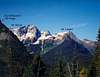
The North Summit
The summit at last! Not too much daylight left and we've still got such a long way to go.
 |  |  |  |
Siracusan - Oct 16, 2018 8:42 am - Hasn't voted
A few additions/ corrections on this from trip of 10/14/18done parts of this route twice. section 1: Recent fires in the area have made a lot of the hike in through burn area. You can go to the clearing as described or actually before the switch backs at mile 4.5 you can break off and head downstream a little and find a crossing to the burn and then go up the ridge. I went up as described and down the burn all the way to below the switch backs. The burn is pretty easy travel. Section 2: Either way The burn has made the lower ridge easier to travel. Section 3: Finding the campsite at 5800 feet is very difficult... both this attempt and last attempt I ended up too high before going over and then you end up scrambling down class 3-4 terrain and this time too, but found the way on the way back. I would recommend to bring a GPS and probably start a direct traverse at or just below 5800 ft. to skirt the bottom of the lowest buttress. There is about 100 feet of slide alder to cross into the basin here, but if you can find the deer trail it helps a lot. If you go too high, it's easy terrain to get up to cleator berge pass and then hike over berge, just quite a bit more elevation. You could also drop from the top of the ridge into the basin, looks easier up there, or find a way down the buttress, like I did, but don't recommend. Then follow as described except for the "ramp"... I really have no idea what this ramp was or is... but anyway, there is a ledge up high (maybe 200ft above the bottom of the buttress) it looks doable, but very exposed... I had my dog, not worth it. Continue around towards almost the bottom of the buttress within site of the noted slabs, then you'll see 20ft of 3rd class going up to a ledge (maybe the "ramp"), go up there continue to the Caren, then go straight up hugging the buttress on your right now, very steeply, until you finally break through into the boulder field and heather basin. The idea should be to hug the buttress all the way down until almost the slabs then go up to the ledge and over, and then once again hug the buttress on the way up. There were signs of travel, but not much. Section 5: Why jump across this chasm? when you can just go up and around the pool to the SW where there are many easy foot crossings. That's all for my corrections. There are signs the burn will grow in first with dense underbrush in the coming years... at some point 3-10 years from now this route may be too brushy to do the lower part of the ridge without a terrible schwack... it's only 13 easy trail miles to high pass and not too bad over mt Berge to get to the basin and other alternate routes might be better at that point. Spectacular basin with tons of larches, great in October.
Klenke - Oct 16, 2018 10:59 pm - Hasn't voted
Re: A few additions/ corrections on this from trip of 10/14/18I've been up that route twice to do Buck. But it was a long time ago. Obviously knowing the route from the first time helped guide us the second time. Now whether I could dial it in if I went up there again, I can't say. So your information could be helpful to others. As for the burn area, that's good to know. I do need to get back up there to do Berge and some other peaks. I did hike the trail through that burn this summer so I know what you mean about the lack of underbrush. I'm sure the fireweed will take hold first. Regarding the jump across the outlet: why not? It's a cool spot. The jump isn't all that terrifying (or I don't remember it being terrifying; perhaps it has changed).
Siracusan - Jul 31, 2023 1:52 pm - Hasn't voted
Current conditions from 7/2023Well time brought me back to Buck basin again and yep it's just as beautiful as ever. We did not come in this route, but only descended it. The descent still goes. Being 5 years after the burn, the burn area is now full of fire weed and downed branches from the dead trees. the lower part is also starting to get full of huckleberries and other brush and is generally harder to navigate. Wear pants for sure even if hot for this part. Probably 2-5 years left on this route before it gets so dense that it will not be worth it. Not as easy as 2018, but not too bad. I'd say, personally I'd still rather take this route up vs. the 15 miles in there from trinity, although I was generally more out of shape this trip, that mileage with a big pack (extra gear that we didn't end up using, weather forecast changed so we changed route plans) kicked my butt. Still top 3 most beautiful areas in the state IMO (high pass and buck basin areas.
Klenke - Jul 31, 2023 8:30 pm - Hasn't voted
Re: Current conditions from 7/2023I descended the direct route from High Pass to the trail a couple of years ago and can attest it's a lot lamer once you get into the burn zone. I passed the hunter's camp at 5800 feet again. It looks the same. The burn zone alternates between being easy to descend to being aggravating. And then at the bottom you have to schwack horizontally over to the trail for what seemed like a long way. All in all I think it's only suitable for a shortcut descent but will only save you about 1.5 hours relative to just taking the trail all the way around.