-
 10993 Hits
-
 73.06% Score
-
 3 Votes
|
|
Route |
|---|---|
|
|
38.62190°N / 78.2845°W |
|
|
Hiking, Bouldering, Scrambling |
|
|
Spring, Fall, Winter |
|
|
Half a day |
|
|
Up to East Class 3 |
|
|


Overview
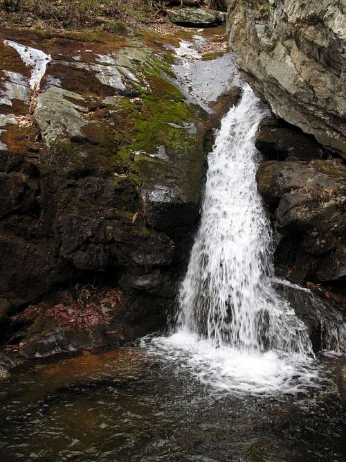
This is the way to reach Hazel Mountain from Skyline Drive. If the scrambling and bushwhacking to the summit do not appeal to you, this route still makes a very nice hike, especially in spring and fall. The scenic highlights of the route are Cave Falls, reached by a short, steep spur trail and located by a large rock overhang that creates the appearance of a shallow cave; and the White Rocks, rock outcrops near Cave Falls that offer scrambling, bouldering, and nice views of the wooded ridges and deep hollows of Hazel Country.
Getting There
Enter Shenandoah National Park at one of its four entrance stations and drive to the Meadow Spring Parking Area between MP 33 and MP 34.
Route Information
According to my guidebook, this loop, without the side trip to the summit of Hazel Mountain, is 8.6 miles. Add about another mile RT to include the summit.
Important Waypoints
Start-- Trailhead (2862'). Follow the Hazel Mountain Trail downhill. This stretch of the trail is especially pleasant in late May and early June, when sweet-smelling pinxter flower blooms line parts of the trail.
1.6 mi-- Intersection with White Rocks Trail (2229'). Turn left onto White Rocks Trail. Watch for the signpost designating the spur to Cave Falls. This signpost is on the south side of the trail and is at 2032'. The spur heads steeply downhill for 0.2 mi to Cave Falls and its neighboring cliffs (bottoming out at 1950'), which may appeal to technical climbers. A short distance beyond the spur are the White Rocks. Reaching them requires a little bushwhacking, but the unrestricted views, rare in Shenandoah's backcountry, are worth it. When the trail bottoms out, you must cross Hazel River, which can be deep during periods of heavy runoff.
2.2 mi-- Intersection with Hazel River Trail (1481'). Turn right.
1.6 mi-- Intersection with Hazel Mountain Trail (2442'). Turn right.
2.9 mi-- Trailhead.
To reach the summit, leave the Hazel River Trail at some point and start heading up. As the trail climbs, it follows a tributary of Hazel River that is between the summit and the trail. Eventually, you reach the head of this drainage and you can head for the summit slopes without giving up elevation. This is also the best way to access a boulder-strewn slope that leads almost all the way to the summit ridge and is relatively free of underbrush. The trip up these boulders never gets harder than very easy Class 3, though it can be harder in wet or icy conditions, of course. When you reach the summit ridge this way, head south along the path of least resistance until you reach the highest point.
The summit is less than half a mile from Hazel River Trail. Elevation gain from the trail varies depending on where one leaves the trail, and it ranges from approximately 500-1400'.
Necessary Gear
If you are only hiking the trails, just dress for the day's weather and consider having trekking poles or a walking stick to help with the crossing of Hazel River.
People heading for the summit should wear pants, not shorts, no matter what season it is (or else thorns will make you an unwilling blood donor, and poison ivy may pay a not-so-nice visit), and probably long sleeves as well (this underscores why it is not a good idea to climb this peak during the warmer months).