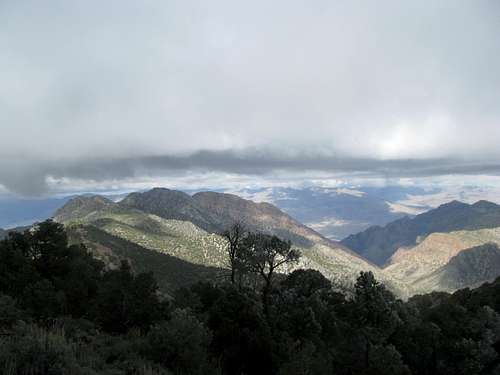
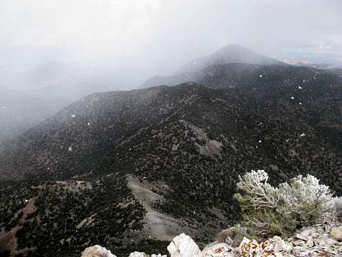
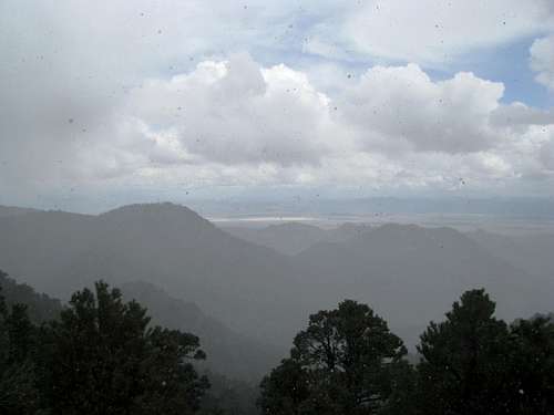
Wednesday morning saw slush rain down on a soggy pre-dawn Tonopah. The precipitation cleared up as I drove south out of town. The rising sun revealed a fresh new coating of snow that ranged from the tops of the surrounding peaks to the edge of highway 95. As the temperature rose degree by miserly degree and I sped further and further south the effects of the preceding night’s snow began to wear off, at least a little. To my right, a thick covering of low clouds smothered the Grapevine Mountains on the California border. And yet, that was my destination for the day.
Like several days ago my tentative plan was for Grapevine Peak, and/but/if the weather didn’t pan out I had planned, with the help of the excellent pages here at SP, several smaller hikes onto various low summits in Death Valley. As I drove by my range of choice, its highest summits hidden in ominous clouds, I swung back and forth between a decision, go or no go. The clouds seemed to be moving northeast from the California side, and beyond the Grapevines Death Valley seemed sunny. And though they were thick they were also low, while some of the surrounding clouds were already dissipating in the morning sun. Finding the unmarked turnoff for Phinney Canyon I bit the bullet and swung my rental into the potentially ominous currents ahead.
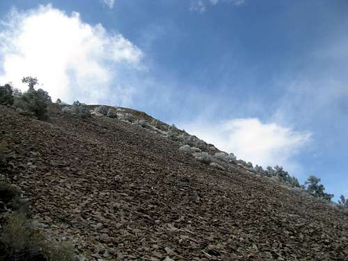
![Stonewall Mtn, NV]() Early birdy Nevada Snow Early birdy Nevada Snow |
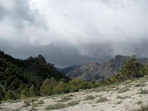
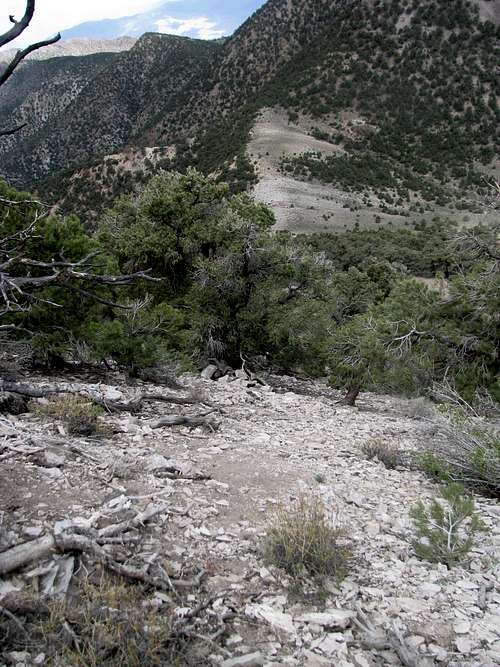
![Heading into Phinney Canyon]() Cloudy Phinney Canyon Cloudy Phinney Canyon |
The route description here on SP for Grapevine Peak is pretty basic: head up to the 7500’ saddle between Wahguyhe and Grapevine, take a right (north) up and over a few bumps, then a final trudge 750’ to the summit. However, at this point of the story the line between reality and fantasy diverge, and perhaps it would make a trifle more sense to partition the narrative now between my thoughts and perceptions at the time versus the cold and impartial glare of reality.
Reality
Unbeknownst to me, the topography to the south of the saddle is almost identical (especially on the ground, in the fog), featuring several bumps radiating southwest before an even longer final trudge to the second highest peak of the range, Wahguyhe Peak.
![The best intentions]() Two paths diverge...I took not the one intended Two paths diverge...I took not the one intended |
Fantasy
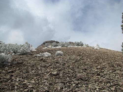
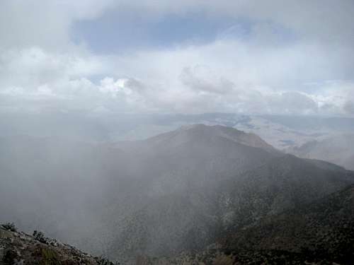
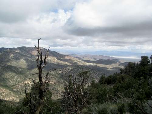
I walked a modest distance to the saddle. Views of Death Valley, glowing under an emerging sun, opened up in front of me. The topography was a little befuddling though. A ridge was supposed to present itself to me on my right, to the northeast, at which point I’d ascend it and follow it to Grapevine. I saw Grapevine ahead, a massive wooded lump with a rocky timberline emerging very reluctantly beneath the low cloud cover. And there was a ridge in that general direction, but there was a large drainage between it and the saddle, the descent of which was not mentioned in the SP route description. But the intrepid scrambler saw a rocky face, just a wee bit back on the dirt road, rising from it and allowing access to the higher ridge without an unnecessary descent. Thusly and justly I backtracked some yards and started a steep scramble up through scree and rocky obstacles, contouring to my left along the side of the loose ridge, eventually cresting it several bumps along.
![Somewhere, Wahguyhe Hides]() (a) high summit hidden in clouds (a) high summit hidden in clouds |
![Gaining a ridge]() Scramble to gain ridge Scramble to gain ridge |
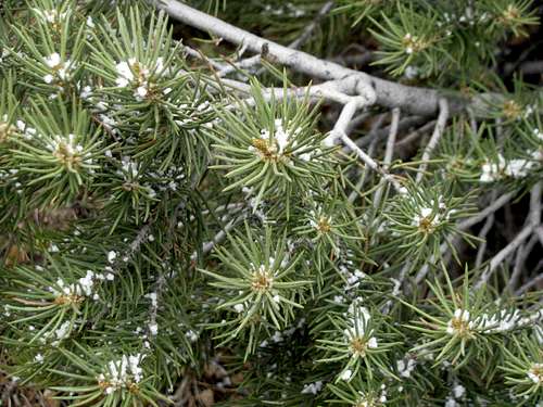
![Frost atop the connecting ridge]() Frosty upper ridges Frosty upper ridges |
![Looking back into Nevada]() Looking back...where? Looking back...where? |
Reality
Before reaching the 7500’ saddle the road switchbacks at a gap with a view back into Nevada. The low cloud cover having hidden the surrounding features driving into Phinney Canyon, I was unaware that I was staring not at Death Valley, but the direction from whence I came. This explained the lack of the ridge rising towards northeast to Grapevine Peak at this "false saddle". I was aware of the existence of a Wahguyhe Peak in the range, but not its location directly opposite from Grapevine from Phinney Canyon. Thus, the first high peak I glimpsed (barely) in the distance I immediately assumed was Grapevine, and consequently instead of heading up to the correct saddle I was jumping southwest along the ridges towards Wahguyhe.
![Wahguyhe in clouds]() Hidden mystery peak Hidden mystery peak |
![Grapevine Peak]() Another high peak...no red flags Another high peak...no red flags |
Fantasy
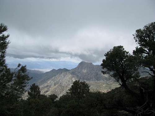
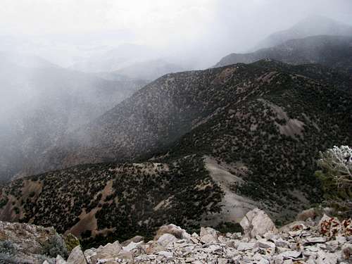
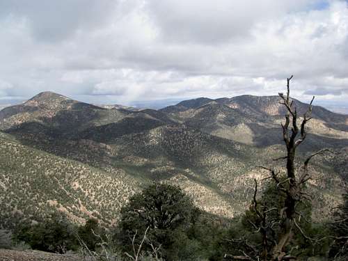
Frost covered the upper reaches of the connecting ridge. The ridge crest was wide, mostly flat, with open terrain of orange dirt between sparse juniper and pinon pines, but several up and downs later it was beginning to drag. The air was warming, and the frost was beginning to thaw before my eyes. The cloud cover was thinning in places too, revealing elusive patches of blue scattered among the grey. Ahead I could see the steep slopes of talus, emerging from the fog, and rising almost to the summit of Grapevine Peak, and I fantasized about a possible mountaintop vista on what was supposed to be a snowy, stormy day.
![Wahguyhe being dramatic]() The peak at last... The peak at last... |
![Finally an appearance]() ...in all its glory! ...in all its glory! |
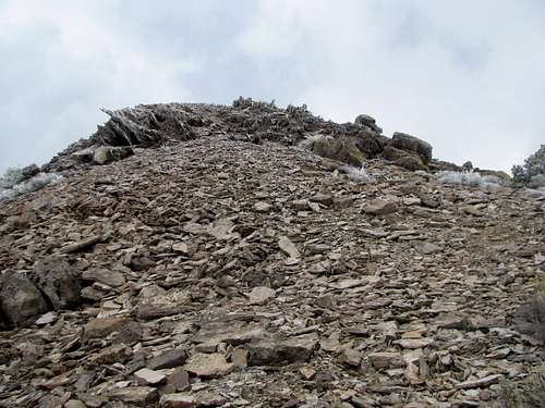
I rounded the last hump and saw before me to disquieting sights: a longer than expected descent into the final saddle before Grapevine, and steep slopes of talus guarding the summit on all sides without any obvious sign of a route up. A third surprise, several stretches of loose, steep scree, caught me on the descent to the saddle. None of these difficulties were mentioned in the SP description or climber’s log entries, and I doubted, not my location or environment but my own tolerance and sufferance threshold for backcountry rambling.
![A discouraging descent]() Descent required Descent required |
![Down to saddle]() But the views... But the views... |
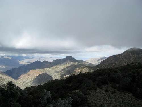
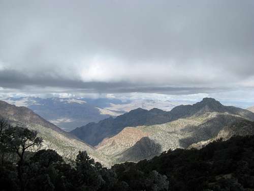
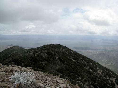
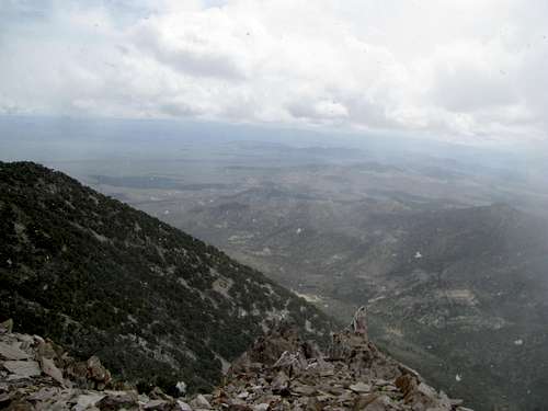
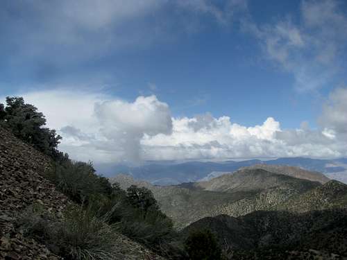
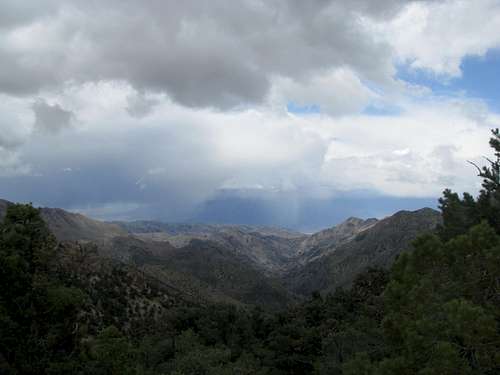
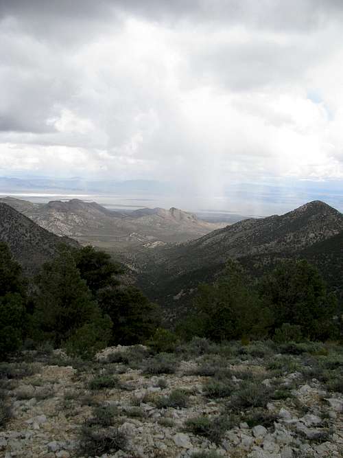
The final 750’ to Grapevine quickly became a longer-than-expected slog, yet I was in a good mood as the weather continued to clear, the Grapevine Range being the dividing line between fair and foul. I could see distant salt flats to my left in sunny Death Valley, and the snow-capped Panamints behind them. To my right the surprisingly rugged terrain of Nevada, sharp rocky pinnacles and red walled canyons comprising the foothills of the Grapevines, still mired in the storm. I noted that the wind had seemingly reversed directions; observing from the highway hours back I noted it was blowing southwest to northeast, but now it definitely switched northeast to southwest. What an odd range, I thought, confusing even the fronts moving in from the Pacific.
Reality
Pretty obvious here. The wind stayed consistent. The route was rougher and rockier than the route description for Grapevine because I was ascending Wahguyhe. The standard approaches mentioned on SP involve climbing straight up the slopes from further back down the dirt road, so as not to rope in an annoying and unnecessary descent of about 400’ before a final rough climb of 1,100’ (as opposed to an easier ascent of 750’ with an obvious route a la Grapevine). The foothills in Nevada was actually Mt. Palmer in Death Valley, and the surrounding red walled canyons was, well, Red Wall Canyon, which a ranger had actually pointed out to me several days back (and then I had even looked at the map and pondered an ascent of Palmer from Red Wall Canyon). Needless to say, the salt flats of Death Valley were probably just dry lake beds in Nevada, and snow covered Telescope Peak was actually snow covered Stonewall Mountain (which I had actually driven by several hours earlier). Ah, the plight of the ignorant.
![The descent before the ascent]() An unnecessary descent An unnecessary descent |
![Wahguyhe]() before re-ascending before re-ascending |
![Is that a fossil?]() Fossil? Fossil? |
![Looking back at saddle]() Back down at saddle Back down at saddle |
Fantasy
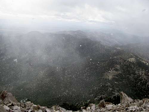
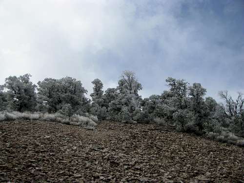
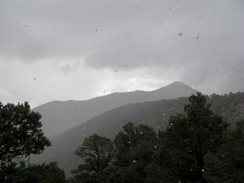
Scree and dirt became talus, and as the going got slower a storm blew up behind me, showering snow upon my back. Another sunny break as I tried to contour towards a gentler slope left of the summit, and then the weather turned ugly again.
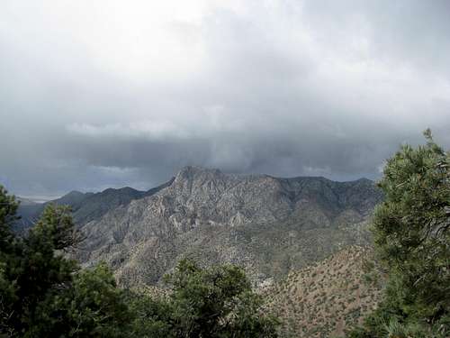
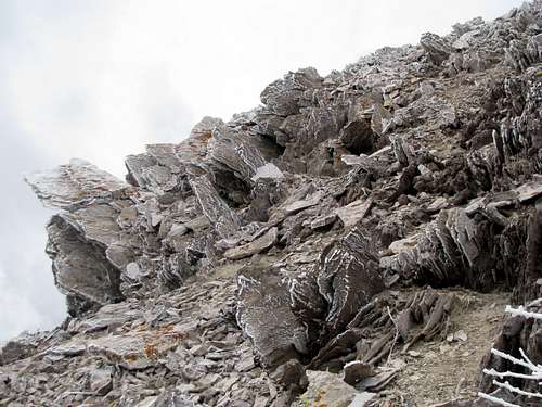
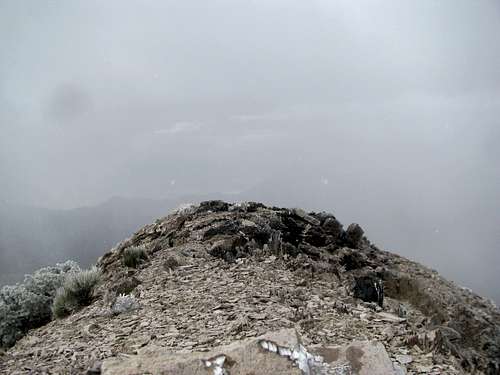
Odd, funky rocks with sharp, uneven slopes and corners garnished the summit of Grapevine Peak.
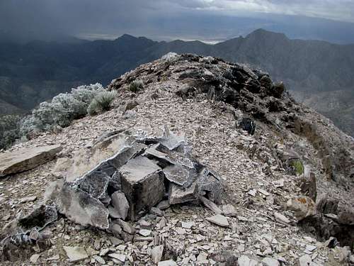
I got my views (except to the “north”), along with some bonus drama, as a storm blew over from Nevada all the way to the sharp promontory of Wahguyhe Peak, to the south.
I took pictures, a quick video, and marveled at the views while my fingers froze under the weight of the cold, the wind, and the snow. Making a quick exit, I scampered down the talus slopes with less hassle than I’d anticipated, arriving quickly at the saddle.
The sun was out again, with it almost balmy temperatures.
I downed a few granola bars, regained the ridge, and followed the ridge crest towards the saddle as the weather made yet another 180, this time switchbacking to constant hail.
Low tree cover was still better than no tree cover, and as I neared the saddle I could almost discern a climbers trail under the light blanket of hail leading all the way back to the saddle.
And here
reality begins to intertwine, even intrude in, upon
fantasy. (complete sidebar, but...what climbers trail? And if so…why?)I descended to the saddle, and it looked different. I wandered around befuddled before figuring out which direction down the dirt road would bring me back. I descended to a point where I recognized the site of my prior exit point, off the road and up the ridge. And yet, as the road wound down I could swear that it was heading west into Death Valley rather than back into Nevada.
I kept waiting for the road to round some unknown curve or gap through the mountains, and back in the right direction, according at least to my bearings. And yet as it edged further and further into the wrong side of the range I began to contemplate a turn-around point, before I descended too far into, supposedly, Death Valley. The ridges around me didn’t match those from the morning, but that may well have been because of the presence of the sun now, and the lack of one earlier.
But I passed a boulder I recognized from the morning, and soon afterwards caught a glimpse of my rental. As I continued the drive out in the wrong direction I finally realized my mistake. I had thought the tall peak in the distance behind me during the climb was Wahguyhe. Obviously that must have been Grapevine.
![Grapevine Peak]() A peak lost... A peak lost... |
A quick glance at the map confirmed Wahguyhe’s proximity to Phinney Canyon.
![Parting shot at Wahguyhe]() A peak gained. But... A peak gained. But... |
I briefly considered returning to tag Grapevine, but a glimpse back at the range, now fully engulfed in the storm, forcing me to dismiss any notions of instant redemption.
![Storm overtakes Grapevine Range]() Redemption? Redemption? |
I drove back to Tonopah mired in not the least bit of confusion. What was I to think of this day? Was it a failure? I had failed in my target summit, but ended up climbing one that was just a bit lower, yet involving more elevation gain and a certainly more burdensome, if not difficult, ascent. One peak’s loss was another one gained, and while I certainly plan to return someday to Grapevine, and had I made it the first time I doubt the reverse to be true, but yet even today, seeing the summit still sneering at me and taunting me from pictures taken a month and a half prior, and despite the growing temptation to remain content, or even complacent, with my Wahguyhe experience (and what an experience it was!), I question whether total absolution still awaits on the summit yet travelled, whether it will always await there, at an elusive summit engulfed in a murky future.
![Storm overtakes Grapevine Range]() Another day Another day |
Comments
No comments posted yet.

 Early birdy Nevada Snow
 Cloudy Phinney Canyon
 Two paths diverge...I took not the one intended
 (a) high summit hidden in clouds
 Scramble to gain ridge
 Frosty upper ridges
 Looking back...where?

 Hidden mystery peak
 Another high peak...no red flags
 The peak at last...
 ...in all its glory!
 Descent required
 But the views...
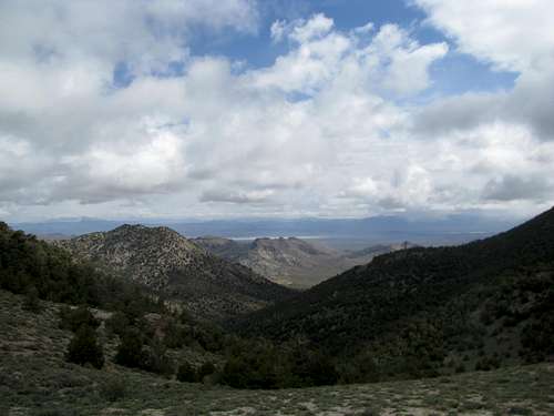
 An unnecessary descent
 before re-ascending
 Fossil?
 Back down at saddle
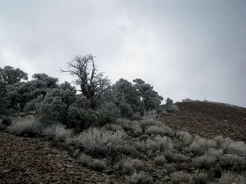

 A peak lost...
 A peak gained. But...
 Redemption?
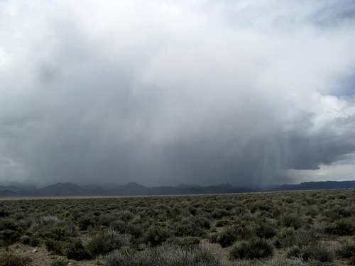 Another day