
-
 6668 Hits
-
 0% Score
-
 0 Votes
|
|
Route |
|---|---|
|
|
39.42310°N / 106.1228°W |
|
|
Mountaineering, Skiing |
|
|
Spring, Winter |
|
|
Half a day |
|
|
AI2 |
|
|
III |
|
|
Overview
From the west, the pyramid shape of Pacific Peak sticks out above the Mosquito Range. From Copper Mountain it’s not so much the shape that catches the eye, but the west face and its rugged rock bands, scree fields and intermittent snow lines. The lines that run apron to ridgeline are few, but one over all others draws keen attention. The Y Couloir.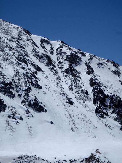 A Close up of the Y
Getting There
From the Mayflower Gulch trailhead, head up the 4x4 road until you can cross into the basin on your left and bear toward the Pacific Creek drainage between Mayflower Hill and the west shoulder of Atlantic Peak. Continue up this drainage bearing NE toward the west ridge of Pacific. The ridge will be obvious.Once at the base of the ridge traverse north around the base of Pacific almost halfway. The Y Couloir will loom above you, splitting at the very top, this is possible to see from the bottom.
Route Description
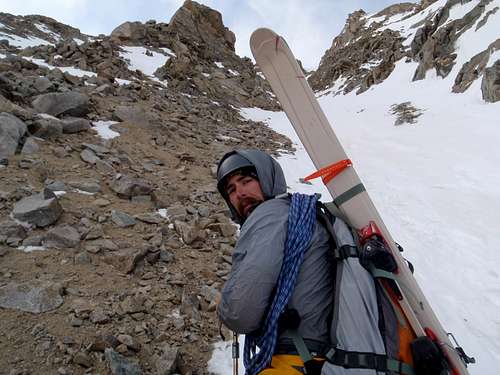
The route is very straight forward. Climb the couloir until the split, taking the left or right branch to the ridge top. From there the route turns up and north, joining the West Ridge route and is a class 3 scramble to the summit.Depending on snow year the couloir sits around 40-45 degrees. Avalanche hazard is huge, there’s nowhere to run. The west faces of the 10 Mile/Mosquito Ranges get blasted by the wind all winter and spring. This can make the snow conditions interesting depending on temperatures. Be ready to get wind blasted if it picks up. Beware of rock fall and watch your footing. A fall in the couloir would send you to the bottom, a fall in either of the upper splits could result in a fall over rocks. For descent pick your poison. West ridge, the east ridge would be cool for a car-to-car. Down climb. Ski the Y, or the North Couloir like we did.
 At the bottom of the Y, looking up.
 Looking down the Y, climbing up.