Preface
This Trip Report is a joint effort by the 3 hikers involved (
Bechtt,
Mountain Impulse and
Travis_), each describing a separate part of the outing from his point of view. Like most eye-witness reports, recollections are not totally consistent, leading to some mild sniping and bitching, but all in good fun.
The Planning: Google Images and SPer Input
Written by Mountain Impulse:
There was a modest build-up to this exploratory outing in an SP thread and
San Gabriel Mountains Forum. Travis had done some homework including apparently putting a magnifying glass to the Google image of our proposed route (now known as
Etiwanda Ridge) to determine whether it was even feasible. Local SPers weighed in with opinions, speculation and encouragement.
The question mark was San Gabriel mountain variety VEGETATION. Now Travis has great sentimentality towards vegetation and was inclined to give the benefit of the doubt to our ridge being passable (by humans). So Tom and I signed on. After all, Travis had the route on his GPS and he could lead. How bad could it be? Answer: not too bad unless you lost the animal trail/firebreak. At these times, we became painfully aware that this ridge has a particular affinity for shoulder-height white buckthorn cover.
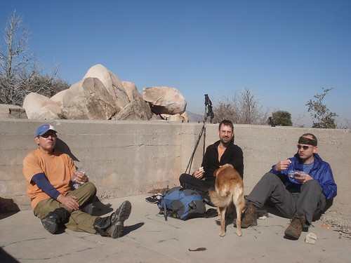
Tom’s 9 year old dog
Coco (aka Coco the Dog), tagged along. Now, Coco is no hiking slouch. She now has 42
HPS peaks under her collar and may shoot for a list finish (potentially giving other
self-proclaimed peak-baggers a run for their money). Coco’s self-imposed responsibility on the hike was to count noses. For real. Every time Coco got ahead of us, she would eventually turn around and point her snout at each one of us as if to say “Still got three.”
Trying the Ridge on for Size
We got to the “trailhead”, the north end of Etiwanda Ave. in Rancho Cucamonga at 7 a.m. Newbie SPer
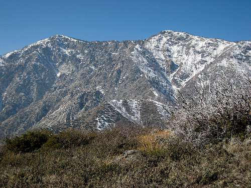
Narcolepticpug met us there and transported us on a bruising ride in his Toyota Tacoma to the bottom of Etiwanda Ridge. We noticed right away that there is no “warm up” terrain on this ridge. It starts out steeply and continues that way along its 3-mile length to the San Sevaine fire road.
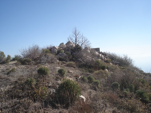
The ridge, seen from afar, is a beautiful sight. It could even be described as sensual, owing to the way it curves and weaves along its spine, as seen in this report's primary image.
The Ascent
![Google Earth view]() Google Earth Image of Ascent
Google Earth Image of Ascent
As ridges go, this one is straight forward -- just follow it to the top. Unfortunately, it has the typical flora feature of south facing San Gabriel mountain sides -- brush! But from the parking spot on the bottom of the ridge, we didn't know this for sure and were hoping for the best. The skies were clear, the temperature set at a brisk ~45 degrees, and the sun was just painting the ridge line with it's rays. Travis quickly set off on one of his grueling paces up the fire break followed closely by Coco, myself, Augie (Mountain Impulse), and Brian (Narcolepticpug). On the steep ascent up to the first high point, Brian realized that our pace was a little healthier than he was planning for and dropped back for a more liesurely hike (he would make it through the worst of it before turning around, not realizing that he was so close). The climb to the first intermediate ridge bump was quick and uneventful -- a couple of steep sections but no brush to speak of. For this I was very happy as I had chosen to wear shorts today.
From the top, we gazed down at the the brush choked saddle and wondered what we had gotten into. However, upon descending we found a use trail that skirted the saddle on its western edge avoiding the thickets of buckthorn found on top. As we continued ever upwards, I slowly noticed the increase in the density of brush as the thorns and brambles began taking their toll on my legs. As usual, Travis just drove onward not thinking about the effects of the brush on Coco and I. A bit more into the ascent, we came upon a rocky headwall that, although climbable, promised some serious brush at its top. Fortunately, the fire break veered west along the side of the ridge and although brush infested, it was much easier than if we had stuck to the ridge. The last part of the ascent after the fire break was an attempt by all of us (except Travis) to weave in and out of the thickets of buckthorn. I finally surrendered and attached my zip-on leggings to my shorts. As soon as I did that, the brush ended giving way to the clear top of the ridge and within ten minutes, we found ourselves at the 1N34 forest road.
On To San Sevaine Lookout
Written by Travis_:
Now that we had reached the fireroad (1N34) the hiking was easy. Good thing, Coco and I were tired of listening to whining about the brush on the way up. For some reason Tom choose to wear shorts through the worst of the brush and then decided to zip on his pant legs just as the brush ended. I didn't understand that and assumed that Tom was one of those types that enjoyed being miserable. While I thought I did an expert job of navigating by staying on the actual firebreak an avoiding most of the brush, nothing seemed good enough for some of our fellow hikers. But now that the going was easy all I heard were grumblings about having to loose so much elevation on our way to San Sevaine Lookout. We went east down 1N34 fireroad just past San Sevaine Flats when we spotted something running across the road. Tom and Augie thought it was a rabbit, but as I investigated and spotted the “so called” rabbit stalking away and then turning around and staring at us with sharp, pointed ears. I figured that it was a Bobcat. Yes, it had a small, slightly fluffy little tail, but that was where the similarity with a rabbit ended. It was pretty neat watching him calmly walking around about 20 yards from us. I yelled at him to see his reaction, he didn’t even react, we were not apparently worthy of his reaction. (bechtt edit: if you don't see a picture of a bobcat that's because Travis has been smoking something again)
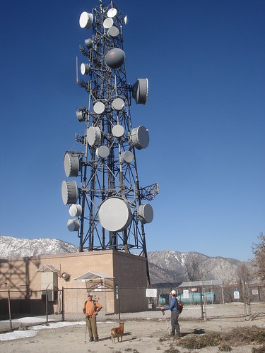
We continued on our way until the
road splits and we headed northeast towards the
radio towers. There was a lot of dead trees from the last fire but the area still had its beauty. About 2 miles from where we started on the fire road we were at the radio towers looking down (way down) over the edge of the road along a ridge descending to the east towards where we figured San Sevaine Lookout was. Now Tom said something about how there is supposed to be a road leading to the Lookout and how I led them wrong again, but I was not to be bothered by such details and just proceeded along this very nice looking ridge. As it turns out, this ridge is actually a much nicer route than the brush covered “road”, but more on that later. Along the ridge we went, enjoying the views and brushless hike. After a short while the ridge sort of ended and started to descend to a saddle. I started to head southeast in order to pick up the road for the final ascent of San Sevaine when Tom asked me where I was going (as if I were leading them wrong again). I told him, indicating that I could see the lookout foundation and we still had a ways to go. He figured we should try to stay on what little ridge there was and head northeast. I am an easygoing hiker and did not want to start an argument so I agreed. Well, Tom’s route led us into a very steep, crumbly, wet, muddy and generally not enjoyable ditch (or maybe better called a drainage, I don’t know). I did not complain and did my best to get through this ditch and back up the other side, but now this spawned more complaining from my fellow hikers. “I want to hike the road back” says Augie. “Just wait until we climb up there and pummel you” says Tom, seemingly forgetting that this was his chosen route!
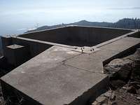
To make a long story short, I did not let the negative spew from Tom and Augie (mainly Tom) get to me and I led us out of the ditch, through some buckthorn (even trampled over some of the buckthorn to make a trail for them) and found the so-called road. We followed the road, which was very overgrown, to the summit. The foundation of the lookout tower was nice except for some graffiti. Nothing ruins the natural beauty of an area like graffiti (I fantasized about catching the artist red handed and smashing him over his head with his paint can). We enjoyed the
views and ate our lunch in the warmth of the sun within the reservoir that appeared to have been built into the base of this Lookout tower. Then we checked out the actual
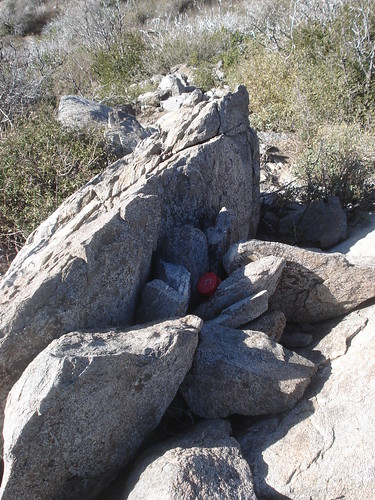
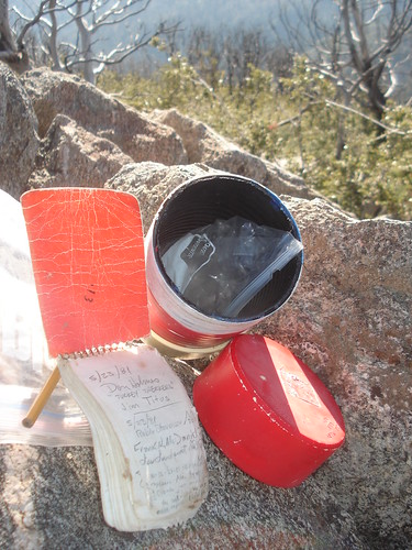
high point slightly to the north, found the
summit register and all left our mark (the register dated back to 1981). We finally left to hike all the way back to where we first joined the fire road and on to Buck Point. As I eluded to earlier, the
road route back to the main road was not very pleasant. In my opinion it had worse bush than found anywhere during our ascent. It was so bad that Tom and Augie actually lost the road and bushwhacked cross country to regain the main road. Needless to say the ridge route is better as long as you stay to the south and regain the road near the saddle rather than head north and enter Tom’s ditch.
Disclaimer: I may have stretched the truth a little in my write-up. Tom and Augie may not have actually complained that much, or even at all. And Coco might not have been sick of all the whining during the ascent. And I possibly may have been partially responsible for getting us in the ditch on the way to San Sevaine LO. All in good fun :)
Continuing on to Buck Point and the Descent
Written by Mountain Impulse:
After we had ascended the 3 miles and 3,700 feet of gain on Etiwanda Ridge to the 1N34 Forest Road in a little over 2 hours, we had congratulated ourselves on our speed and sensed that San Sevaine Lookout was just a stroll down the road. As a matter of fact, it took us 1 and ½ hours from this point to get to San Sevaine Lookout by the route Travis has described above.
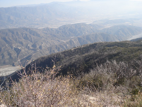
After finding our way out of the bowels of the brush from San Sevaine back to the main forest road things got a lot less adventuresome and even a little boring as we diddly-bopped west back towards Buck Point. But the air was pure, cold and invigorating and I was kept entertained by watching Coco count noses every few minutes to make sure no one got separated.
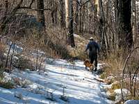
![Co-Co and Bechtt]() Coco and Tom treading lightly in the snow
Coco and Tom treading lightly in the snow
We hiked past the point where our ascent ridge met the road (there is a section of fence there) and, as the road started to dip down, we took a left up a ridge at a spot marked by a steel pipe sticking out on the right side of the road. We encountered some snow cover here. There were enough icy patches to cause Tom and I some slipping and sliding due to his treadbare light hiking boots and my light trail runners.
The ascent was gentle and in no time we were on top of the large flat summit of Buck Point. At 6,433 feet, it was dwarfed by Cucamonga Peak looming to the west.
![Cucamonga Pk (L) from Buck Point]() Cucamonga Peak (L) from summit of Buck Pt.
Cucamonga Peak (L) from summit of Buck Pt.
At Buck Point, we found that the register was noticeably singed by the last fire. We all hydrated a bit here, including Coco lapping up some water from Tom’s bladder hose, and then made our way back to our drop in point on Etiwanda Ridge.
Our descent was uneventful except for a couple of things. First, at one point Travis went slightly off route. This deviation was enough to put Tom and Coco and I into Buckthorn City. Thrashing through the shoulder high buckthorn, it occurred to me to be careful lest the thorn of a slapping branch find my neck’s jugular vein. Coco had a tough time of it as well and I’m sure her thoughts of Travis at that moment were not very lady-like.
We got back on track and continued our descent. My enjoyment factor on the descent was greatly diminished by having lost the toenail on my big right toe just as we had started our descent. The pain from the pressure of the toe against my shoe was excruciating but my choices were zilch except to continue.
![Coco, Tom & Travis]() Coco, Tom and Travis on summit of Buck Pt.
Coco, Tom and Travis on summit of Buck Pt.
A final slightly dissonant note on the descent was that trigger fingers got busy in the valley below in the afternoon and the “boom-boom-boom” of massive firepower accompanied our ears for quite a ways. Sounded just like light artillery. The retorts were so crisp and seemingly so near that I felt like low-crawling or at least ducking at times. You want to assume that all hunters and target shooters will be responsible at all times. Nevertheless, hearing sustained weapons fire while hiking always makes me a bit nervous.
But make no mistake. The bottom line is that we had a great time. Immediately that Coco got into the back of Tom’s car after the hike, she conked out like a log. Sixteen and a half miles and 6,000 feet of gain. A respectable workout for all of us.


Comments
Post a Comment