Introduction
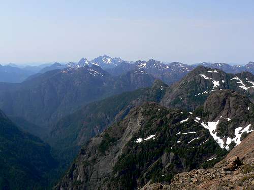
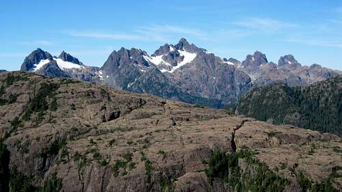
I first saw Mt McKelvie from the top of
Thumb Peak in the
Alava Bate Sanctuary in July 2010. I had always thought that there wasn’t much between the Sanctuary and The Haite Range to the north but there very patently was. A distinctive snow capped ridge of summits presented both a surprise and an invitation and it wasn’t long after getting home from the Sanctuary before I turned to all my usual sources in order to solve what, to me at least, was a mystery.
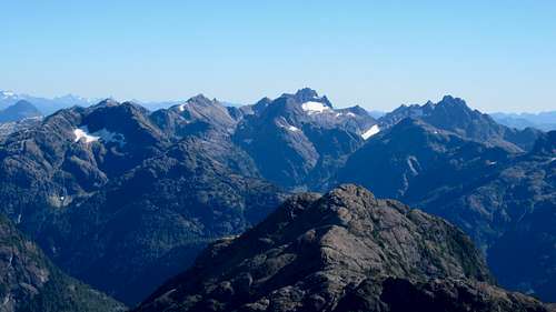
![Mt McKelvie from Thumb Peak]() Mt McKelvie from Thumb Peak
Mt McKelvie from Thumb Peak
Other than Mt McKelvie’s name, there wasn’t all that much to find. What ascents there had been were minimally documented and had come from tidewater on the Tahsis Inlet on the west coast of the Island. In order to access the range from this point a substantial gain and loss of elevation up and over an intervening peak had to be reckoned with. This didn’t sound like a trivial undertaking and certainly not as part of a day trip. The only other option was from the east but my maps showed very little in the way of industrial roads west of Vernon Lake, still quite some distance from any valleys that might provide access to the ridge system of which McKelvie was part. Nowadays “all the usual sources” aren’t limited to books and maps. Now we have such tools as Google Earth and, as luck would have it, Google had posted a recent update on the west coast of the Island that offered drastically enhanced resolution within an area around Tahsis that included the Sanctuary, Haite Range and yes, the McKelvie Basin. Regardless of what my maps showed, there on my screen were new roads extending beyond Vernon Lake up the McIver Creek valley and into a drainage almost due east of the summit to an elevation of about 750 m and only 3 km away as the crow flies. A route onwards could be clearly seen up the drainage to the northwest into a basin below the summit ridge. Light green foliage on the display gave way to alpine only 300 m elevation above the end of the nearest spur. The route from the upper basin to the ridge wasn’t obvious but not to any extent that was going to deter anyone. With such promising beta my friends Rick and Tony didn’t need much convincing and a month after our foray into the Sanctuary we were heading up-Island in my truck to see what the area had to offer.
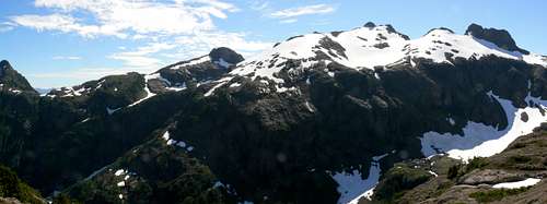
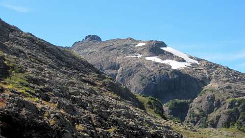
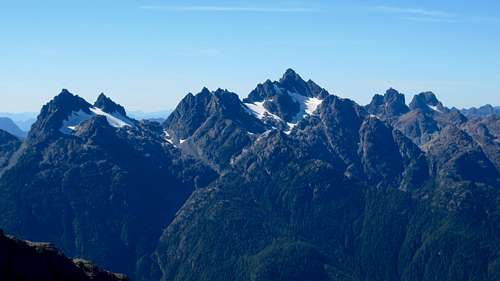
![Mt McKelvie Northwest Aspect]() Mt McKelvie Northwest Aspect. The ridge access col on the extreme right of the shot.
Mt McKelvie Northwest Aspect. The ridge access col on the extreme right of the shot.First Attempt. August 25/26 2010
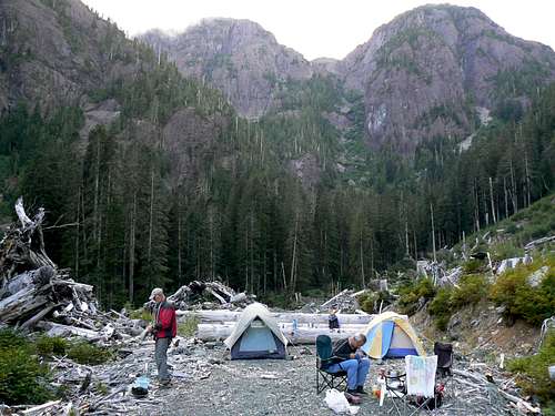
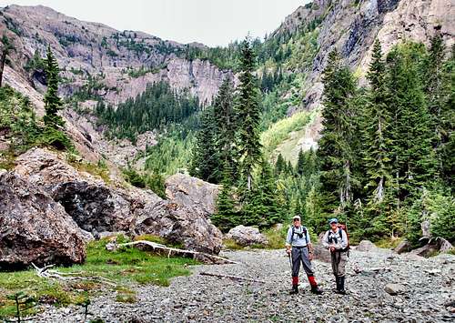
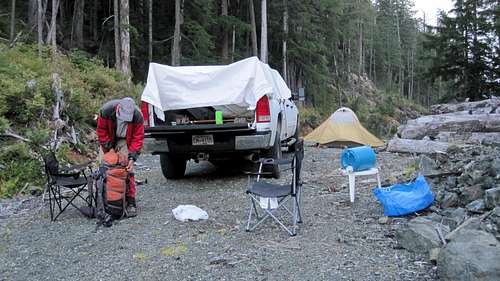
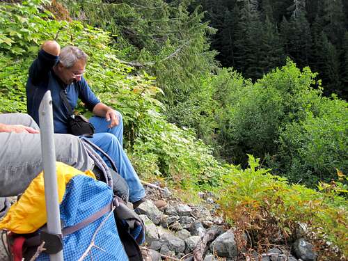
Since our approach was on unmapped roads I had already constructed a route in Google Earth from the Nimpkish main line to the end of the spur that came closest to the summit and transferred it to my GPS. After climbing Waring Peak as a warm up on the 25th, we packed up camp and headed off to the start of our theoretical route. Somewhere west of Vernon Lake the road we were driving on disappeared from the map on my GPS. Happily the red line we were following continued to coincide with the gravel that extended beyond the truck’s hood. In fact it was a wide well surfaced main line for much of the way until it narrowed and got rougher as we began to follow McIvor Creek up the valley. Exactly where I’d marked it, the access spur we wanted appeared on the right. I locked in 4WD and we headed up the steep approach. A serious water bar just up from the main line presented a bit of an obstacle but we were soon over it and continuing on. After only a few minutes, the angle eased and we entered a beautiful hanging valley – albeit scarred by recent logging. The road up the valley was just a gentle gradient – with a few easy water bars – until just before it petered out into the usual end-of-road slash pile, a large log barred further progress. This was clearly camp for the night.
An overcast morning saw us walking up to the end of the road where we turned left and headed west across the last of the logging debris and into the old growth beyond where we swung back to the northwest track that I had on my GPS and began to follow the creek. The water course was a complex mess of braided tributaries, deadfall, tumbled boulders and fall-on-your-ass stuff in general. At one point Rick took the left bank of whatever branch we found ourselves on while Tony and I took the right. We’d just decided that Rick had made the better choice when we heard him talking to someone. Crossing over to meet up with him we discovered that he’d treed a bear, that said bear was mighty PO-ed and that Rick had talked soothingly to it as he passed by. Whatever works I suppose.
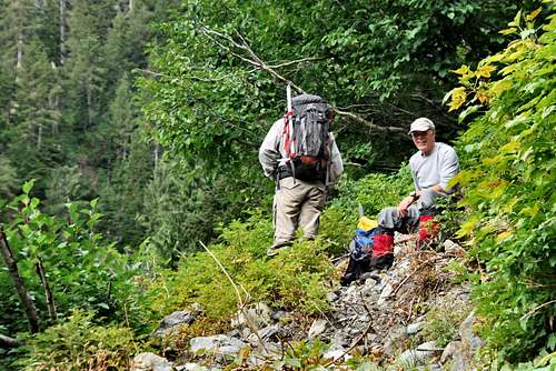
![First Camp in the Lower Valley]() First Camp in the Lower Valley
First Camp in the Lower Valley
| ![Lower Valley Bush]() Lower Valley Bush
Lower Valley Bush
| ![Break Time]() Break Time
Break Time
| ![Wrong Gully]() Wrong Gully
Wrong Gully
| ![The Idyllic Grove]() The Idyllic Grove
The Idyllic Grove |
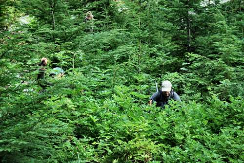
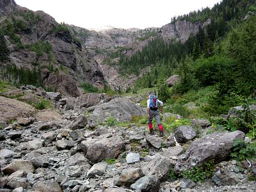
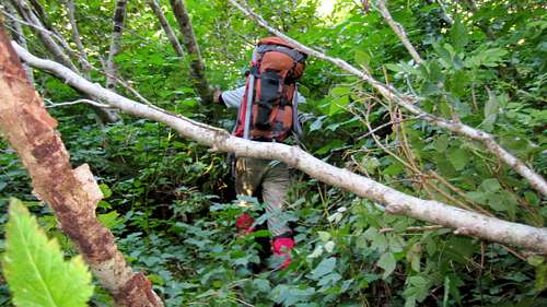
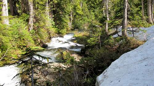
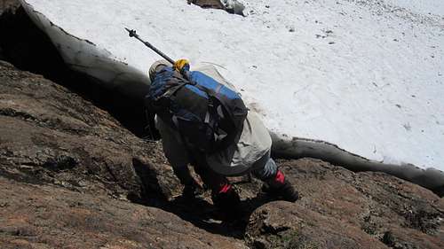
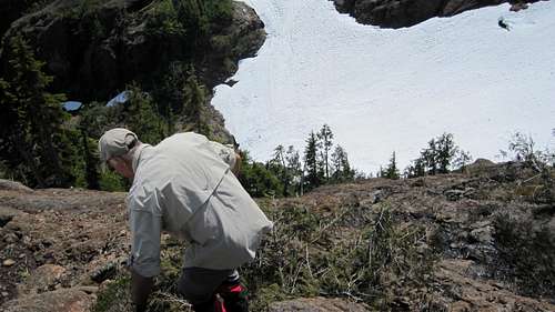
Moving on we found a decent elk trail that petered out into a nice cocktail of slide alder and devils club the flora most likely responsible for the nice light green I’d seen on GE. After protracted swimming around in this stuff we eventually emerged onto an open talus slope and paused for a rest. The slope entered a boulder choked gully which headed pretty well north – off our NW route. A lovely patch of dense krumholtz lay on our chosen path, so we un-chose it and went up the gully. Unfortunately this dead ended at a vertical wall and we were faced with a hairy traverse to get back onto the plotted route. This accomplished, we dropped into a little grassy bowl on the other side of which lay the first heather, open ground and elk sign everywhere. Following in our large friends’ footsteps, we crossed a series of muddy meadows and suddenly arrived at the creek in an idyllic grove. I think it was at this point that it became apparent to us that we were likely the first humans to visit this place. A realisation both sobering and humbling and providing for a special piquancy to what lay ahead.
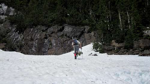
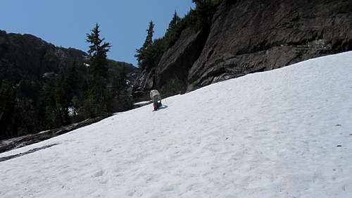
After a break we followed the elk trail up the creek, out of the last big trees and into a stunning hanging valley. Precipitous on both sides and ahead, it obviously saw plenty of avalanche action and stone fall in general. The creek simply and abruptly disappeared under aeons of talus and left us a nice gravel highway to hike along for the next half an hour.
The bad news was that ahead lay a cliff band that GE had not revealed and that barred access to the upper bowl and the ridge beyond. Weaknesses lay to left and right but which to try first?
By this time the overcast conditions had consolidated and the first rain was obviously not too far away. Tony hiked up the right hand route a way and returned to say that it might go. But we were all tired after hours of route finding in dense virgin bush and none of us fancied getting down it in wet conditions, so the decision was taken to call it a day.
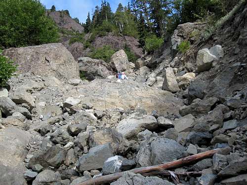
![McIvor Creek Approach Valley]() The Upper Valley and the Gravel Highway
The Upper Valley and the Gravel Highway
| ![The Hanging Valley]() The Hanging Valley
The Hanging Valley
| ![Approach Valley]() Approaching the Cliff Band
Approaching the Cliff Band |
We’d flagged our progress going up so it was quick trip down as far as the little grassy bowl below the “hairy traverse”. Crossing the bowl we picked up what we’d missed on the way out – excellent elk trail – which took us down through some nasty slide alder before crossing the krumholtz band we’d chosen to avoid going up and emerging at the top of the open talus slope.
Thereafter we followed our flags down the route, through the devils club etc nastiness and out to the road. By this time the rain had begun in earnest and rather than hang around and try again the following day, we opted to head for the east coast of the Island and the better conditions usually prevalent there. A sound decision as it turned out.
We were well pleased with our first foray. The bush had been tough but just to see that valley beyond it had made it a day to remember and we were sure that once the cliff band had been passed, the summit would be ours when we returned next year.
As it turned out there was no next year. Rick had been battling cancer for years at this point and finally lost his fight late in 2010. It’s a lasting tribute to the man that he was out battling dense bush and climbing steep, virgin ground less than four months before the end.
For my part, I was dealing with the end of a forty year marriage and had my thoughts focussed elsewhere. So 2011 came and went. In 2012 Tony and I decided we needed to finish the McKelvie project. We owed it to Rick.
Second Attempt. June 30/July 01 2012
This turned out to be the shortest chapter in our story. We headed up Island in spite of a dismal forecast hoping that the weatherman was wrong for once.
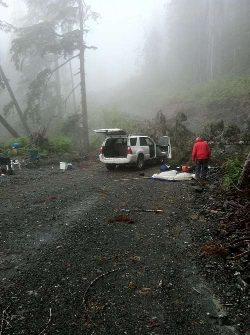
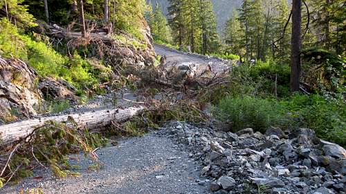
A good kilometre or so before the access spur we found the road blocked by a large fallen tree so we set up camp in the middle of the blocked road and, after supper, walked the rest of the approach to see what we were faced with the next day. Deadfall was everywhere and it was very obvious that no road crew had been out this way for some time. It was 20-30 minutes to the access spur and then another 15 minutes up it to the beginning of the lower valley. Here we found that the road we had driven in 2010 had been essentially debuilt. It was blocked by a large log and the water bars that extended beyond towards our camp site were enormous tank traps and not worth even contemplating with my 4Runner. Since we would also have to walk at least 30 minutes up the valley to the start of our route, we set our alarms 2 hours earlier than planned and hit the sack.
![Road Camp]() Road Camp
Road Camp
| ![Blocked Road]() Blocked Road
Blocked Road |
This turned out to be totally redundant. We got up to rain and near zero visibility and called this one off.
Third Attempt. July 15/16 2012
Not to be deterred, two weeks later and armed with a better forecast, we were back for another go. Everything was exactly as we’d left it. The tree still blocked the road and our tent sites were undisturbed.
Up early the next morning it was well over an hour before we reached our 2010 camp site at the head of the valley.
It had been a cool summer to date and the preceding winter had been long and cold. It was no surprise, therefore, that we encountered the first snow soon after engaging the bush. The elk also weren’t too keen on going up high in search of non-existent pasture and very little sign of their passage was apparent. A few of our flags from 2010 remained but mostly we were route finding again. At least this time we had a real, not theoretical, GPS track and we knew not to follow the dead end gully. Nevertheless, it took plenty of effort and time to get through the bush and reach the idyllic grove – which this time contained a rushing maelstrom rather than a burbling brook.
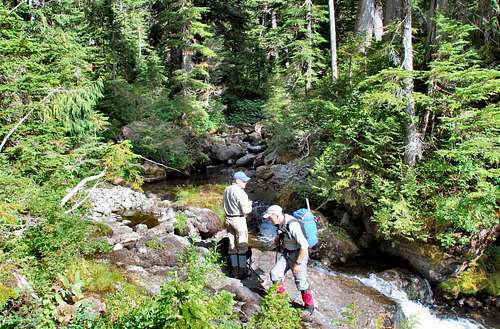
![Walking the Road]() Walking the Road
Walking the Road
| ![Lower Valley Bush]() Lower Valley Bush
Lower Valley Bush
| ![The Idyllic Grove in 2012]() The Idyllic Grove in 2012
The Idyllic Grove in 2012
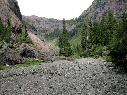
| ![Avalanche Chaos in the Upper Valley]() Avalanche Chaos in the Upper Valley
Avalanche Chaos in the Upper Valley |
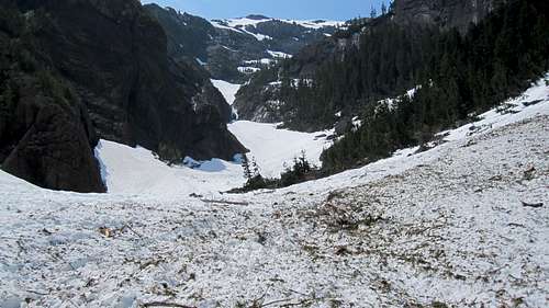
The hanging valley was buried under a couple of metres of the white stuff and had seen avalanche after avalanche over the winter. Debris and chaos was everywhere.
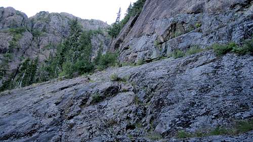
Conditions argued against attempting the right side of the cliff band so we looked at options to climber’s left. This side was much lower but we would have to keep as far away as we could from the precipitous chute on this side down which the upper mountain was draining with tremendous force. The cliff band squeezed right up to the chute in places and a way would have to be found between the two.
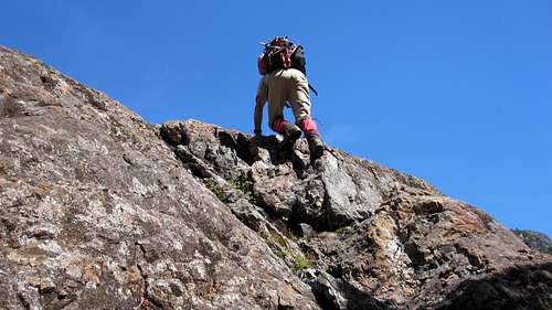
A snow gully to the right offered access to the cliff band and took us up 100 vertical metres or so before bluffing out. We judged the rock climb from here to be beyond our capabilities. Descending again we turned west and uphill keeping as far as possible to the right and away from the moat. A second, shorter gully soon opened up and we climbed up it a little way before deeking left into a brief section of snow free bush. This led to a wide snow ramp with the chute on the left and vertical cliffs on the right. We climbed the ramp to a narrow exit and ramp beyond, all the while keeping close to the base of the cliff. A right turn at the top of the narrow ramp put us at the base of a 10 metre Class 3 step which we climbed without difficulty and found ourselves, at last, above the cliffs and on the edge of the upper bowl. The col giving access to the ridge was 500 metres away and looked like a straightforward objective. However, we were by this point well past our turn round time and, once more, we had to retreat.
![Retreating from the First Gully]() Retreating from the First Gully
Retreating from the First Gully
| ![The Second Gully]() The Second Gully
The Second Gully
| ![Bluffs Route Snow Ramp]() Bluffs Route Snow Ramp
Bluffs Route Snow Ramp
| ![Third Class Step]() Third Class Step
Third Class Step
| ![Descending the Bluffs Route]() Descending the Bluffs Route
Descending the Bluffs Route |
As on the last occasion we were well pleased with our progress. It’s rare that an exploratory route goes first time and now that we knew the way to the upper bowl, we felt sure that we’d finally bag McKelvie on our next visit.
Several hours and lots of cuts and bruises later we were at the far end of the lower valley and walking down the access spur. We soon noticed sawdust everywhere and that fact that all the deadfall had been cut. A crew had been up the valley and we’d left my tent in the middle of the road! We hurried down the road expecting either a bulldozed tent or, at best, an irate note from the forestry company. Instead we found that the crew had carefully moved and re-pitched the tent on a new site by the side of the road and left all our belongings undisturbed. The downed tree was also gone of course. A big thank you guys, if ever you read this. And, of course, next time we could add 2 hours to our day by driving at least to the near end of the lower valley.
Once again, life got in the way a bit and next time turned out to be 2014.
Fourth and Final Attempt. September 4-6 2014
With a perfect forecast at the end of a long, hot summer we figured that it was now or never for McKelvie. Nothing was going to stop us this time and we packed with every intention of a bivouac if that’s what it took to finally draw a line under this 4 year old project.
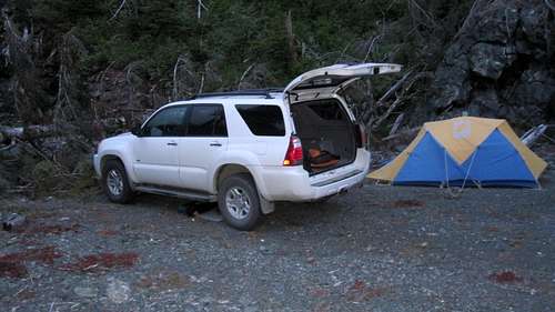
September 4th saw us driving the by now familiar roads, past our middle-of-the-road campsite of 2102 and up the access spur to the entrance to the lower valley where we soon found a nice spot to camp.
We were up early on the 5th and by 7.30 am were already in the old growth forest and dodging from bank to bank of the braided creek. By now we were very familiar with the route and, although we had our moments in the devils club and slide alder thickets, there were plenty of our flags left, the elk had set good trail and we were safely out of the bush and at the idyllic grove by about 10 am. The brook was burbling benignly again, there was no snow on the route and the upper valley was back to its “gravel highway” state of 2010. Just before tackling the cliff band we took the decision to stash our bivvy gear.
![Base Camp 2014]() Base Camp 2014
Base Camp 2014
| ![Route to Upper Bowl]() Slabs Route to Upper Bowl
Slabs Route to Upper Bowl
| ![Upper Bowl]() Upper Bowl
Upper Bowl
| ![The Haihte Range from the Ridge]() The Haihte Range from the Ridge
The Haihte Range from the Ridge
| ![Summit Approach]() First View of the Summit
First View of the Summit |
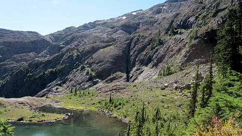
The snow filled gullies of 2012 were bare this time and, although we found the second and key gully easily enough, the going was much slower over broken ground and then bush. The snow ramp of 2012 was now a wide rock slab up which we scrambled easily enough. The Class 3 step was likewise soon behind us and well before noon we passed our previous high point on the way to the stunning tarn-filled upper bowl directly below the summit ridge. Beyond the tarns we searched around a little to the north and soon found a steep heather filled gully that led up towards the ridge. Up we went without difficulty and, shortly before 1 pm, stood on the ridge crest with the Haihte Range filling the view to the west and the summit of McKelvie in plain view to the south and still looking a good distance away. Bar accident we knew we had it in the bag at this point and sat down to a snooze and well deserved lunch in one of the loveliest places I’ve had the pleasure to experience.
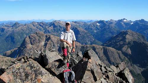
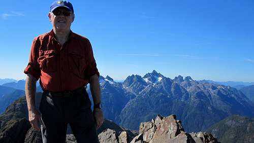
Refreshed, we set off on the last leg to the summit. An easy ridge crest dropped off to a small col and tarn. From here we opted to contour across the face of an intervening high point and straight into the col directly below the summit block rather than drop down to snow and climb up to the col from there. This involved a little exposure but was mostly on easy angled, slabby ground. From the col a zigzag course up grassy ramps took us to a final bit of unpleasantness in the shape of a nasty scree field right under the summit before, at 3.15 pm precisely, we finally stood on top.
Now we could see right down to the Tahsis Inlet as well as the village itself far below. Although more distant than the Haihte Range, the Alava Bate Sanctuary was in full and uninterrupted view. And there, of course, was Thumb Peak from which I’d first seen McKelvie four years previously. To the east and south and in a long arc lay old friends we’d enjoyed over the years: Victoria, Sutton, Alston, Waring, Conuma and more previously unseen from this perspective. Truly a magnificent reward at the end of our long quest. Did we philosophise about it all? Did we delve into the spiritual value of the experience? Feel something reborn within ourselves? Nah. After 10 minutes Tony said “right, let’s get the hell out of here, it’s a long way down”. I couldn’t have agreed more.
![Mt McKelvie Northeast Aspect]() Mt McKelvie Northeast Aspect
Mt McKelvie Northeast Aspect
| ![Final Scree Field]() Final Scree Field
Final Scree Field
| ![Summit View South - The Alava Bate Sanctuary]() Summit View South - The Alava Bate Sanctuary
Summit View South - The Alava Bate Sanctuary
| ![Tahsis Village and Inlet]() Tahsis Village and Inlet
Tahsis Village and Inlet
| ![Summit View North - The Haite Range]() Summit View North - The Haite Range
Summit View North - The Haite Range |
Down the scree, across the traverse, into the access col and down the gully. Across the upper bowl, down the 3rd Class step and then the ramp by the chute, legs growing ever more tired and feet ever more sore as the clock ticked beyond 13 hours. With the shadows lengthening we spotted our cache below in the upper valley and knew we’d made a fine choice to lug bivvy gear up through the bush.
Setting up camp in the only flattish spot around we got the stove going and brewed pints of tea. Too tired to cook we made do with any and all cold food we had with us and crawled into our bags just as the last of the light was fading. It was a wonderful warm and pleasant night and we lay for a while chatting and revelling in our achievement and enjoying the stars and satellites overhead until sleep finally overtook us. Rick would have loved it.
Next morning were greeted by a stunning sunrise. Reluctant to take a final leave of a place we’d come to know so well we didn’t get away until 7.30. Two hours later we were at Tony’s truck happy in the knowledge that we hadn’t tried that bush in the dark.
Tired, scratched, cut, bitten and supremely satisfied we packed up and began the long drive back home.


Comments
Post a Comment