The Background
Please click on any photo for further description.
Evans and Bierstadt are the closest and easiest 14ers to Boulder and the Denver area. For this reason, we were hesitant to climb the standard routes on these two peaks in fear of hundreds of people. The plan was to park on the Mt. Evans Road near 13,000 and make the high traverse up Bierstadt's East Ridge, across the Sawtooth, up Mt. Evans' West Ridge, and return to the car down the road. This route is named in Gerry Roach's 14er book as combo 3.19. Nevertheless, we still ran into hundreds of people on the final pitch to the summit of Evans. It still amazes me that you can drive nearly to the top of Evans. I remember when I first climbed Bierstadt last September, I looked over at Evans and saw a traffic jam on the road.
The Beginning
Our group was five deep: Adam, Pete, Jessup, Maverick (14ers.com), and myself. We left Boulder around 2:30AM and after paying the fee to drive up the road (don't want to get a ticket when our car is parked in a pull out), made it to the pull out at 13,000ft around 4:10am. It was cold, but calm and skies looked clear to the west.
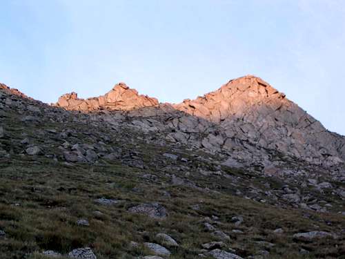
We desceneded down a steep and extremely loose gully in the dark with headlamps to reach Scott Gomer Creek. I kicked off a boulder the size of a fridge that rolled over a thousand feet to the valley floor. At this point, there is a large marsh and lake that must be crossed and no apparent trail. We chose to skirt the lake to the north, which was a bad idea because of the terrible willows. At this point, the sun was coming up and we had a nice view of the remainder of our route up Bierstadt.
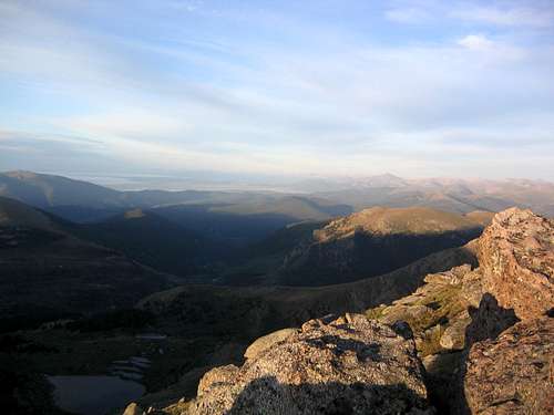
Once on the other side of the lake/marsh, we scrambled up a steep grassy slope, angling mostly straight up but slightly to the right, for a thousand feet to reach Bierstadt's East Ridge. Below is the view south from Bierstadt's East Ridge.
Bierstadt's East Ridge Ascent
Upon reaching the ridge, we saw the several large towers and not much of a trail.
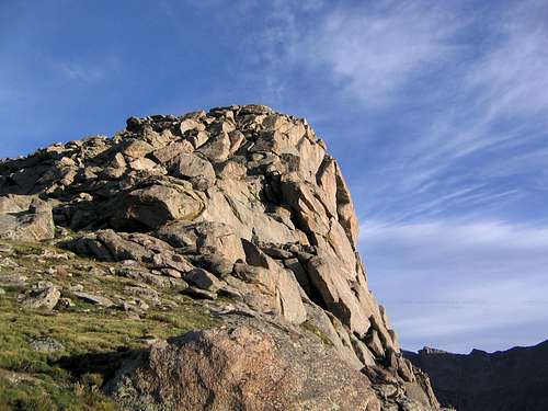
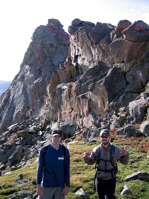
Everyone had done some research on routes up this exposed ridge and we felt confident of finding a safe route. We bypassed several towers on the west side of the ridge and came to the first class 3 climbing. On the ridge's East side, a faint trail skirts about 100 feet below the ridge and ends abruptly. At this point, you must do an ascending traverse up and to the left (southwesterly) to reach the ridge. Following the ridge crest for another 1/8 mile, mostly all class 3, we reached a final tower with a class three crack. The exposure is great and the rock solid.
On the right is the view from the top of the final tower shows Bierstadt still another 1/2 mile away
Bierstadt's East Ridge Descent
Descending from the tower required more class 3 scrambling, with two spots only a couple feet wide and hundreds of feet down on both sides. The photo on the left shows Maverick descending the last tower. The photo on the right is adam and pete with the approximate route down the last tower behind them.
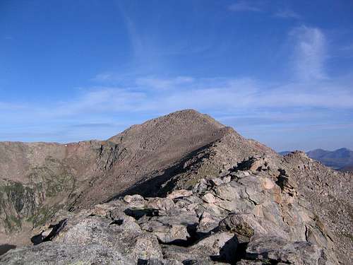
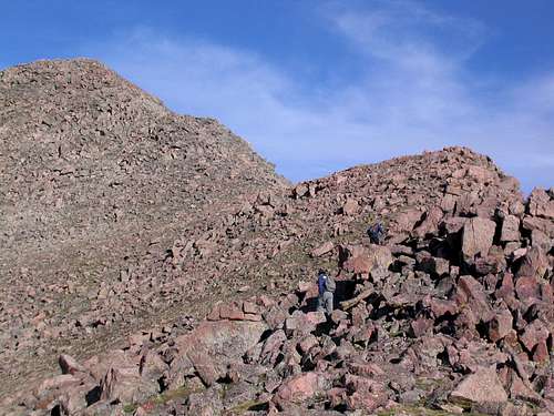
The ridge from this point to the summit of Bierstadt requires not much more than boulder hopping.
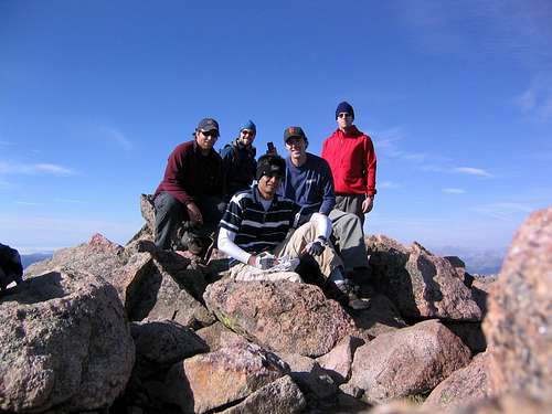
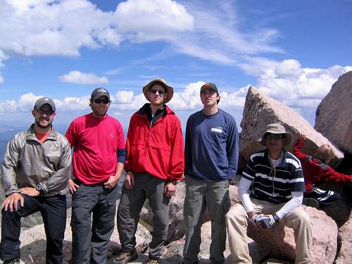
![Summit photo on Bierstadt.]() Summit Photo on Bierstadt
Summit Photo on BierstadtThe Sawtooth
The descent from Bierstadt to the low point between the Sawtooth and Bierstadt is rough and steep. But once you reach the bottom, more class 3 scrambling awaits. After traversing across the ridge, you cross over to the west side of the Sawtooth ridge. Again, exposure for those who like that type of thing. The danger is minimum, but the drop is huge. We carefully crossed the steepest ledges and ascended a loose gully to exit the traverse.
(Passing through a crack while traversing to the crossover point)
To the Summit of Evans
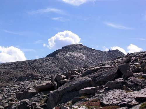
![View of route up Evans after Sawtooth]() Rest of the route up Evans
Rest of the route up Evans
At this point, we began to tire out a bit and had a snack. The rest of the route up Evans was visible and it looked far away (1.2 miles and 800 vertical or so really). We continued for 1/2 a mile until Adam decided to assult one of the cairns.
![Cairn in Trouble on Evan s West Ridge]() Cairn in Trouble
Cairn in Trouble
The rest of the route is the standard west ridge route for Evans. We began to see more and more people and finally turned a corner to see the parking lot and hoardes of people. We made the final ascent to the summit and joined in with hundreds of other people celebrating their achievement. After a summit photo and wrestling with a 6 year old boy for the summit register (unsuccessfully), we returned to the car, 1000ft and a mile below.


Comments
Post a Comment