
-
 6793 Hits
-
 0% Score
-
 0 Votes
|
|
Route |
|---|---|
|
|
40.44500°N / 76.822°W |
|
|
Hike (Class 1) |
|
|
Less than two hours |
|
|
Walk-up |
|
|
Approach
Follow the directions in the "Getting There" section of the main page.
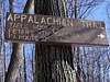
Route Description
This route is about as easy as they come in terms of the Appalachian Trail. The route is basically a very nice ridge-walk with a few ups and downs. You'll gain probably about two hundred feet round trip in total. Winter, with snow on the ground would be the best time to hike the route because the man-eating rocks won't kill your boots:) But otherwise, the trail provides some fine scrubby views south and north to the fertile valleys below. The total distance of the trip is four miles, being two miles each way and is a nice walk in the woods with great views south from Table Rock.
 |  |
Essential Gear
Comfortable hiking boots, trekking pole, snack/water, and a camera.
Miscellaneous Info
If you have information about this route that doesn't pertain to any of the other sections, please add it here.