
-
 32668 Hits
-
 82.48% Score
-
 15 Votes
|
|
Mountain/Rock |
|---|---|
|
|
40.44500°N / 76.822°W |
|
|
1275 ft / 389 m |
|
|
Overview
Table Rock is a large sandstone outcropping that overlooks Clarks Valley, just north of Harrisburg, Pennsylvania. Its name, as you can imagine, comes from one particular rock that looks just like a table sticking up out of the mountainside. Technically, it is a part of the Peters Mountain ridgeline. Many people do this as a separate hike, unless you're doing the entire Appalachian Trail, which is why this is a separate page. Similar to PA's other Appalachian summits, this area is a broad and decently flat-topped ridge with steep sides.
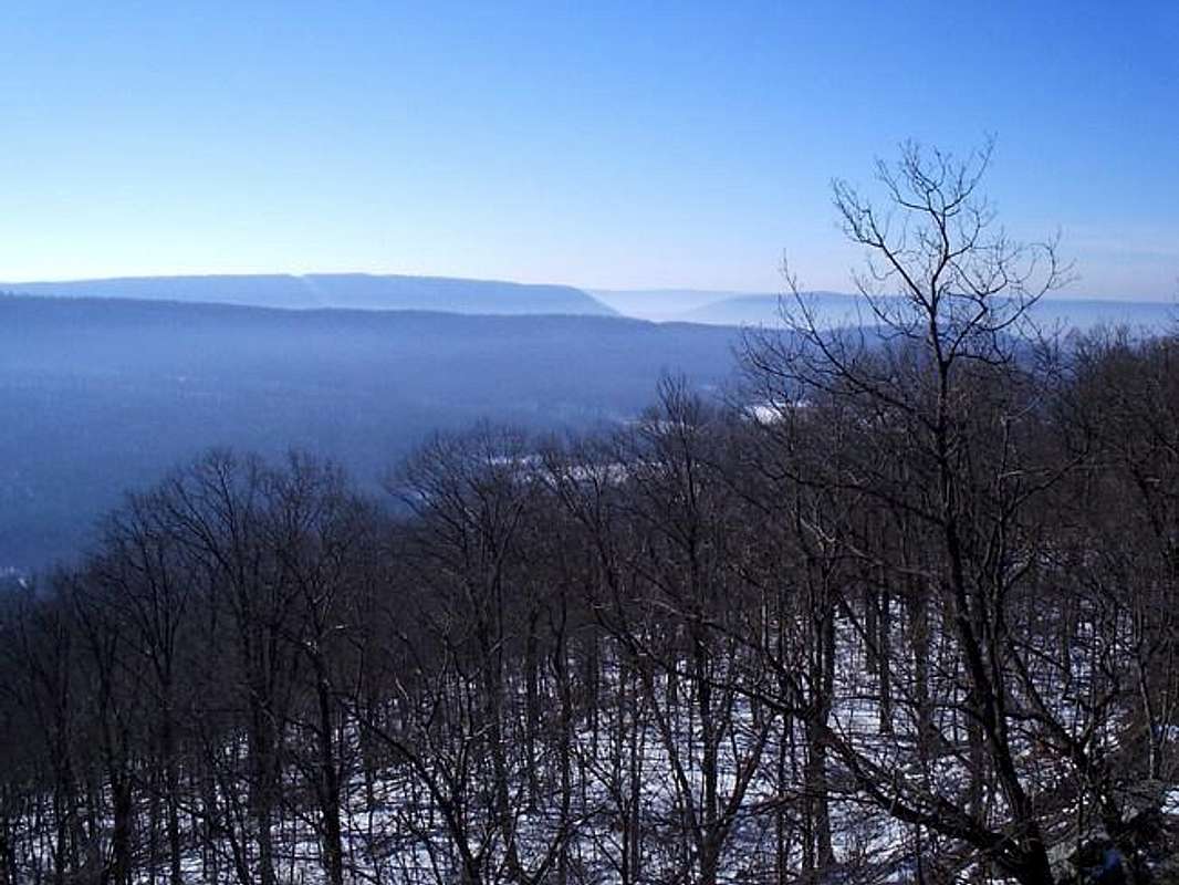
Geologically, this part of Peters Mountain ridge is what used to be beach front property. As you can see in the rock layers along the outcropping, the sandstone is metamorphosized rock which refers to the remnants of that ancient beach. This area was pushed up along with the rest of the ridge when the Appalachians were created as the continent of Africa slammed into North America. Some of these mountains were once probably higher than today's present Himalaya.
The most common approach to Table Rock is via the Appalachian Trail as stated earlier. The trail is rocky just as with the rest of PA's part of the trail. That's what we're known for though. There are some nice rock scrambling opportunities up the face of Table Rock. The face is about fifty feet and vertical in most places with some nice ledges and cracks. You'll find plenty for a couple of hours of mountain scenery at Table Rock.
 |
 |
 |
 |
 |
Getting There
From Harrisburg:
From Interstate 81, take Route 22/322 west towards Lewistown and Halifax. After approximately seven miles of heading north along the river you'll reach the exit for Halifax and PA 225. This road heads over Peters Mountain. Head up the mountain until you reach the top hairpin turn where you'll see the A.T.'s bridge crossing the highway. There is a macadamed road that turns right and heads up to a little parking area right of the road. Here you'll find a trail map and A.T. postings for this section of the trail.
Red Tape
There are no permits or parking passes required to hike in this area. The only seasonal closures would be due to snow, but for the most part they get the road plowed pretty quickly. For conservation purposes, follow the “LEAVE NO TRACE” program and you'll be fine.
 |
 |
 |
When To Climb
This summit is climbable any time of the year. The suggested time of year to hike here would be early fall or mid-late winter because of the foliage and the views. Be careful if you do this hike in fall because there are hunters on the north and south face of the mountain. Take care to stay on the ridgeline and not stray during hunting season.
Camping
There is no camping in the immediate vicinity of Table Rock. There is the Peters Mountain Shelter which is only a mile east along the A.T. This shelter as are most of PA's A.T. shelters, free of charge and there is no care-taker.
Mountain Conditions
Current and up to date weather conditions may be found by clicking the link below!
weather.com