
|
|
Route |
|---|---|
|
|
47.19485°N / 10.19892°E |
|
|
Hiking |
|
|
Summer |
|
|
Most of a day |
|
|
none |
|
|
Overview
This lovely and technically not at all difficult route takes you through a beautiful and well preserved section of the western Lechtal Alps, drawing a circle around one of the important summits of this area, the 2632 meters high Rüfispitze. The views to the mountains of the Lechquellengebirge, the Bregenzerwald, the Allgäu Alps, the Lechtal Alps and the Verwall group are marvelous, and for the largest part one moves above the 2000-meter-mark. One starts in Lech and ends in Zürs. Most of it is in Vorarlberg, the section between the Rauhekopfscharte and the Stuttgart Hut being in Tyrol.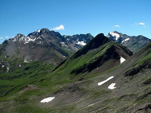 On the tyrolean section of the trail
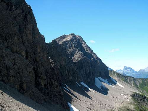 The Rüfispitze from the Rauhekopfscharte
 The Kuglaspitze (2684m)
Getting There
The starting point for this route is Lech am Arlberg.Lech, 1445 meters above sea level and mostly known as a winter resort, is a charming village and offers many possibilities also in summer. There are many excellent hotels and very well-kept pensions which are open all year around and offer accommodation at moderate cost, and Lech is surrounded on all sides by beautiful and preserved mountain areas with countless hiking possibilities. The town of Zürs, on the other hand, is exclusively a winter resort. All hotels and restaurants are closed down in summer, so that oftentimes during that time of the year it appears somewhat like a ghost-town. Thus, in summer, take into consideration that there are no accommodation possibilities in Zürs!
 The village of Lech am Arlberg
Nearest airports: Zürich, Munich, Innsbruck.
Here are the three simplest ways of getting to Lech am Arlberg by car:
Coming by car from Zürich: Take the motorway to St. Gallen and continue on the motorway, following the signs to St. Margrethen-Chur, as far as Diepoldsau. Here, turn left and follow the road to Hohenems (Austria). Now take the A14, following the signs to Innsbruck, past Feldkirch until Bludenz. Then follow the E60 (Arlberg-Schnellstrasse) as far as Langen am Arlberg (Langen a. A.). In Langen, turn off and follow the road leading through the village of Stuben up towards the Arlberg pass. 3 km before the top of the Arlberg, there is the turn-off towards Flexenpass-Zürs-Lech. Follow this road to Lech. Distance: 196,8 km, duration: 2h 13min.
Coming by car from Innsbruck: Head for the A12 direction Bregenz and follow it until it ends in Landeck. In Landeck, follow the signs to Bregenz and continue on the road through the Stanzer Tal as far as St. Anton. Then take the road to St. Christoph-Arlbergpass, go over the pass and 3 km down the other side. At crossroads, turn right and follow the road leading over the Flexenpass to Zürs and Lech. Distance: 116,8 km; duration: 1h 32min.
Coming by car from Munich: Follow the E533 towards Garmisch-Partenkirchen, then, in Oberau, just ca. 5 km before reaching Garmisch, turn right, following the signs to Reutte (Austria). Upon arrival in Reutte, stay on the road (no. 198) leading up the entire tyrolean Lechtal valley and in Warth, turn left onto the road to Lech. Distance: 188,7 km; duration: 2h 45min.
Coming by means of public transportation: All fast trains commuting between Zürich (Switzerland) or Bregenz (Austria) and Vienna stop in Langen am Arlberg. In Langen, change to the postal car that commutes regularly between Langen and Lech. Coming from Munich: Take one of the international trains bound for Italy via Innsbruck, alight in Innsbruck and change to one of the fast trains bound for Bregenz or Zürich. Alight in Langen a. A., then take the postal car to Lech.
Route Description
Lowest point: Lech am Arlberg, 1445m (4741 feet).Highest point: Rauhekopfscharte, 2415m (7923 feet).
Height gain: about 1100 meters (3609 feet), considering the descent from Rüfikopf to Monzabonsattel and the regaining on the way.
Altitude at the end of the trail in Zürs: 1717m (5633 feet).
Overall mileage: about 12 or 13 kilometers
Start in Lech. Follow the well-marked trail leading first steeply through mountain forest, then less steeply through a wide alpine meadow with a final steeper rise to the Rüfikopf (2362m), or save yourself these three hours and take the Rüfikopfbahnen cable-car to just shortly below the Rüfikopf's summit.
 Lake Monzabon
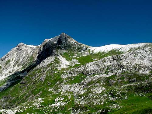 Wösterspitze seen from Monzabon saddle
 The Rauher Kopf
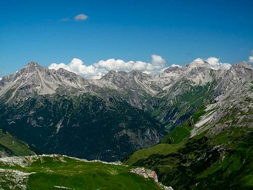 The view to the Allgäu Alps
 The Krabachtal valley
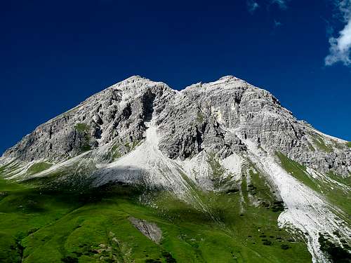 The Rüfispitze (2632m)
Essential Gear
Apart from good mountain shoes and rain and wind protection, no extra gear is needed, as it is a marked trail all the way. No need to bring tons of food along, either - at the top station of the Rüfikopfbahnen there is a restaurant, and food and drink are also served at the Stuttgart hut.External Links
online weather forecast for LechMaps
The in my opinion best maps to use are: Kompass Wanderkarte no. 33 Arlberg/Verwallgruppe 1:50000 and Kompass Wanderkarte no. 24 Lechtaler Alpen/Hornbachkette 1:50000. There are also the Alpenvereinskarte 25 no. 3/2 (Lechtaler Alpen, Arlberggebiet) and ÖK 50 Blatt 143 (St. Anton am Arlberg).A useful guide-book for this area (in German, though) would be the AV-Führer Lechtaler Alpen Alpin, Bergverlag Rudolf Rother.