
-
 7471 Hits
-
 74.01% Score
-
 4 Votes
|
|
Route |
|---|---|
|
|
49.24880°N / 125.31761°W |
|
|
Hiking, Mountaineering, Skiing |
|
|
Spring, Summer, Fall, Winter |
|
|
Half a day |
|
|
Class 2/AI1 |
|
|
Overview
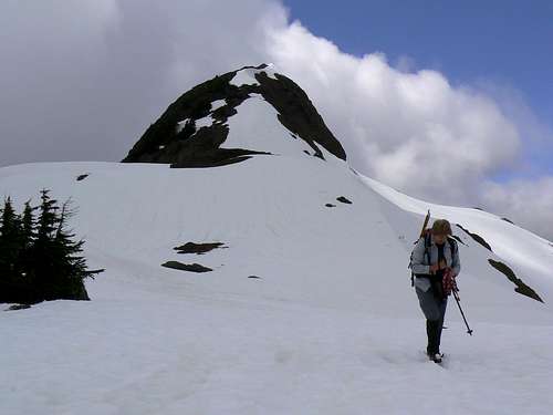 Upper east ridge Upper east ridge |
A brief phase through logging slash is followed by an equally brief one in old growth before emerging onto open ground at only 850 metres elevation.
Thereafter, wonderful open ridge hiking to the last steep climb up the summit block.
Probably the best choice when cornice hazard threatens the North Face Route.
East Ridge Approach
From the signal light at the bottom of the hill in Port Alberni drive 6.8 km and turn left onto McCoy Lake Road. Drive 1.9 km and keep right on Tyler Road. Go ahead 1.6 km to a 4 way junction at N49 15.254 W124 54.241 and go straight across onto gravel. Approximately 1 km later the road swings round to the west and begins to follow Taylor Arm, an offshoot of the south side of Sproat Lake.
Continue about 13 km and keep left at N49 14.018 W125 02.867, the junction with Taylor Main. Shortly thereafter the road turns south (may now be called Gracie Main) and begins to climb up a pass ahead. Proceed 6 km up and over the pass and down to the junction with Nahmint Main at N49 11.720 W125 04.421. Turn right and cross the Nahmint River within 1 km.
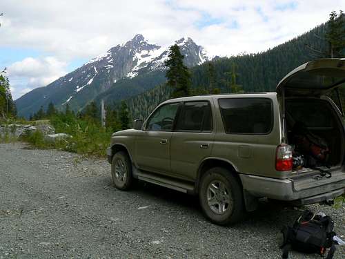 Nahmint Valley approach drive limit | 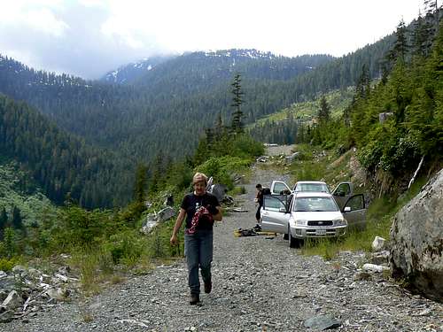 Adder Mountain East Ridge Route Start |
Drive west on Nahmint on good 2WD surface and after 5.8 km cross the river again to its north bank at N49 12.810 W125 09.049
Proceed west on Nahmint for just over 4 km and note spur 600 on the right at N49 13.732 W125 11.935. This gives access to Mt Klitsa.
Proceed west on Nahmint. Soon after spur 600 the road deteriorates and the first of the cross ditches/water bars appear. Lock in 4WD and go ahead a further ~ 7 km to a large washout that bars further progress at N49 14.412 W125 15.919. There is adequate parking here.
Route Description
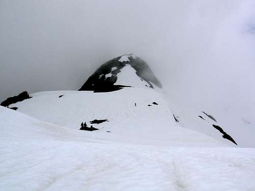
Group on the east ridge of Adder Mountain approaching the summit
Walk off the road and pick your way slightly north of west up through the logging slash following flagging where you can find it. This route is less frequently travelled than the north route and consequently there’s nothing startlingly obvious in the way of a use-path. About 10 minutes in the slash should see you safely into the old growth above.
Proceed up through the trees gradually swinging round to a true northwesterly heading to intersect a stream flowing down from a small tarn above. Go up either bank of the stream to the neighbourhood of the tarn at N49 15.105 W125 17.997 and 1,100 metres elevation.
 Lower east ridge Lower east ridge |  Upper east ridge Upper east ridge |  Climbing the summit block Climbing the summit block |  East ridge from the summit East ridge from the summit |
You are already out onto friendly open slopes at about 850 metres elevation but above the tarn the sub alpine ridge is wide open and presents wonderful open hiking, particularly when still under snow.
Head left (west) up the wide ridge and directly up to the summit. There are two steep phases before the steepest one on the summit block itself. Several bluffs provide sporty diversions if desired but, if not, an easy route around (usually on the south side) is always available. When the route is snow covered, some might appreciate an axe on the last pitch.
Walk across to the slightly lower west summit if desired being careful to avoid cornice hazard in early season.
Descend by the same route. About 10 km return from cars including the road walk. Average time: 3-3.5 hours up and 2-2.5 hours down (less on snow).
A Mapsource/Garmin tracklog is available for the full approach and east ridge route. Just send me an email or PM.