
-
 9106 Hits
-
 75.81% Score
-
 6 Votes
|
|
Route |
|---|---|
|
|
49.24880°N / 125.31757°W |
|
|
Hiking, Mountaineering, Skiing |
|
|
Spring, Summer, Fall, Winter |
|
|
Most of a day |
|
|
AI1 or AI2 if summit ridge cornices or cornice shear line are in place |
|
|
Overview
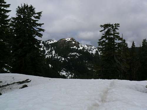
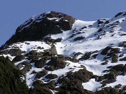 Adder Mountain north face Adder Mountain north face |
A relatively long climb through a brief phase of logging slash and a longer one of old growth forest above to exit onto the open north ridge at ~1,000 metres elevation. Thereafter, lovely ridge hiking to the summit. Cornice hazard may bar access to the summit ridge in some conditions.
Adder Mountain north face from about 1 km. Note the early season cornices on the summit ridge
North Ridge/Face Approach
Drive west out of Port Alberni for about 40 km, along the north shore of Sproat Lake, across the Taylor River at the end of the lake and finally up Sutton Pass. Immediately after the elevation sign (175m) at the top of the pass, watch for a gravel road on your left (south). It forms a V junction with the main highway. Turn up here and engage 4WD.
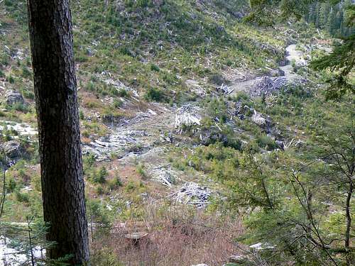 Route Start from above | 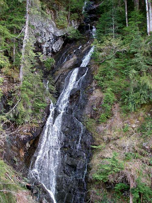 Waterfall en route |
Within the first few hundred metres you hit the first water bar. If it’s any consolation it’s one of the worst, clearly put there by the logging company who lease the land in order to discourage anyone from proceeding further except those with serious intent. The access roads are not all shown on the map but are quite easy to follow. In general, keep right at any junction you come to. As mentioned above, the roads are steep and rough and, in all, there are a dozen or so water bars to cross. It takes 15-20 minutes from the main highway to reach the top of the road you want. The coordinates of the top of the road are (NAD85) N 49° 16.5&min; W 125° 20.2&min.
The road end is flat with plenty of room to turn around and pitch several tents. Water is only a few metres away down the hill if you need it although it's probably more convenient to haul a barrel in with you.
Route Description
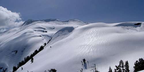
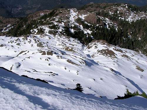
North ridge in profile from the east ridge
You’ll spot flagging as soon as you enter the trees if not before. For the first hour or so there’s also quite a distinctive path – at least by Island standards.
Proceed south steeply at times but on occasions over flat or only gentle uphill terrain. After about 30 minutes at an elevation of 755 metres you reach a well flagged route junction. The “old” route goes down and to the right and crosses the river at this point. Go straight on for the preferred “new” route. Coordinates at this position are: N 49° 16.35' W 125° 19.8'.
Continue south and up through the forest. Depending on conditions and season, this will involve crossing and re-crossing the increasingly convoluted streams that run down the valley. If you’re in luck, snow bridges will be in place. If not, you’ll find yourself climbing up and down vertical 2-3 metre snow walls to get down to and across each stream.
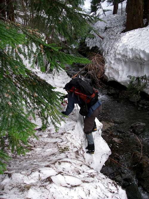 Negotiating Stream Crossings | 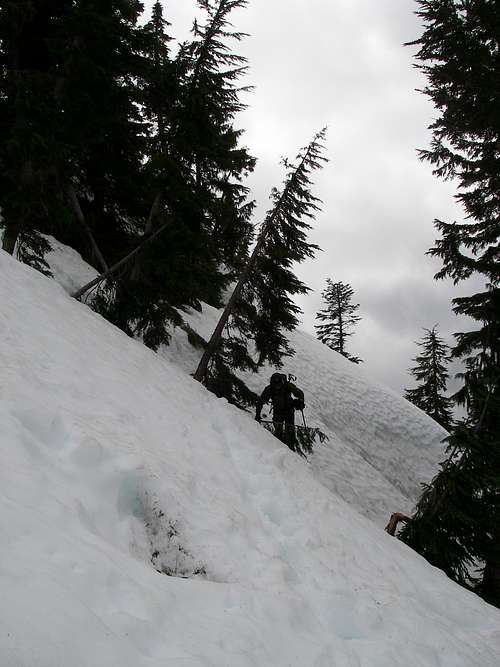 into the Alpine | 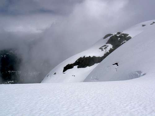 Low vis on the open N Ridge | 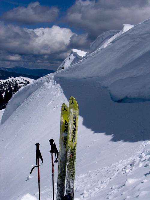 Summit Cornices |
Once in the alpine resume a southerly course. Low down the north ridge is broad and may be quite featureless if there’s snow on the ground or if visibility is low. As you approach the summit block, however, the ridge narrows and you really only have one place to go.
In summer climb easy slopes to the summit ridge at the most convenient point. In early season prepare to risk the cornices that bar access to the ridge or let discretion be the better part of valour and call it a day at this point. In between times the cornices may have fallen off and you’re left with a 3-5 metre high wall at the shear point. Climb it at any low point you can find to attain the ridge.
Once on the ridge, turn left (east) and walk up to the top. The east summit is only higher than the west by a couple of metres. Take care on the summit ridge if you spot shear cracks indicating unsupported snow.
Descend the way you came up. The round trip takes 10-12 hours car to car.
Looking down the N face
See attached trip report.