-
 12522 Hits
-
 74.01% Score
-
 4 Votes
|
|
Route |
|---|---|
|
|
48.09155°N / 113.90024°W |
|
|
Hiking, Mountaineering |
|
|
Spring, Summer, Fall, Winter |
|
|
Half a day |
|
|
Overview
This is the primary route to Mount Aeneas with views into the Flathead Valley and into the Swan and Mission mountain ranges. Upon arrival at the summit vistas will include Glacier National Park as well as Hungry Horse Reservoir.
Total distance to the summit ≅ 3.0 miles.
Total elevation gained ≅ 1,778 feet.
This route is on trails for its entirity but the upper portions of the trails present exposure to falls of great distances while walking on the trails if one should slip.
Route Description
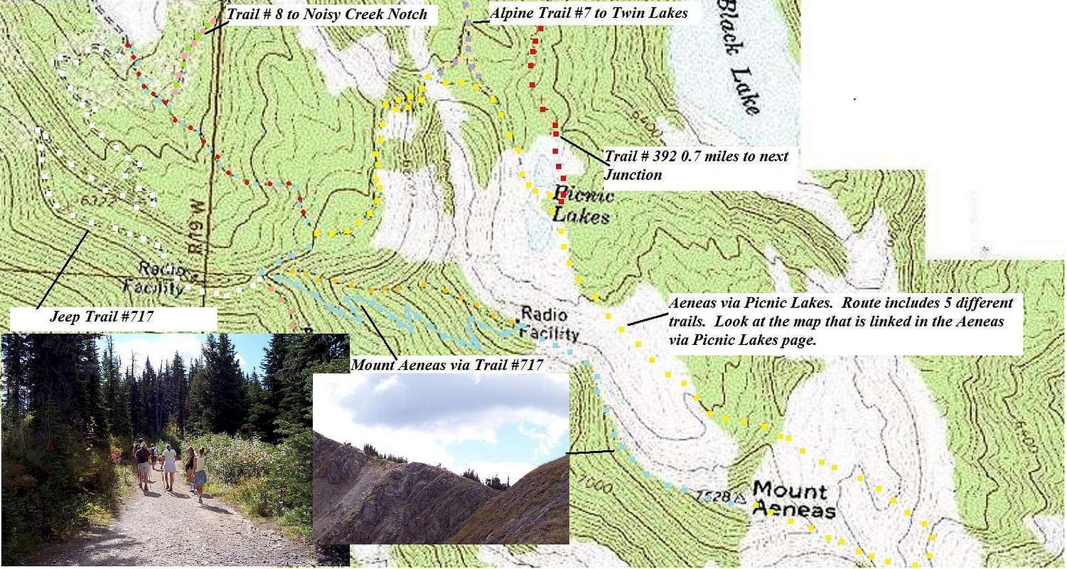
After arriving at Camp Misery fight the urge to walk up a trail and follow the jeep trail behind the closed gate instead. This service road ends in about 1 mile. This is Trail # 717. In 1.5 miles you will reach an intersection. Upon reaching the saddle views of the Flathead Valley are available. An interesting side trip includes a short climb to a small knob that is 6,437 feet in elevation.
Upon reaching this intersection there are three options of travel. To describe the correct fork follow a clockwise rotation as the options are described. The left and right trails are Alpine # 7. The trail that immediately heads up the hill is trail # 717 and leads to Mount Aeneas. The correct trail begins to gain altitude almost immediately as compared to the others that remain flat for a while.
The Mount Aeneas Trail has numerous switchbacks and eventually reaches the top of the ridge at a microwave relay station. Take a short rest to enjoy the fabulous views an then continue up the ridgeline to the summit.
To return either retrace your steps or continue down the trail #717 following the ridge and drop down to Picnic Lakes and then return to Camp Misery via Trail # 392 and # 7. After reaching the rock turn right on trail # 68 then left on to trail #8.
Essential Gear
The usual equipment for hiking is needed. Plan on carrying Bear Deterrent Spray and water unless you own a filter. There is water at the Camp Misery Trailhead bt the remainder of the route is dry.If an early or late season journey is planned obviously appropriate gear for winter travel including avalance beacons will be needed.


