|
|
Route |
|---|---|
|
|
18.76812°N / 145.67323°E |
|
|
Mountaineering |
|
|
Spring, Fall |
|
|
Expedition |
|
|
Class 4 |
|
|
II |
|
|
Overview
Based on new topo data found in 2017, an analysis led the team to think the true highpoint was located along the eastern portion of the southern crater rim. Looking at various sources of satellite imagery several potential routes leading to P960 or P952 were identified. It was hoped that the team could land at the southeast beach and take the direct R4 route or more likely the R3 -> R2 route to P960. Unfortunately conditions forced us to land at the southwest beach which meant we had to use the longer R1 -> R2 route. Over six days the local support cut a trail through heavy sword grass and ferns, establishing 4 camps along the way. Once we reached P960, it appeared that P952 might be higher. Using a 5x hand level and a Sokkia B24 survey level it was determined (sighting and back-sighting) that P952 was indeed the true high point. Members of the team secured the Class 4 crater rim traverse between P960 and P952 using ropes, snow pickets and angle iron, and a caving ladder. See the team's trip report for full details.
Getting There
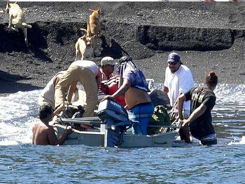
The team decided to charter a boat (Super Emerald) to get from Saipan to Agrihan with the climbers, local support members and all their food/water/camping gear. The original intent was to land at the southeast beach. From there we would take the direct R4 route or more likely the R3 -> R2 route to P960. Talking with NIMO and the boat captain it was decided the best landing place was on a southwest beach near the small inhabited village. With the villagers permission the team established a base camp in and around the old dispensary building.
Route Description
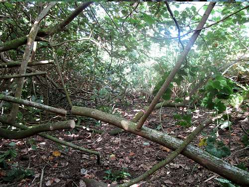
The lower 1/4 of Agrihan is covered in mostly coconut palm forest. Along the edges or empty canopy there is moderate undergrowth, but in denser areas there is little undergrowth. The primary concern/danger is being careful of the abundant number of feral pigs.
The next 1/4 of Agrihan is covered in dense sword grass (typically 6-7 feet/2 meter tall) that you have to machete your way through. This is where the 6 local support members came in valuable. Four members would work on cutting new trail while the other two would carry water/supplies.
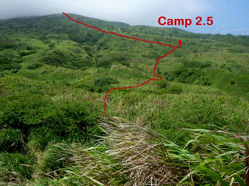
After three days, Camp 2 was established near the D1 difficulty. This was the deepest ravine complex (40-50 feet/12-15 meters) and we fixed hand lines for safety/ease-of-use through this area. (These lines were pulled and reused for the crater rim traverse).
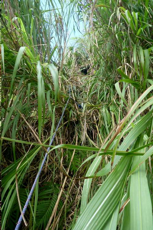
Fortunately the upper 1/2 of this route is covered in knee-to-waist high ferns for the most part (75%-ferns, 25%-sword grass) which makes easy trail cutting. Two days later Camp 4 (High Camp) was established. When the clouds lifted (only occasionally in early June) we had a fantastic view of the upper ridges and crater rim.
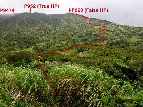
Careful examination of maps and the terrain allowed the team to pass through difficulty areas D5 and D6 with ease; the ravines were minor. The final ridge takes you straight to P960 with the last few hundred feet in a "cloud forest" environment due to a semi-permanent cloud cap. P960 is a nice broad summit (relatively speaking) and is a good location to celebrate and peer into the very large crater.
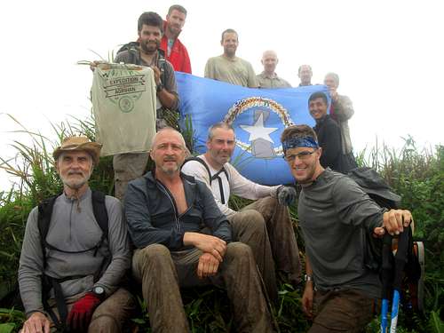
Using a 5x hand level and a Sokkia B24 survey level, the team wanted to verify which peak was the true highpoint of Agrihan. It was quickly speculated that P952 might be higher.
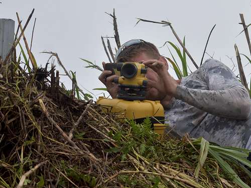
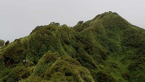
Members of the team secured the Class 4 crater rim traverse between P960 and P952 using ropes, snow pickets and angle iron, and a caving ladder. Please read the "June 2, 2018" section within the "Agrihan 2018 Expedition" trip report for full details on the traverse. Once established, it took two days of patience for the clouds to lift before we confirmed (sighting and back-sighting) that P952 is indeed the true highpoint. Some 5-7 feet (2 meters) higher than P960 and 2-3 feet (1 meter) higher than P947. Nothing else around the crater rim came close. even P945 (western summit) was some 40-50 feet (12-15 meters) lower than P952.
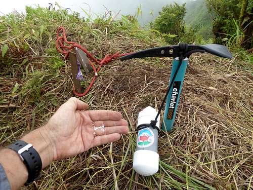
An ice axe and summit register were left at the summit.
Essential Gear
Sufficient food and water (especially important due to the heat and humidity) is needed for all team members. You may consider bringing supplemental food and water for any locals you hire since they tend to underestimate their needs.
Based upon 2018 experience you may want to secure the Class 4 crater rim traverse using:
- full-length climbing ropes
- snow pickets or lightweight angle iron to drive 1.5-2 feet into the soil/pumice-gravel as anchors
- lightweight (3-4 pounds/2 kg) sledge hammer
- caving ladder or jumars/ascenders
External Links
