
-
 603 Hits
-
 78.27% Score
-
 9 Votes
|
|
Mountain/Rock |
|---|---|
|
|
37.92955°N / 107.7584°W |
|
|
San Miguel |
|
|
Hiking, Mountaineering, Scrambling, Skiing |
|
|
12785 ft / 3897 m |
|
|
Overview
Ajax Peak
Elevation : 12,785'
County : San Miguel
Quad : Telluride
Range: San Juan Mountains
Coords : 37.9287°N, 107.7556°W
Rise : 125'
Saddle : 12,660'
Line Parent : Telluride Peak
Parent Lineage
Proximate Parent : Telluride Peak
Isolation : 1.08 miles
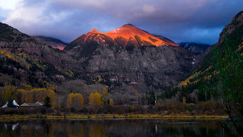
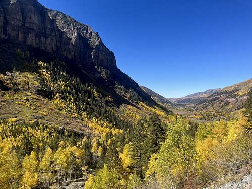
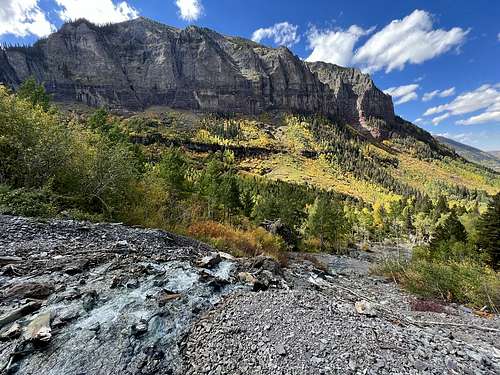
Iconic Ajax Peak towers above the eastern end of Telluride’s box canyon. When looking up at the peak from downtown Telluride it is hard to believe that a hikers trail reaches the summit. Fortunately the Bridal Veil Road snakes its way up the canyon's head wall, climbing 1,300-ft. as it ascends to the power plant atop the wall. From here a stiff climb up a section of the Black Bear Road leads to a trail ascending steep switchbacks to the summit of Ajax Peak, gaining almost 2,500-ft. in 2.8 miles.
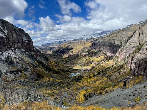
Hikers are rewarded for their efforts with stunning 360-degree views from atop the peak. Here stunning views extend to the summits and ridges ringing the Marshall Basin, the Savage Creek Valley, Ingram Basin and Bridal Veil Basin. In the distance are the high peaks of the Mount Sneffels and Lizard Head Wildernesses. Telluride lies cradled in the valley to the west while the ruins of the Tom Boy Mine are visible at the base of the peak’s north slopes.
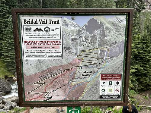
This trail is not recommended for anyone with a fear of heights or any discomfort when climbing steep trails to dizzying heights. A 4WD is recommended for reach the trailhead at the top of the Bridal Veil road. Check at the Telluride Visitor Center for current road conditions.
 |
 |
 |
Getting There
From Telluride: Drive east through Telluride on Colorado Avenue for a little over 2.0 miles past the Pandora Mill to a large unmarked parking area. Park here is you are driving a 2WD vehicle. 4WD is recommended beyond this point. (Check with the Telluride Visitor Center on current road conditions before setting out on the hike.) Add 4.0 miles to the round-trip distance and 1,300-ft. in elevation gain for the hike if parking at the 2WD lot near the Pandora Mine.
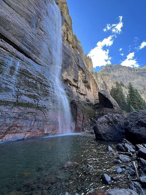
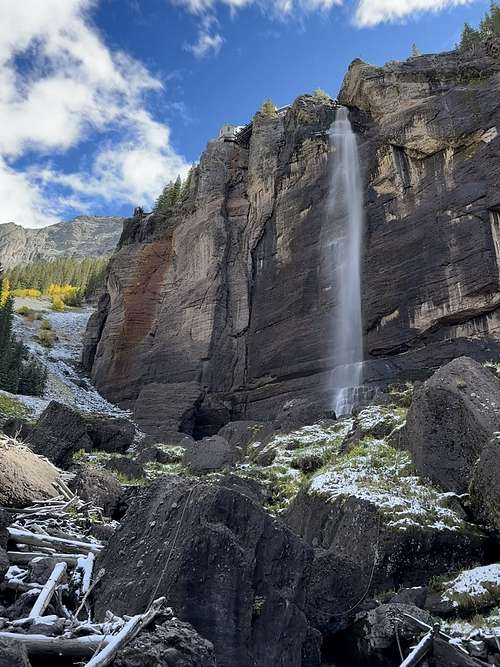
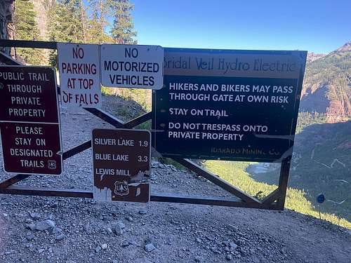
If you are in a 4WD follow the dirt road, marked as Forest Road #636 on maps, for 2.0-miles up a series of switchback to the Bridal Veil Power plant. The road gets rougher and rockier as you climb. Parking is VERY limited at the top and fills up early in the morning. Be sure not to block the gate. If there is no available parking, turn around and go back down the road until you find a safe, wide spot to park out of the flow of traffic (and not on private property.) A good place to park is at the base of the waterfall. From the waterfall it is 0.8-mile walk to the end of the road.
Note: Two-way traffic is permitted between the Pandora Mine and the power plant. The road above the power plant, the notorious Black Bear Road, is one-way downhill toward Telluride.
 |
 |
 |
Route
The trail mileage in this description assumes you park at the end of the Bridal Veil Road high above the east side of Telluride (see driving directions below). Add 4.0 miles to the round-trip distance and 1,300-ft. in elevation gain for the hike if parking at the 2WD lot near the Pandora Mine.
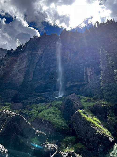
Near the end of the Bridal Veil Road is an intersection with the Black Bear Road marked with a sign reading, “One Way Only, Do Not Enter.” (The Black Bear Road is a very difficult 4WD road that begins off Highway 550, south of Ouray, Colorado.) Ascend the Black Bear Road on a series of steep switchbacks, passing the ruins of the Black Bear Mill and Ingram Falls. Beyond the falls the road curves around a very tight switchback called “Adios Corner” and climbs a series of rock slabs known as “The Steps” alongside a creek cascading down the gully to the right of the road. This is considered one of the most difficult parts of the road for vehicles.
After 1.1 miles you will see mining cables overhead. The trail to Ajax peak, marked with a rock cairn, starts on the left (north) side of the road between the second and third cable. The narrow, but well-defined trail ascends steeply through meadows on long switchbacks. As you gain elevation enjoy ever improving views to the east/southeast of Peak 13,510-ft. and Trico Peak (13,321-ft.) rising above Ingram Basin. Ballard Mountain (12,804-ft.) towers above Silver Lake to the southwest. Soon Lizard Head (13,113-ft.), Wilson Peak (14,017-ft.) and Mount Wilson (14,246-ft.) in the Lizard Head Wilderness are seen in the distance to the west.
 |
 |
 |
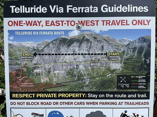
The Black Bear road, starting south of Red Mountain Pass on Highway 550, goes over Black Bear Pass (12,840-ft.) and descends Ingram Basin on dangerous and difficult switchbacks to meet the 4WD road coming up from Telluride.]
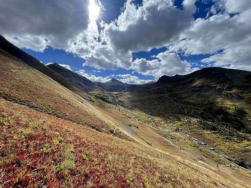
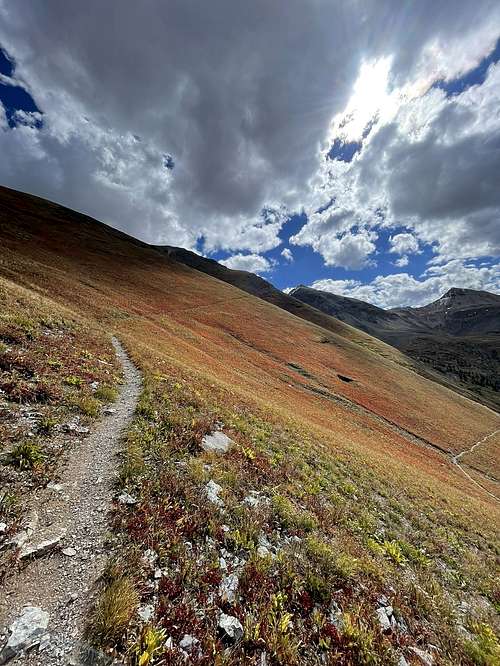
After 2.2 miles the trail crosses scree covered slopes. Ignore any faint trails you see branching to the left. Instead stay on the main trail heading east.
Reach the top of the ridge at 2.6 miles. As you crest the ridge terrific views open to the high peaks rimming the north side of Savage Creek and the Marshall Basin cirque. Deep in the valley below the trail are the ruins of the Tom Boy Mine and the road leading to the mine.
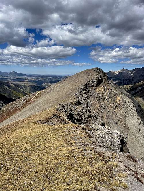
On the ridge the trail turns left (west), crosses a scree-covered saddle and then climbs on moderate grades to the top of Ajax Peak (12,785-ft.) at 2.8 miles. The last section of the trail ascends on stable scree along the south side of the ridge, a bit below the ridge crest.
Atop Ajax Peak enjoy 360-degree views. From this perspective we have a birds-eye-view of Telluride nestled in the valley to the west. Mendoza Peak (13,275-ft.) towers above the head of Marshall Basin to the northeast. Mount Emma (13,581-ft.), Gilpin Peak (13,694-ft.) and Mount Sneffels (14,150-ft.) rise in the distance beyond Mendoza.
To the north, Chicago Peak soars over the Tom Boy Mine complex and the Savage Creek Valley. Further up the valley are fine views of Telluride Peak and the 13,000-ft. summits ringing the head of Savage Basin. The Tom Boy Mine/Imogene Pass road is seen snaking up Savage Basin and crossing the divide at Imogene Pass.
To the south the high summits surrounding the Bridal Veil Basin fill the skyline. Peaks easy to pick out on the horizon include Ballard Mountain, La Junta Peak (13,472-ft.) and Peak 13,614-ft. Telluride Peak and Trico Peak dominate the view to the east. If you look carefully you will be able to see Black Bear Pass on the divide to the south of Trico Peak.
When you are done taking in the views retrace your steps to the trailhead. Use care as you descend the steep trail. Keep an eye out for traffic along the Black Bear Road. Step off the narrow road to let vehicles pass safely.
 |
 |
 |
Red Tape
Weather and Snow:
National Weather Service Forecast
NOAA Snow Depth Map
When to Climb
Spring / Summer/Fall
Camping
Camping around Telluride you can find on this link:
External Links
https://www.peakbagger.com/peak.aspx?pid=55505
https://listsofjohn.com/peak/1027