
-
 3656 Hits
-
 71.06% Score
-
 1 Votes
|
|
Route |
|---|---|
|
|
45.79140°N / 7.44280°E |
|
|
Hike |
|
|
Half a day |
|
|
Walk-Up |
|
|
Approach
From Nus take R36 into Valle di St. Barthélmy. The Road climbs to the village Blavy from where it flattens and leads more or less straight on to the hamlet of Issologne. It makes a sharp turn to the south and climbs back to St. Barthélmy. Here a number of hiking trails start. The one you want is marked No 9.
Route Description
Altitude gain: 1000m
Difficulty: Hike, exposed near the summit
Duration: 3h 30min
Trailhead: St. Barthélmy
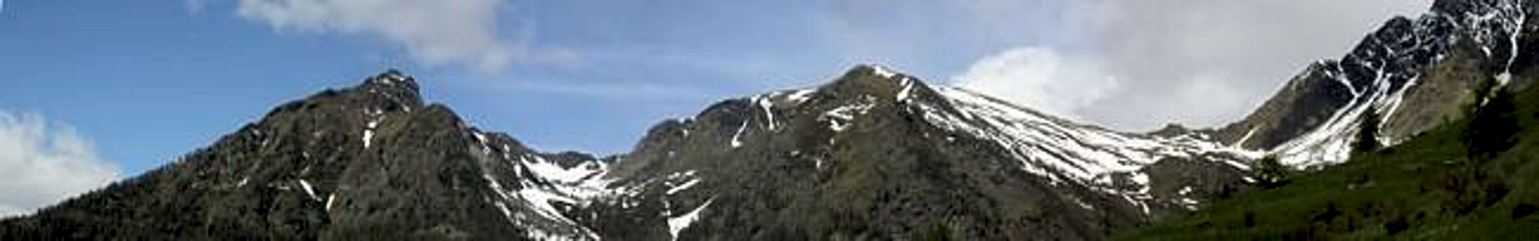
Due to the fact that the trailhead at St. Barthélmy is already at an elevation of 1633m it doesn't take long to get over the timberline. Thus the whole hike awards you with pretty views, mainly to the southwest. The eastern part of Valle d'Aosta will come into view only after you reach the ridgeline which finally leads to Becca d'Avuille.
Start out from St. Barthelmy along a trail into the valley of the Chaleby Creek. The trails are marked, you'll find it difficult to find the way out of the village nevertheless. It leads through a narrow pathway between two houses, at the top of which it turns left (west) along the farmed meadows of the village. You get to two Alpes, Alpe Pleoules (1779m) and Alpe Chaleby (1940m) the latter of which is connected to civilization by a dirt road.
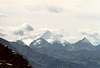
Turn south onto that road at the Alpe and head for Alpe Fontin. After some 2km a road turns off left, leading south into Valle d'Aosta. Stay on the upper road, where shortly afterwards atrail (marks 8, 9) turns off right into the forrest. The trail heads for Alpe Léché (2298m) where you can decide for Gran Pays (2726m, trails 8, 105) or Becca d'Avuille (trail No 9). This latter trails leads below the south face of Gran Pays where you get a great view of your final destination, Becca d'Avuille (see the big pict on the main page).
The trail descends into a cirque, where there is an abandoned farm (Collet) and crosses a creek before ascending into a small unnamed pass at 2514m. For descending you can later follow the valley of this creek. There is supposed to be a trail but there isn't. Just follow the creek and you'll get to Alpe Fontin, from where a regular trail heads downwards again.
From the pass - which you'll get to after a steep scrambling approach turn southeast on the ridge that finally leads to Becca d'Avuille. Orientation is quite a problem here. Try to stay as far to the left of the ridge as you can. Some parts are pretty exposed but you'll nevertheless reach the summit without much trouble.
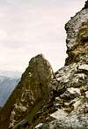
There is a tower to the east of the summit (look at the picture in my summit log) which is slightlya higher than the main summit. To scale this tower you certainly need climbing experience. The climb is exposed but probably won't exceed III rd degree.
 |  |  |  |
Essential Gear
Usual hiking gear is sufficient. For the tower east of the summit bring rope and some wedges.