
|
|
Mountain/Rock |
|---|---|
|
|
57.81185°N / 5.24734°W |
|
|
Mountaineering |
|
|
3484 ft / 1062 m |
|
|
Overview
An Teallach is without doubt one of the most impressive group of hills in Scotland. It is located in the Wester Ross region of the highlands, close to Ullapool and easily accessible from main roads.
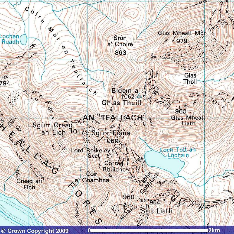
Within the An Teallach group are nine separate tops with heights over 3000 feet, all are concentrated within an area of 4Km by 2Km.
There is no actual peak called An Teallach, this name refers to the whole group of hills listed below:-
Glas Mheall Mhor 979m.
Bidean a' Ghlas Thuille 1062m.
Sgurr Fiona 1060m.
Sgurr Creag an Eich 1017m.
Glas Mheall Liath 960m.
Lord Berkeley's Seat 1030m.
Corrag Bhuidhe 1049m.
Stob Cadha Gobhlach 960m.
Sail Liath 954m.
Quartzite on the summit of Glas Mheall Liath.
Each of these tops has a completely different character even though the type of rock is generally the same.
The geological structure of An Teallach comprises of Torridonian sandstone and Cambrian Quartzite.
On the ridge of Glas Mheall Liath, this is particularly evident where the Red Torridion Sandstone contrasts vividly with the light grey to white quartzite.
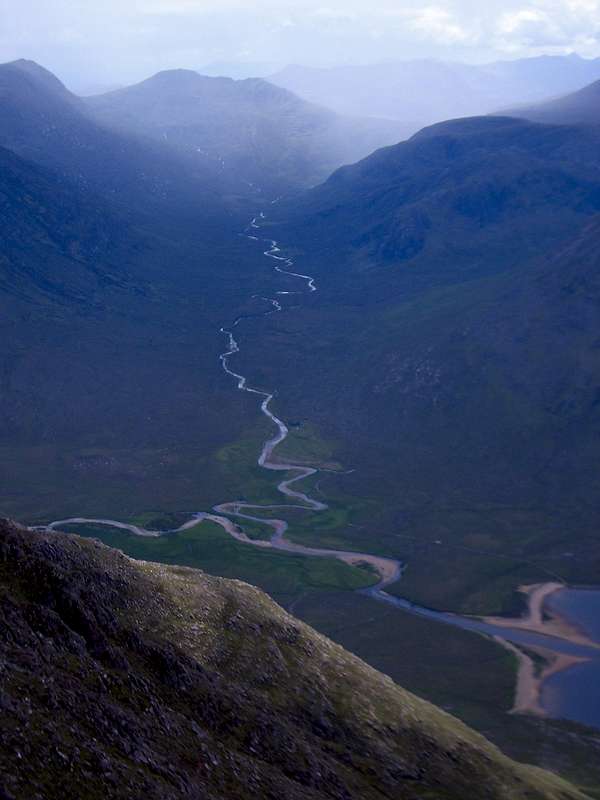
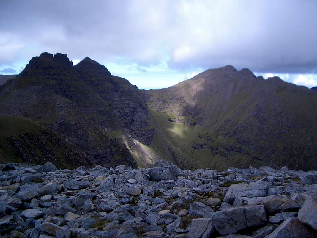
Typical Glaciation. - Gleanne na Muice.
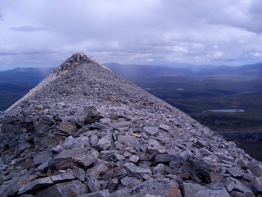
The Torridian Red Sandstone at the summit of Corrag Bhuide
The rocks have been subject to glaciation, erosion and denuding by the grazing of sheep and other animals. In general though the rock is sound in most parts and little evidence of scree (talus) can be seen except on the higher part of the ridges.
Contrasting Quartzite and Torridian sandstone.
An excellent example of the typical effects of glaciation can be seen in the glen below Sgurr Fiona.
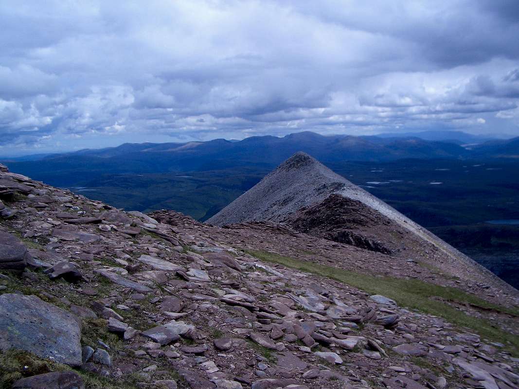
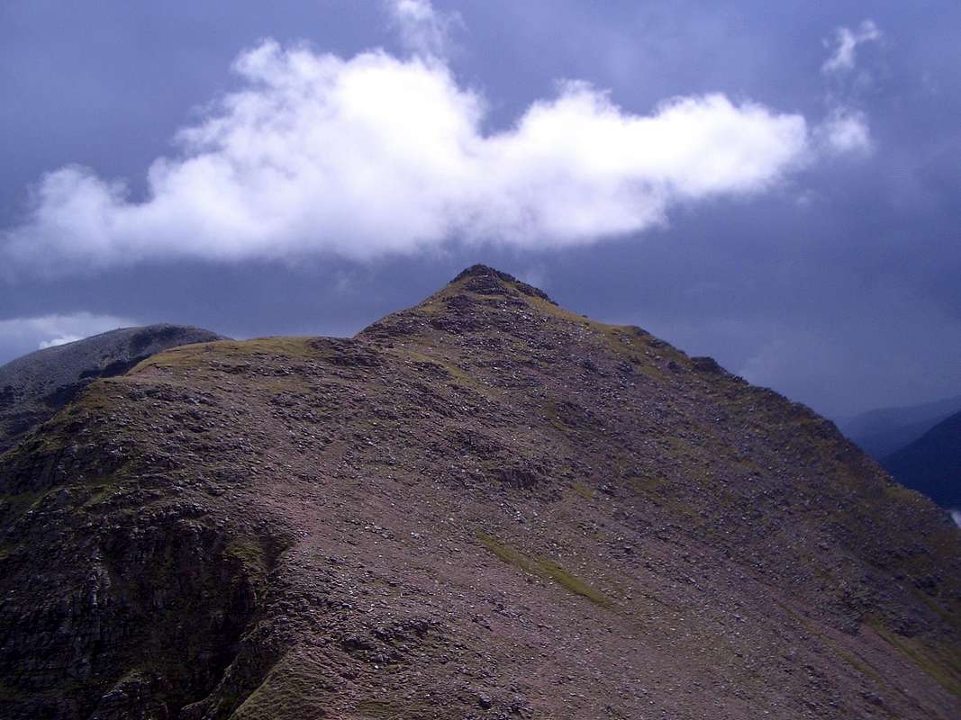
The fine ridge of An Teallach seen from Glas Mheall Mhor.
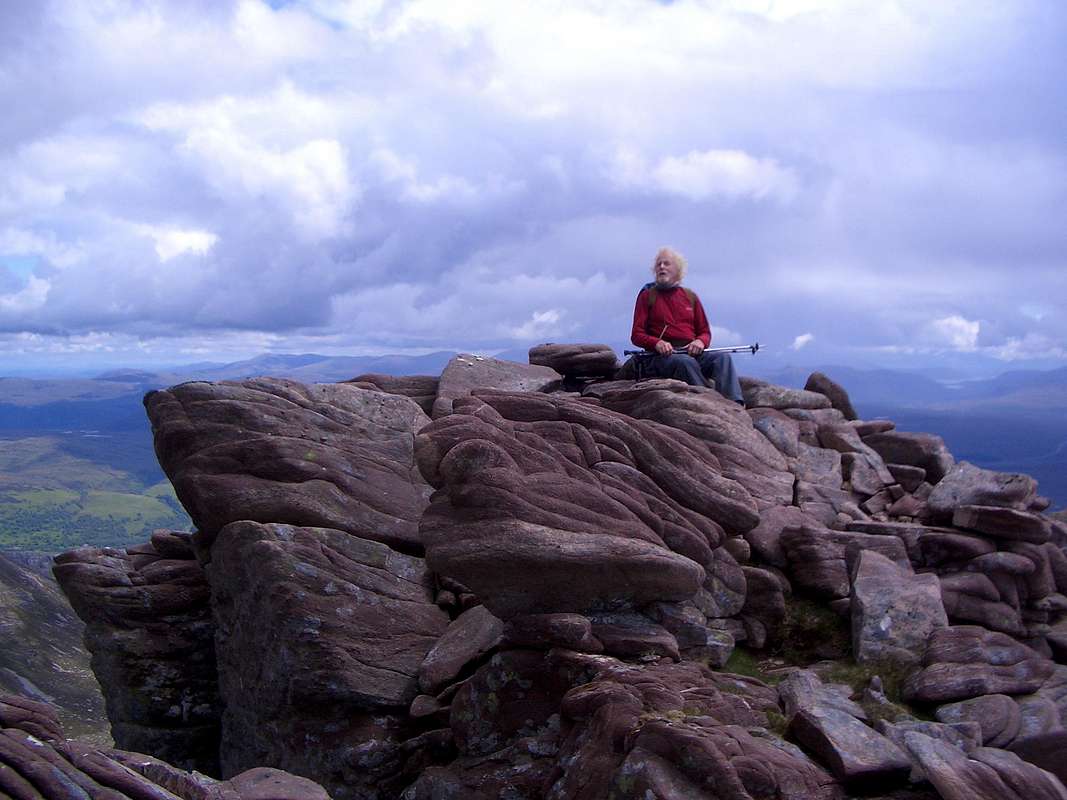
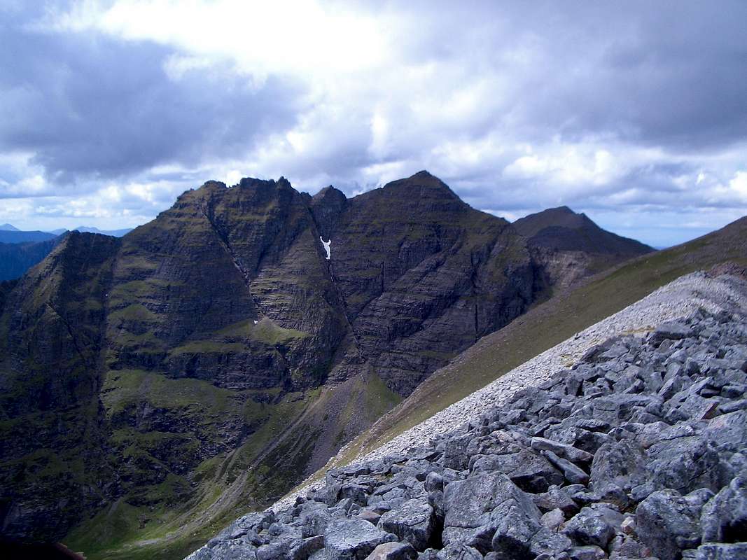
The section of the An Teallach ridge from Sgurr Fiona to Corrag Bhuide is particularly fine, combining a high level traverse, scrambling up sandstone outcrops and enjoying spectacular views from precipitous heights and also providing a high level path for the more timid hiker.
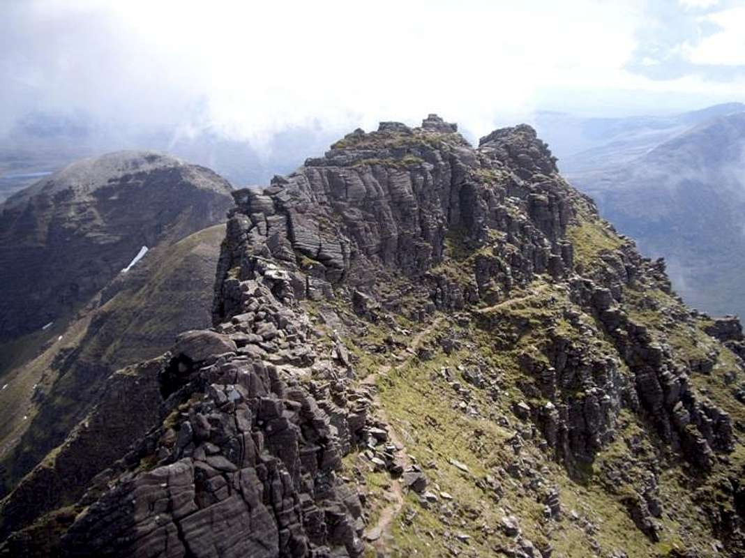
The high level trail around the summit ridge of Corrag Bhuide avoids any scrambling. (Image by daw37)
Red Torridian Sandstone on the summit of Glas Mheall Mhor
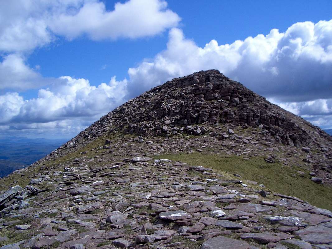
Stob Cadha Gobhlach.
Sail Liath summit and it's quartzite boulders.
Getting There
Travel to the nearest access points to An Teallach by road is easiest from Inverness which is easily reached from the south via Perth on the main A9 road.From Inverness go north on the A862 to Muir of Ord and then pick up the A832 towards Garve. Beyond there is a junction with the A835 signposted to Ullapool. Take this as far as the Falls of Measach and join the A832 again to Dundonnell.
National (Scotland, England and Wales) Rail links exist to Inverness and a rail/bus through ticket scheme operates from there to Ullapool.
Scheduled flights into Glasgow or Edinburgh airports provide access to Scotland but Inverness airport is closer to An Teallach and has scheduled flights from London airports and many European airports using Easyjet and FlyBe airlines.
Red Tape
There is no red tape in Scotland. There is a legal right to roam over the hills and valleys. However, in some areas, deer stalking is carried out at certain times of the year. Although this does not normally affect this particular area, ask locally before you go on the hills.In some areas temporary restrictions on access may be imposed during bird breeding season, again, ask locally for more details.
Camping and other accomodations
Campsites are located in the area of An Tealach at the following locations:Badcaul - Nothern Lights campsite - Map ref: NH 023 914.
Badrallach - Badrallach Bothy & Camp Site - Map ref: NH 067 917.
Dundonnell - Dundonnell Hotel
Camusnagaul - Sail Mhor Croft Hostel
The most useful detailed map of the area for walkers navigation is the Ordnance Survey one:
An Teallach & Slioch - 1:25,000 - ISBN 978-0-319-23970.
For general touring and appreciation of the whole of Scotland look at:
Scotland - Ordnance Survey - 1:500,000 - ISBN 978-0-319-24536-1.
Guides:
For a general guide to the ridge walk,
100 Best Routes on Scottish Mountains by Ralph Storer - ISBN 978-0-7515-1890-0
For further information go to the Scottish Mountaineering Club website
Scottish Mountaineering Club
Maps and Guides
Maps:The most useful detailed map of the area for walkers navigation is the Ordnance Survey one:
An Teallach & Slioch - 1:25,000 - ISBN 978-0-319-23970.
For general touring and appreciation of the whole of Scotland look at:
Scotland - Ordnance Survey - 1:500,000 - ISBN 978-0-319-24536-1.
Guides:
For a general guide to the ridge walk,
100 Best Routes on Scottish Mountains by Ralph Storer - ISBN 978-0-7515-1890-0
For further information go to the Scottish Mountaineering Club website
External Links
For details on the classification of the tops listed in the overview, and guidebooks to many areas of Scotland:Scottish Mountaineering Club