
-
 4091 Hits
-
 0% Score
-
 0 Votes
|
|
Route |
|---|---|
|
|
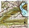
40.35300°N / 77.09°W |
|
|
Hike (Class 2) |
|
|
Less than two hours |
|
|
Walk-up |
|
|
Approach
Follow the directions in the "Getting There" section of the main page.
Route Description
The trail first climbs a steep bank and then slowly gains steady elevation around the head. After about 0.25 miles the trail descends from the top of a knob and converges after about 150 yards with another trail that enters from the right. From here the trail starts its gradual ascent toward Hawk Rocks. After 0.5 miles you'll start hitting the boulder field. The trail continues across this very large slide for quite a while until you can finally make out the cliffs above and to the left of you at Hawk Rocks. Along the entire trail you'll get wonderful vistas to the north and west as well as down into Sherman Creek. Finally after a short distance the trail will turn left (east) and head up the steepest part to Hawk Rocks in about half a mile. Views extend to the north, east, and west.
 |  |
Essential Gear
Good pair of hiking shoes, water/snacks, and a camera.
Miscellaneous Info
If you have information about this route that doesn't pertain to any of the other sections, please add it here.