
-
 28842 Hits
-
 76.66% Score
-
 7 Votes
|
|
Custom Object |
|---|---|
|
|
32.92344°N / 116.18797°W |
|
|
Cave |
Overview
 Cave Exploration
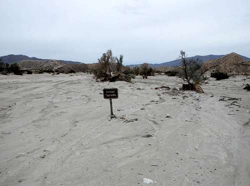
Arroyo Tapiado is Spanish for "walled dry creek". The Arroyo Tapiado in Anza Borrego State Park is home to the largest known mud cave systems in the world. There are between 20 and 30 separate caves. The ground material in which these caves were formed is comprised of gypsiferous claystone, known commonly as mudstone. These psuedokarst caves were formed during periods of rapid drainage when water flowed through subterranean tributaries.
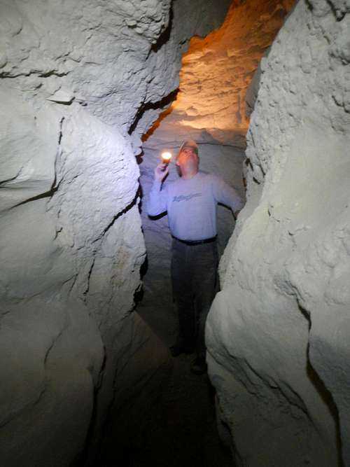
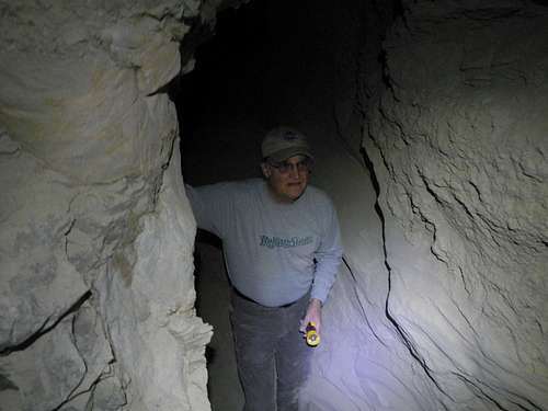 Narrow Passages
"Carry's Big Cave" is the longest known cave and has been measured to 1300 feet long. It's ceilings are over 100 feet high in places. Many passage ways are narrow and not suitable for everyone. Also, low ceilings can present a danger, so wearing a spelunking helmet might be a good idea. Always bring at least two sources of light per person. Some of the cave walls contain silica crystal formations and or fossils. Other caves are home to large cave spiders and bats.
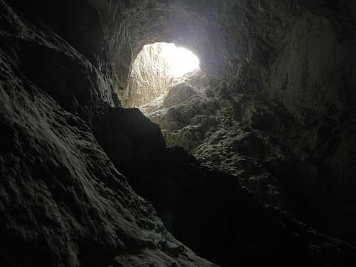 A Sinkhole Opening
The entrances are not always easy to spot from the bottom of the wash. Only a few are visible from the car. Many entrances start further back, inside the tributaries. Watch for what looks like small boot paths leading away from the main wash. Many of these paths lead to a cave entrance.
Never visit the Arroyo Tapiado during periods when rain is predicted. Along with most of the attractions in Anza Borrego, a 4 wheel drive vehicle is necessary for access.
Driving Directions - 4WD
From Christmas Circle in Borrego Springs, head south on S3 (Borrego Springs Road) for 5.3 miles. Turn right on Yaqui Pass road and continue for 6.9 miles to CA-78. Turn right (west) onto CA-78 and proceed 7 miles to a left turn junction.
Turn left onto S2 (Great Southern Overland Stage Route) which goes towards the town of Ocotillo. Follow S2 (Great Southern Overland Stage Route) for 29.4 miles to the left turn onto a dirt road which may be signed as "Palm Springs" or "Vallecito Wash".
The turnoff is located here:
Lat: 32.91530705 Lon: -116.24061996
Proceed east along the dirt road and watch for a small sign on the left which says "Arroyo Tapiado". Turn north and continue 3 or 4 miles to where the caves are located.
 The Sign At The Last Junction
Cave Maps
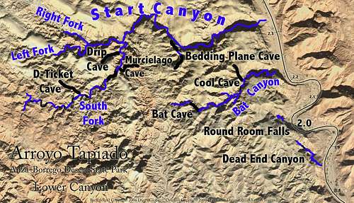 Lower Canyon Lower Canyon |
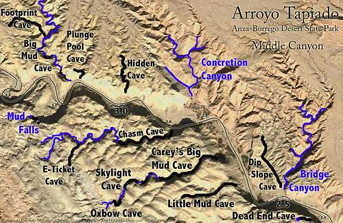 Middle Canyon Middle Canyon |
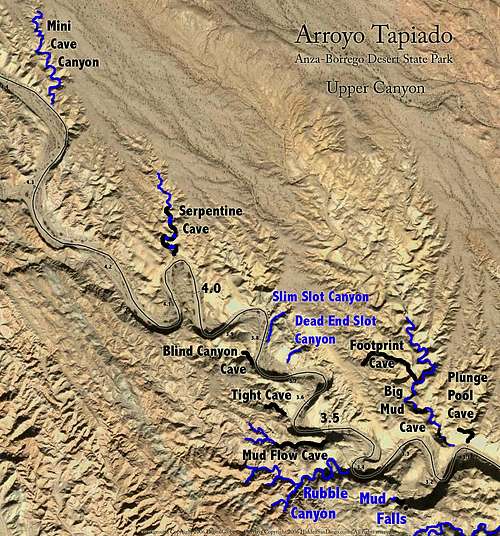 Upper Canyon Upper Canyon |
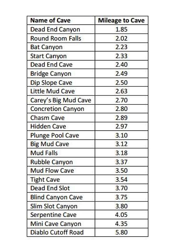 Cave Chart Cave Chart |
External Links
Information
- History, geology, exploration, maps, and descriptions: PDF File
- Directions to each cave entrance: PDF File
- Area overview
- Hidden San Diego's: subscription website
More Videos
- Arroyo Tapiado mud caves, Anza Borrego
- Carrizo Badlands: Arroyo Tapiado Mud Caves, Canyon Sin Nombre
- Many videos from Arroyo Tapiado by a417susp