
|
|
Area/Range |
|---|---|
|
|
33.26890°N / 116.4057°W |
|
|
Hiking, Scrambling, Canyoneering |
|
|
Spring, Fall, Winter |
|
|
750 ft / 229 m |
|
|
Overview
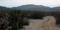
The Anza Borrego Desert State Park is the largest state park in California, containing over 600,000 acres of the Colorado Desert. It lies approximately 2 hours east of San Diego. The elevation of the park varies from just above sea level to over 6,000 feet. The most popular activities include hiking, backpacking, and camping. The park also has countless miles of 4wd roads and mountain bike trails. Due to high temperatures, the park is best visited during late fall, winter, and early spring.The name "Anza Borrego" was derived from the name of Juan Bautista de Anza, a Spanish explorer, and the Spanish word "borrego" which translates to bighorn sheep. The park was established in 1933.
Important Phone Numbers
| Visitor Center | 760-767-5311 |
| Emergency | 911 |
| Borrego Medical Center | 760-767-5051 |
| Poison Center | 760-543-6000 |
| Road Conditions | 760-767-ROAD |
Getting There
Access to the park can be had from highways 8, 78, and 86. Due to the size of the park and the fact that there are over 500 miles of roads within the park, no one set of directions will get everyone where they need to go. Click here for a good map of the park, and visit the peak pages for more specific directions.Red Tape
There is some confusion in regards to the red tape in the park. There are no fees or permits required for parking, hiking, or backcountry camping with a couple exceptions. If you enter the park by parking your vehicle in the Clevend National Forest, you will need an Adventure Pass. There is also a fee ($6) to park at the Palm Canyon Campground. The developed campgrounds also require fees and reservations. See the camping section.Coyote Canyon is closed June 1 - September 30 to allow the bighorn sheep uninterrupted access to the creek during the hot summer months.
Partially located within the park is the Carrizo Impact Area. Entrance into this area is forbidden. The region was used by the Navy for target practice during World War II and the Korean War. While this activity stopped long ago, unexploded ordinance still poses a threat. You can learn more about the region here.
The Peaks
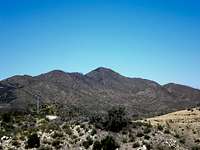
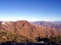
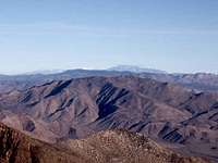

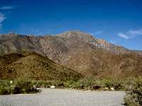

Peak Information
| Peak | Page By | Map | Elevation | Nearest Highway |
|---|---|---|---|---|
| Chariot Mountain | N/A | X | 4644 ft | S2 |
| Combs Peak | NavySeabee | X | 6193 ft | 79 |
| Coyote Peak | N/A | X | 3192 ft | S22 |
| Garnet Peak | thebeave7 | X | 5900 ft | S1 |
| Granite Mountain | thebeave7 | X | 5633 ft | S2 |
| Grapevine Mountain | N/A | X | 3831 ft | 78 |
| Indianhead Peak | Shano | X | 3960 ft | S22 |
| Round Mountain | N/A | X | 3367 ft | 8 |
| San Ysidro Peak | erock | X | 6147 ft | S22 |
| Sunset Mountain | BCL | X | 3657 ft | 78 |
| Table Mountain | N/A | X | 4089 ft | 8 |
| Mount Tule | N/A | X | 4647 ft | 8 |
| Villager Peak | N/A | X | 5756 ft | S22 |
| Whale Peak | Dennis Poulin | X | 5349 ft | S2 |
Camping
There are three established campgrounds within the park. Reservations are required from September - May. There is a reservation fee of $7.50. The remainder of the year is first come, first served. More information can be found and reservations can be made HERE.There are a few primative campgrounds within the park. They do not have tiolets or tables. They can be located on this MAP.
Backcountry camping is also allowed within the park. Your vehicle must be one full car length off the road. Also, fires must be contained in metal containers. Firewood must be hauled in and ashes hauled out.
Weather
The current weather conditions can be found here.Satistical averages can be found here.
Based on the summit registers I've read, only heavy drug users visit the park during the summer.
SOCALHUSKER - Mar 13, 2009 12:07 pm - Voted 10/10
Link...to info about the Carrizo Impact Area is broken. Here's the closest thing I could find in regards to information about the area. Hope it helps.
BCL - Jul 5, 2009 11:30 am - Hasn't voted
Updated.Updated, thanks.
Mark Doiron - Dec 23, 2014 6:22 am - Hasn't voted
Thank God I Found a Backcountry Toilet!There is a backcountry pit toilet at the primitive campground near Split Mountain. It was a very timely discovery for me, LOL! I think it would be worth mentioning the town of Borrego Springs, which is entirely surrounded by the park. The town includes several restaurants, hotels/motels, and gas stations, though it can be pricey there. I definitely recommend Kendall's Cafe to eat (accessed from the south side of the town's shopping mall). I'm told that the locals prefer to keep that one under the radar so it doesn't become over-crowded with tourists. Also, my guide during my recent four day trip to photograph the area (a 15 year volunteer at the park), told me that the park's lowest point is one hundred something feet below sea level. Sorry, I don't recall the exact value (but could get it for you by contacting him). Finally, there is an excellent (but non-topo) map of the park useful for any recreational activities. It is available with and without an associated guide book. http://www.amazon.com/Anza-Borrego-Desert-Region-Diana-Lindsay/dp/0899974015/ref=sr_1_sc_1?ie=UTF8 Thanks for the page--it's an amazing area to visit! --mark d.