

|
|
Mountain/Rock |
|---|---|
|
|
33.81215°N / 110.9079°W |
|
|
Gila |
|
|
Mountaineering |
|
|
Spring, Summer, Fall, Winter |
|
|
7748 ft / 2362 m |
|
|
Overview
Aztec Peak is the highest point in the Sierra Ancha, the mountain range that runs north of Globe and east of Lake Roosevelt, merging in with the Mogollon Rim to the north. The main route through the Sierra Ancha is state route AZ-288, which is unpaved for some segments as it winds through the heart of the range.
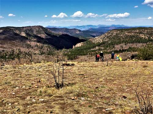
A well-graded dirt road goes all the way to the summit of Aztec Peak, although there are multiple places to park and start the hike. There is lookout tower at the summit, which is sometimes manned (although it was fenced off and unmanned as of April 17th, 2021). However, even without ascending the tower, the views are excellent, with Roosevelt Lake in partial view along with numerous mountain ranges.
Another major draw to this area is Workman Creek Falls, one of the highest waterfalls in the State of Arizona. How impressive it is will depend on the time of year and quantity of water. FR 487 goes over the top of Workman Creek Falls, but it is possible to bushwhack down to the falls for a view from below.
Aztec Peak is best hiked during the spring and fall months. March through May; October and November are ideal. Aztec Peak and the surrounding forest will get snow during winter; and can be very cold. The summers are very hot and there is fire danger. Temperatures here are generally 20-30 degrees cooler than Phoenix.
Getting There
The turn-off to Aztec Peak is about a 2 ½ hour drive from downtown Phoenix. However, the drive up to the Sierra Ancha is very scenic.
Aztec Peak is reached by taking Forest Road 487 off of AZ-288. The road has been paved almost all the way to the turn off to FR 487. FR 487 is a dirt road accessible by 2WD with some clearance. If the gate isn’t closed, you can drive all the way to the summit.
From Phoenix, get on US 60 East which goes through Mesa, then Apache Junction, after which it becomes more rural and continues towards the town of Globe. Before entering Globe, take AZ-188 North for about 14 ½ miles to AZ-288. Continue 25 miles north to FR 487. Another option from North Scottsdale or North Phoenix is to take the Beeline Highway north, and then south on AZ-188 to Roosevelt Lake and then to AZ-288. The drive can be done as a loop.
Once on FR 487, a good starting point is either at Cascade Campground, which is a little over 5 miles from the summit via the road; or the Falls Day Use parking half mile further up from Cascade and closer to Workman Creek Falls. There is additional day use parking along the road to the summit.
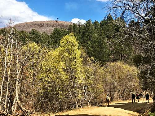
There is a trail up to the summit called Trail 151 or "Abbey's Trail" which is 3.8 miles up FR 487. There is parking by the trail. The trail is about 1.6 miles to the summit gaining 1,000’. However, it is unmaintained and quite overgrown. From the same junction it is 3 ¼ miles to the summit via the main road. If wanting to do an easy loop, you can drive up to Trail 151 and make an almost 5-mile loop taking the 151 to the summit and the road down, or vice-versa.
While there are summits nearby Aztec Peak, including Carr Peak 7,602’ and Carr Mountain 7,630’, they are very hard to reach, with no trails and thick brush and trees with thorns on them. However, there is plenty of other hiking in the Sierra Ancha to enjoy while visiting the area.
Red Tape
Sometimes a gate is closed past the Falls Day Use area, about 2 1/2 miles up FR 487, and hikers need to park there and walk the rest of the way. There are several campgrounds along the way.
Forest closures may occur during fire season.
Please check out: https://www.fs.usda.gov/alerts/tonto/alerts-notices