
-
 9704 Hits
-
 76.66% Score
-
 7 Votes
|
|
Route |
|---|---|
|
|
38.32140°N / 105.3046°W |
|
|
Hiking, Scrambling |
|
|
Spring, Summer, Fall, Winter |
|
|
Most of a day |
|
|
Overview
 North side of Bear Gulch
As outlined here, this route takes in both summits of Curley Peak (the USGS / historical summit to the east and the modern / highpoint summit to the west) as well as the nearby summit of UN 9245. The route leverages Class 1 hiking trails most of the way except for easy bushwhacking to the tops of the peaks. Each summit requires easy scrambling on granite boulders that can be kept to Class 2+ with careful route finding.
This is a pleasant, most-of-the-day hike that starts scenic, and the scenery never really stops. The cliffs greeting you at the trailhead, the woodsy ruggedness of Bear Gulch, the granite rock outcrops, and the heart-stopping views of the Sangre de Cristo Mountains all are sure to delight.
Approximate Roundtrip Distance: 8.5 miles
Net Elevation Gain: 2,800 feet (cumulative gain is higher)
YDS Rating: Class 2+ for some off-trail route-finding and final boulder scrambles
Getting There
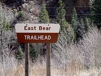 Clearly marked trailhead
 Gambel Oak
From Cañon City
• From US 50, take CO 115 (9th Street) south 1 ½ mile to Elm Ave. (See cemetery.)
• Turn right onto Elm Ave.
• Follow Elm Ave. 1/3 mile to Oak Creek Grade Road.
• Turn left on Oak Creek Grade Road.
• Follow Oak Creek Grade Road (County Road 143) for roughly 11 miles to the Bear Creek Trailhead.
• If you reach the Oak Creek Campground, you have gone just a little too far.
Route Description
 Across highpoint boulders
 Along the Tanner Trail in Bear Gulch
• Leave the parking lot and cross to the west side of the road to the Tanner Trail (which may or may not be marked as such).
• The trail will follow Bear Gulch for about 1 ½ - 2 miles to a saddle with UN 9245.
• From the saddle, the trail turns sharply north, ascending steeply through boulders to reach a plateau.
• The trail traverses the pleateau in a generally northwestern direction, beginning first in the forest, then entering a lovely Ponderosa Pine meadow. The views of the Sangre de Cristo Mountains from the meadow clearing just east of Curley Peak will knock your socks off!
• Circumnavigate the eastern summit of Curley Peak, staying on trail to the junction with the Stultz Trail.
• From here, head nearly due-south toward the saddle between the two Curley summits. I chose to ascend the 9660 ft highpoint first, then descended to the saddle between the two peaks to re-ascend the USGS highpoint. Both summits require easy scrambling on grippy granite to reach the tops.
• Descend between the two peaks to the Tanner – Stultz trail junction.
• Regain the Tanner Trail and cross the lovely meadow, across the plateau and down through the boulder fields to the saddle with UN 9245.
• From the saddle, strike south, off-trail, toward the top of UN 9245. Staying west of the gentle ridgeline should aid in avoiding the dense stands of juvenile fir.
• The summit of UN 9245 affords more views of the Sangre de Cristos as well as southward vistas of fellow Wet Mountains summits.
• Retrace your steps heading north back to the saddle (resist the temptation to drop directly to the northeast through the jungle to Bear Gulch).
• Regain the Tanner Trail, and out-hike approximately 1 ½ miles to the trailhead.

Essential Gear
 Ponderosa Savanna
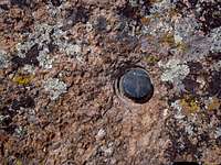 USGS Pin
Standard hiking gear appropriate to the season is sufficient. Have the tools and the knowledge needed for effective and safe off-trail navigation.
Axeman - Sep 9, 2012 11:52 pm - Voted 9/10
Curley Peak VariationA nice variation on the route described is to continue left on the Tanner Trail where it joins the Stolz trail, a couple hundred yards to a junction with spur trail 1333-1. Follow this trail left (west) to a nice broad overlook, then cross the meadow and follow the ridge towards the Curley Peak(s) just keep following the ridge to hit all the high points, then drop back a bit to rejoin the trail near the Stoltz-Tanner junction. This adds a half mile or so to the hike but it's worth it and shortens the bushwack a bit. Minor correction: to the saddle described in the route it is approximately 2.2 miles from the trailhead (not 1.5) It is an additional 1.5 miles to the trail junction (the sign says 3 but it's wrong!)
Sarah Simon - Sep 11, 2012 12:27 am - Hasn't voted
Re: Curley Peak VariationAxeman, Thanks for the additions / corrections, particularly the variation information. I'll take a look at the mileages I stated and see if we can make some adjustments. Sarah