


Marcsoltan - Feb 13, 2013 8:33 am - Voted 10/10
Fantastic shot,...Windsor.
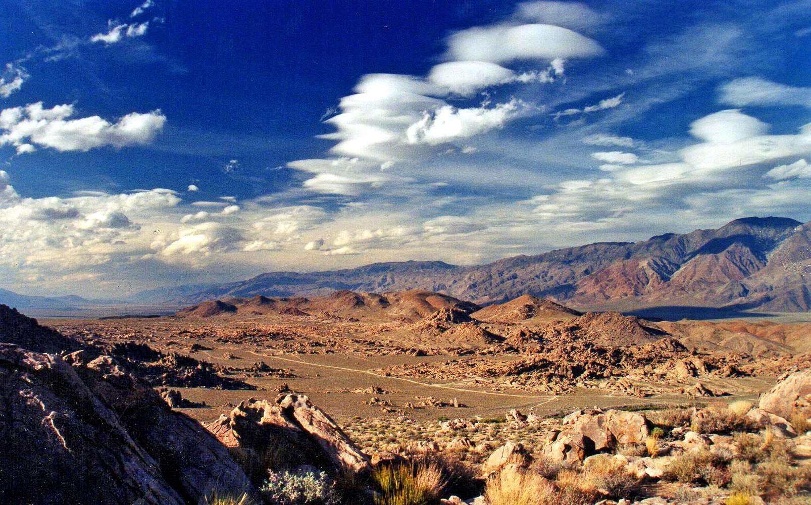
Love the color of the rocks, clouds and the whole thing.

Noondueler - Feb 13, 2013 10:20 pm - Hasn't voted
Re: Fantastic shot,...Thanks Marc. Yeah, I like this one too. I made a big wall blow-up of it years ago.
Marcsoltan - Feb 13, 2013 11:04 pm - Voted 10/10
Re: Fantastic shot,...I just used it to dress up the Alabama Hills Page. I hope you don't mind, but if you do, please let me know.
Thanks,
Noondueler - Feb 14, 2013 1:00 am - Hasn't voted
Re: Fantastic shot,...Sure Marc. Glad you're adding it to the page!

Vitaliy M. - Feb 13, 2013 8:44 pm - Voted 10/10
Great shotYou caught the clouds in the right position!
Noondueler - Feb 13, 2013 10:22 pm - Hasn't voted
Re: Great shotThanks Vitaliy. It looks like some of those lenticulars are racing around the sky.

ExploreABitMore - Jan 24, 2014 12:23 pm - Hasn't voted
Nice PhotoIs rattlesnake mountain the Alabama Hills High Point, as marked on the topo?
Noondueler - Jan 24, 2014 4:26 pm - Hasn't voted
Re: Nice PhotoThanks Granite! I did a mountain page on it. I got the name from locals it's not on the topo but it's real easy to find just go to the page, or Alabama Hills.
-ND
Noondueler - Jan 24, 2014 11:26 pm - Hasn't voted
Re: Nice PhotoActually the big pile on the north side north of whitney portal road is a bit higher.

hightinerary - Jan 25, 2014 2:23 pm - Hasn't voted
AL-titudeRattlesnake Hill is just southwest of the junction of Whitney Portal Road and Horseshoe Meadows Road. Apparently it is not considered to be in the Alabama Hills, since it is 1645 meters and the designated high point is only 1632 meters. And at 1711 meters, the peak across the Portal Road to the northwest is higher than either of them.
Noondueler - Jan 25, 2014 2:35 pm - Hasn't voted
Re: AL-titudeThe 1711 hill ("big pile") is what I am referring to here. It is more complex. I nick named it "Cobra Hill" on a few shots I took from the top. If you approach it from the Movie Flat area some of the routes are really committing time consuming route finding boulder hops. If you approach from further up Whitney Portal road higher on the alluvial fan and more from the southwest the elevation gain is less and the route finding is pretty simple.
hightinerary - Jan 25, 2014 2:44 pm - Hasn't voted
Re: AL-titudeRight - I climbed it in May 2012, from the east. I couldn't tell which was the highest boulder on the summit, so of course I had to climb them all. I just considered it Peak 1743.
ExploreABitMore - Feb 17, 2014 11:24 am - Hasn't voted
Re: Nice PhotoThanks Noondueler! Found it, looks like a fun one ;-)


Comments
Post a Comment