
-
 2507 Hits
-
 81.84% Score
-
 14 Votes
|
|
Route |
|---|---|
|
|
38.05934°N / 122.60426°W |
|
|
Hiking |
|
|
Spring, Summer, Fall, Winter |
|
|
Half a day |
|
|
Class 1 |
|
|
I |
|
|
Overview

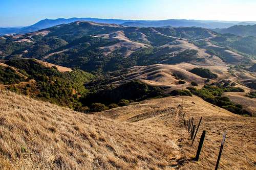
West from the trail
Getting There
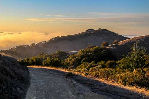
Descending the trail at sunset
Route Description
Looking down the direct route
Take note: Be sure to take into account foxtails getting in your foot garmets in the grass in early summer. You can ruin a pair of socks quickly traipsing though the stuff when it's high and dry.
Descent route: Simply follow the trail back down along the ridge until it switchbacks down the southwest slope and then goes east on the lower slope and
contours back around some ravines and back to the pass at approximately 4 miles.
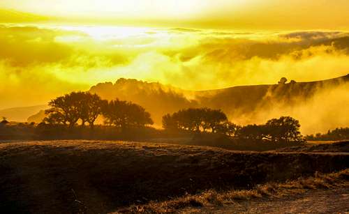
This route is about 6 miles round trip and 1,240' el. gain.![Sunset colors light up the incoming fog]()
West from the trailGood foot support (cross trainers or boots) for the steep sections. A raincoat and or windbreaker in cooler wet weather.. Snacks, lunch and plenty of water on hot summer days. Sunscreen.
Descent route: Simply follow the trail back down along the ridge until it switchbacks down the southwest slope and then goes east on the lower slope and
contours back around some ravines and back to the pass at approximately 4 miles.
This route is about 6 miles round trip and 1,240' el. gain.
Essential Gear
West from the trail